How to get to Ina Zeitvogel by bus?
Click on the bus route to see step by step directions with maps, line arrival times and updated time schedules.
From Lotto-Annahmestelle, Vereinbarte Verwaltungsgemeinschaft Sinzheim
68 minFrom Baden-Baden, Karlsruhe/Baden-Baden Airport, Rheinmünster
37 minFrom Müller Fleisch, Birkenfeld
220 minFrom Grinde-Hütte, Seebach
146 minFrom Epplesee, Rheinstetten
94 minFrom Schloss Neuenbürg, Verwaltungsgemeinschaft Neuenbürg
217 minFrom Waldbronn Eistreff, Waldbronn
133 minFrom 75217, Birkenfeld
219 min
How to get to Ina Zeitvogel by train?
Click on the train route to see step by step directions with maps, line arrival times and updated time schedules.
Bus stops near Ina Zeitvogel in Vereinbarte Verwaltungsgemeinschaft Rastatt
Train stations near Ina Zeitvogel in Vereinbarte Verwaltungsgemeinschaft Rastatt
- Rastatt, 10 min walk,VIEW
Light Rail stations near Ina Zeitvogel in Vereinbarte Verwaltungsgemeinschaft Rastatt
- Rastatt Beinle, 31 min walk,VIEW
Bus lines to Ina Zeitvogel in Vereinbarte Verwaltungsgemeinschaft Rastatt
- 239, Rastatt Bahnhof,VIEW
- 212, Baden-Baden Bahnhof - Rastatt Bahnhof,VIEW
- 221, Rastatt Kapellenstraße - Steinmauern Rathaus,VIEW
- 222, Rastatt Bahnhof - Karlsruhe Entenfang,VIEW
- 227, Rastatt Bahnhof - Durmersheim Raiffeisenplatz,VIEW
- 231, Rastatt Bahnhof - Soufflenheim Centre de secours,VIEW
- 232, Plittersdorf Bühlstraße - Rauental Bischweierer Str.,VIEW
- 234, Schwarzach (Bd) Bahnhof - Rastatt Bahnhof,VIEW
- 235, Rastatt Waldfriedhof - RA Gustav-Heinemann-Schule,VIEW
- 236, Rastatt Bernhardusbrunnen - Rastatt Kaufland,VIEW
- 241, Rastatt Tulla-Gymnasium - Oberndorf Abzw. B462,VIEW
- 258, Rastatt Kapellenstraße - Muggensturm Freibad,VIEW
- 212, Baden-Baden - Rastatt Bahnhof,VIEW
- 222, Mörsch Rösselsbrünnle - Rastatt Bahnhof,VIEW
- 227, Durmersheim Raiffeisenplatz - Bietigheim Schneidergarten,VIEW
- 232, Rauental Bischweierer Str. - Plittersdorf Bühlstraße,VIEW
- 234, Airpark Terminal (FKB) - Rastatt Bahnhof,VIEW
- 241, Kuppenheim Bf - Rastatt Bahnhof,VIEW
- 233, Plittersdorf Fähre,VIEW
What are the closest stations to Ina Zeitvogel?
The closest stations to Ina Zeitvogel are:
- Rastatt Krankenhaus is 163 meters away, 3 min walk.
- Rastatt Schlossgalerie is 439 meters away, 6 min walk.
- Rastatt Schloss is 498 meters away, 7 min walk.
- Rastatt is 712 meters away, 10 min walk.
- Rastatt Beinle is 2363 meters away, 31 min walk.
Which bus lines stop near Ina Zeitvogel?
These bus lines stop near Ina Zeitvogel: 212, 222, 234, 239, X34.
Which train lines stop near Ina Zeitvogel?
These train lines stop near Ina Zeitvogel: RB 44, RB44, RE2, S7, S8.
What’s the nearest train station to Ina Zeitvogel in Vereinbarte Verwaltungsgemeinschaft Rastatt?
The nearest train station to Ina Zeitvogel in Vereinbarte Verwaltungsgemeinschaft Rastatt is Rastatt. It’s a 10 min walk away.
What’s the nearest bus station to Ina Zeitvogel in Vereinbarte Verwaltungsgemeinschaft Rastatt?
The nearest bus station to Ina Zeitvogel in Vereinbarte Verwaltungsgemeinschaft Rastatt is Rastatt Krankenhaus. It’s a 3 min walk away.
What time is the first light rail to Ina Zeitvogel in Vereinbarte Verwaltungsgemeinschaft Rastatt?
The S8 is the first light rail that goes to Ina Zeitvogel in Vereinbarte Verwaltungsgemeinschaft Rastatt. It stops nearby at 5:05 AM.
What time is the last light rail to Ina Zeitvogel in Vereinbarte Verwaltungsgemeinschaft Rastatt?
The S8 is the last light rail that goes to Ina Zeitvogel in Vereinbarte Verwaltungsgemeinschaft Rastatt. It stops nearby at 12:56 AM.
What time is the first train to Ina Zeitvogel in Vereinbarte Verwaltungsgemeinschaft Rastatt?
The S8 is the first train that goes to Ina Zeitvogel in Vereinbarte Verwaltungsgemeinschaft Rastatt. It stops nearby at 4:55 AM.
What time is the last train to Ina Zeitvogel in Vereinbarte Verwaltungsgemeinschaft Rastatt?
The RB44 is the last train that goes to Ina Zeitvogel in Vereinbarte Verwaltungsgemeinschaft Rastatt. It stops nearby at 1:44 AM.
What time is the first bus to Ina Zeitvogel in Vereinbarte Verwaltungsgemeinschaft Rastatt?
The 231 is the first bus that goes to Ina Zeitvogel in Vereinbarte Verwaltungsgemeinschaft Rastatt. It stops nearby at 5:04 AM.
What time is the last bus to Ina Zeitvogel in Vereinbarte Verwaltungsgemeinschaft Rastatt?
The 234 is the last bus that goes to Ina Zeitvogel in Vereinbarte Verwaltungsgemeinschaft Rastatt. It stops nearby at 12:35 AM.
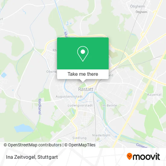
See Ina Zeitvogel, Vereinbarte Verwaltungsgemeinschaft Rastatt, on the map
Public Transit to Ina Zeitvogel in Vereinbarte Verwaltungsgemeinschaft Rastatt
Wondering how to get to Ina Zeitvogel in Vereinbarte Verwaltungsgemeinschaft Rastatt? Moovit helps you find the best way to get to Ina Zeitvogel with step-by-step directions from the nearest public transit station.
Moovit provides free maps and live directions to help you navigate through your city. View schedules, routes, timetables, and find out how long does it take to get to Ina Zeitvogel in real time.
Looking for the nearest stop or station to Ina Zeitvogel? Check out this list of stops closest to your destination: Rastatt Krankenhaus; Rastatt Schlossgalerie; Rastatt Schloss; Rastatt; Rastatt Beinle.
Bus: 212, 222, 234, 239, X34, 221, 227, 231, 221, 227, 231.Train: RB 44, RB44, RE2, S7, S8, RE7, S32, S71, S81.
Want to see if there’s another route that gets you there at an earlier time? Moovit helps you find alternative routes or times. Get directions from and directions to Ina Zeitvogel easily from the Moovit App or Website.
We make riding to Ina Zeitvogel easy, which is why over 1.5 million users, including users in Vereinbarte Verwaltungsgemeinschaft Rastatt, trust Moovit as the best app for public transit. You don’t need to download an individual bus app or train app, Moovit is your all-in-one transit app that helps you find the best bus time or train time available.
For information on prices of train, bus and light rail, costs and ride fares to Ina Zeitvogel, please check the Moovit app.
Use the app to navigate to popular places including to the airport, hospital, stadium, grocery store, mall, coffee shop, school, college, and university.
Ina Zeitvogel Address: Lyzeumstraße 21 76437 Rastatt street in Vereinbarte Verwaltungsgemeinschaft Rastatt
- Immorat GmbH Immobilien Rastatt,
- Schloßpark,
- A.M.Sports,
- Blackchip.Vc,
- Eberhard Brandt,
- Nachhaltig Landkreis Rastatt,
- Lyzeumstraße,
- Schäfer,
- Stefan Bratzel Heilpraktiker,
- Spielhalle California,
- Kieferorthopädische Praxis Dr.Nassim Trips,
- Kieferorthopädie,
- Lucian-Reich-Straße,
- Ärztenetz Mittelbaden,
- Krankenhausseelsorge,
- Dr.Med. Michael Hoeschel,
- Notdienstzentrale Rastatt,
- Klinikum Mittelbaden Klinik Rastatt-Notaufnahme,
- M-Bau,
- Johanna Adam Verwaltungs
Places Near Ina Zeitvogel (Vereinbarte Verwaltungsgemeinschaft Rastatt)
- Klinikum Stuttgart - Katharinenhospital, Stuttgart-Mitte,
- Mettingen Eros-Center Puff Laufhaus, Esslingen Am Neckar,
- Mercedes-Benz Museum (Mercedes Museum Stuttgart), Bad Cannstatt,
- SI-Centrum, Möhringen,
- Marmorsaal Im Weissenburgpark, Stuttgart-Süd,
- Waldfriedhof, Degerloch,
- FlixBus Haltestelle, Stuttgart,
- Mercedes-Benz Museum, Bad Cannstatt,
- Gasometer Pforzheim, Pforzheim,
- Pariser Platz Stuttgart, Stuttgart-Mitte,
- Wilhelma (U-Bahn Wilhelma), Bad Cannstatt,
- Porsche-Arena, Bad Cannstatt,
- Schleyerhalle, Bad Cannstatt,
- Hanns-Martin-Schleyer-Halle (Stuttgart Hans-Martin-Schleyerhalle), Bad Cannstatt,
- Im Wizemann (Halle), Bad Cannstatt,
- Porsche Museum, Zuffenhausen,
- Gleis 101/102 (tief), Stuttgart-Mitte,
- Geilhaus Haus 33a, Reutlingen-Betzingen,
- Hauptbahnhof Stuttgart, Stuttgart-Mitte,
- Hanns-Martin-Schleyer-Halle, Bad Cannstatt
How to get to popular places in Stuttgart with public transit
Get around Vereinbarte Verwaltungsgemeinschaft Rastatt by public transit!
Traveling around Vereinbarte Verwaltungsgemeinschaft Rastatt has never been so easy. See step by step directions as you travel to any attraction, street or major public transit station. View bus and train schedules, arrival times, service alerts and detailed routes on a map, so you know exactly how to get to anywhere in Vereinbarte Verwaltungsgemeinschaft Rastatt.
When traveling to any destination around Vereinbarte Verwaltungsgemeinschaft Rastatt use Moovit's Live Directions with Get Off Notifications to know exactly where and how far to walk, how long to wait for your line, and how many stops are left. Moovit will alert you when it's time to get off — no need to constantly re-check whether yours is the next stop.
Wondering how to use public transit in Vereinbarte Verwaltungsgemeinschaft Rastatt or how to pay for public transit in Vereinbarte Verwaltungsgemeinschaft Rastatt? Moovit public transit app can help you navigate your way with public transit easily, and at minimum cost. It includes public transit fees, ticket prices, and costs. Looking for a map of Vereinbarte Verwaltungsgemeinschaft Rastatt public transit lines? Moovit public transit app shows all public transit maps in Vereinbarte Verwaltungsgemeinschaft Rastatt with all Bus, Train, Subway, Light Rail, Ferry, S-Bahn and Funicular routes and stops on an interactive map.
Stuttgart has 7 transit type(s), including: Bus, Train, Subway, Light Rail, Ferry, S-Bahn and Funicular, operated by several transit agencies, including SSB - Stadtbahn, SSB, SSB - Seilbahn / Zacke, S-Bahn Stuttgart, Rhein-Neckar-Verkehr GmbH (rnv), Karlsruher Verkehrsverbund, DB AG, DB Regiobus BW, Arverio Baden-Württemberg GmbH, DB RegioNetz Verkehrs GmbH Westfrankenbahn, DB Regio AG Baden-Württemberg, Südwestdeutsche Verkehrs-AG, DB Regio AG Mitte Region Hessen, DB and Bodensee-Oberschwaben-Bahn