How to get to Inain by bus?
Click on the bus route to see step by step directions with maps, line arrival times and updated time schedules.
From Avintes, Vila Nova De Gaia
102 minFrom Rua Alto de Barreiros, Fânzeres e São Pedro da Cova
66 minFrom Rua Elias Garcia, Ermesinde
71 minFrom Madalena, Vila Nova De Gaia
50 minFrom Centro de Saúde de Gondomar, Gondomar (São Cosme), Valbom e Jovim
66 minFrom Nogueira da Maia, Nogueira e Silva Escura
75 minFrom MaiaShopping, Maia
86 minFrom Rua 5 de Outubro, Vila Nova De Gaia
90 minFrom Terminal Intermodal de Campanhã, Campanhã
52 minFrom Mimo Requintado, Gulpilhares e Valadares
102 min
How to get to Inain by train?
Click on the train route to see step by step directions with maps, line arrival times and updated time schedules.
How to get to Inain by metro?
Click on the metro route to see step by step directions with maps, line arrival times and updated time schedules.
Bus stops near Inain in Ramalde
Metro station near Inain in Ramalde
- Ramalde, 12 min walk,VIEW
Bus lines to Inain in Ramalde
- 202, Aliados - Passeio Alegre,VIEW
- 208, Trindade - Aldoar (J. Freg.),VIEW
- 501, Trindade - Matosinhos (Praia),VIEW
- 13M, Matosinhos Mercado,VIEW
- 507, Sidónio Pais,VIEW
- 601, Aeroporto,VIEW
- 2M, Av. Aliados,VIEW
- 201, Viso,VIEW
- 502, Bolhão,VIEW
- 503, Boavista (bom Sucesso),VIEW
- 504, Norteshopping,VIEW
- 1, Casa da Música,VIEW
What are the closest stations to Inain?
The closest stations to Inain are:
- Av. Do Bessa is 223 meters away, 4 min walk.
- Rot. Do Bessa is 263 meters away, 4 min walk.
- Bessa is 725 meters away, 10 min walk.
- António Patrício is 790 meters away, 11 min walk.
- Ramalde is 918 meters away, 12 min walk.
Which bus lines stop near Inain?
These bus lines stop near Inain: 202, 208, 501, 601.
Which train lines stop near Inain?
These train lines stop near Inain: IR, LINHA DE BRAGA, LINHA DO MARCO.
Which metro lines stop near Inain?
These metro lines stop near Inain: A, C, E.
What’s the nearest metro station to Inain in Ramalde?
The nearest metro station to Inain in Ramalde is Ramalde. It’s a 12 min walk away.
What’s the nearest bus station to Inain in Ramalde?
The nearest bus stations to Inain in Ramalde are Av. Do Bessa and Rot. Do Bessa. The closest one is a 4 min walk away.
What time is the first metro to Inain in Ramalde?
The C is the first metro that goes to Inain in Ramalde. It stops nearby at 6:00 AM.
What time is the last metro to Inain in Ramalde?
The A is the last metro that goes to Inain in Ramalde. It stops nearby at 1:29 AM.
What time is the first bus to Inain in Ramalde?
The 2M is the first bus that goes to Inain in Ramalde. It stops nearby at 3:09 AM.
What time is the last bus to Inain in Ramalde?
The 2M is the last bus that goes to Inain in Ramalde. It stops nearby at 2:47 AM.
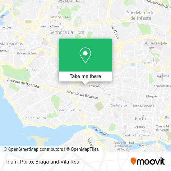
See Inain, Ramalde, on the map
Public Transit to Inain in Ramalde
Wondering how to get to Inain in Ramalde? Moovit helps you find the best way to get to Inain with step-by-step directions from the nearest public transit station.
Moovit provides free maps and live directions to help you navigate through your city. View schedules, routes, timetables, and find out how long does it take to get to Inain in real time.
Looking for the nearest stop or station to Inain? Check out this list of stops closest to your destination: Av. Do Bessa; Rot. Do Bessa; Bessa; António Patrício; Ramalde.
Bus: 202, 208, 501, 601, 13M, 507, 2M, 201, 502, 503, 504, 1.Train: IR, LINHA DE BRAGA, LINHA DO MARCO.Metro: A, C, E, B, BX.
Want to see if there’s another route that gets you there at an earlier time? Moovit helps you find alternative routes or times. Get directions from and directions to Inain easily from the Moovit App or Website.
We make riding to Inain easy, which is why over 1.5 million users, including users in Ramalde, trust Moovit as the best app for public transit. You don’t need to download an individual bus app or train app, Moovit is your all-in-one transit app that helps you find the best bus time or train time available.
For information on prices of bus, metro and train, costs and ride fares to Inain, please check the Moovit app.
Use the app to navigate to popular places including to the airport, hospital, stadium, grocery store, mall, coffee shop, school, college, and university.
Inain Address: Rua João de Deus 753 Boavista, 4100-462 Porto street in Ramalde
- Obs - Mediação de Seguros,
- Probiol-Produção de Biocombustiveis, S.a.,
- Mil e 1 Chás-Comércio de Chás, Unipessoal, Lda,
- Generali Tranquilidade Agente Ana Cristina Castro Samagaio,
- Casa do Ténis,
- Nletras Tabacaria,
- Rua Primeiro De Janeiro,
- Jgl Higiene e Limpeza,
- Evereve - Imobiliária,
- Evereve Clínica,
- Sadbury LLC-Representação Permanente Em Portugal,
- Clínica do Bessa,
- Anabela Peres de Sousa - Clínica de Medicina Dentária Integrativa,
- Midas Francos,
- Db Consultoria,
- Clínica e'Sensia,
- Climastar,
- Sociedade Interbancaria de Serviços S a Sibs,
- Loja Axadrezada,
- Área de Letras
Places Near Inain (Ramalde)
- Avintes, Vila Nova De Gaia,
- Palácio de Cristal, Lordelo do Ouro e Massarelos,
- Leça da Palmeira, Matosinhos e Leça da Palmeira,
- MAR Shopping, Matosinhos e Leça da Palmeira,
- Zoo Santo Inácio, Vila Nova De Gaia,
- Rua Calouste Gulbenkian, Lordelo do Ouro e Massarelos,
- Hospital de Santo António, Cedofeita, Santo Ildefonso, Sé, Miragaia, São Nicolau e Vitória,
- Senhor de Matosinhos, Matosinhos e Leça da Palmeira,
- VILA do CONDE PORTO FASHION OUTLET, Modivas,
- Canidelo, Vila Nova De Gaia,
- Acesso ao Shopping Parque Nascente, Campanhã,
- El Corte Inglés de Gaia, Mafamude e Vilar do Paraíso,
- Espinho, Espinho,
- Maia, Maia,
- Parque Aquatico Amarante - Aqua Aventura, Amarante,
- Hospital da Prelada, Ramalde,
- Hospital Santos Silva, Vila Nova De Gaia,
- Exponor, Matosinhos e Leça da Palmeira,
- Valongo, Valongo,
- Arrábida Shopping, Santa Marinha e São Pedro da Afurada
How to get to popular places in Porto, Braga and Vila Real with public transit
Get around Ramalde by public transit!
Traveling around Ramalde has never been so easy. See step by step directions as you travel to any attraction, street or major public transit station. View bus and train schedules, arrival times, service alerts and detailed routes on a map, so you know exactly how to get to anywhere in Ramalde.
When traveling to any destination around Ramalde use Moovit's Live Directions with Get Off Notifications to know exactly where and how far to walk, how long to wait for your line, and how many stops are left. Moovit will alert you when it's time to get off — no need to constantly re-check whether yours is the next stop.
Wondering how to use public transit in Ramalde or how to pay for public transit in Ramalde? Moovit public transit app can help you navigate your way with public transit easily, and at minimum cost. It includes public transit fees, ticket prices, and costs. Looking for a map of Ramalde public transit lines? Moovit public transit app shows all public transit maps in Ramalde with all Bus, Train, Metro, Ferry, Funicular and Gondola routes and stops on an interactive map.
Porto, Braga and Vila Real has 6 transit type(s), including: Bus, Train, Metro, Ferry, Funicular and Gondola, operated by several transit agencies, including Metro do Porto, Metro do Porto - Metrobus, CP - Comboios de Portugal, STCP, UNIR Mobilidade da Area Metropolitana do Porto, Getbus - Aerobus, Mobiave, Valpibus, TUB - Transportes Urbanos de Braga, TuViana, Guimabus, Ave Mobilidade, Cávado Mobilidade, Transdev and Câmara Municipal de Santo Tirso