Directions to Inaz Church (Beech Grove) with public transportation
The following transit lines have routes that pass near Inaz Church
 Bus: 56.
How to get to Inaz Church by bus?
Click on the bus route to see step by step directions with maps, line arrival times and updated time schedules.
From Bath & Body Works, Indianapolis City (Balance)
72 minFrom Trinity Insurance Agency LLC, Indianapolis City (Balance)
105 minFrom Prosperity Indiana, Indianapolis City (Balance)
54 minFrom IU Health Gateway Office Building, Indianapolis City (Balance)
54 minFrom Great Oaks Commons (dog park), Indianapolis City (Balance)
54 minFrom Rockitcoin, Indianapolis City (Balance)
52 minFrom St. Mary of the Woods college, Indianapolis City (Balance)
53 minFrom Indiana University Health / Gateway Plaza - Lot G, Indianapolis City (Balance)
54 minFrom US Bankruptcy Court, Indianapolis City (Balance)
42 minFrom Community Hospital South, Indianapolis City (Balance)
87 min
Bus stop near Inaz Church in Beech Grove
- Emerson Ave & Lifegate Way, 10 min walk,VIEW
Bus lines to Inaz Church in Beech Grove
- 56, Emerson/Thompson,VIEW
What are the closest stations to Inaz Church?
The closest stations to Inaz Church are:
- Emerson Ave & Lifegate Way is 801 yards away, 10 min walk.
Which bus line stops near Inaz Church?
56 (Emerson/Thompson)
What’s the nearest bus station to Inaz Church in Beech Grove?
The nearest bus station to Inaz Church in Beech Grove is Emerson Ave & Lifegate Way. It’s a 10 min walk away.
What time is the first bus to Inaz Church in Beech Grove?
The 56 is the first bus that goes to Inaz Church in Beech Grove. It stops nearby at 5:42 AM.
What time is the last bus to Inaz Church in Beech Grove?
The 56 is the last bus that goes to Inaz Church in Beech Grove. It stops nearby at 10:01 PM.
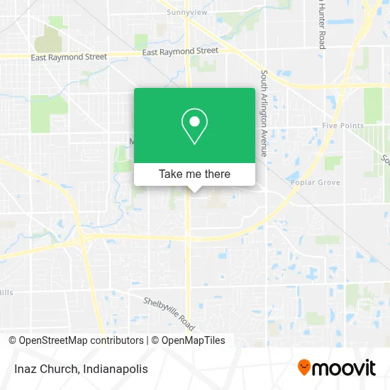
See Inaz Church, Beech Grove, on the map
Public Transit to Inaz Church in Beech Grove
Wondering how to get to Inaz Church in Beech Grove? Moovit helps you find the best way to get to Inaz Church with step-by-step directions from the nearest public transit station.
Moovit provides free maps and live directions to help you navigate through your city. View schedules, routes, timetables, and find out how long does it take to get to Inaz Church in real time.
Looking for the nearest stop or station to Inaz Church? Check out this list of stops closest to your destination: Emerson Ave & Lifegate Way.
Bus: 56.
Want to see if there’s another route that gets you there at an earlier time? Moovit helps you find alternative routes or times. Get directions from and directions to Inaz Church easily from the Moovit App or Website.
We make riding to Inaz Church easy, which is why over 1.5 million users, including users in Beech Grove, trust Moovit as the best app for public transit. You don’t need to download an individual bus app or train app, Moovit is your all-in-one transit app that helps you find the best bus time or train time available.
For information on prices of bus, costs and ride fares to Inaz Church, please check the Moovit app.
Use the app to navigate to popular places including to the airport, hospital, stadium, grocery store, mall, coffee shop, school, college, and university.
Inaz Church Address: 5152 Hornet Ave street in Beech Grove
- Indiana Bureau of Motor Vehicles,
- South Emerson Church of God,
- TACO BELL,
- Hornet Park Elementary School,
- Abundant Faith Christian Church,
- Sherry E Bowen Buzard NP,
- Community Physician Network Family Medicine Care,
- Beech Grove High School,
- National Pony of the Americas Club,
- Family Dollar,
- J and J Treasure Trove,
- 3 B's Enterprise,
- Fervent Prayer Church South,
- Riteway Tool & Fasteners Inc.,
- BMV Beech Grove,
- Churchman Hill Plaza Shopping Center,
- PJ's College of Cosmetology,
- Family Dollar / Dollar Tree,
- Emporium Flea Market,
- T and T Customz
Places Near Inaz Church (Beech Grove)
- I-465 / I-65 Interchange, Indianapolis City (Balance),
- Lilly Corporate Center (Eli Lilly & Co), Indianapolis City (Balance),
- Methodist Hospital of Indianapolis, Indianapolis City (Balance),
- Eskenazi Hospital, Indianapolis City (Balance),
- Indianapolis Motor Speedway, Speedway,
- Train Ride At Castleton Mall, Indianapolis City (Balance),
- Indianapolis Airport Zone 2, Indianapolis City (Balance),
- I U Health Methodist Hospital, Indianapolis City (Balance),
- Gainbridge Fieldhouse, Indianapolis City (Balance),
- Cotter's Massage Parlor With Happy Endings, Indianapolis City (Balance),
- Indiana, Indianapolis City (Balance),
- St. Vincent entrance #1, Indianapolis City (Balance),
- Jersey Barn, Indianapolis City (Balance),
- Indiana Convention Center, Indianapolis City (Balance),
- THE BALT, Indianapolis City (Balance),
- Plainfield, IN, Plainfield,
- St. Vincent Hospital - Indianapolis, Indianapolis City (Balance),
- Lucas Oil Stadium, Indianapolis City (Balance),
- Castleton Square Mall, Indianapolis,
- 119 W 19th St Parking, Indianapolis City (Balance)
How to get to popular places in Indianapolis with public transit
Get around Beech Grove by public transit!
Traveling around Beech Grove has never been so easy. See step by step directions as you travel to any attraction, street or major public transit station. View bus and train schedules, arrival times, service alerts and detailed routes on a map, so you know exactly how to get to anywhere in Beech Grove.
When traveling to any destination around Beech Grove use Moovit's Live Directions with Get Off Notifications to know exactly where and how far to walk, how long to wait for your line, and how many stops are left. Moovit will alert you when it's time to get off — no need to constantly re-check whether yours is the next stop.
Wondering how to use public transit in Beech Grove or how to pay for public transit in Beech Grove? Moovit public transit app can help you navigate your way with public transit easily, and at minimum cost. It includes public transit fees, ticket prices, and costs. Looking for a map of Beech Grove public transit lines? Moovit public transit app shows all public transit maps in Beech Grove with all bus routes and stops on an interactive map.
Indianapolis has 1 transit type(s), including: bus, operated by several transit agencies, including IndyGo, FlixBus-us and Greyhound-us