How to get to Income Care Unit by bus?
Click on the bus route to see step by step directions with maps, line arrival times and updated time schedules.
How to get to Income Care Unit by train?
Click on the train route to see step by step directions with maps, line arrival times and updated time schedules.
How to get to Income Care Unit by subway?
Click on the subway route to see step by step directions with maps, line arrival times and updated time schedules.
Subway stations near Income Care Unit in Manhattan
Bus stops near Income Care Unit in Manhattan
- Broadway at Exchange Pl#, 3 min walk,VIEW
- New York - Broadway @ Exchange Pl (Northbound), 3 min walk,VIEW
- Broadway/Exchange Alley, 3 min walk,VIEW
- Broadway/Rector St, 3 min walk,VIEW
- Broadway Between Exc. Place & Morris St, 4 min walk,VIEW
- Trinity Pl/Morris St, 4 min walk,VIEW
- Trinity Pl & Exchange Alley, 4 min walk,VIEW
- Broadway & Wall St, 4 min walk,VIEW
- Trinity Pl/Rector St, 5 min walk,VIEW
Bus lines to Income Care Unit in Manhattan
- 120, New York Lower Manhattan,VIEW
- 404, Wall Street to Route 9 (Pine Street),VIEW
- 604, Route 36 to Wall Street - Highlands Middle Road,VIEW
- 720, Exit 5 to Port Authority - Wall Street,VIEW
- 206, Parkway Express - Wall Street Via Jersey City,VIEW
- 314, Parkway Express to Wall Street-Starts Monmouth,VIEW
- SIM2, Tottenville Via Huguenot Av Via Hylan Bl,VIEW
- SIM32, Travis Via N Gannon Av Via Victory Bl,VIEW
- SIM34, Mariners Harbor Via Watchogue Rd,VIEW
- X27, Bay Ridge - Manhattan Express,VIEW
- X28, Sea Gate / Bensonhurst - Manhattan Express,VIEW
- SIM1, Eltngvlle Trans Ctr Via Hylan Via Rich,VIEW
- SIM1C, Eltngvlle Trans Ctr Via Hylan Via Rich,VIEW
- SIM3C, Pt Rchmnd Via Narrows Rd N Via Watchogue,VIEW
- SIM33C, Mariners Harbor Via N Gannon Av,VIEW
- SUBURBAN TRANSIT, New York,VIEW
- SIM4, Annadale Via Richmond Av,VIEW
- SIM4C, Huguenot Via Richmond Av Via Arthur Kill,VIEW
- QM65, Laurelton,VIEW
- SHORTLINE HUDSON, New York,VIEW
What are the closest stations to Income Care Unit?
The closest stations to Income Care Unit are:
- Broad St is 47 yards away, 1 min walk.
- Wall St is 162 yards away, 2 min walk.
- Broadway at Exchange Pl# is 190 yards away, 3 min walk.
- New York - Broadway @ Exchange Pl (Northbound) is 199 yards away, 3 min walk.
- Broadway/Exchange Alley is 217 yards away, 3 min walk.
- Broadway/Rector St is 231 yards away, 3 min walk.
- Broadway Between Exc. Place & Morris St is 234 yards away, 4 min walk.
- Trinity Pl/Morris St is 268 yards away, 4 min walk.
- Trinity Pl & Exchange Alley is 269 yards away, 4 min walk.
- Broadway & Wall St is 284 yards away, 4 min walk.
- Rector St is 285 yards away, 4 min walk.
- Trinity Pl/Rector St is 386 yards away, 5 min walk.
Which bus lines stop near Income Care Unit?
These bus lines stop near Income Care Unit: 120, BM2, BXM18, M15, M15-SBS.
Which train lines stop near Income Care Unit?
These train lines stop near Income Care Unit: BLU, GRE, RED.
Which subway lines stop near Income Care Unit?
These subway lines stop near Income Care Unit: 2, 3, 4, 5, R, W.
What’s the nearest subway station to Income Care Unit in Manhattan?
The nearest subway station to Income Care Unit in Manhattan is Broad St. It’s a 1 min walk away.
What’s the nearest bus station to Income Care Unit in Manhattan?
The nearest bus stations to Income Care Unit in Manhattan are Broadway at Exchange Pl#, New York - Broadway @ Exchange Pl (Northbound), Broadway/Exchange Alley and Broadway/Rector St. The closest one is a 3 min walk away.
What time is the first subway to Income Care Unit in Manhattan?
The 1 is the first subway that goes to Income Care Unit in Manhattan. It stops nearby at 3:00 AM.
What time is the last subway to Income Care Unit in Manhattan?
The 2 is the last subway that goes to Income Care Unit in Manhattan. It stops nearby at 4:12 AM.
What time is the first bus to Income Care Unit in Manhattan?
The SIM1C is the first bus that goes to Income Care Unit in Manhattan. It stops nearby at 3:56 AM.
What time is the last bus to Income Care Unit in Manhattan?
The SIM1C is the last bus that goes to Income Care Unit in Manhattan. It stops nearby at 2:56 AM.
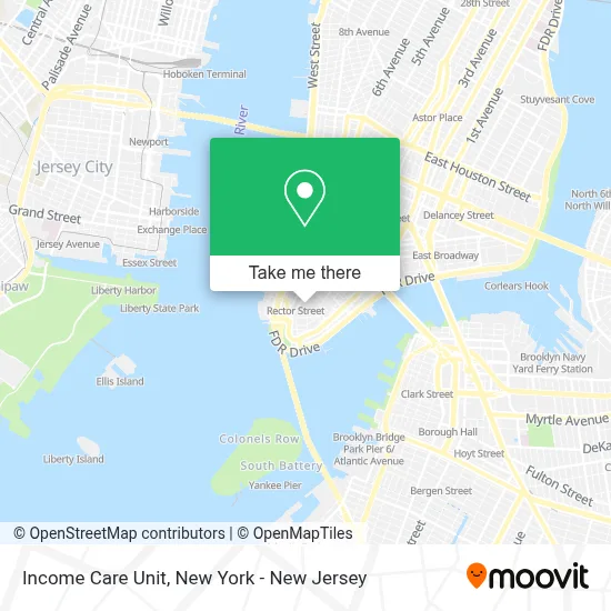
See Income Care Unit, Manhattan, on the map
Public Transit to Income Care Unit in Manhattan
Wondering how to get to Income Care Unit in Manhattan? Moovit helps you find the best way to get to Income Care Unit with step-by-step directions from the nearest public transit station.
Moovit provides free maps and live directions to help you navigate through your city. View schedules, routes, timetables, and find out how long does it take to get to Income Care Unit in real time.
Looking for the nearest stop or station to Income Care Unit? Check out this list of stops closest to your destination: Broad St; Wall St; Broadway at Exchange Pl#; New York - Broadway @ Exchange Pl (Northbound); Broadway/Exchange Alley; Broadway/Rector St; Broadway Between Exc. Place & Morris St; Trinity Pl/Morris St; Trinity Pl & Exchange Alley; Broadway & Wall St; Rector St; Trinity Pl/Rector St.
Bus: 120, BM2, BXM18, M15, M15-SBS, 404, 604, 720.Train: BLU, GRE, RED.Subway: 2, 3, 4, 5, R, W, J, M, Z, N, 1.
Want to see if there’s another route that gets you there at an earlier time? Moovit helps you find alternative routes or times. Get directions from and directions to Income Care Unit easily from the Moovit App or Website.
We make riding to Income Care Unit easy, which is why over 1.5 million users, including users in Manhattan, trust Moovit as the best app for public transit. You don’t need to download an individual bus app or train app, Moovit is your all-in-one transit app that helps you find the best bus time or train time available.
For information on prices of subway, bus and train, costs and ride fares to Income Care Unit, please check the Moovit app.
Use the app to navigate to popular places including to the airport, hospital, stadium, grocery store, mall, coffee shop, school, college, and university.
Income Care Unit Address: 30 Broad St street in Manhattan
- Family Court,
- Law Office of Peter G Goodman PLLC,
- Construction Law Expert,
- Clean 2 Clean,
- Precision Painting Plus,
- White Werbel & Fino,
- Complete Playground,
- BTB Soft,
- Lyftbiz,
- Unlocal,
- Gregory Kushnick Psy D,
- Bluestone Lane Coffee Shop - Financial District,
- Lezdo Techmed Llc,
- Tamer Nasr,
- Flat Rate Legal,
- Discipio,
- Mark Sharobeem,
- Goldencap,
- Lifespa,
- Navis Pack & Ship
Places Near Income Care Unit (Manhattan)
- Katz's Deli, Manhattan,
- Hudson Yards, Manhattan,
- 1 Police Plaza, Manhattan,
- Chinatown, Manhattan,
- qqqq, Manhattan,
- Queens Center Mall, Queens,
- Rockefeller Center, Manhattan,
- Pier 83, Manhattan,
- Bellevue Hospital, Manhattan,
- 3 Stone St, Manhattan,
- 111 Centre New York City Supreme Court, Manhattan,
- 26 Federal Plaza, Manhattan,
- 376 Hudson Street, Manhattan,
- San Gennaro Feast, Manhattan,
- 911 Memorial, Manhattan,
- Times Square, Manhattan,
- 66 John Street, Manhattan,
- Mountainside Hospital, Glen Ridge,
- Wall Street, Manhattan,
- SoHo, Manhattan
How to get to popular places in New York - New Jersey with public transit
Get around Manhattan by public transit!
Traveling around Manhattan has never been so easy. See step by step directions as you travel to any attraction, street or major public transit station. View bus and train schedules, arrival times, service alerts and detailed routes on a map, so you know exactly how to get to anywhere in Manhattan.
When traveling to any destination around Manhattan use Moovit's Live Directions with Get Off Notifications to know exactly where and how far to walk, how long to wait for your line, and how many stops are left. Moovit will alert you when it's time to get off — no need to constantly re-check whether yours is the next stop.
Wondering how to use public transit in Manhattan or how to pay for public transit in Manhattan? Moovit public transit app can help you navigate your way with public transit easily, and at minimum cost. It includes public transit fees, ticket prices, and costs. Looking for a map of Manhattan public transit lines? Moovit public transit app shows all public transit maps in Manhattan with all Bus, Train, Subway, Light Rail, Ferry and Cable Car routes and stops on an interactive map.
New York - New Jersey has 6 transit type(s), including: Bus, Train, Subway, Light Rail, Ferry and Cable Car, operated by several transit agencies, including MTA Subway, Metro-North Railroad, LIRR, PATH, MTA New York City Transit - Express routes, MTA Bus, NJ Transit, NYC Ferry, NICE bus, Bee-Line Bus, NJ Transit Rail, Norwalk Transit District, Hartford Line, River Valley Transit and HART