How to get to Indacochea by bus?
Click on the bus route to see step by step directions with maps, line arrival times and updated time schedules.
From RENIEC, Jesus Mari
40 minFrom Parque El Olivar, San Isidro
32 minFrom Av El Sol Villa El Salvador, Villa El S
52 minFrom Av Circunvalación club golf los inkas 206 208, Santiago D
54 minFrom Jesús María, Jesus Mari
35 minFrom Salamanca, Ate
54 minFrom Policlínico Pablo Bermúdez - EsSalud, Jesus Mari
41 minFrom Hospital Geriátrico San José PNP, San Miguel
43 min
How to get to Indacochea by metro?
Click on the metro route to see step by step directions with maps, line arrival times and updated time schedules.
Bus stops near Indacochea in Barranco
Metro station near Indacochea in Barranco
- Ayacucho, 26 min walk,VIEW
Bus lines to Indacochea in Barranco
- C, Terminal Matellini (Chorrillos) - Estación Ramón Castilla (Centro De Lima),VIEW
- EX1, Estación Central (Lima) - Terminal Matellini (Chorrillos),VIEW
- 1053, Campoy (San Juan De Lurigancho) - San Genaro (Chorrillos),VIEW
- 1055, Campoy (San Juan De Lurigancho) - Delicias De Villa (Chorrillos),VIEW
- 1087, Alameda Sur (Chorrillos) - 28 De Julio (Jesús María),VIEW
- 1090, Los Horizontes (Chorrillos) - Óvalo Gutiérrez (Miraflores) ,VIEW
- 1091, S.J.M - San Isidro,VIEW
- 1092, Sebastian Barranca (La Victoria) - San Genaro (Chorrillos),VIEW
- 1111, San Gabriel (Villa María Del Triunfo) - Universitaria (Lima),VIEW
- 1231, Chorrillos - Carabayllo,VIEW
- 1098, Wiesse (San Juan de Lurigancho) - Sumac Paccha (Lurín),VIEW
- L, Terminal Naranjal (Independencia) - Terminal Matellini (Chorrillos),VIEW
What are the closest stations to Indacochea?
The closest stations to Indacochea are:
- Estación Estadio Unión is 161 meters away, 3 min walk.
- Independencia, 202 is 363 meters away, 5 min walk.
- Montero Rosas is 457 meters away, 6 min walk.
- Estación Boulevard is 744 meters away, 10 min walk.
- Ayacucho is 1981 meters away, 26 min walk.
Which bus lines stop near Indacochea?
These bus lines stop near Indacochea: 1055, 1090, 1092, 1111, 1231, EX1.
Which metro line stops near Indacochea?
LINEA 1 (Separadora Industrial (Villa El Salvador) - Bayóvar (San Juan De Lurigancho))
What’s the nearest metro station to Indacochea in Barranco?
The nearest metro station to Indacochea in Barranco is Ayacucho. It’s a 26 min walk away.
What’s the nearest bus station to Indacochea in Barranco?
The nearest bus station to Indacochea in Barranco is Estación Estadio Unión. It’s a 3 min walk away.
What time is the first metro to Indacochea in Barranco?
The LINEA 1 is the first metro that goes to Indacochea in Barranco. It stops nearby at 5:15 AM.
What time is the last metro to Indacochea in Barranco?
The LINEA 1 is the last metro that goes to Indacochea in Barranco. It stops nearby at 10:33 PM.
What time is the first bus to Indacochea in Barranco?
The 1090 is the first bus that goes to Indacochea in Barranco. It stops nearby at 4:45 AM.
What time is the last bus to Indacochea in Barranco?
The 1111 is the last bus that goes to Indacochea in Barranco. It stops nearby at 11:37 PM.
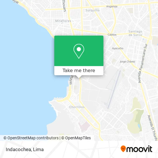
See Indacochea, Barranco, on the map
Public Transit to Indacochea in Barranco
Wondering how to get to Indacochea in Barranco? Moovit helps you find the best way to get to Indacochea with step-by-step directions from the nearest public transit station.
Moovit provides free maps and live directions to help you navigate through your city. View schedules, routes, timetables, and find out how long does it take to get to Indacochea in real time.
Looking for the nearest stop or station to Indacochea? Check out this list of stops closest to your destination: Estación Estadio Unión; Independencia; Montero Rosas; Estación Boulevard; Ayacucho.
Bus: 1055, 1090, 1092, 1111, 1231, EX1, C, 1053, 1087, 1091, 1098, L.Metro: LINEA 1.
Want to see if there’s another route that gets you there at an earlier time? Moovit helps you find alternative routes or times. Get directions from and directions to Indacochea easily from the Moovit App or Website.
We make riding to Indacochea easy, which is why over 1.5 million users, including users in Barranco, trust Moovit as the best app for public transit. You don’t need to download an individual bus app or train app, Moovit is your all-in-one transit app that helps you find the best bus time or train time available.
For information on prices of bus and metro, costs and ride fares to Indacochea, please check the Moovit app.
Use the app to navigate to popular places including to the airport, hospital, stadium, grocery store, mall, coffee shop, school, college, and university.
Indacochea Address: Jirón Independencia Cercado, 15063 Barranco street in Barranco
- I. E. Mercedes Indacochea,
- Agencia de Viaje-Killari Tours,
- Orquídea Catering y Eventos,
- Jirón Libertad 246 Barranco Lima Perú,
- Avenida Las Palmas,
- Gregorini Cebreros Carla Mariela,
- Calle Montero Rosas,
- denisse,
- Jr Montero Rosas 315,
- Pasaje Solari,
- CALLE LOS DEPORTES 132 BARRANCO URB SAUZALITO,
- Jr <Comandante Montero Rosas,
- Estadio Municipal de Barranco,
- PANAMERICANA SUR 270,
- Independencia,
- Estadio Union de Barranco,
- Calle JUAN FRANCISCO RAFFO 100,
- Calle Tarapaca,
- Calle Rissi No 129,
- Av Panamericana sur (bolognesi) frente a la estacion del metropolitano Union
Places Near Indacochea (Barranco)
- Av. La Marina, San Miguel,
- Mall Del Sur,
- Real Plaza Puruchuco, Ate,
- Hospital Edgardo Rebagliati Martins, Jesus Mari,
- av arequipa, Lima,
- Barranco, Barranco,
- Av. Salaverry, Jesus Mari,
- Plaza San Miguel, San Miguel,
- Circuito Mágico Del Agua, Lima,
- Parque de las Leyendas, San Miguel,
- Pontificia Universidad Católica del Perú - PUCP, San Miguel,
- Av. Abancay, Lima,
- Centro Comercial Plaza Norte, Independen,
- Parque Kennedy, Miraflores,
- Larcomar, Miraflores,
- Paradero Av.Brasil,
- Miraflores, Miraflores,
- Gamarra,
- Aeropuerto Internacional Jorge Chávez, Ventanilla,
- Jockey Plaza, Santiago D
How to get to popular places in Lima with public transit
Get around Barranco by public transit!
Traveling around Barranco has never been so easy. See step by step directions as you travel to any attraction, street or major public transit station. View bus and train schedules, arrival times, service alerts and detailed routes on a map, so you know exactly how to get to anywhere in Barranco.
When traveling to any destination around Barranco use Moovit's Live Directions with Get Off Notifications to know exactly where and how far to walk, how long to wait for your line, and how many stops are left. Moovit will alert you when it's time to get off — no need to constantly re-check whether yours is the next stop.
Wondering how to use public transit in Barranco or how to pay for public transit in Barranco? Moovit public transit app can help you navigate your way with public transit easily, and at minimum cost. It includes public transit fees, ticket prices, and costs. Looking for a map of Barranco public transit lines? Moovit public transit app shows all public transit maps in Barranco with all Bus, Metro and Ferry routes and stops on an interactive map.
Lima has 3 transit type(s), including: Bus, Metro and Ferry, operated by several transit agencies, including Metro de Lima Línea 2 , Metro de Lima, Corredor Rojo, Metropolitano, Metropolitano - Alimentadores, Corredor Morado, Corredor Azul, Rutas Tradicionales, Transportes y Servicios La Esperanza S.A., Las Flores S.A., Virgen de la Asunción S.A., Consorcio HAM, Transportes y Service Canadá S.A., ETUL4SA and ETUCHISA