How to get to Independence by bus?
Click on the bus route to see step by step directions with maps, line arrival times and updated time schedules.
From Champions at Lindbergh Elementary School, Tulsa
50 minFrom All Hands on Massage, Tulsa
55 minFrom Oyo Hotel Tulsa Ok I-44/Route 66, Tulsa
56 minFrom Zavala Plus, Tulsa
94 minFrom Transportes Juventino Rosas, Tulsa
93 minFrom Art Emporium 66, Tulsa
86 minFrom Pulperia HN, Tulsa
95 minFrom Red Fork Distillery, Tulsa
71 minFrom Raising Cane's Chicken Fingers, Tulsa
57 minFrom Auto Glass Now, Tulsa
61 min
Bus stops near Independence in Tulsa
Bus lines to Independence in Tulsa
What are the closest stations to Independence?
The closest stations to Independence are:
- (7379) Pine St & Columbia Ave Eb is 363 yards away, 5 min walk.
- (7198) Lewis Ave. & Marshal St. Nb is 983 yards away, 12 min walk.
- (8947) Harvard Ave & Newtown St Sb is 1730 yards away, 21 min walk.
Which bus lines stop near Independence?
These bus lines stop near Independence: 201, 440.
What’s the nearest bus station to Independence in Tulsa?
The nearest bus station to Independence in Tulsa is (7379) Pine St & Columbia Ave Eb. It’s a 5 min walk away.
What time is the first bus to Independence in Tulsa?
The 410 is the first bus that goes to Independence in Tulsa. It stops nearby at 5:43 AM.
What time is the last bus to Independence in Tulsa?
The 410 is the last bus that goes to Independence in Tulsa. It stops nearby at 7:23 PM.
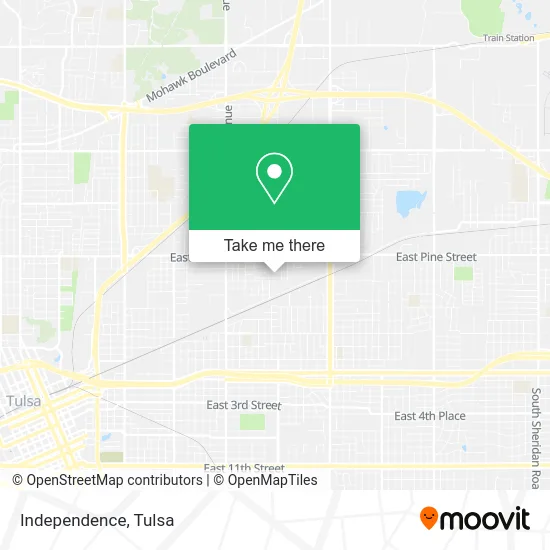
See Independence, Tulsa, on the map
Public Transit to Independence in Tulsa
Wondering how to get to Independence in Tulsa? Moovit helps you find the best way to get to Independence with step-by-step directions from the nearest public transit station.
Moovit provides free maps and live directions to help you navigate through your city. View schedules, routes, timetables, and find out how long does it take to get to Independence in real time.
Looking for the nearest stop or station to Independence? Check out this list of stops closest to your destination: (7379) Pine St & Columbia Ave Eb; (7198) Lewis Ave. & Marshal St. Nb; (8947) Harvard Ave & Newtown St Sb.
Bus: 201, 440, 410.
Want to see if there’s another route that gets you there at an earlier time? Moovit helps you find alternative routes or times. Get directions from and directions to Independence easily from the Moovit App or Website.
We make riding to Independence easy, which is why over 1.5 million users, including users in Tulsa, trust Moovit as the best app for public transit. You don’t need to download an individual bus app or train app, Moovit is your all-in-one transit app that helps you find the best bus time or train time available.
For information on prices of bus, costs and ride fares to Independence, please check the Moovit app.
Use the app to navigate to popular places including to the airport, hospital, stadium, grocery store, mall, coffee shop, school, college, and university.
Independence Address: Tulsa, OK 74110 street in Tulsa
- Taurino Remodeling,
- All-Pro Plumbing,
- Fixed Foundation Towers,
- The Crosby Group,
- FF Tasks,
- Las Palomas: Salon de Fiestas,
- Espino Insurance Agency,
- Urban Auto Salon,
- Church's Texas Chicken,
- Omega Laundromat,
- Herbal Meds,
- Lifesafer Ignition Interlock,
- Maxim Industrial Services,
- Pine & Harvard Discount Liquors & Wines,
- Jacee House Cleaning,
- Sinclair,
- Purpose Learning Academy,
- Jason West,
- Alternative Sober Living House,
- We do It All Renovation and Family Landscaping
Places Near Independence (Tulsa)
- St Francis South Cardinal Building, Tulsa,
- Tulsa Ok, Tulsa,
- Fallout Shelter, Tulsa,
- Bixby, OK, Bixby,
- 71st & Memorial, Tulsa,
- S Garnett Rd / E 21st St, Tulsa,
- Hard Rock Casino, Tulsa,
- Osage Casino, Tulsa,
- Zavala Plus, Tulsa,
- Amazon Fulfillment Center-TUL2, Tulsa,
- Alagon Spa (Olympus Spa), Tulsa,
- Tulsa Zoo, Tulsa,
- St. Francis Hospital Outpatient Infusion, Tulsa,
- Walmart, Tulsa,
- Saint Francis Hospital, Tulsa,
- Broken Arrow, OK, Broken Arrow,
- Tulsa State Fair, Tulsa,
- Plaza Santa Cecilia, Tulsa,
- River Spirit Casino, Tulsa,
- Woodland Hills Mall, Tulsa
How to get to popular places in Tulsa with public transit
Get around Tulsa by public transit!
Traveling around Tulsa has never been so easy. See step by step directions as you travel to any attraction, street or major public transit station. View bus and train schedules, arrival times, service alerts and detailed routes on a map, so you know exactly how to get to anywhere in Tulsa.
When traveling to any destination around Tulsa use Moovit's Live Directions with Get Off Notifications to know exactly where and how far to walk, how long to wait for your line, and how many stops are left. Moovit will alert you when it's time to get off — no need to constantly re-check whether yours is the next stop.
Wondering how to use public transit in Tulsa or how to pay for public transit in Tulsa? Moovit public transit app can help you navigate your way with public transit easily, and at minimum cost. It includes public transit fees, ticket prices, and costs. Looking for a map of Tulsa public transit lines? Moovit public transit app shows all public transit maps in Tulsa with all bus routes and stops on an interactive map.
Tulsa has 1 transit type(s), including: bus, operated by several transit agencies, including MetroLink Tulsa and Greyhound-us