How to get to Indepthpolygraphs.Com by bus?
Click on the bus route to see step by step directions with maps, line arrival times and updated time schedules.
From 177th Fort Washington Ave, Manhattan
64 minFrom Marriott Downtown, Manhattan
56 minFrom 168 St, Manhattan
58 minFrom 4 World Trade Center, Manhattan
53 minFrom Costco, Queens
45 minFrom 120 Wall Street, Manhattan
56 minFrom George Washington Bridge, Manhattan
77 minFrom The Bronx Zoo, Bronx
64 minFrom MetLife Stadium, East Rutherford
58 minFrom King Spa, Palisades Park
58 min
How to get to Indepthpolygraphs.Com by train?
Click on the train route to see step by step directions with maps, line arrival times and updated time schedules.
How to get to Indepthpolygraphs.Com by subway?
Click on the subway route to see step by step directions with maps, line arrival times and updated time schedules.
Bus stops near Indepthpolygraphs.Com in Manhattan
Subway stations near Indepthpolygraphs.Com in Manhattan
Bus lines to Indepthpolygraphs.Com in Manhattan
- QM1, Fresh Meadows 188 St Via Union Tpke,VIEW
- QM5, Glen Oaks 260 St Via H Hrdng Expwy,VIEW
- QM6, Midtown 57 St Via 6 Av,VIEW
- W44, Midtown / W 39th Street,VIEW
- BXM2, Riverdale 263 St Via H. Hudson Pky,VIEW
- SIM10, Eltingville Trans Ctr Via Hylan Via Rich,VIEW
- SIM30, Rosebank Via Forest Av,VIEW
- QM10, Lefrak City,VIEW
- QM12, Midtown 57 St Via 6 Av,VIEW
- QM24, Glendale 73 Pl Via Eliot Av,VIEW
- 57TH ST, Midtown / W 39th Street,VIEW
- QM15, Lindenwood - Midtown Express,VIEW
- QM16, Neponsit - Midtown Express,VIEW
- QM17, Far Rockaway - Midtown Express,VIEW
- QM18, South Ozone Park - Midtown Express,VIEW
- SIM1C, Eltingville - Manhattan Express,VIEW
- SIM3, Pt. Richmond - Midtown Manhattan Express,VIEW
- SIM3C, Pt. Richmond - Manhattan Express,VIEW
- SIM4C, Huguenot - Manhattan Express,VIEW
- SIM33C, Mariners Harbor - Greenwich Village Express,VIEW
What are the closest stations to Indepthpolygraphs.Com?
The closest stations to Indepthpolygraphs.Com are:
- 6 Av/W 55 St is 52 yards away, 1 min walk.
- 6th Ave & W 53rd St is 90 yards away, 2 min walk.
- 6 Av/W 53 St is 101 yards away, 2 min walk.
- W 57 St/6 Av is 191 yards away, 3 min walk.
- 6 Av/W 56 St is 202 yards away, 3 min walk.
- W 57th St & 6th Ave is 243 yards away, 4 min walk.
- 6 Av/W 57 St is 252 yards away, 3 min walk.
- 5 Av/53 St is 255 yards away, 4 min walk.
- 7 Av is 400 yards away, 5 min walk.
- 57 St-7 Av is 544 yards away, 7 min walk.
- 57 St is 647 yards away, 8 min walk.
Which bus lines stop near Indepthpolygraphs.Com?
These bus lines stop near Indepthpolygraphs.Com: BXM4, M31, M5, M7, QM12.
Which train lines stop near Indepthpolygraphs.Com?
These train lines stop near Indepthpolygraphs.Com: 2, YEL.
Which subway lines stop near Indepthpolygraphs.Com?
These subway lines stop near Indepthpolygraphs.Com: A, E, M, R, W.
What’s the nearest subway station to Indepthpolygraphs.Com in Manhattan?
The nearest subway station to Indepthpolygraphs.Com in Manhattan is 5 Av/53 St. It’s a 4 min walk away.
What’s the nearest bus station to Indepthpolygraphs.Com in Manhattan?
The nearest bus station to Indepthpolygraphs.Com in Manhattan is 6 Av/W 55 St. It’s a 1 min walk away.
What time is the first subway to Indepthpolygraphs.Com in Manhattan?
The F is the first subway that goes to Indepthpolygraphs.Com in Manhattan. It stops nearby at 3:00 AM.
What time is the last subway to Indepthpolygraphs.Com in Manhattan?
The D is the last subway that goes to Indepthpolygraphs.Com in Manhattan. It stops nearby at 3:55 AM.
What time is the first bus to Indepthpolygraphs.Com in Manhattan?
The SIM1C is the first bus that goes to Indepthpolygraphs.Com in Manhattan. It stops nearby at 3:05 AM.
What time is the last bus to Indepthpolygraphs.Com in Manhattan?
The SIM1C is the last bus that goes to Indepthpolygraphs.Com in Manhattan. It stops nearby at 3:05 AM.
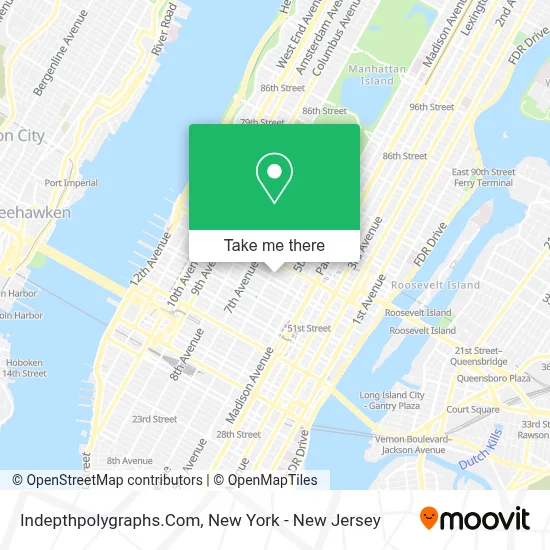
See Indepthpolygraphs.Com, Manhattan, on the map
Public Transit to Indepthpolygraphs.Com in Manhattan
Wondering how to get to Indepthpolygraphs.Com in Manhattan? Moovit helps you find the best way to get to Indepthpolygraphs.Com with step-by-step directions from the nearest public transit station.
Moovit provides free maps and live directions to help you navigate through your city. View schedules, routes, timetables, and find out how long does it take to get to Indepthpolygraphs.Com in real time.
Looking for the nearest stop or station to Indepthpolygraphs.Com? Check out this list of stops closest to your destination: 6 Av/W 55 St; 6th Ave & W 53rd St; 6 Av/W 53 St; W 57 St/6 Av; 6 Av/W 56 St; W 57th St & 6th Ave; 6 Av/W 57 St; 5 Av/53 St; 7 Av; 57 St-7 Av; 57 St.
Bus: BXM4, M31, M5, M7, QM12, QM1, QM5, QM6, W44.Train: 2, YEL.Subway: A, E, M, R, W, F, FX, B, D, N, Q.
Want to see if there’s another route that gets you there at an earlier time? Moovit helps you find alternative routes or times. Get directions from and directions to Indepthpolygraphs.Com easily from the Moovit App or Website.
We make riding to Indepthpolygraphs.Com easy, which is why over 1.5 million users, including users in Manhattan, trust Moovit as the best app for public transit. You don’t need to download an individual bus app or train app, Moovit is your all-in-one transit app that helps you find the best bus time or train time available.
For information on prices of subway, bus and train, costs and ride fares to Indepthpolygraphs.Com, please check the Moovit app.
Use the app to navigate to popular places including to the airport, hospital, stadium, grocery store, mall, coffee shop, school, college, and university.
Indepthpolygraphs.Com Address: 1350 6th Ave street in Manhattan
- Lasttech,
- Maram Travel,
- N.E.W. Skincare,
- Ultyconnect,
- Leadoff Sports,
- Innovo Property Group,
- Casdin Capital, Llc,
- Home Improvement & Renovation Midtown,
- Open Hands Initiative,
- Dayen Group - Executive and Leadership Coaching,
- Fastpasscorp A/S,
- Rooldrive,
- J.O.Y Inc,
- Moma Rain Room,
- Kidonakis & Corona Pllc,
- Zuna,
- Stop - Surveillance Technology Oversight Project,
- Iirr,
- KPMG,
- Breather
Places Near Indepthpolygraphs.Com (Manhattan)
- Queens Center Mall, Queens,
- Rockefeller Center, Manhattan,
- San Gennaro Feast, Manhattan,
- Katz's Deli, Manhattan,
- 111 Centre New York City Supreme Court, Manhattan,
- Times Square, Manhattan,
- Mountainside Hospital, Glen Ridge,
- 66 John Street, Manhattan,
- 376 Hudson Street, Manhattan,
- qqqq, Manhattan,
- Hudson Yards, Manhattan,
- 3 Stone St, Manhattan,
- Wall Street, Manhattan,
- SoHo, Manhattan,
- 911 Memorial, Manhattan,
- Chinatown, Manhattan,
- Bellevue Hospital, Manhattan,
- Pier 83, Manhattan,
- 1 Police Plaza, Manhattan,
- 26 Federal Plaza, Manhattan
How to get to popular places in New York - New Jersey with public transit
Get around Manhattan by public transit!
Traveling around Manhattan has never been so easy. See step by step directions as you travel to any attraction, street or major public transit station. View bus and train schedules, arrival times, service alerts and detailed routes on a map, so you know exactly how to get to anywhere in Manhattan.
When traveling to any destination around Manhattan use Moovit's Live Directions with Get Off Notifications to know exactly where and how far to walk, how long to wait for your line, and how many stops are left. Moovit will alert you when it's time to get off — no need to constantly re-check whether yours is the next stop.
Wondering how to use public transit in Manhattan or how to pay for public transit in Manhattan? Moovit public transit app can help you navigate your way with public transit easily, and at minimum cost. It includes public transit fees, ticket prices, and costs. Looking for a map of Manhattan public transit lines? Moovit public transit app shows all public transit maps in Manhattan with all Bus, Train, Subway, Light Rail, Ferry and Cable Car routes and stops on an interactive map.
New York - New Jersey has 6 transit type(s), including: Bus, Train, Subway, Light Rail, Ferry and Cable Car, operated by several transit agencies, including MTA Subway, Metro-North Railroad, LIRR, PATH, MTA New York City Transit - Express routes, MTA Bus, NJ Transit, NYC Ferry, NICE bus, Bee-Line Bus, NJ Transit Rail, Norwalk Transit District, Hartford Line, River Valley Transit and HART