How to get to Indiana Rural Community Assistance Program by bus?
Click on the bus route to see step by step directions with maps, line arrival times and updated time schedules.
From MERRELL, Indianapolis City (Balance)
42 minFrom Carniceria El Ranchito Supermarket, Indianapolis City (Balance)
57 minFrom FedEx, Indianapolis City (Balance)
49 minFrom Eclipse Real Estate, Indianapolis City (Balance)
42 minFrom S Harding St / W Raymond St, Indianapolis City (Balance)
77 minFrom Broad Ripple Park Tennis Courts, Indianapolis City (Balance)
54 minFrom Richard's Brothel, Indianapolis City (Balance)
55 minFrom Biolife Plasma Services, Indianapolis City (Balance)
81 minFrom Exit 107/Keystone Ave/S, Indianapolis City (Balance)
81 minFrom No 7 Salon & Spa Studio, Indianapolis City (Balance)
39 min
Bus stops near Indiana Rural Community Assistance Program in Indianapolis City (Balance)
Bus lines to Indiana Rural Community Assistance Program in Indianapolis City (Balance)
What are the closest stations to Indiana Rural Community Assistance Program?
The closest stations to Indiana Rural Community Assistance Program are:
- Lafayette Rd & 16th St is 124 yards away, 2 min walk.
- Lafayette Rd & 17th St is 191 yards away, 3 min walk.
- 16th St & Harding St is 290 yards away, 4 min walk.
Which bus lines stop near Indiana Rural Community Assistance Program?
These bus lines stop near Indiana Rural Community Assistance Program: 15, 25, 30.
What’s the nearest bus station to Indiana Rural Community Assistance Program in Indianapolis City (Balance)?
The nearest bus station to Indiana Rural Community Assistance Program in Indianapolis City (Balance) is Lafayette Rd & 16th St. It’s a 2 min walk away.
What time is the first bus to Indiana Rural Community Assistance Program in Indianapolis City (Balance)?
The 6 is the first bus that goes to Indiana Rural Community Assistance Program in Indianapolis City (Balance). It stops nearby at 4:54 AM.
What time is the last bus to Indiana Rural Community Assistance Program in Indianapolis City (Balance)?
The 6 is the last bus that goes to Indiana Rural Community Assistance Program in Indianapolis City (Balance). It stops nearby at 12:00 AM.
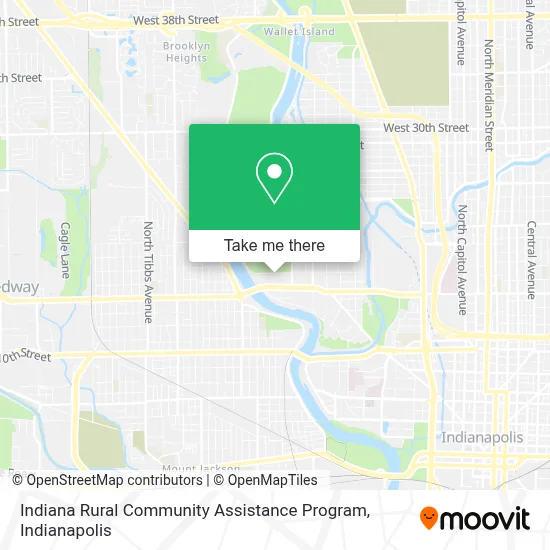
See Indiana Rural Community Assistance Program, Indianapolis City (Balance), on the map
Public Transit to Indiana Rural Community Assistance Program in Indianapolis City (Balance)
Wondering how to get to Indiana Rural Community Assistance Program in Indianapolis City (Balance)? Moovit helps you find the best way to get to Indiana Rural Community Assistance Program with step-by-step directions from the nearest public transit station.
Moovit provides free maps and live directions to help you navigate through your city. View schedules, routes, timetables, and find out how long does it take to get to Indiana Rural Community Assistance Program in real time.
Looking for the nearest stop or station to Indiana Rural Community Assistance Program? Check out this list of stops closest to your destination: Lafayette Rd & 16th St; Lafayette Rd & 17th St; 16th St & Harding St.
Bus: 15, 25, 30, 37, 6.
Want to see if there’s another route that gets you there at an earlier time? Moovit helps you find alternative routes or times. Get directions from and directions to Indiana Rural Community Assistance Program easily from the Moovit App or Website.
We make riding to Indiana Rural Community Assistance Program easy, which is why over 1.5 million users, including users in Indianapolis City (Balance), trust Moovit as the best app for public transit. You don’t need to download an individual bus app or train app, Moovit is your all-in-one transit app that helps you find the best bus time or train time available.
For information on prices of bus, costs and ride fares to Indiana Rural Community Assistance Program, please check the Moovit app.
Use the app to navigate to popular places including to the airport, hospital, stadium, grocery store, mall, coffee shop, school, college, and university.
Indiana Rural Community Assistance Program Address: 1845 W 18th St street in Indianapolis City (Balance)
- 10,
- 13,
- Vintage Indy Registry,
- Silly Puddy,
- Box Media Production Space,
- Center Township Assessor,
- Annex Group Trailer,
- Fair Haven Foundation,
- Los Molcajetes El Patiecito,
- Taylor - Dunn,
- The Little Swans Academy Daycare,
- B&B Contracting & Supply,
- Harding Center,
- Edington Gallery,
- Long's Bakery (Longs Bakery),
- Pershing Place,
- Pershing Place Apartments,
- Arely Romero,
- Amoco,
- Krispy Krunchy Chicken
Places Near Indiana Rural Community Assistance Program (Indianapolis City (Balance))
- I U Health Methodist Hospital, Indianapolis City (Balance),
- Plainfield, IN, Plainfield,
- Gainbridge Fieldhouse, Indianapolis City (Balance),
- Castleton Square Mall, Indianapolis,
- Lucas Oil Stadium, Indianapolis City (Balance),
- Eskenazi Hospital, Indianapolis City (Balance),
- THE BALT, Indianapolis City (Balance),
- I-465 / I-65 Interchange, Indianapolis City (Balance),
- 119 W 19th St Parking, Indianapolis City (Balance),
- Cotter's Massage Parlor With Happy Endings, Indianapolis City (Balance),
- St. Vincent Hospital - Indianapolis, Indianapolis City (Balance),
- Methodist Hospital of Indianapolis, Indianapolis City (Balance),
- Indiana Convention Center, Indianapolis City (Balance),
- Jersey Barn, Indianapolis City (Balance),
- Indiana, Indianapolis City (Balance),
- St. Vincent entrance #1, Indianapolis City (Balance),
- Train Ride At Castleton Mall, Indianapolis City (Balance),
- Lilly Corporate Center (Eli Lilly & Co), Indianapolis City (Balance),
- Indianapolis Airport Zone 2, Indianapolis City (Balance),
- Indianapolis Motor Speedway, Speedway
How to get to popular places in Indianapolis with public transit
Get around Indianapolis City (Balance) by public transit!
Traveling around Indianapolis City (Balance) has never been so easy. See step by step directions as you travel to any attraction, street or major public transit station. View bus and train schedules, arrival times, service alerts and detailed routes on a map, so you know exactly how to get to anywhere in Indianapolis City (Balance).
When traveling to any destination around Indianapolis City (Balance) use Moovit's Live Directions with Get Off Notifications to know exactly where and how far to walk, how long to wait for your line, and how many stops are left. Moovit will alert you when it's time to get off — no need to constantly re-check whether yours is the next stop.
Wondering how to use public transit in Indianapolis City (Balance) or how to pay for public transit in Indianapolis City (Balance)? Moovit public transit app can help you navigate your way with public transit easily, and at minimum cost. It includes public transit fees, ticket prices, and costs. Looking for a map of Indianapolis City (Balance) public transit lines? Moovit public transit app shows all public transit maps in Indianapolis City (Balance) with all bus routes and stops on an interactive map.
Indianapolis has 1 transit type(s), including: bus, operated by several transit agencies, including IndyGo, FlixBus-us and Greyhound-us