How to get to Indiana State Health Insurance Assistance Program - Ship by bus?
Click on the bus route to see step by step directions with maps, line arrival times and updated time schedules.
From Super 8-Indianapolis Emerson Ave (Indianapolis Super Eight), Beech Grove
43 minFrom Saraga International Grocery, Indianapolis City (Balance)
36 minFrom Q St, Beech Grove
37 minFrom Moller Road & 38th Street, Indianapolis
59 minFrom Copyfire Type, Indianapolis City (Balance)
40 minFrom Midtown Indiana Polis, Indianapolis City (Balance)
30 minFrom Meijer, Indianapolis City (Balance)
65 minFrom Metropolitan, Indianapolis City (Balance)
39 minFrom USPS Collection Box - Blue Box, Indianapolis City (Balance)
64 min
Bus stops near Indiana State Health Insurance Assistance Program - Ship in Indianapolis City (Balance)
Bus lines to Indiana State Health Insurance Assistance Program - Ship in Indianapolis City (Balance)
- 90, 66th,VIEW
- 92, Transit Center,VIEW
- 8, Airport,VIEW
- 24, Ameriplex,VIEW
- 3, Michigan Street,VIEW
- 6, Harding,VIEW
- 10, 10th Street,VIEW
- 15, West 34th St,VIEW
- 34, ML King/Michigan Rd,VIEW
- 37, Park 100,VIEW
- 11, Community Hosp East,VIEW
- 25, Walmart Laf Rd,VIEW
- GREYHOUND US0100, Atlanta - Chicago,VIEW
- GREYHOUND US0112, Montgomery - Nashville - Detroit,VIEW
- GREYHOUND US0120S, Chicago - Indianapolis,VIEW
- GREYHOUND US0157S, Indianapolis - Des Moines,VIEW
- GREYHOUND US0421, New York - Pittsburgh - St. Louis,VIEW
What are the closest stations to Indiana State Health Insurance Assistance Program - Ship?
The closest stations to Indiana State Health Insurance Assistance Program - Ship are:
- Statehouse Station Nb is 124 yards away, 2 min walk.
- Washington St & Victory Field - 800 W is 139 yards away, 3 min walk.
- Washington St & Senate Ave is 311 yards away, 4 min walk.
- Vermont St & Capitol Ave is 533 yards away, 7 min walk.
- Ohio St & Meridian St is 572 yards away, 7 min walk.
- Indianapolis Bus Station is 616 yards away, 8 min walk.
Which bus lines stop near Indiana State Health Insurance Assistance Program - Ship?
These bus lines stop near Indiana State Health Insurance Assistance Program - Ship: 8, 90, 92.
What’s the nearest bus station to Indiana State Health Insurance Assistance Program - Ship in Indianapolis City (Balance)?
The nearest bus station to Indiana State Health Insurance Assistance Program - Ship in Indianapolis City (Balance) is Statehouse Station Nb. It’s a 2 min walk away.
What time is the first bus to Indiana State Health Insurance Assistance Program - Ship in Indianapolis City (Balance)?
The GREYHOUND US0100 is the first bus that goes to Indiana State Health Insurance Assistance Program - Ship in Indianapolis City (Balance). It stops nearby at 4:40 AM.
What time is the last bus to Indiana State Health Insurance Assistance Program - Ship in Indianapolis City (Balance)?
The GREYHOUND US0421 is the last bus that goes to Indiana State Health Insurance Assistance Program - Ship in Indianapolis City (Balance). It stops nearby at 7:35 PM.
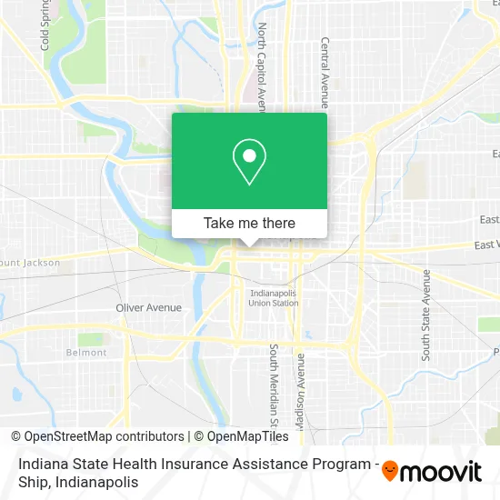
See Indiana State Health Insurance Assistance Program - Ship, Indianapolis City (Balance), on the map
Public Transit to Indiana State Health Insurance Assistance Program - Ship in Indianapolis City (Balance)
Wondering how to get to Indiana State Health Insurance Assistance Program - Ship in Indianapolis City (Balance)? Moovit helps you find the best way to get to Indiana State Health Insurance Assistance Program - Ship with step-by-step directions from the nearest public transit station.
Moovit provides free maps and live directions to help you navigate through your city. View schedules, routes, timetables, and find out how long does it take to get to Indiana State Health Insurance Assistance Program - Ship in real time.
Looking for the nearest stop or station to Indiana State Health Insurance Assistance Program - Ship? Check out this list of stops closest to your destination: Statehouse Station Nb; Washington St & Victory Field - 800 W; Washington St & Senate Ave; Vermont St & Capitol Ave; Ohio St & Meridian St; Indianapolis Bus Station.
Bus: 8, 90, 92, 24, 3, 6, 10, 15, 34, 11, 25, GREYHOUND US0100, GREYHOUND US0112, GREYHOUND US0120S, GREYHOUND US0157S, GREYHOUND US0421.
Want to see if there’s another route that gets you there at an earlier time? Moovit helps you find alternative routes or times. Get directions from and directions to Indiana State Health Insurance Assistance Program - Ship easily from the Moovit App or Website.
We make riding to Indiana State Health Insurance Assistance Program - Ship easy, which is why over 1.5 million users, including users in Indianapolis City (Balance), trust Moovit as the best app for public transit. You don’t need to download an individual bus app or train app, Moovit is your all-in-one transit app that helps you find the best bus time or train time available.
For information on prices of bus, costs and ride fares to Indiana State Health Insurance Assistance Program - Ship, please check the Moovit app.
Use the app to navigate to popular places including to the airport, hospital, stadium, grocery store, mall, coffee shop, school, college, and university.
Indiana State Health Insurance Assistance Program - Ship Address: 311 W Washington St street in Indianapolis City (Balance)
- Rakdevelopments Incorporated Enterprises LLC PLLC 1994,
- Hannah News,
- Marks Realty,
- Presidential Place Park,
- Breakthrough Performance Group LLC,
- House of Class Bartender Services,
- Indiana Government Center Conference Room B,
- Indiana Alcohol & Tobacco Commission,
- Indiana State Board of Accounts,
- Indianapolis Marriott Downtown,
- Marriott-Indianapolis Downtown ,
- The Stargate,
- Liz's Office,
- STARBUCKS,
- Capitol Commons Garage,
- Republic Parking,
- Plaza Carolina Mall,
- Plaza Carolina Mall (Lincoln Plaza Center),
- FDIC,
- Green Line Airport Shuttle
Places Near Indiana State Health Insurance Assistance Program - Ship (Indianapolis City (Balance))
- Castleton Square Mall, Indianapolis,
- I U Health Methodist Hospital, Indianapolis City (Balance),
- Indianapolis Airport Zone 2, Indianapolis City (Balance),
- Jersey Barn, Indianapolis City (Balance),
- 119 W 19th St Parking, Indianapolis City (Balance),
- Indiana, Indianapolis City (Balance),
- Eskenazi Hospital, Indianapolis City (Balance),
- St. Vincent Hospital - Indianapolis, Indianapolis City (Balance),
- Plainfield, IN, Plainfield,
- Indianapolis Motor Speedway, Speedway,
- Methodist Hospital of Indianapolis, Indianapolis City (Balance),
- I-465 / I-65 Interchange, Indianapolis City (Balance),
- Train Ride At Castleton Mall, Indianapolis City (Balance),
- Gainbridge Fieldhouse, Indianapolis City (Balance),
- Cotter's Massage Parlor With Happy Endings, Indianapolis City (Balance),
- Indiana Convention Center, Indianapolis City (Balance),
- Lucas Oil Stadium, Indianapolis City (Balance),
- THE BALT, Indianapolis City (Balance),
- Lilly Corporate Center (Eli Lilly & Co), Indianapolis City (Balance),
- St. Vincent entrance #1, Indianapolis City (Balance)
How to get to popular places in Indianapolis with public transit
Get around Indianapolis City (Balance) by public transit!
Traveling around Indianapolis City (Balance) has never been so easy. See step by step directions as you travel to any attraction, street or major public transit station. View bus and train schedules, arrival times, service alerts and detailed routes on a map, so you know exactly how to get to anywhere in Indianapolis City (Balance).
When traveling to any destination around Indianapolis City (Balance) use Moovit's Live Directions with Get Off Notifications to know exactly where and how far to walk, how long to wait for your line, and how many stops are left. Moovit will alert you when it's time to get off — no need to constantly re-check whether yours is the next stop.
Wondering how to use public transit in Indianapolis City (Balance) or how to pay for public transit in Indianapolis City (Balance)? Moovit public transit app can help you navigate your way with public transit easily, and at minimum cost. It includes public transit fees, ticket prices, and costs. Looking for a map of Indianapolis City (Balance) public transit lines? Moovit public transit app shows all public transit maps in Indianapolis City (Balance) with all bus routes and stops on an interactive map.
Indianapolis has 1 transit type(s), including: bus, operated by several transit agencies, including IndyGo, FlixBus-us and Greyhound-us