How to get to Infinity Play by bus?
Click on the bus route to see step by step directions with maps, line arrival times and updated time schedules.
From Old Strathcona Farmer's Market, Edmonton
52 minFrom Dr Diane Hinves Psychologist, Edmonton
56 minFrom Telus World Of Science, Edmonton
51 minFrom Old Strathcona, Edmonton
51 minFrom Argyll Road and 75 Street, Edmonton
80 minFrom 14315 118 Avenue Northwest, Edmonton
67 minFrom Edmonton's K-days, Edmonton
32 minFrom La Cite Francophone, Edmonton
68 minFrom JW Marriott Edmonton Ice District Residences, Edmonton
36 minFrom Epl Edmonton Public Library, Edmonton
71 min
Bus stops near Infinity Play in Edmonton
Light Rail stations near Infinity Play in Edmonton
- Belvedere Station, 24 min walk,VIEW
Bus lines to Infinity Play in Edmonton
What are the closest stations to Infinity Play?
The closest stations to Infinity Play are:
- Manning Drive & 137 Avenue is 177 meters away, 3 min walk.
- Fort Road & 136 Avenue is 189 meters away, 3 min walk.
- 50 Street & 140 Avenue is 774 meters away, 10 min walk.
- 50 Street & 137 Avenue is 816 meters away, 11 min walk.
- Belvedere Station is 1862 meters away, 24 min walk.
Which bus lines stop near Infinity Play?
These bus lines stop near Infinity Play: 053, 054.
What’s the nearest light rail station to Infinity Play in Edmonton?
The nearest light rail station to Infinity Play in Edmonton is Belvedere Station. It’s a 24 min walk away.
What’s the nearest bus station to Infinity Play in Edmonton?
The nearest bus stations to Infinity Play in Edmonton are Manning Drive & 137 Avenue and Fort Road & 136 Avenue. The closest one is a 3 min walk away.
What time is the first bus to Infinity Play in Edmonton?
The 002 is the first bus that goes to Infinity Play in Edmonton. It stops nearby at 3:21 AM.
What time is the last bus to Infinity Play in Edmonton?
The 002 is the last bus that goes to Infinity Play in Edmonton. It stops nearby at 3:21 AM.
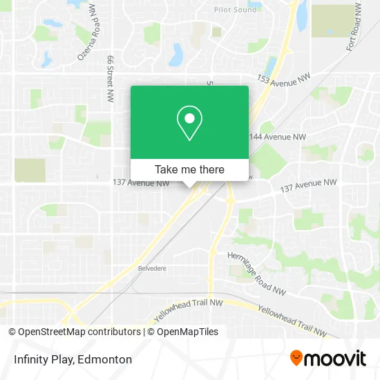
See Infinity Play, Edmonton, on the map
Public Transit to Infinity Play in Edmonton
Wondering how to get to Infinity Play in Edmonton? Moovit helps you find the best way to get to Infinity Play with step-by-step directions from the nearest public transit station.
Moovit provides free maps and live directions to help you navigate through your city. View schedules, routes, timetables, and find out how long does it take to get to Infinity Play in real time.
Looking for the nearest stop or station to Infinity Play? Check out this list of stops closest to your destination: Manning Drive & 137 Avenue; Fort Road & 136 Avenue; 50 Street & 140 Avenue; 50 Street & 137 Avenue; Belvedere Station.
Bus: 053, 054, 002, 633, 113, 114, 119, 104.
Want to see if there’s another route that gets you there at an earlier time? Moovit helps you find alternative routes or times. Get directions from and directions to Infinity Play easily from the Moovit App or Website.
We make riding to Infinity Play easy, which is why over 1.5 million users, including users in Edmonton, trust Moovit as the best app for public transit. You don’t need to download an individual bus app or train app, Moovit is your all-in-one transit app that helps you find the best bus time or train time available.
For information on prices of bus and light rail, costs and ride fares to Infinity Play, please check the Moovit app.
Use the app to navigate to popular places including to the airport, hospital, stadium, grocery store, mall, coffee shop, school, college, and university.
Infinity Play Address: 13560 Fort Rd NW Edmonton, AB T5A 1C5 street in Edmonton
- Weight Watchers,
- Budget House,
- Mamystar Edmonton,
- Reflectix,
- 13578 Fort Road Northwest,
- Savers,
- Scoop N Roll Creamery,
- Red Claw Gaming Corp.,
- Treasure Hunt YEG Liquidation Store,
- Value Village,
- Coinamatic,
- Manning Drive & 137 Avenue,
- Kokomo Beach,
- Boston Pizza,
- Apna Panjab Sweets,
- Amazon Locker-Rahf,
- Indian & South Pacific Market,
- Rycor Holdings,
- Manning Crossing Shopping Center,
- Nca National Cash Advance
Places Near Infinity Play (Edmonton)
- MacEwan University, Edmonton,
- Royal Alexandra Hospital, Edmonton,
- Kaye Edmonton Clinic, Edmonton,
- Borden Park, Edmonton,
- University of Alberta, Edmonton,
- Canada Place Service Canada Centre, Edmonton,
- Cross Cancer Institute, Edmonton,
- West Edmonton Mall, Edmonton,
- Edmonton Valley Zoo, Edmonton,
- Fort Edmonton Park, Edmonton,
- Rogers Place, Edmonton,
- Edmonton EXPO Centre, Edmonton,
- Alberta Legislature Building, Edmonton,
- Northgate Centre, Edmonton,
- Edmonton VIA Rail Station, Edmonton,
- Whyte Avenue, Edmonton,
- Edmonton Commonwealth Stadium, Edmonton,
- Grey Nuns Community Hospital, Edmonton,
- Kingsway Mall, Edmonton,
- Londonderry Mall, Edmonton
How to get to popular places in Edmonton with public transit
Get around Edmonton by public transit!
Traveling around Edmonton has never been so easy. See step by step directions as you travel to any attraction, street or major public transit station. View bus and train schedules, arrival times, service alerts and detailed routes on a map, so you know exactly how to get to anywhere in Edmonton.
When traveling to any destination around Edmonton use Moovit's Live Directions with Get Off Notifications to know exactly where and how far to walk, how long to wait for your line, and how many stops are left. Moovit will alert you when it's time to get off — no need to constantly re-check whether yours is the next stop.
Wondering how to use public transit in Edmonton or how to pay for public transit in Edmonton? Moovit public transit app can help you navigate your way with public transit easily, and at minimum cost. It includes public transit fees, ticket prices, and costs. Looking for a map of Edmonton public transit lines? Moovit public transit app shows all public transit maps in Edmonton with all Bus and Light Rail routes and stops on an interactive map.
Edmonton has 2 transit type(s), including: Bus and Light Rail, operated by several transit agencies, including ETS LRT, ETS, Strathcona County Transit, St. Albert Transit, Spruce Grove Transit, Fort Saskatchewan Transit, Beaumont Transit and Leduc Transit