How to get to Infinity Signs & Graphix by bus?
Click on the bus route to see step by step directions with maps, line arrival times and updated time schedules.
From Astrazeneca HQ, Montgomery County
49 minFrom Park Potomac Place, Montgomery County
89 minFrom I-270 Exit 9A/B (I-370 / Sam Eig Hwy. Interchange), Montgomery County
57 minFrom Olney MD USA, Montgomery County
74 minFrom Clarksburg Premium Outlets, Montgomery County
95 minFrom Montgomery College-Rockville, Montgomery County
62 minFrom RIO Washingtonian Center, Montgomery County
66 minFrom Kentlands, Montgomery County
53 minFrom Glenstone Museum, Montgomery County
91 minFrom Rockville, MD, Montgomery County
69 min
Train station near Infinity Signs & Graphix in Montgomery County
- Metropolitan Grove Marc Eb, 5 min walk,VIEW
Bus stops near Infinity Signs & Graphix in Montgomery County
What are the closest stations to Infinity Signs & Graphix?
The closest stations to Infinity Signs & Graphix are:
- Metropolitan Grove Marc Eb is 344 yards away, 5 min walk.
- Stedwick Rd & Frenchton Pl is 667 yards away, 9 min walk.
- Frederick Rd & Wheatfield Dr is 4213 yards away, 50 min walk.
Which bus lines stop near Infinity Signs & Graphix?
These bus lines stop near Infinity Signs & Graphix: 59, 60, 64.
What’s the nearest train station to Infinity Signs & Graphix in Montgomery County?
The nearest train station to Infinity Signs & Graphix in Montgomery County is Metropolitan Grove Marc Eb. It’s a 5 min walk away.
What’s the nearest bus station to Infinity Signs & Graphix in Montgomery County?
The nearest bus station to Infinity Signs & Graphix in Montgomery County is Stedwick Rd & Frenchton Pl. It’s a 9 min walk away.
What time is the first train to Infinity Signs & Graphix in Montgomery County?
The MARC is the first train that goes to Infinity Signs & Graphix in Montgomery County. It stops nearby at 5:27 AM.
What time is the last train to Infinity Signs & Graphix in Montgomery County?
The MARC is the last train that goes to Infinity Signs & Graphix in Montgomery County. It stops nearby at 8:00 PM.
What time is the first bus to Infinity Signs & Graphix in Montgomery County?
The 55 is the first bus that goes to Infinity Signs & Graphix in Montgomery County. It stops nearby at 4:28 AM.
What time is the last bus to Infinity Signs & Graphix in Montgomery County?
The 55 is the last bus that goes to Infinity Signs & Graphix in Montgomery County. It stops nearby at 1:24 AM.
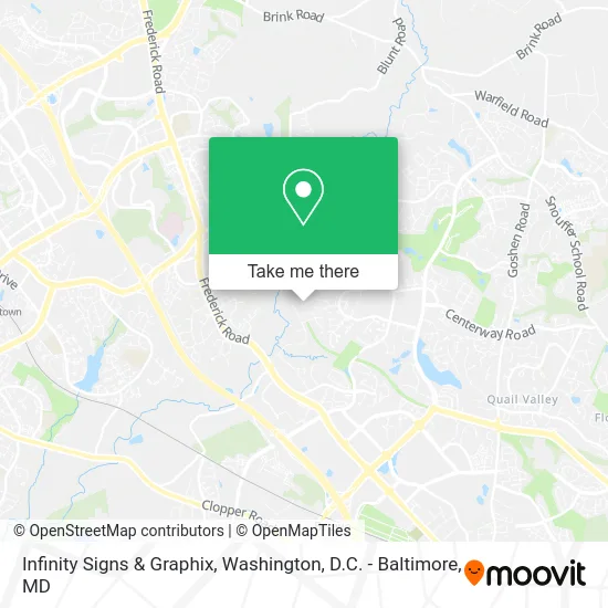
See Infinity Signs & Graphix, Montgomery County, on the map
Public Transit to Infinity Signs & Graphix in Montgomery County
Wondering how to get to Infinity Signs & Graphix in Montgomery County? Moovit helps you find the best way to get to Infinity Signs & Graphix with step-by-step directions from the nearest public transit station.
Moovit provides free maps and live directions to help you navigate through your city. View schedules, routes, timetables, and find out how long does it take to get to Infinity Signs & Graphix in real time.
Looking for the nearest stop or station to Infinity Signs & Graphix? Check out this list of stops closest to your destination: Metropolitan Grove Marc Eb; Stedwick Rd & Frenchton Pl; Frederick Rd & Wheatfield Dr.
Bus: 59, 60, 64, 55.Train: MARC.
Want to see if there’s another route that gets you there at an earlier time? Moovit helps you find alternative routes or times. Get directions from and directions to Infinity Signs & Graphix easily from the Moovit App or Website.
We make riding to Infinity Signs & Graphix easy, which is why over 1.5 million users, including users in Montgomery County, trust Moovit as the best app for public transit. You don’t need to download an individual bus app or train app, Moovit is your all-in-one transit app that helps you find the best bus time or train time available.
For information on prices of bus and metro, costs and ride fares to Infinity Signs & Graphix, please check the Moovit app.
Use the app to navigate to popular places including to the airport, hospital, stadium, grocery store, mall, coffee shop, school, college, and university.
Infinity Signs & Graphix Address: 10721 Seneca Spring Way Montgomery Village, MD 20886 street in Montgomery County
- Emergency 24 Hour 7 Day Locksmith,
- Law Office of Jinu Patel,
- Annateiko Designs,
- Bajra,
- Soldierfit,
- Metropolitan Glass Company,
- Watkins Mill Pool,
- Frederick MD-355,
- Stedwick Jogging Path,
- Luis Benitez,
- Care and Beyond,
- Iglesia Cristiana de Maryland,
- Repair My Phone and More,
- Caspi Appliance Repair,
- DMV Wise Painting,
- TS Photography,
- Salvation Army Family Store - Gaithersburg, MD,
- Frederick MD-355,
- RT-355,
- Elise's Flowers
Places Near Infinity Signs & Graphix (Montgomery County)
- Washington DC VA Medical Center, Washington,
- Rock Creek Tennis Center, Washington,
- Washington National Cathedral, Washington,
- PG Mall, Prince George's County,
- Camden Yards, Baltimore,
- Basilica of the National Shrine, Washington,
- Westfield Montgomery Mall, Montgomery County,
- M&T Bank Stadium, Baltimore,
- The Anthem, Washington,
- National Zoo, Washington,
- Pennsylvania Ave NW (3rd st and pennsylvania), Washington,
- Amazon Hq2, Arlington County,
- National Museum of African American History and Culture, Washington,
- Marriott Marquis Washington, DC, Washington,
- Sibley Memorial Hospital, Washington,
- Capital One Arena, Washington,
- National Theatre, Washington,
- Museum Of The Bible, Washington,
- Georgetown, Washington,
- Warner Theatre, Washington
How to get to popular places in Washington, D.C. - Baltimore, MD with public transit
Get around Montgomery County by public transit!
Traveling around Montgomery County has never been so easy. See step by step directions as you travel to any attraction, street or major public transit station. View bus and train schedules, arrival times, service alerts and detailed routes on a map, so you know exactly how to get to anywhere in Montgomery County.
When traveling to any destination around Montgomery County use Moovit's Live Directions with Get Off Notifications to know exactly where and how far to walk, how long to wait for your line, and how many stops are left. Moovit will alert you when it's time to get off — no need to constantly re-check whether yours is the next stop.
Wondering how to use public transit in Montgomery County or how to pay for public transit in Montgomery County? Moovit public transit app can help you navigate your way with public transit easily, and at minimum cost. It includes public transit fees, ticket prices, and costs. Looking for a map of Montgomery County public transit lines? Moovit public transit app shows all public transit maps in Montgomery County with all Bus, Train, Metro, Light Rail and Ferry routes and stops on an interactive map.
Washington, D.C. - Baltimore, MD has 5 transit type(s), including: Bus, Train, Metro, Light Rail and Ferry, operated by several transit agencies, including WMATA, Montgomery County Ride On, Fairfax Connector, TheBus, PRTC, DASH - Alexandria, Arlington Transit (ART), RTA of Central Maryland, MDOT MTA, MDOT MTA Light RailLink, MDOT MTA Commuter Bus, MDOT MTA Local Bus, FXBGO!, Virginia Railway Express (VRE) and MARC