How to get to Inflate DMV by bus?
Click on the bus route to see step by step directions with maps, line arrival times and updated time schedules.
From Walmart, Arlington County
89 minFrom Punch Bowl Social, Arlington County
70 minFrom The Westin Arlington Gateway, Arlington County
73 minFrom Kingstowne, VA, Fairfax County
48 minFrom Inova Fairfax Hospital North Tower Building, Fairfax County
43 minFrom Thomas Jefferson Community Center & Theatre, Arlington County
66 minFrom Uspto, Alexandria
70 minFrom The Westin Alexandria Old Town, Alexandria
66 minFrom Arlington Cinema 'N' Drafthouse, Arlington County
54 minFrom Alexandria Station - AMTRAK/VRE (ALX), Alexandria
55 min
How to get to Inflate DMV by train?
Click on the train route to see step by step directions with maps, line arrival times and updated time schedules.
Bus stops near Inflate DMV in Fairfax County
Train station near Inflate DMV in Fairfax County
- Backlick Road Station, 60 min walk,VIEW
Bus lines to Inflate DMV in Fairfax County
What are the closest stations to Inflate DMV?
The closest stations to Inflate DMV are:
- Braddock Rd & Columbia Rd is 180 yards away, 3 min walk.
- Edsall @ Dublin is 373 yards away, 5 min walk.
- Backlick @ Woodland is 854 yards away, 11 min walk.
- Backlick Road Station is 5119 yards away, 60 min walk.
Which bus lines stop near Inflate DMV?
These bus lines stop near Inflate DMV: 306, 321, 322, 402.
Which train line stops near Inflate DMV?
MANASSAS LINE (Broad Run)
What’s the nearest bus station to Inflate DMV in Fairfax County?
The nearest bus station to Inflate DMV in Fairfax County is Braddock Rd & Columbia Rd. It’s a 3 min walk away.
What time is the first train to Inflate DMV in Fairfax County?
The MANASSAS LINE is the first train that goes to Inflate DMV in Fairfax County. It stops nearby at 5:42 AM.
What time is the last train to Inflate DMV in Fairfax County?
The MANASSAS LINE is the last train that goes to Inflate DMV in Fairfax County. It stops nearby at 7:34 PM.
What time is the first bus to Inflate DMV in Fairfax County?
The 401 is the first bus that goes to Inflate DMV in Fairfax County. It stops nearby at 3:41 AM.
What time is the last bus to Inflate DMV in Fairfax County?
The 402 is the last bus that goes to Inflate DMV in Fairfax County. It stops nearby at 2:15 AM.
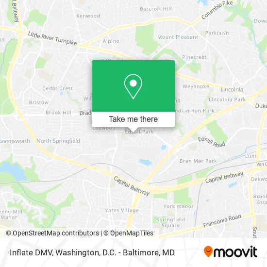
See Inflate DMV, Fairfax County, on the map
Public Transit to Inflate DMV in Fairfax County
Wondering how to get to Inflate DMV in Fairfax County? Moovit helps you find the best way to get to Inflate DMV with step-by-step directions from the nearest public transit station.
Moovit provides free maps and live directions to help you navigate through your city. View schedules, routes, timetables, and find out how long does it take to get to Inflate DMV in real time.
Looking for the nearest stop or station to Inflate DMV? Check out this list of stops closest to your destination: Braddock Rd & Columbia Rd; Edsall @ Dublin; Backlick @ Woodland; Backlick Road Station.
Bus: 306, 321, 322, 402, F29, 401.Train: MANASSAS LINE.
Want to see if there’s another route that gets you there at an earlier time? Moovit helps you find alternative routes or times. Get directions from and directions to Inflate DMV easily from the Moovit App or Website.
We make riding to Inflate DMV easy, which is why over 1.5 million users, including users in Fairfax County, trust Moovit as the best app for public transit. You don’t need to download an individual bus app or train app, Moovit is your all-in-one transit app that helps you find the best bus time or train time available.
For information on prices of bus, metro and train, costs and ride fares to Inflate DMV, please check the Moovit app.
Use the app to navigate to popular places including to the airport, hospital, stadium, grocery store, mall, coffee shop, school, college, and university.
Inflate DMV Address: 6712 New Hope Dr Springfield, VA 22151 street in Fairfax County
- Handyman Francisco,
- Fil Asian / American Ministry at Word of Life International Church,
- Iglesia Adventista de Burke,
- FedEx,
- Better Flyers,
- DC Mobile Advertising,
- Penn-Mar Best Wings,
- Fbi Background Checks,
- Full Service Payroll. Income Taxes,
- Action Musalla Virginia,
- Brenda Rozier Clark,
- Michael Wortman,
- Et Massage,
- Ernie Apaga Realty,
- Virtual Soccer,
- Georges Traboulsi DDS,
- Maximaids, Inc,
- Bni Realty,
- Eyecastle CCTV,
- JK Medical Supplies
Places Near Inflate DMV (Fairfax County)
- Pennsylvania Ave NW (3rd st and pennsylvania), Washington,
- The Anthem, Washington,
- Rock Creek Tennis Center, Washington,
- PG Mall, Prince George's County,
- Georgetown, Washington,
- Camden Yards, Baltimore,
- Marriott Marquis Washington, DC, Washington,
- National Mall, Washington,
- Capital One Arena, Washington,
- Westfield Montgomery Mall, Montgomery County,
- Museum Of The Bible, Washington,
- Sibley Memorial Hospital, Washington,
- National Zoo, Washington,
- Amazon Hq2, Arlington County,
- Warner Theatre, Washington,
- Basilica of the National Shrine, Washington,
- Washington DC VA Medical Center, Washington,
- Washington National Cathedral, Washington,
- M&T Bank Stadium, Baltimore,
- National Museum of African American History and Culture, Washington
How to get to popular places in Washington, D.C. - Baltimore, MD with public transit
Get around Fairfax County by public transit!
Traveling around Fairfax County has never been so easy. See step by step directions as you travel to any attraction, street or major public transit station. View bus and train schedules, arrival times, service alerts and detailed routes on a map, so you know exactly how to get to anywhere in Fairfax County.
When traveling to any destination around Fairfax County use Moovit's Live Directions with Get Off Notifications to know exactly where and how far to walk, how long to wait for your line, and how many stops are left. Moovit will alert you when it's time to get off — no need to constantly re-check whether yours is the next stop.
Wondering how to use public transit in Fairfax County or how to pay for public transit in Fairfax County? Moovit public transit app can help you navigate your way with public transit easily, and at minimum cost. It includes public transit fees, ticket prices, and costs. Looking for a map of Fairfax County public transit lines? Moovit public transit app shows all public transit maps in Fairfax County with all Bus, Train, Metro, Light Rail and Ferry routes and stops on an interactive map.
Washington, D.C. - Baltimore, MD has 5 transit type(s), including: Bus, Train, Metro, Light Rail and Ferry, operated by several transit agencies, including WMATA, Montgomery County Ride On, Fairfax Connector, TheBus, PRTC, DASH - Alexandria, Arlington Transit (ART), RTA of Central Maryland, MDOT MTA, MDOT MTA Light RailLink, MDOT MTA Commuter Bus, MDOT MTA Local Bus, FXBGO!, Virginia Railway Express (VRE) and MARC