How to get to Informaticasanse by bus?
Click on the bus route to see step by step directions with maps, line arrival times and updated time schedules.
From Exe Hotel Norte Madrid, Madrid
28 minFrom Hospital Carlos III-Urgencias, Madrid
46 minFrom Avenida de Manoteras, Madrid
46 minFrom Parque Juan Carlos I, Madrid
71 minFrom Autovía A-1 (Madrid-Burgos) km 24, San Sebastián De Los Reyes
25 minFrom Campus de Cantoblanco, Madrid
42 minFrom Centro Comercial La Vaguada, Área Metropolitana De Madrid Y Corredor Del Henares
61 minFrom Estacion de Chamartin, Madrid
42 minFrom C.C. La Vaguada, Madrid
62 minFrom Kiosko Ramón Y Cajal, Madrid
44 min
How to get to Informaticasanse by train?
Click on the train route to see step by step directions with maps, line arrival times and updated time schedules.
From Exe Hotel Norte Madrid, Madrid
60 minFrom Hospital Carlos III-Urgencias, Madrid
50 minFrom Avenida de Manoteras, Madrid
47 minFrom Campus de Cantoblanco, Madrid
32 minFrom Centro Comercial La Vaguada, Área Metropolitana De Madrid Y Corredor Del Henares
70 minFrom Estacion de Chamartin, Madrid
39 minFrom C.C. La Vaguada, Madrid
71 minFrom Kiosko Ramón Y Cajal, Madrid
42 min
How to get to Informaticasanse by metro?
Click on the metro route to see step by step directions with maps, line arrival times and updated time schedules.
From Exe Hotel Norte Madrid, Madrid
71 minFrom Hospital Carlos III-Urgencias, Madrid
56 minFrom Avenida de Manoteras, Madrid
60 minFrom Centro Comercial La Vaguada, Área Metropolitana De Madrid Y Corredor Del Henares
54 minFrom Estacion de Chamartin, Madrid
44 minFrom C.C. La Vaguada, Madrid
54 minFrom Kiosko Ramón Y Cajal, Madrid
49 min
Bus stops near Informaticasanse in San Sebastián De Los Reyes
Metro station near Informaticasanse in San Sebastián De Los Reyes
- Manuel De Falla, 6 min walk,VIEW
Train station near Informaticasanse in San Sebastián De Los Reyes
- Alcobendas - San Sebastián De Los Reyes, 21 min walk,VIEW
Bus lines to Informaticasanse in San Sebastián De Los Reyes
- 4, Moscatelares,VIEW
- 154, Av. Colmenar Viejo - Ntra. Sra. Carmen,VIEW
- 158, Av. San Luis - Av. Burgos,VIEW
- 827A, Iván Pavlov - Rectorado,VIEW
- 154C, Av. Quiñones - Cerro Del Baile,VIEW
- 5, San Sebastián de los Reyes,VIEW
- N102, Intercambiador De Plaza De Castilla (Nivel 0, Isla 4),VIEW
- 2, La Moraleja,VIEW
- 7, Circular (Estación FF.CC. - Polígonos - Estación FF.CC.),VIEW
- 827, Av. España - M. Sebastián Izuel,VIEW
What are the closest stations to Informaticasanse?
The closest stations to Informaticasanse are:
- Av. Sierra - Cervantes is 348 meters away, 5 min walk.
- Av. Sierra - Navas De Tolosa is 350 meters away, 5 min walk.
- Manuel De Falla is 455 meters away, 6 min walk.
- Av. Colmenar Viejo - Ntra. Sra. Carmen is 476 meters away, 7 min walk.
- Alcobendas - San Sebastián De Los Reyes is 1591 meters away, 21 min walk.
Which bus lines stop near Informaticasanse?
These bus lines stop near Informaticasanse: 154, 154C, 191, 827.
Which train line stops near Informaticasanse?
C4A (Alcobendas - S. S. De Los Reyes)
Which metro line stops near Informaticasanse?
M-10 (Hospital Infanta Sofía)
What’s the nearest metro station to Informaticasanse in San Sebastián De Los Reyes?
The nearest metro station to Informaticasanse in San Sebastián De Los Reyes is Manuel De Falla. It’s a 6 min walk away.
What’s the nearest train station to Informaticasanse in San Sebastián De Los Reyes?
The nearest train station to Informaticasanse in San Sebastián De Los Reyes is Alcobendas - San Sebastián De Los Reyes. It’s a 21 min walk away.
What’s the nearest bus station to Informaticasanse in San Sebastián De Los Reyes?
The nearest bus stations to Informaticasanse in San Sebastián De Los Reyes are Av. Sierra - Cervantes and Av. Sierra - Navas De Tolosa. The closest one is a 5 min walk away.
What time is the first metro to Informaticasanse in San Sebastián De Los Reyes?
The M-10 is the first metro that goes to Informaticasanse in San Sebastián De Los Reyes. It stops nearby at 6:05 AM.
What time is the last metro to Informaticasanse in San Sebastián De Los Reyes?
The M-10 is the last metro that goes to Informaticasanse in San Sebastián De Los Reyes. It stops nearby at 1:52 AM.
What time is the first train to Informaticasanse in San Sebastián De Los Reyes?
The C4A is the first train that goes to Informaticasanse in San Sebastián De Los Reyes. It stops nearby at 5:30 AM.
What time is the last train to Informaticasanse in San Sebastián De Los Reyes?
The C4A is the last train that goes to Informaticasanse in San Sebastián De Los Reyes. It stops nearby at 12:02 AM.
What time is the first bus to Informaticasanse in San Sebastián De Los Reyes?
The N102 is the first bus that goes to Informaticasanse in San Sebastián De Los Reyes. It stops nearby at 3:22 AM.
What time is the last bus to Informaticasanse in San Sebastián De Los Reyes?
The N102 is the last bus that goes to Informaticasanse in San Sebastián De Los Reyes. It stops nearby at 2:24 AM.
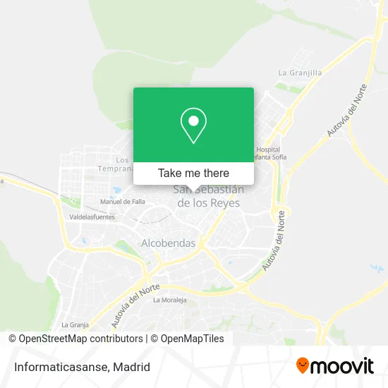
See Informaticasanse, San Sebastián De Los Reyes, on the map
Public Transit to Informaticasanse in San Sebastián De Los Reyes
Wondering how to get to Informaticasanse in San Sebastián De Los Reyes? Moovit helps you find the best way to get to Informaticasanse with step-by-step directions from the nearest public transit station.
Moovit provides free maps and live directions to help you navigate through your city. View schedules, routes, timetables, and find out how long does it take to get to Informaticasanse in real time.
Looking for the nearest stop or station to Informaticasanse? Check out this list of stops closest to your destination: Av. Sierra - Cervantes; Av. Sierra - Navas De Tolosa; Manuel De Falla; Av. Colmenar Viejo - Ntra. Sra. Carmen; Alcobendas - San Sebastián De Los Reyes.
Bus: 154, 154C, 191, 827, 4, 158, 827A, 5, N102, 2, 7.Train: C4A.Metro: M-10.
Want to see if there’s another route that gets you there at an earlier time? Moovit helps you find alternative routes or times. Get directions from and directions to Informaticasanse easily from the Moovit App or Website.
We make riding to Informaticasanse easy, which is why over 1.5 million users, including users in San Sebastián De Los Reyes, trust Moovit as the best app for public transit. You don’t need to download an individual bus app or train app, Moovit is your all-in-one transit app that helps you find the best bus time or train time available.
For information on prices of bus, metro and train, costs and ride fares to Informaticasanse, please check the Moovit app.
Use the app to navigate to popular places including to the airport, hospital, stadium, grocery store, mall, coffee shop, school, college, and university.
Informaticasanse Address: Calle Hermanos Sanz, 3 28701 San Sebastián de los Reyes street in San Sebastián De Los Reyes
- Ares Soluciones Integrales,
- Calle Francisco Navacerrada, 16,
- The Breath Company S.L,
- Hugan Motor, ASETRA,
- Peluqueros Estilistas,
- Street Culture,
- La Tostaderia de Altam,
- Peluquería Cris,
- Duoqin Chen,
- Calle Miguel del Campo / Calle Antonio del Campo,
- Unger,
- Maná,
- Santander,
- El Super del Club de C,
- Apinceladas Estudio,
- Team Chaparral,
- Piensos Raposo,
- Serrano,
- Anserjo,
- Regalo Alimentación
Places Near Informaticasanse (San Sebastián De Los Reyes)
- Estadio Wanda Metropolitano, Área Metropolitana De Madrid Y Corredor Del Henares,
- Plenilunio, Área Metropolitana De Madrid Y Corredor Del Henares,
- Mercadillo de Majadahonda, Majadahonda,
- Nassica, Área Metropolitana De Madrid Y Corredor Del Henares,
- Mendez Alvaro, Madrid,
- Palacio De Vistalegre, Área Metropolitana De Madrid Y Corredor Del Henares,
- Estacion de Chamartin, Madrid,
- Rastro De Madrid, Área Metropolitana De Madrid Y Corredor Del Henares,
- Centro Comercial La Gavia, Área Metropolitana De Madrid Y Corredor Del Henares,
- Calle de López de Hoyos 169, Madrid,
- Tres Aguas, Alcorcón,
- Hospital Clínico Universitario San Carlos, Madrid,
- Hospital Universitario Ramón y Cajal, Madrid,
- Plaza Mayor, Madrid,
- Sala La Riviera, Madrid,
- Wizink Center, Madrid,
- Hospital Universitario La Paz, Madrid,
- Centro Comercial Oasiz Madrid, Área Metropolitana De Madrid Y Corredor Del Henares,
- Centro Comercial Islazul, Área Metropolitana De Madrid Y Corredor Del Henares,
- Centro Comercial La Vaguada, Área Metropolitana De Madrid Y Corredor Del Henares
How to get to popular places in Madrid with public transit
Get around San Sebastián De Los Reyes by public transit!
Traveling around San Sebastián De Los Reyes has never been so easy. See step by step directions as you travel to any attraction, street or major public transit station. View bus and train schedules, arrival times, service alerts and detailed routes on a map, so you know exactly how to get to anywhere in San Sebastián De Los Reyes.
When traveling to any destination around San Sebastián De Los Reyes use Moovit's Live Directions with Get Off Notifications to know exactly where and how far to walk, how long to wait for your line, and how many stops are left. Moovit will alert you when it's time to get off — no need to constantly re-check whether yours is the next stop.
Wondering how to use public transit in San Sebastián De Los Reyes or how to pay for public transit in San Sebastián De Los Reyes? Moovit public transit app can help you navigate your way with public transit easily, and at minimum cost. It includes public transit fees, ticket prices, and costs. Looking for a map of San Sebastián De Los Reyes public transit lines? Moovit public transit app shows all public transit maps in San Sebastián De Los Reyes with all Bus, Train, Metro and Light Rail routes and stops on an interactive map.
Madrid has 4 transit type(s), including: Bus, Train, Metro and Light Rail, operated by several transit agencies, including Metro de Madrid, Metro Ligero, Tranvía de Parla, Renfe Cercanías - Servicios de Autobús especiales, Renfe Cercanias, Renfe Cercanías, EMT, Interurbanos, Urbanos de Alcalá de Henares, Urbanos de Alcobendas, Urbanos de Alcorcón, Urbanos de Algete, Urbanos de Aranjuez, Urbanos de Arganda del Rey and Urbanos de Arroyomolinos