How to get to Ingenius Lab by bus?
Click on the bus route to see step by step directions with maps, line arrival times and updated time schedules.
From Tribunal Judiciaire de Nanterre, Arrondissement de Nanterre
75 minFrom Mont Valérien, Suresnes
79 minFrom Le Chesnay, Le Chesnay
51 minFrom Hôpital Foch, Arrondissement de Nanterre
93 minFrom Saint-Cloud, Saint-Cloud
96 minFrom Île des Impressionnistes, Chatou
44 minFrom Vaucresson, Vaucresson
71 minFrom Le Ruban Bleu, Nanterre
70 minFrom Hopital Foch, Suresnes
90 minFrom Bezons, Bezons
75 min
Bus stops near Ingenius Lab in Saint-Germain-En-Laye
Light Rail stations near Ingenius Lab in Saint-Germain-En-Laye
- Lisière Pereire, 4 min walk,VIEW
RER station near Ingenius Lab in Saint-Germain-En-Laye
- Saint-Germain-En-Laye, 20 min walk,VIEW
Bus lines to Ingenius Lab in Saint-Germain-En-Laye
- R2N, Gare de Saint-Germain-En-Laye,VIEW
- R3N, Gare de Saint-Germain-En-Laye,VIEW
- SOIR, Gare de Saint-Germain-En-Laye,VIEW
- R1, Lycée Léonard De Vinci - Les Hauts Grillets - Gare De Saint-Germain-En-Laye,VIEW
- R2S, Gare De Saint-Germain-En-Laye - Gare De Saint-Germain-En-Laye,VIEW
- R3S, Gare de Saint-Germain-En-Laye,VIEW
- 6281, Lycée International,VIEW
- 56, Pont de Bougival,VIEW
- 5211, Alexandre Bertrand,VIEW
- 5314, Place Lamant,VIEW
What are the closest stations to Ingenius Lab?
The closest stations to Ingenius Lab are:
- Place Sainte-Catherine is 17 meters away, 1 min walk.
- Prieuré is 150 meters away, 3 min walk.
- Lisière Pereire is 309 meters away, 4 min walk.
- Gallieni is 414 meters away, 6 min walk.
- Place Lamant is 584 meters away, 8 min walk.
- Saint-Germain-En-Laye is 1551 meters away, 20 min walk.
Which RER line stops near Ingenius Lab?
A (Cergy le Haut / Poissy / Saint Germain en Laye)
Which bus lines stop near Ingenius Lab?
These bus lines stop near Ingenius Lab: 259, R1, R2S, R3N, R3S.
What’s the nearest light rail station to Ingenius Lab in Saint-Germain-En-Laye?
The nearest light rail station to Ingenius Lab in Saint-Germain-En-Laye is Lisière Pereire. It’s a 4 min walk away.
What’s the nearest bus station to Ingenius Lab in Saint-Germain-En-Laye?
The nearest bus station to Ingenius Lab in Saint-Germain-En-Laye is Place Sainte-Catherine. It’s a 1 min walk away.
What’s the nearest RER station to Ingenius Lab in Saint-Germain-En-Laye?
The nearest RER station to Ingenius Lab in Saint-Germain-En-Laye is Saint-Germain-En-Laye. It’s a 20 min walk away.
What time is the first light rail to Ingenius Lab in Saint-Germain-En-Laye?
The T13 is the first light rail that goes to Ingenius Lab in Saint-Germain-En-Laye. It stops nearby at 5:42 AM.
What time is the last light rail to Ingenius Lab in Saint-Germain-En-Laye?
The T13 is the last light rail that goes to Ingenius Lab in Saint-Germain-En-Laye. It stops nearby at 10:10 PM.
What time is the first bus to Ingenius Lab in Saint-Germain-En-Laye?
The R1 is the first bus that goes to Ingenius Lab in Saint-Germain-En-Laye. It stops nearby at 5:22 AM.
What time is the last bus to Ingenius Lab in Saint-Germain-En-Laye?
The SOIR is the last bus that goes to Ingenius Lab in Saint-Germain-En-Laye. It stops nearby at 1:41 AM.
What time is the first RER to Ingenius Lab in Saint-Germain-En-Laye?
The A is the first RER that goes to Ingenius Lab in Saint-Germain-En-Laye. It stops nearby at 5:04 AM.
What time is the last RER to Ingenius Lab in Saint-Germain-En-Laye?
The A is the last RER that goes to Ingenius Lab in Saint-Germain-En-Laye. It stops nearby at 1:14 AM.
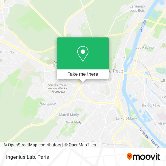
See Ingenius Lab, Saint-Germain-En-Laye, on the map
Public Transit to Ingenius Lab in Saint-Germain-En-Laye
Wondering how to get to Ingenius Lab in Saint-Germain-En-Laye? Moovit helps you find the best way to get to Ingenius Lab with step-by-step directions from the nearest public transit station.
Moovit provides free maps and live directions to help you navigate through your city. View schedules, routes, timetables, and find out how long does it take to get to Ingenius Lab in real time.
Looking for the nearest stop or station to Ingenius Lab? Check out this list of stops closest to your destination: Place Sainte-Catherine; Prieuré; Lisière Pereire; Gallieni; Place Lamant; Saint-Germain-En-Laye.
RER: A.Bus: 259, R1, R2S, R3N, R3S, R2N, SOIR, 6281, 56.
Want to see if there’s another route that gets you there at an earlier time? Moovit helps you find alternative routes or times. Get directions from and directions to Ingenius Lab easily from the Moovit App or Website.
We make riding to Ingenius Lab easy, which is why over 1.5 million users, including users in Saint-Germain-En-Laye, trust Moovit as the best app for public transit. You don’t need to download an individual bus app or train app, Moovit is your all-in-one transit app that helps you find the best bus time or train time available.
For information on prices of bus, RER, train and light rail, costs and ride fares to Ingenius Lab, please check the Moovit app.
Use the app to navigate to popular places including to the airport, hospital, stadium, grocery store, mall, coffee shop, school, college, and university.
Ingenius Lab Address: 2 Rue Jean Jaurès 78100 Saint-Germain-en-Laye street in Saint-Germain-En-Laye
- Midas Pharma,
- Gosnell Paul,
- Chihat Medani Chakiba Sara,
- Jean Philippe Pariel,
- Place de la Fontaine Sainte-Catherine,
- Dr Monteil,
- CAF Yvelines,
- Rue de Bergette,
- Loisirs Club,
- Saint Germain en Laye,
- 1 Rue du Prieuré,
- Jardin Aux Oiseaux,
- Résidence Bergette Marais,
- Musee Maurice Denis,
- Mh Deco,
- Musée Maurice Denis - le Prieuré,
- Eglise Saint-Léger,
- Centurium Habilis Immobilier,
- Du Prieure,
- Tribunal d'Instance de Saint-Germain-en-Laye
Places Near Ingenius Lab (Saint-Germain-En-Laye)
- Hôpital de la Pitié-Salpêtrière, Paris,
- Théâtre Mogador, Paris,
- Hôpital Pitié Salpêtrière, Paris,
- Gare Routière Flixbus, Paris,
- Galeries Lafayette, Paris,
- Beaugrenelle, Paris,
- Fondation Louis Vuitton, Paris,
- Hôpital Cochin, Paris,
- 29 Rue Manin, Paris,
- Hôpital Beaujon, Clichy,
- Hôpital Necker, Paris,
- Hôpital Henri Mondor, Creteil,
- Hopital Lariboisière, Paris,
- Hopital Foch, Suresnes,
- Hôpital Saint-Joseph, Paris,
- Galeries Lafayette Haussmann, Paris,
- Marché Saint-Pierre, Paris,
- Atelier Des Lumieres, Paris,
- Centre Hospitalier des 15/20, Paris,
- Créteil Soleil, Creteil
How to get to popular places in Paris with public transit
Get around Saint-Germain-En-Laye by public transit!
Traveling around Saint-Germain-En-Laye has never been so easy. See step by step directions as you travel to any attraction, street or major public transit station. View bus and train schedules, arrival times, service alerts and detailed routes on a map, so you know exactly how to get to anywhere in Saint-Germain-En-Laye.
When traveling to any destination around Saint-Germain-En-Laye use Moovit's Live Directions with Get Off Notifications to know exactly where and how far to walk, how long to wait for your line, and how many stops are left. Moovit will alert you when it's time to get off — no need to constantly re-check whether yours is the next stop.
Wondering how to use public transit in Saint-Germain-En-Laye or how to pay for public transit in Saint-Germain-En-Laye? Moovit public transit app can help you navigate your way with public transit easily, and at minimum cost. It includes public transit fees, ticket prices, and costs. Looking for a map of Saint-Germain-En-Laye public transit lines? Moovit public transit app shows all public transit maps in Saint-Germain-En-Laye with all Bus, Train, Metro, Light Rail, RER, Funicular and Gondola routes and stops on an interactive map.
Paris has 7 transit type(s), including: Bus, Train, Metro, Light Rail, RER, Funicular and Gondola, operated by several transit agencies, including RATP, RER, RER Bus de remplacement, Train, Train Bus de remplacement, Tramway Bus de remplacement, TER, ADP, Magical Shuttle, Argenteuil - Boucles de Seine, Autocars Dominique, Bièvre, Brie et 2 Morin, Le Bus - C.C. du Clermontois and Cœur d’Essonne