How to get to Ingrid Huber by bus?
Click on the bus route to see step by step directions with maps, line arrival times and updated time schedules.
From Kloster Untermarchtal, Verwaltungsgemeinschaft Munderkingen
103 minFrom Amazon-DBX8, Herbrechtingen
211 minFrom Möbel Rieger, Vereinbarte Verwaltungsgemeinschaft Der Stadt Göppingen
238 minFrom Media Markt, Gemeindeverwaltungsverband Eislingen-Ottenbach-Salach
226 minFrom Heidenheim an der Brenz, Heidenheim An Der Brenz
131 minFrom HORNBACH, Vereinbarte Verwaltungsgemeinschaft Der Stadt Göppingen
227 minFrom Kaufland Geislingen, Vereinbarte Verwaltungsgemeinschaft Der Stadt Geislingen An Der Steige
135 minFrom Action, Gemeindeverwaltungsverband Eislingen-Ottenbach-Salach
230 min
How to get to Ingrid Huber by train?
Click on the train route to see step by step directions with maps, line arrival times and updated time schedules.
Bus stops near Ingrid Huber in Stuttgart
Train stations near Ingrid Huber in Stuttgart
- Ulm Hauptbahnhof, 17 min walk,VIEW
Bus lines to Ingrid Huber in Stuttgart
- 1, Ulm Söflingen Bstg A - Ulm Ostpreußenweg Bstg A,VIEW
- 2, Ulm Kuhberg Schulzentrum Bstg B - Ulm Science Park II Bstg A,VIEW
- E, Wiblingen Kemptener Straße Bstg A - Dellmensingen Hirsch,VIEW
- N1, Ulm ZOB Bstg D1 - Einsingen Ensostraße Bstg A,VIEW
- N8, Ulm Zob,VIEW
- 46, Reutti Ortsmitte,VIEW
- 10, Ulm Blautal-Center Bstg B - Ulm Ehinger Tor Bstg E,VIEW
- 11, Ulm ZOB Bstg D1 - Ulm ZOB Bstg D2,VIEW
- 12, Unterweiler Hartstraße Bstg A - Ulm ZOB Bstg E,VIEW
- 21, Erbach Bahnhof Bstg 1 - Ehingen Busbahnhof Bstg 5,VIEW
- 49, Ulm Kuhberg Schulzentrum,VIEW
- 8, Grimmelfingen Eisenbahnstraße,VIEW
What are the closest stations to Ingrid Huber?
The closest stations to Ingrid Huber are:
- Ulm Blücherstraße Bstg A is 352 meters away, 5 min walk.
- Ulm Saarlandstraße Bstg A is 398 meters away, 6 min walk.
- Ulm Ehinger Tor is 491 meters away, 7 min walk.
- Ulm Haßlerstraße Bstg A is 509 meters away, 7 min walk.
- Ulm Römerplatz is 780 meters away, 11 min walk.
- Ulm Sulzbachweg Bstg B is 896 meters away, 12 min walk.
- Ulm Hauptbahnhof is 1280 meters away, 17 min walk.
Which train lines stop near Ingrid Huber?
These train lines stop near Ingrid Huber: MEX 16, RE5, RS 5.
Which light rail line stops near Ingrid Huber?
2 (Ulm Kuhberg Schulzentrum)
Which bus lines stop near Ingrid Huber?
These bus lines stop near Ingrid Huber: 21, 46, 49, 585.
What’s the nearest train station to Ingrid Huber in Stuttgart?
The nearest train station to Ingrid Huber in Stuttgart is Ulm Hauptbahnhof. It’s a 17 min walk away.
What’s the nearest bus station to Ingrid Huber in Stuttgart?
The nearest bus station to Ingrid Huber in Stuttgart is Ulm Blücherstraße Bstg A. It’s a 5 min walk away.
What time is the first light rail to Ingrid Huber in Stuttgart?
The 1 is the first light rail that goes to Ingrid Huber in Stuttgart. It stops nearby at 4:10 AM.
What time is the last light rail to Ingrid Huber in Stuttgart?
The 1 is the last light rail that goes to Ingrid Huber in Stuttgart. It stops nearby at 1:13 AM.
What time is the first train to Ingrid Huber in Stuttgart?
The RE50 is the first train that goes to Ingrid Huber in Stuttgart. It stops nearby at 4:25 AM.
What time is the last train to Ingrid Huber in Stuttgart?
The 62N is the last train that goes to Ingrid Huber in Stuttgart. It stops nearby at 7:39 AM.
What time is the first bus to Ingrid Huber in Stuttgart?
The 11 is the first bus that goes to Ingrid Huber in Stuttgart. It stops nearby at 4:40 AM.
What time is the last bus to Ingrid Huber in Stuttgart?
The 11 is the last bus that goes to Ingrid Huber in Stuttgart. It stops nearby at 12:16 AM.
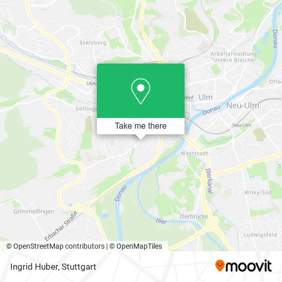
See Ingrid Huber, Stuttgart, on the map
Public Transit to Ingrid Huber in Stuttgart
Wondering how to get to Ingrid Huber in Stuttgart? Moovit helps you find the best way to get to Ingrid Huber with step-by-step directions from the nearest public transit station.
Moovit provides free maps and live directions to help you navigate through your city. View schedules, routes, timetables, and find out how long does it take to get to Ingrid Huber in real time.
Looking for the nearest stop or station to Ingrid Huber? Check out this list of stops closest to your destination: Ulm Blücherstraße Bstg A; Ulm Saarlandstraße Bstg A; Ulm Ehinger Tor; Ulm Haßlerstraße Bstg A; Ulm Römerplatz; Ulm Sulzbachweg Bstg B; Ulm Hauptbahnhof.
Train: MEX 16, RE5, RS 5, SAB, RS2, RE3, RE3, RS3, MEX16, RE200.Light Rail: 2.Bus: 21, 46, 49, 585, 1, 2, E, N1, N8, 10, 11, 12.
Want to see if there’s another route that gets you there at an earlier time? Moovit helps you find alternative routes or times. Get directions from and directions to Ingrid Huber easily from the Moovit App or Website.
We make riding to Ingrid Huber easy, which is why over 1.5 million users, including users in Stuttgart, trust Moovit as the best app for public transit. You don’t need to download an individual bus app or train app, Moovit is your all-in-one transit app that helps you find the best bus time or train time available.
For information on prices of bus, train and light rail, costs and ride fares to Ingrid Huber, please check the Moovit app.
Use the app to navigate to popular places including to the airport, hospital, stadium, grocery store, mall, coffee shop, school, college, and university.
Ingrid Huber Address: Römerstraße 82 89077 Ulm street in Stuttgart
- M. Butz & M. Bund,
- Bierteufele,
- Gebhard Ehing Dentallabor,
- Wanderlust Corporate Design,
- Phi,
- Hasenstall,
- Phi Restaurant,
- Zwick It Service und Sicherheit,
- Fliesen-Galerije-Comerc, Zweigniederlassung Ulm,
- Impressum,
- Bäckerei Betz,
- Betz,
- Saarlandstraße,
- Montagebau Braig,
- Erwin Maier Solartechnik,
- Evangelischer Kindergarten,
- Sahin Serkan Kfz-Sachverständigenbüro,
- SV Serkansahin de,
- Kindergärten,
- Richard Patent
Places Near Ingrid Huber (Stuttgart)
- SI-Centrum, Möhringen,
- Hauptbahnhof Stuttgart, Stuttgart-Mitte,
- FlixBus Haltestelle, Stuttgart,
- Hanns-Martin-Schleyer-Halle (Stuttgart Hans-Martin-Schleyerhalle), Bad Cannstatt,
- Marmorsaal Im Weissenburgpark, Stuttgart-Süd,
- Porsche Museum, Zuffenhausen,
- Wilhelma (U-Bahn Wilhelma), Bad Cannstatt,
- Mettingen Eros-Center Puff Laufhaus, Esslingen Am Neckar,
- Im Wizemann (Halle), Bad Cannstatt,
- Mercedes-Benz Museum, Bad Cannstatt,
- Porsche-Arena, Bad Cannstatt,
- Waldfriedhof, Degerloch,
- Mercedes-Benz Museum (Mercedes Museum Stuttgart), Bad Cannstatt,
- Hanns-Martin-Schleyer-Halle, Bad Cannstatt,
- Klinikum Stuttgart - Katharinenhospital, Stuttgart-Mitte,
- Schleyerhalle, Bad Cannstatt,
- Geilhaus Haus 33a, Reutlingen-Betzingen,
- Gleis 101/102 (tief), Stuttgart-Mitte,
- Pariser Platz Stuttgart, Stuttgart-Mitte,
- Gasometer Pforzheim, Pforzheim
How to get to popular places in Stuttgart with public transit
Get around Stuttgart by public transit!
Traveling around Stuttgart has never been so easy. See step by step directions as you travel to any attraction, street or major public transit station. View bus and train schedules, arrival times, service alerts and detailed routes on a map, so you know exactly how to get to anywhere in Stuttgart.
When traveling to any destination around Stuttgart use Moovit's Live Directions with Get Off Notifications to know exactly where and how far to walk, how long to wait for your line, and how many stops are left. Moovit will alert you when it's time to get off — no need to constantly re-check whether yours is the next stop.
Wondering how to use public transit in Stuttgart or how to pay for public transit in Stuttgart? Moovit public transit app can help you navigate your way with public transit easily, and at minimum cost. It includes public transit fees, ticket prices, and costs. Looking for a map of Stuttgart public transit lines? Moovit public transit app shows all public transit maps in Stuttgart with all Bus, Train, Subway, Light Rail, Ferry, S-Bahn and Funicular routes and stops on an interactive map.
Stuttgart has 7 transit type(s), including: Bus, Train, Subway, Light Rail, Ferry, S-Bahn and Funicular, operated by several transit agencies, including SSB - Stadtbahn, SSB, SSB - Seilbahn / Zacke, S-Bahn Stuttgart, Rhein-Neckar-Verkehr GmbH (rnv), Karlsruher Verkehrsverbund, DB AG, DB Regiobus BW, Arverio Baden-Württemberg GmbH, DB RegioNetz Verkehrs GmbH Westfrankenbahn, DB Regio AG Baden-Württemberg, Südwestdeutsche Verkehrs-AG, DB Regio AG Mitte Region Hessen, DB and Bodensee-Oberschwaben-Bahn