Inhaúma station - Monday schedule
| Line | Direction | Time |
|---|---|---|
| L2 | Botafogo | 5:18 AM |
| L2 | Botafogo | 5:24 AM |
| L2 | Botafogo | 5:30 AM |
| L2 | Pavuna | 5:34 AM |
| L2 | Botafogo | 5:35 AM |
| L2 | Pavuna | 5:40 AM |
| L2 | Botafogo | 5:41 AM |
| L2 | Pavuna | 5:45 AM |
| L2 | Botafogo | 5:47 AM |
| L2 | Pavuna | 5:51 AM |
| L2 | Botafogo | 5:52 AM |
| L2 | Pavuna | 5:57 AM |
| L2 | Botafogo | 5:58 AM |
| L2 | Pavuna | 6:02 AM |
| L2 | Botafogo | 6:03 AM |
| L2 | Pavuna | 6:08 AM |
| L2 | Botafogo | 6:09 AM |
| L2 | Pavuna | 6:13 AM |
| L2 | Botafogo | 6:15 AM |
| L2 | Pavuna | 6:19 AM |
| L2 | Botafogo | 6:20 AM |
| L2 | Pavuna | 6:25 AM |
| L2 | Botafogo | 6:25 AM |
| L2 | Botafogo | 6:30 AM |
| L2 | Pavuna | 6:30 AM |
Directions to Inhaúma station with public transit
The following transit lines have routes that pass near Inhaúma
 Bus: 292, 296, 627, 946, 687.
- Metro: L2.
- Train: RAMAL BELFORD ROXO.
How to get to Inhaúma station by bus?
Click on the bus route to see step by step directions with maps, line arrival times and updated time schedules.
How to get to Inhaúma station by train?
Click on the train route to see step by step directions with maps, line arrival times and updated time schedules.
How to get to Inhaúma station by metro?
Click on the metro route to see step by step directions with maps, line arrival times and updated time schedules.
Bus stops near Inhaúma stop
- Metrô Inhaúma, 1 min walk,
- Praça Vinte E Quatro De Outubro, 43, 6 min walk,
Train stations near Inhaúma station
- Pilares, 18 min walk,
Metro stations near Inhaúma station
- Engenho Da Rainha, 21 min walk,
Bus lines to Inhaúma station
- 627, Inhaúma,
- 946, Engenho Da Rainha,
- 296, Irajá - Castelo (Brs 4 - Via Norte Shopping),
- 687, Pavuna - Méier (Via Est. Velha da Pavuna),
- 688, Pavuna - Méier (Via Álvaro de Miranda),
- 711, Rocha Miranda - Rio Comprido (Brs 6 - Via Inhaúma / Benfica),
- 908, Terminal Deodoro - Bonsucesso (Direto - Via Guadalupe / Metrô Inhaúma),
- SN 908, LECD107 - Terminal Deodoro - Bonsucesso (Direto - via Metrô Inhaúma),
- SV 908, Terminal Deodoro - Bonsucesso (Via Rua Álvaro de Miranda),
- 292, Castelo,
- SN 292, Castelo,
- 311, Candelária,
- 492L, Caxias,
- 629, Saens Peña,
- SN 629, Saens Peña,
What are the closest stations to Inhaúma?
The closest stations to Inhaúma are:
- Metrô Inhaúma stop is 11 meters away, 1 min walk.
- Praça Vinte E Quatro De Outubro, 43 stop is 406 meters away, 6 min walk.
- Pilares station is 1388 meters away, 18 min walk.
- Engenho Da Rainha station is 1627 meters away, 21 min walk.
Which bus lines stop near Inhaúma?
These bus lines stop near Inhaúma: 292, 296, 627, 946.
Which metro line stops near Inhaúma?
L2 (Pavuna)
Which train line stops near Inhaúma?
RAMAL BELFORD ROXO (Belford Roxo)
What’s the nearest metro station to Inhaúma?
The nearest metro station to Inhaúma is Engenho Da Rainha. It’s a 21 min walk away.
What’s the nearest train station to Inhaúma?
The nearest train station to Inhaúma is Pilares. It’s a 18 min walk away.
What’s the nearest bus station to Inhaúma?
The nearest bus station to Inhaúma is Metrô Inhaúma. It’s a 1 min walk away.
What time is the first metro to Inhaúma?
The L2 is the first metro that goes to Inhaúma. It stops nearby at 5:16 AM.
What time is the last metro to Inhaúma?
The L2 is the last metro that goes to Inhaúma. It stops nearby at 12:35 AM.
What time is the first train to Inhaúma?
The RAMAL BELFORD ROXO is the first train that goes to Inhaúma. It stops nearby at 5:05 AM.
What time is the last train to Inhaúma?
The RAMAL BELFORD ROXO is the last train that goes to Inhaúma. It stops nearby at 10:18 PM.
What time is the first bus to Inhaúma?
The SN 908 is the first bus that goes to Inhaúma. It stops nearby at 3:13 AM.
What time is the last bus to Inhaúma?
The SN 908 is the last bus that goes to Inhaúma. It stops nearby at 2:57 AM.
Inhaúma station
 Taken by Anonymous
See Inhaúma station on the map
Public transit to Inhaúma station
Looking for directions to Inhaúma in Inhaúma, Brazil?
Download the Moovit App to find the current schedule and step-by-step directions for Bus, Metro or Train routes that pass through Inhaúma.
Looking for the nearest stops closest to Inhaúma ? Check out this list of closest stops to your destination: Metrô Inhaúma; Praça Vinte E Quatro De Outubro; Pilares; Engenho Da Rainha.
Bus: 292, 296, 627, 946, 687, 688, 711, 908, SN 292, 311, 492L, 629.Metro: L2.Train: RAMAL BELFORD ROXO.
We make riding on public transit to Inhaúma easy, which is why over 1.7 billion users, including users in Inhaúma trust Moovit as the best app for public transit.
Use the app to navigate to popular places including to the airport, hospital, stadium, grocery store, mall, coffee shop, school, college, and university.
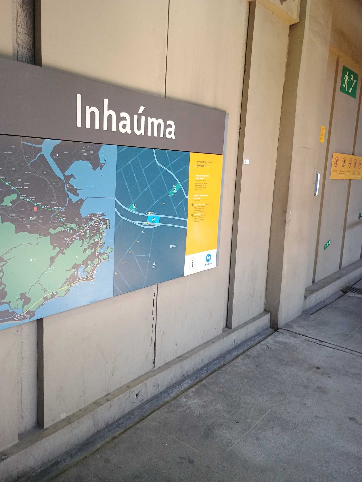
The station has the following entrances: B - Cemitério, B - Av. Pastor and A - Padre Januário
The first line to this station is L2, at 5:18 AM, and the last line is L2 at 12:32 AM.
72 Avenida Automovel Clube, Rio de Janeiro, Brazil
This station serves Metrô Rio’s lines
Popular routes from Inhaúma station
- Metrô Inhaúma,
- Praça Vinte E Quatro De Outubro, 43
Bus stops near Inhaúma stop
- Pilares
Train station near Inhaúma station
- Engenho Da Rainha
Metro station near Inhaúma station
- Rua Intendente Cunha Menezes, 191,
- Parada De Lucas,
- Ponto Final - Estação De Marechal Hermes (Linha 783),
- Estr. Engenho D'Água | Parkjacarepaguá (Acesso 1),
- Avenida Marechal Fontenele, 4619,
- Estrada Intendente Magalhães, 1041,
- Metrô Irajá (Sentido Madureira),
- Terminal De Bangu - Buraco Do Faim,
- Hospital Dos Servidores - Entrada Principal,
- Rua Expedicionário Da Pátria 420,
- Avenida Brasil - Passarela 32,
- Rodovia Presidente Dutra (Trevo De Paracambi),
- Village Mall,
- Alto De Vieira - Divisa Teresópolis/Nova Friburgo,
- Av. Luís Carlos Prestes | Barrashopping - Nível Lagoa (Fundos),
- Passarela Do Cemitério Do Corte 8 (Sentido Gramacho),
- Largo Do Machado (Linhas Para Rua Das Laranjeiras),
- Rodoviária Sul,
- Ninho Do Urubu,
- Ambev (Portão 1)
Popular public transit stations in Inhaúma
Get around Inhaúma by public transit!
Traveling around Inhaúma has never been so easy. See step by step directions as you travel to any attraction, street or major public transit station. View bus and train schedules, arrival times, service alerts and detailed routes on a map, so you know exactly how to get to anywhere in Inhaúma.
When traveling to any destination around Inhaúma use Moovit's Live Directions with Get Off Notifications to know exactly where and how far to walk, how long to wait for your line, and how many stops are left. Moovit will alert you when it's time to get off — no need to constantly re-check whether yours is the next stop.
Wondering how to use public transit in Inhaúma or how to pay for public transit in Inhaúma? Moovit public transit app can help you navigate your way with public transit easily, and at minimum cost. It includes public transit fees, ticket prices, and costs. Looking for a map of Inhaúma public transit lines? Moovit public transit app shows all public transit maps in Inhaúma with all Bus, Train, Metro, Light Rail, Ferry, Cable Car, Gondola and Funicular routes and stops on an interactive map.
Rio de Janeiro Region has 8 transit type(s), including: Bus, Train, Metro, Light Rail, Ferry, Cable Car, Gondola and Funicular, operated by several transit agencies, including TrensRJ, Metrô Rio, VLT Carioca, Barcas Rio, BRT MOBI-Rio, Auto Viação Alpha, Auto Viação Tijuca, Gire Transportes, Transurb, Viação Nossa Senhora das Graças, Consórcio INTERSUL, Braso Lisboa, Caprichosa Auto Ônibus, Auto Viação Três Amigos and Rodoviária Âncora Matias