How to get to Injury Docs Now Flushing by bus?
Click on the bus route to see step by step directions with maps, line arrival times and updated time schedules.
From City Island, Bronx
70 minFrom Plattduetsche Park, Franklin Square
67 minFrom DMV Jamaica Nys, Queens
34 minFrom Resorts World Casino, Queens
82 minFrom JFK Building 141, Queens
81 minFrom Springfield Gardens, NY, Queens
61 minFrom Manhasset, NY, Manhasset
43 minFrom Jamaica, Queens
42 minFrom Walmart, Queens
69 minFrom Macy's, Queens
45 min
How to get to Injury Docs Now Flushing by train?
Click on the train route to see step by step directions with maps, line arrival times and updated time schedules.
How to get to Injury Docs Now Flushing by subway?
Click on the subway route to see step by step directions with maps, line arrival times and updated time schedules.
Bus stops near Injury Docs Now Flushing in Queens
Train station near Injury Docs Now Flushing in Queens
- Broadway, 17 min walk,VIEW
Bus lines to Injury Docs Now Flushing in Queens
What are the closest stations to Injury Docs Now Flushing?
The closest stations to Injury Docs Now Flushing are:
- Northern Blvd / 194th St is 79 yards away, 2 min walk.
- Northern Blvd / 189th St is 390 yards away, 5 min walk.
- Northern Blvd / Francis Lewis Blvd is 416 yards away, 5 min walk.
- Francis Lewis Blvd/44 Av is 471 yards away, 6 min walk.
- 47 Av/196 St is 867 yards away, 11 min walk.
- Broadway is 1391 yards away, 17 min walk.
Which bus lines stop near Injury Docs Now Flushing?
These bus lines stop near Injury Docs Now Flushing: N20G, Q27, Q31, Q76.
Which train line stops near Injury Docs Now Flushing?
PORT WASHINGTON BRANCH (New York)
Which subway line stops near Injury Docs Now Flushing?
7 (Queens)
What’s the nearest train station to Injury Docs Now Flushing in Queens?
The nearest train station to Injury Docs Now Flushing in Queens is Broadway. It’s a 17 min walk away.
What’s the nearest bus station to Injury Docs Now Flushing in Queens?
The nearest bus station to Injury Docs Now Flushing in Queens is Northern Blvd / 194th St. It’s a 2 min walk away.
What time is the first train to Injury Docs Now Flushing in Queens?
The PORT WASHINGTON BRANCH is the first train that goes to Injury Docs Now Flushing in Queens. It stops nearby at 3:39 AM.
What time is the last train to Injury Docs Now Flushing in Queens?
The PORT WASHINGTON BRANCH is the last train that goes to Injury Docs Now Flushing in Queens. It stops nearby at 2:35 AM.
What time is the first bus to Injury Docs Now Flushing in Queens?
The Q27 is the first bus that goes to Injury Docs Now Flushing in Queens. It stops nearby at 3:19 AM.
What time is the last bus to Injury Docs Now Flushing in Queens?
The Q27 is the last bus that goes to Injury Docs Now Flushing in Queens. It stops nearby at 3:20 AM.
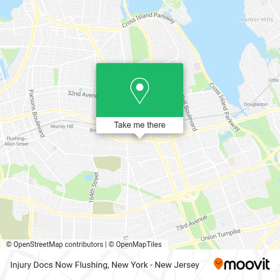
See Injury Docs Now Flushing, Queens, on the map
Public Transit to Injury Docs Now Flushing in Queens
Wondering how to get to Injury Docs Now Flushing in Queens? Moovit helps you find the best way to get to Injury Docs Now Flushing with step-by-step directions from the nearest public transit station.
Moovit provides free maps and live directions to help you navigate through your city. View schedules, routes, timetables, and find out how long does it take to get to Injury Docs Now Flushing in real time.
Looking for the nearest stop or station to Injury Docs Now Flushing? Check out this list of stops closest to your destination: Northern Blvd / 194th St; Northern Blvd / 189th St; Northern Blvd / Francis Lewis Blvd; Francis Lewis Blvd/44 Av; 47 Av/196 St; Broadway.
Bus: N20G, Q27, Q31, Q76, Q12, Q13, N20X.Train: PORT WASHINGTON BRANCH.Subway: 7.
Want to see if there’s another route that gets you there at an earlier time? Moovit helps you find alternative routes or times. Get directions from and directions to Injury Docs Now Flushing easily from the Moovit App or Website.
We make riding to Injury Docs Now Flushing easy, which is why over 1.5 million users, including users in Queens, trust Moovit as the best app for public transit. You don’t need to download an individual bus app or train app, Moovit is your all-in-one transit app that helps you find the best bus time or train time available.
For information on prices of bus, train and subway, costs and ride fares to Injury Docs Now Flushing, please check the Moovit app.
Use the app to navigate to popular places including to the airport, hospital, stadium, grocery store, mall, coffee shop, school, college, and university.
Injury Docs Now Flushing Address: 193-02 Northern Blvd street in Queens
- Dr. Mark Snyder, Dc,
- Auburndale Tires & Auto Repairs,
- 뉴욕함소아한의원 Hamsoa New York,
- 786 Halal Doner Kabab Inc,
- Gyz Studio 斯波蒂尔美育集团,
- Libertyx Bitcoin Atm,
- Dr. Jonathan Cho, Optometrist, and Associates - Flushing,
- Frederick Funeral Home,
- Western Union,
- Raaz Hookah Lounge,
- Dr. Jonathan Cho, Optometrist, and Associates - Bayside,
- El Patron,
- N.Y.C.B.,
- 뉴욕 아씨한복 입니다,
- Ups - Fedex - DHL - Cj택배 / Cj Nationwide / Usps,
- Flagstar Bank,
- Frankie & Johnnie's Steak,
- 192nd St (192nd street and northern blvd),
- 192nd St (192nd northern boulevard),
- Union Pharmacy
Places Near Injury Docs Now Flushing (Queens)
- Wall Street, Manhattan,
- 1 Police Plaza, Manhattan,
- Rockefeller Center, Manhattan,
- Katz's Deli, Manhattan,
- SoHo, Manhattan,
- Chinatown, Manhattan,
- Bellevue Hospital, Manhattan,
- Pier 83, Manhattan,
- 911 Memorial, Manhattan,
- qqqq, Manhattan,
- Queens Center Mall, Queens,
- San Gennaro Feast, Manhattan,
- Hudson Yards, Manhattan,
- 3 Stone St, Manhattan,
- 111 Centre New York City Supreme Court, Manhattan,
- 376 Hudson Street, Manhattan,
- Times Square, Manhattan,
- 66 John Street, Manhattan,
- 26 Federal Plaza, Manhattan,
- Mountainside Hospital, Glen Ridge
How to get to popular places in New York - New Jersey with public transit
Get around Queens by public transit!
Traveling around Queens has never been so easy. See step by step directions as you travel to any attraction, street or major public transit station. View bus and train schedules, arrival times, service alerts and detailed routes on a map, so you know exactly how to get to anywhere in Queens.
When traveling to any destination around Queens use Moovit's Live Directions with Get Off Notifications to know exactly where and how far to walk, how long to wait for your line, and how many stops are left. Moovit will alert you when it's time to get off — no need to constantly re-check whether yours is the next stop.
Wondering how to use public transit in Queens or how to pay for public transit in Queens? Moovit public transit app can help you navigate your way with public transit easily, and at minimum cost. It includes public transit fees, ticket prices, and costs. Looking for a map of Queens public transit lines? Moovit public transit app shows all public transit maps in Queens with all Bus, Train, Subway, Light Rail, Ferry and Cable Car routes and stops on an interactive map.
New York - New Jersey has 6 transit type(s), including: Bus, Train, Subway, Light Rail, Ferry and Cable Car, operated by several transit agencies, including MTA Subway, Metro-North Railroad, LIRR, PATH, MTA New York City Transit - Express routes, MTA Bus, NJ Transit, NYC Ferry, NICE bus, Bee-Line Bus, NJ Transit Rail, Norwalk Transit District, Hartford Line, River Valley Transit and HART