Directions to Injury Relief Chiropractic (Manassas) with public transportation
The following transit lines have routes that pass near Injury Relief Chiropractic
 Bus: 60, 65.
- Train: CARDINAL, CRESCENT, NORTHEAST REGIONAL, MANASSAS LINE.
How to get to Injury Relief Chiropractic by bus?
Click on the bus route to see step by step directions with maps, line arrival times and updated time schedules.
From Chantilly, VA, Fairfax County
146 minFrom National Reconnaissance Office, Fairfax County
210 minFrom University Boulevard (Gainesville) Park And Ride Lot, Prince William County
213 minFrom Arabx Com Inc, Fairfax County
178 minFrom Spa World, Fairfax County
168 minFrom Fairfax County Government Center, Fairfax County
117 minFrom Dulles Expo Center, Fairfax County
180 minFrom Centreville, VA, Fairfax County
164 min
Bus stop near Injury Relief Chiropractic in Manassas
- Sudley Rd @ Stonewall Rd, 3 min walk,VIEW
Train station near Injury Relief Chiropractic in Manassas
- Manassas, 35 min walk,VIEW
Bus lines to Injury Relief Chiropractic in Manassas
- 65, 65 - Nova Community College,VIEW
What are the closest stations to Injury Relief Chiropractic?
The closest stations to Injury Relief Chiropractic are:
- Sudley Rd @ Stonewall Rd is 202 yards away, 3 min walk.
- Manassas is 2913 yards away, 35 min walk.
Which bus lines stop near Injury Relief Chiropractic?
These bus lines stop near Injury Relief Chiropractic: 60, 65.
What’s the nearest bus station to Injury Relief Chiropractic in Manassas?
The nearest bus station to Injury Relief Chiropractic in Manassas is Sudley Rd @ Stonewall Rd. It’s a 3 min walk away.
What time is the first train to Injury Relief Chiropractic in Manassas?
The MANASSAS LINE is the first train that goes to Injury Relief Chiropractic in Manassas. It stops nearby at 5:09 AM.
What time is the last train to Injury Relief Chiropractic in Manassas?
The NORTHEAST REGIONAL is the last train that goes to Injury Relief Chiropractic in Manassas. It stops nearby at 8:30 PM.
What time is the first bus to Injury Relief Chiropractic in Manassas?
The 65 is the first bus that goes to Injury Relief Chiropractic in Manassas. It stops nearby at 6:13 AM.
What time is the last bus to Injury Relief Chiropractic in Manassas?
The 65 is the last bus that goes to Injury Relief Chiropractic in Manassas. It stops nearby at 8:24 PM.
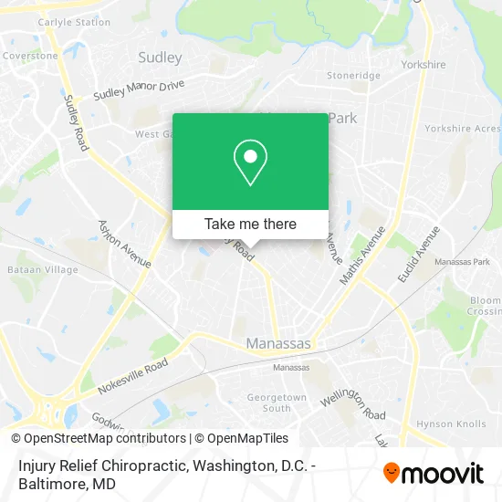
See Injury Relief Chiropractic, Manassas, on the map
Public Transit to Injury Relief Chiropractic in Manassas
Wondering how to get to Injury Relief Chiropractic in Manassas? Moovit helps you find the best way to get to Injury Relief Chiropractic with step-by-step directions from the nearest public transit station.
Moovit provides free maps and live directions to help you navigate through your city. View schedules, routes, timetables, and find out how long does it take to get to Injury Relief Chiropractic in real time.
Looking for the nearest stop or station to Injury Relief Chiropractic? Check out this list of stops closest to your destination: Sudley Rd @ Stonewall Rd; Manassas.
Bus: 60, 65.Train: CARDINAL, CRESCENT, NORTHEAST REGIONAL, MANASSAS LINE.
Want to see if there’s another route that gets you there at an earlier time? Moovit helps you find alternative routes or times. Get directions from and directions to Injury Relief Chiropractic easily from the Moovit App or Website.
We make riding to Injury Relief Chiropractic easy, which is why over 1.5 million users, including users in Manassas, trust Moovit as the best app for public transit. You don’t need to download an individual bus app or train app, Moovit is your all-in-one transit app that helps you find the best bus time or train time available.
For information on prices of bus and metro, costs and ride fares to Injury Relief Chiropractic, please check the Moovit app.
Use the app to navigate to popular places including to the airport, hospital, stadium, grocery store, mall, coffee shop, school, college, and university.
Injury Relief Chiropractic Address: 8807 Sudley Rd Manassas, VA 20110 street in Manassas
- Anthem Healthkeepers : Independent Authorized Agent Richard Spears,
- Troy Turner - State Farm Insurance Agent,
- Care Advantage, Inc.,
- Health Insurance Brokers Manassas,
- Northern Virginia Fence Company,
- 20110,
- Post Office,
- Golden Spa,
- Molly Marie Skincare,
- Accessstar Community Living Services Inc.,
- Fairfax Contractor,
- American Data Networks,
- Genius Auto Trans,
- Shiekh Mohammed M Hossain,
- Dragon Massage Spa,
- Royal Beauty Hair Salon,
- Manassas VA Workers Compensation Attorney,
- Ibew Local Union 26,
- Aquafeel Virginia,
- Manassas Wellness Center
Places Near Injury Relief Chiropractic (Manassas)
- Amazon Hq2, Arlington County,
- Marriott Marquis Washington, DC, Washington,
- The Anthem, Washington,
- National Zoo, Washington,
- Washington DC VA Medical Center, Washington,
- Rock Creek Tennis Center, Washington,
- Georgetown, Washington,
- National Mall, Washington,
- Camden Yards, Baltimore,
- National Museum of African American History and Culture, Washington,
- Sibley Memorial Hospital, Washington,
- Warner Theatre, Washington,
- Westfield Montgomery Mall, Montgomery County,
- Pennsylvania Ave NW (3rd st and pennsylvania), Washington,
- Washington National Cathedral, Washington,
- PG Mall, Prince George's County,
- M&T Bank Stadium, Baltimore,
- Capital One Arena, Washington,
- Museum Of The Bible, Washington,
- Basilica of the National Shrine, Washington
How to get to popular places in Washington, D.C. - Baltimore, MD with public transit
Get around Manassas by public transit!
Traveling around Manassas has never been so easy. See step by step directions as you travel to any attraction, street or major public transit station. View bus and train schedules, arrival times, service alerts and detailed routes on a map, so you know exactly how to get to anywhere in Manassas.
When traveling to any destination around Manassas use Moovit's Live Directions with Get Off Notifications to know exactly where and how far to walk, how long to wait for your line, and how many stops are left. Moovit will alert you when it's time to get off — no need to constantly re-check whether yours is the next stop.
Wondering how to use public transit in Manassas or how to pay for public transit in Manassas? Moovit public transit app can help you navigate your way with public transit easily, and at minimum cost. It includes public transit fees, ticket prices, and costs. Looking for a map of Manassas public transit lines? Moovit public transit app shows all public transit maps in Manassas with all Bus, Train, Metro, Light Rail and Ferry routes and stops on an interactive map.
Washington, D.C. - Baltimore, MD has 5 transit type(s), including: Bus, Train, Metro, Light Rail and Ferry, operated by several transit agencies, including WMATA, Montgomery County Ride On, Fairfax Connector, TheBus, PRTC, DASH - Alexandria, Arlington Transit (ART), RTA of Central Maryland, MDOT MTA, MDOT MTA Light RailLink, MDOT MTA Commuter Bus, MDOT MTA Local Bus, FXBGO!, Virginia Railway Express (VRE) and MARC