How to get to Ink Bound Tattoo by bus?
Click on the bus route to see step by step directions with maps, line arrival times and updated time schedules.
From Newport Mall, Jersey City
64 minFrom Hudson Street, Jersey City
53 minFrom Clara Maass Medical Center, Belleville
43 minFrom Grove Street (Path), Jersey City
54 minFrom 51, Jersey City
43 minFrom The Mills At Jersey Gardens, Elizabeth
58 minFrom Ikea, Elizabeth
44 minFrom JP Morgan Chase Co., Jersey City
60 minFrom Hudson Mall, Jersey City
36 min
How to get to Ink Bound Tattoo by train?
Click on the train route to see step by step directions with maps, line arrival times and updated time schedules.
Bus stops near Ink Bound Tattoo in Newark
Train station near Ink Bound Tattoo in Newark
- Newark Penn Station, 7 min walk,VIEW
Light Rail stations near Ink Bound Tattoo in Newark
- Penn Station Light Rail Arrival, 8 min walk,VIEW
Bus lines to Ink Bound Tattoo in Newark
- 40, Port Newark Tyler & Marsh,VIEW
- 108, New York Via Union City,VIEW
- 5, Kinney,VIEW
- 11, Newark - Willowbrook,VIEW
- 21, Main Street,VIEW
- 28, Newark - Montclair State - Willowbrook,VIEW
- 29, Bloomfield Avenue,VIEW
- 30, North Arlington-Kearny-Newark,VIEW
- 39, Irvington - Newark,VIEW
- 41, Park Avenue,VIEW
- 44, Tremont - Central Avenue - Newark Penn Station,VIEW
- 62, Newark - Elizabeth,VIEW
- 65, Newark - Somerville,VIEW
- 66, Newark - Mountainside,VIEW
- 67, Toms River - Lakewood - Newark,VIEW
- 70, Newark - Livingston Mall,VIEW
- 71, Newark - West Caldwell,VIEW
- 72, Paterson - Bloomfield - Newark,VIEW
- 73, Newark - Orange - Livingston,VIEW
- 76, Newark - Hackensack,VIEW
What are the closest stations to Ink Bound Tattoo?
The closest stations to Ink Bound Tattoo are:
- Market St at Union St is 168 yards away, 3 min walk.
- Bus Lanes (Raymond Blvd Side) is 221 yards away, 4 min walk.
- Newark (Amtrak) is 221 yards away, 4 min walk.
- Mcwhorter St at Hamilton St is 316 yards away, 4 min walk.
- Eastbound Market St under Bridge is 507 yards away, 7 min walk.
- Newark Penn Station is 522 yards away, 7 min walk.
- Penn Station Light Rail Arrival is 552 yards away, 8 min walk.
Which bus lines stop near Ink Bound Tattoo?
These bus lines stop near Ink Bound Tattoo: 1, 25, 40, 62.
Which train line stops near Ink Bound Tattoo?
RED (Newark - World Trade Center)
Which light rail line stops near Ink Bound Tattoo?
NLR (Penn Station)
What’s the nearest light rail station to Ink Bound Tattoo in Newark?
The nearest light rail station to Ink Bound Tattoo in Newark is Penn Station Light Rail Arrival. It’s a 8 min walk away.
What’s the nearest train station to Ink Bound Tattoo in Newark?
The nearest train station to Ink Bound Tattoo in Newark is Newark Penn Station. It’s a 7 min walk away.
What’s the nearest bus station to Ink Bound Tattoo in Newark?
The nearest bus station to Ink Bound Tattoo in Newark is Market St at Union St. It’s a 3 min walk away.
What time is the first light rail to Ink Bound Tattoo in Newark?
The NLR is the first light rail that goes to Ink Bound Tattoo in Newark. It stops nearby at 4:30 AM.
What time is the last light rail to Ink Bound Tattoo in Newark?
The NLR is the last light rail that goes to Ink Bound Tattoo in Newark. It stops nearby at 1:15 AM.
What time is the first train to Ink Bound Tattoo in Newark?
The RED is the first train that goes to Ink Bound Tattoo in Newark. It stops nearby at 3:10 AM.
What time is the last train to Ink Bound Tattoo in Newark?
The RED is the last train that goes to Ink Bound Tattoo in Newark. It stops nearby at 2:55 AM.
What time is the first bus to Ink Bound Tattoo in Newark?
The 25 is the first bus that goes to Ink Bound Tattoo in Newark. It stops nearby at 3:00 AM.
What time is the last bus to Ink Bound Tattoo in Newark?
The ADT N813 is the last bus that goes to Ink Bound Tattoo in Newark. It stops nearby at 6:40 AM.
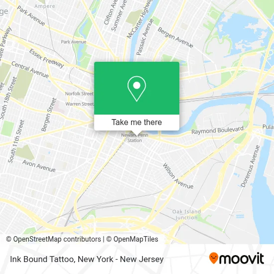
See Ink Bound Tattoo, Newark, on the map
Public Transit to Ink Bound Tattoo in Newark
Wondering how to get to Ink Bound Tattoo in Newark? Moovit helps you find the best way to get to Ink Bound Tattoo with step-by-step directions from the nearest public transit station.
Moovit provides free maps and live directions to help you navigate through your city. View schedules, routes, timetables, and find out how long does it take to get to Ink Bound Tattoo in real time.
Looking for the nearest stop or station to Ink Bound Tattoo? Check out this list of stops closest to your destination: Market St at Union St; Bus Lanes (Raymond Blvd Side); Newark (Amtrak); Mcwhorter St at Hamilton St; Eastbound Market St under Bridge; Newark Penn Station; Penn Station Light Rail Arrival.
Bus: 1, 25, 40, 62, 108, ADT N809, ADT N810, ADT N813, ADT N816, ADT N823, FAB10, FAB11, 5, 11, 21, 28, 29, 34.Train: RED, ACELA, CARDINAL, CAROLINIAN, CRESCENT, KEYSTONE SERVICE.Light Rail: NLR.
Want to see if there’s another route that gets you there at an earlier time? Moovit helps you find alternative routes or times. Get directions from and directions to Ink Bound Tattoo easily from the Moovit App or Website.
We make riding to Ink Bound Tattoo easy, which is why over 1.5 million users, including users in Newark, trust Moovit as the best app for public transit. You don’t need to download an individual bus app or train app, Moovit is your all-in-one transit app that helps you find the best bus time or train time available.
For information on prices of train, bus and light rail, costs and ride fares to Ink Bound Tattoo, please check the Moovit app.
Use the app to navigate to popular places including to the airport, hospital, stadium, grocery store, mall, coffee shop, school, college, and university.
Ink Bound Tattoo Address: 46 Ferry St street in Newark
- Smoking Monkey Smoke Shop,
- Lemos Pizza,
- Bounce Luggage Storage - Newark Penn Station,
- Coin Genie Bitcoin Atm,
- Sora Training (Nj Sora Class),
- Leleco Bakery,
- Radical Storage,
- NJ Sora and Sora Renewal Classes Armed and Unarmed,
- The Treasure Box,
- J & A Little Deli,
- Anti Aging Wellness Md,
- New #1 Garden,
- NJ Sora Class,
- Sora Class / Sora Training / Sora Renewal - Classes,
- Forno's of Spain Restaurant (Fornos of Spain),
- J&A Little Deli,
- Flagstar Bank,
- Garden State Community Bank, A Division Of New York Community Bank,
- Bitcoin Depot - Bitcoin Atm,
- Western Union
Places Near Ink Bound Tattoo (Newark)
- Queens Center Mall, Queens,
- 3 Stone St, Manhattan,
- Chinatown, Manhattan,
- SoHo, Manhattan,
- San Gennaro Feast, Manhattan,
- 111 Centre New York City Supreme Court, Manhattan,
- qqqq, Manhattan,
- Times Square, Manhattan,
- Bellevue Hospital, Manhattan,
- Wall Street, Manhattan,
- Pier 83, Manhattan,
- Mountainside Hospital, Glen Ridge,
- Katz's Deli, Manhattan,
- Hudson Yards, Manhattan,
- 376 Hudson Street, Manhattan,
- 66 John Street, Manhattan,
- 911 Memorial, Manhattan,
- 26 Federal Plaza, Manhattan,
- 1 Police Plaza, Manhattan,
- Rockefeller Center, Manhattan
How to get to popular places in New York - New Jersey with public transit
Get around Newark by public transit!
Traveling around Newark has never been so easy. See step by step directions as you travel to any attraction, street or major public transit station. View bus and train schedules, arrival times, service alerts and detailed routes on a map, so you know exactly how to get to anywhere in Newark.
When traveling to any destination around Newark use Moovit's Live Directions with Get Off Notifications to know exactly where and how far to walk, how long to wait for your line, and how many stops are left. Moovit will alert you when it's time to get off — no need to constantly re-check whether yours is the next stop.
Wondering how to use public transit in Newark or how to pay for public transit in Newark? Moovit public transit app can help you navigate your way with public transit easily, and at minimum cost. It includes public transit fees, ticket prices, and costs. Looking for a map of Newark public transit lines? Moovit public transit app shows all public transit maps in Newark with all Bus, Train, Subway, Light Rail, Ferry and Cable Car routes and stops on an interactive map.
New York - New Jersey has 6 transit type(s), including: Bus, Train, Subway, Light Rail, Ferry and Cable Car, operated by several transit agencies, including MTA Subway, Metro-North Railroad, LIRR, PATH, MTA New York City Transit - Express routes, MTA Bus, NJ Transit, NYC Ferry, NICE bus, Bee-Line Bus, NJ Transit Rail, Norwalk Transit District, Hartford Line, River Valley Transit and HART