How to get to Ink'D Tattoos by bus?
Click on the bus route to see step by step directions with maps, line arrival times and updated time schedules.
From Biltmore Apartments, Indianapolis City (Balance)
44 minFrom Super 8-Indianapolis Emerson Ave (Indianapolis Super Eight), Beech Grove
63 minFrom We Buy Indianapolis Homes, Indianapolis City (Balance)
50 minFrom Brothers Auto Parts (Brothers Auto Salvage), Indianapolis City (Balance)
78 minFrom Sunoco, Indianapolis City (Balance)
41 minFrom Cleanslate Outpatient Addiction Medicine, Indianapolis City (Balance)
32 minFrom Lt Connel Realty, Indianapolis City (Balance)
57 minFrom Shortridge High School, Indianapolis City (Balance)
50 minFrom Entrance I-74 E, Indianapolis City (Balance)
84 minFrom IndyGo Route #31 Greenwood to Indianapolis, Indianapolis City (Balance)
48 min
Bus stops near Ink'D Tattoos in Indianapolis City (Balance)
Bus lines to Ink'D Tattoos in Indianapolis City (Balance)
What are the closest stations to Ink'D Tattoos?
The closest stations to Ink'D Tattoos are:
- Madison Ave & Yoke St is 54 yards away, 1 min walk.
- Meridian St & Southern Ave is 174 yards away, 3 min walk.
Which bus lines stop near Ink'D Tattoos?
These bus lines stop near Ink'D Tattoos: 16, 31.
What’s the nearest bus station to Ink'D Tattoos in Indianapolis City (Balance)?
The nearest bus station to Ink'D Tattoos in Indianapolis City (Balance) is Madison Ave & Yoke St. It’s a 1 min walk away.
What time is the first bus to Ink'D Tattoos in Indianapolis City (Balance)?
The 16 is the first bus that goes to Ink'D Tattoos in Indianapolis City (Balance). It stops nearby at 5:23 AM.
What time is the last bus to Ink'D Tattoos in Indianapolis City (Balance)?
The 31 is the last bus that goes to Ink'D Tattoos in Indianapolis City (Balance). It stops nearby at 9:42 PM.
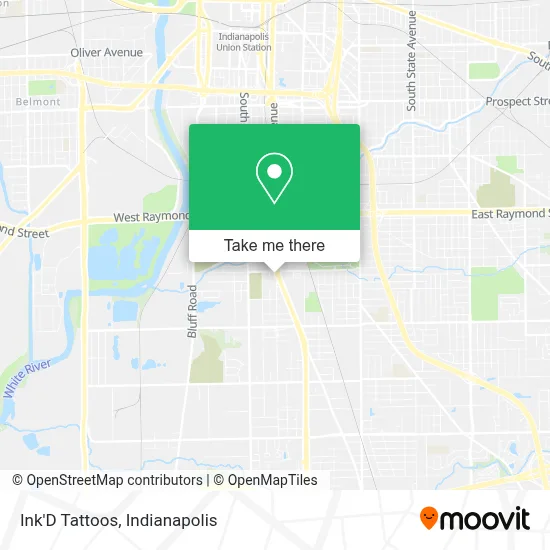
See Ink'D Tattoos, Indianapolis City (Balance), on the map
Public Transit to Ink'D Tattoos in Indianapolis City (Balance)
Wondering how to get to Ink'D Tattoos in Indianapolis City (Balance)? Moovit helps you find the best way to get to Ink'D Tattoos with step-by-step directions from the nearest public transit station.
Moovit provides free maps and live directions to help you navigate through your city. View schedules, routes, timetables, and find out how long does it take to get to Ink'D Tattoos in real time.
Looking for the nearest stop or station to Ink'D Tattoos? Check out this list of stops closest to your destination: Madison Ave & Yoke St; Meridian St & Southern Ave.
Bus: 16, 31.
Want to see if there’s another route that gets you there at an earlier time? Moovit helps you find alternative routes or times. Get directions from and directions to Ink'D Tattoos easily from the Moovit App or Website.
We make riding to Ink'D Tattoos easy, which is why over 1.5 million users, including users in Indianapolis City (Balance), trust Moovit as the best app for public transit. You don’t need to download an individual bus app or train app, Moovit is your all-in-one transit app that helps you find the best bus time or train time available.
For information on prices of bus, costs and ride fares to Ink'D Tattoos, please check the Moovit app.
Use the app to navigate to popular places including to the airport, hospital, stadium, grocery store, mall, coffee shop, school, college, and university.
Ink'D Tattoos Address: 2612 S Madison Ave street in Indianapolis City (Balance)
- R.A. Miller Tattoos,
- Imilestones,
- Bonbon Vintage,
- Nutrition Guerrero,
- WESTERN UNION,
- Indy Cleaning Service,
- Adult and Child Health,
- S&R Welding,
- Calvary Zomi Baptist Church,
- Carpenters Benefits Facility,
- Pearman Locksmith,
- Darbar Sri Guru Granth Sahib Ji,
- Marksbary Lawncare,
- Concordia Cemetery,
- South Village, Indiana,
- Wheeler Mission Store,
- Wiseman Investments,
- Store Space,
- Southside Automotive Center,
- Last Chance Pizza
Places Near Ink'D Tattoos (Indianapolis City (Balance))
- Jersey Barn, Indianapolis City (Balance),
- THE BALT, Indianapolis City (Balance),
- Methodist Hospital of Indianapolis, Indianapolis City (Balance),
- St. Vincent entrance #1, Indianapolis City (Balance),
- Indiana, Indianapolis City (Balance),
- Indianapolis Motor Speedway, Speedway,
- I-465 / I-65 Interchange, Indianapolis City (Balance),
- Train Ride At Castleton Mall, Indianapolis City (Balance),
- Lucas Oil Stadium, Indianapolis City (Balance),
- Plainfield, IN, Plainfield,
- Eskenazi Hospital, Indianapolis City (Balance),
- Gainbridge Fieldhouse, Indianapolis City (Balance),
- St. Vincent Hospital - Indianapolis, Indianapolis City (Balance),
- 119 W 19th St Parking, Indianapolis City (Balance),
- Cotter's Massage Parlor With Happy Endings, Indianapolis City (Balance),
- Castleton Square Mall, Indianapolis,
- I U Health Methodist Hospital, Indianapolis City (Balance),
- Lilly Corporate Center (Eli Lilly & Co), Indianapolis City (Balance),
- Indianapolis Airport Zone 2, Indianapolis City (Balance),
- Indiana Convention Center, Indianapolis City (Balance)
How to get to popular places in Indianapolis with public transit
Get around Indianapolis City (Balance) by public transit!
Traveling around Indianapolis City (Balance) has never been so easy. See step by step directions as you travel to any attraction, street or major public transit station. View bus and train schedules, arrival times, service alerts and detailed routes on a map, so you know exactly how to get to anywhere in Indianapolis City (Balance).
When traveling to any destination around Indianapolis City (Balance) use Moovit's Live Directions with Get Off Notifications to know exactly where and how far to walk, how long to wait for your line, and how many stops are left. Moovit will alert you when it's time to get off — no need to constantly re-check whether yours is the next stop.
Wondering how to use public transit in Indianapolis City (Balance) or how to pay for public transit in Indianapolis City (Balance)? Moovit public transit app can help you navigate your way with public transit easily, and at minimum cost. It includes public transit fees, ticket prices, and costs. Looking for a map of Indianapolis City (Balance) public transit lines? Moovit public transit app shows all public transit maps in Indianapolis City (Balance) with all bus routes and stops on an interactive map.
Indianapolis has 1 transit type(s), including: bus, operated by several transit agencies, including IndyGo, FlixBus-us and Greyhound-us