How to get to Ink Driven Studios by bus?
Click on the bus route to see step by step directions with maps, line arrival times and updated time schedules.
From Facade Tek, Indianapolis City (Balance)
63 minFrom MSD Wayne Township Operations Center, Indianapolis City (Balance)
102 minFrom Ferguson, Indianapolis City (Balance)
58 minFrom IUPUI: Gymnasium (The Jungle), Indianapolis City (Balance)
40 minFrom Michael A Carroll Track & Soccer Stadium, Indianapolis City (Balance)
39 minFrom Little People, Indianapolis City (Balance)
31 minFrom Methodist Hospital Cardiac Catheterization Lab, Indianapolis City (Balance)
62 minFrom Bluestar Painting, Indianapolis City (Balance)
43 minFrom Indianapolis Urban League, Indianapolis City (Balance)
42 minFrom IUPUI: Business / SPEA Building (BS), Indianapolis City (Balance)
38 min
Bus stops near Ink Driven Studios in Indianapolis City (Balance)
Bus lines to Ink Driven Studios in Indianapolis City (Balance)
What are the closest stations to Ink Driven Studios?
The closest stations to Ink Driven Studios are:
- High School Rd & 38th St is 101 yards away, 2 min walk.
- 38th St & High School Rd is 183 yards away, 3 min walk.
- High School Rd & Westhaven is 483 yards away, 6 min walk.
Which bus lines stop near Ink Driven Studios?
These bus lines stop near Ink Driven Studios: 10, 38.
What’s the nearest bus station to Ink Driven Studios in Indianapolis City (Balance)?
The nearest bus station to Ink Driven Studios in Indianapolis City (Balance) is High School Rd & 38th St. It’s a 2 min walk away.
What time is the first bus to Ink Driven Studios in Indianapolis City (Balance)?
The 10 is the first bus that goes to Ink Driven Studios in Indianapolis City (Balance). It stops nearby at 4:49 AM.
What time is the last bus to Ink Driven Studios in Indianapolis City (Balance)?
The 10 is the last bus that goes to Ink Driven Studios in Indianapolis City (Balance). It stops nearby at 11:54 PM.
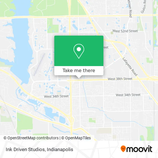
See Ink Driven Studios, Indianapolis City (Balance), on the map
Public Transit to Ink Driven Studios in Indianapolis City (Balance)
Wondering how to get to Ink Driven Studios in Indianapolis City (Balance)? Moovit helps you find the best way to get to Ink Driven Studios with step-by-step directions from the nearest public transit station.
Moovit provides free maps and live directions to help you navigate through your city. View schedules, routes, timetables, and find out how long does it take to get to Ink Driven Studios in real time.
Looking for the nearest stop or station to Ink Driven Studios? Check out this list of stops closest to your destination: High School Rd & 38th St; 38th St & High School Rd; High School Rd & Westhaven.
Bus: 10, 38, 15.
Want to see if there’s another route that gets you there at an earlier time? Moovit helps you find alternative routes or times. Get directions from and directions to Ink Driven Studios easily from the Moovit App or Website.
We make riding to Ink Driven Studios easy, which is why over 1.5 million users, including users in Indianapolis City (Balance), trust Moovit as the best app for public transit. You don’t need to download an individual bus app or train app, Moovit is your all-in-one transit app that helps you find the best bus time or train time available.
For information on prices of bus, costs and ride fares to Ink Driven Studios, please check the Moovit app.
Use the app to navigate to popular places including to the airport, hospital, stadium, grocery store, mall, coffee shop, school, college, and university.
Ink Driven Studios Address: 3804 N High School Rd Indianapolis, IN 46254 street in Indianapolis City (Balance)
- Store,
- 38th St Smoke Shop,
- Amazon Locker-Frown,
- Josiah,
- 38th St & High School Rd,
- Penske Auto Center,
- Minute Key,
- 3902 N High School Rd Parking,
- Legacy Estimating,
- Red Carpet Inn,
- Autozone Auto Parts,
- Google Review,
- Plaza Mall,
- Llantera Pacifi Co.,
- Locksmith Foraluminum Doors,
- Fat Man's BBQ,
- R&B Construction,
- Peace and Love Braiding,
- All Day Emergency Locksmith,
- Carpenters Tax Service
Places Near Ink Driven Studios (Indianapolis City (Balance))
- Methodist Hospital of Indianapolis, Indianapolis City (Balance),
- St. Vincent Hospital - Indianapolis, Indianapolis City (Balance),
- Jersey Barn, Indianapolis City (Balance),
- Indianapolis Airport Zone 2, Indianapolis City (Balance),
- Lilly Corporate Center (Eli Lilly & Co), Indianapolis City (Balance),
- Indianapolis Motor Speedway, Speedway,
- THE BALT, Indianapolis City (Balance),
- I-465 / I-65 Interchange, Indianapolis City (Balance),
- Eskenazi Hospital, Indianapolis City (Balance),
- Plainfield, IN, Plainfield,
- Castleton Square Mall, Indianapolis,
- St. Vincent entrance #1, Indianapolis City (Balance),
- Indiana, Indianapolis City (Balance),
- Gainbridge Fieldhouse, Indianapolis City (Balance),
- I U Health Methodist Hospital, Indianapolis City (Balance),
- Indiana Convention Center, Indianapolis City (Balance),
- 119 W 19th St Parking, Indianapolis City (Balance),
- Cotter's Massage Parlor With Happy Endings, Indianapolis City (Balance),
- Lucas Oil Stadium, Indianapolis City (Balance),
- Train Ride At Castleton Mall, Indianapolis City (Balance)
How to get to popular places in Indianapolis with public transit
Get around Indianapolis City (Balance) by public transit!
Traveling around Indianapolis City (Balance) has never been so easy. See step by step directions as you travel to any attraction, street or major public transit station. View bus and train schedules, arrival times, service alerts and detailed routes on a map, so you know exactly how to get to anywhere in Indianapolis City (Balance).
When traveling to any destination around Indianapolis City (Balance) use Moovit's Live Directions with Get Off Notifications to know exactly where and how far to walk, how long to wait for your line, and how many stops are left. Moovit will alert you when it's time to get off — no need to constantly re-check whether yours is the next stop.
Wondering how to use public transit in Indianapolis City (Balance) or how to pay for public transit in Indianapolis City (Balance)? Moovit public transit app can help you navigate your way with public transit easily, and at minimum cost. It includes public transit fees, ticket prices, and costs. Looking for a map of Indianapolis City (Balance) public transit lines? Moovit public transit app shows all public transit maps in Indianapolis City (Balance) with all bus routes and stops on an interactive map.
Indianapolis has 1 transit type(s), including: bus, operated by several transit agencies, including IndyGo, FlixBus-us and Greyhound-us