Directions to Ink Jet (Paulista) with public transportation
The following transit lines have routes that pass near Ink Jet
How to get to Ink Jet by bus?
Click on the bus route to see step by step directions with maps, line arrival times and updated time schedules.
From Avenida Senador Salgado Filho, Paulista
41 minFrom Mix Mateus, Olinda
53 minFrom Avenida Doutor Joaquim Nabuco, Olinda
41 minFrom Junta Militar De Olinda, Olinda
33 minFrom Cemitério Jardim Metropolitano, Olinda
73 minFrom Varadouro, Olinda
41 minFrom tuuuuu, Olinda
47 minFrom Alto da Sé, Olinda
42 minFrom Avenida Ministro Marcos Freire, Olinda
25 minFrom Avenida Presidente Kennedy, Olinda
47 min
Bus stops near Ink Jet in Paulista
Bus lines to Ink Jet in Paulista
- 1922 PAU AMARELO / TI PELÓPIDAS, Pau Amarelo / Ti Pelópidas,VIEW
- 1950 ENGENHO MARANGUAPE / VARADOURO, Engenho Maranguape / Varadouro,VIEW
- 1955 CONJUNTO PRAIA DO JANGA (ENGENHO MARANGUAPE) / TI PELÓPIDAS, Via Tururu,VIEW
- 1960 TI RIO DOCE / MARIA FARINHA (CASA CAIADA), Ti Rio Doce / Maria Farinha (Casa Caiada),VIEW
- 1982 CONJUNTO BEIRA MAR / DERBY, Conjunto Beira Mar / Derby,VIEW
- 1992 PAU AMARELO, Pau Amarelo,VIEW
- 1994 CONJUNTO BEIRA MAR, Via Prefeitura Do Recife,VIEW
- 1995 PAU AMARELO (BACURAU), Pau Amarelo (Bacurau),VIEW
What are the closest stations to Ink Jet?
The closest stations to Ink Jet are:
- Rua Poeta João Neves, 386 is 175 meters away, 3 min walk.
- Av. Dr. Cláudio José Gueiros Leite, 242 | Bompreço is 221 meters away, 4 min walk.
Which bus lines stop near Ink Jet?
These bus lines stop near Ink Jet: 1922 PAU AMARELO / TI PELÓPIDAS, 1982 CONJUNTO BEIRA MAR / DERBY, 1992 PAU AMARELO.
What’s the nearest bus station to Ink Jet in Paulista?
The nearest bus station to Ink Jet in Paulista is Rua Poeta João Neves, 386. It’s a 3 min walk away.
What time is the first bus to Ink Jet in Paulista?
The 1995 PAU AMARELO (BACURAU) is the first bus that goes to Ink Jet in Paulista. It stops nearby at 3:33 AM.
What time is the last bus to Ink Jet in Paulista?
The 1995 PAU AMARELO (BACURAU) is the last bus that goes to Ink Jet in Paulista. It stops nearby at 3:36 AM.
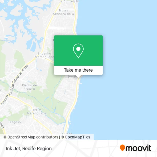
See Ink Jet, Paulista, on the map
Public Transit to Ink Jet in Paulista
Wondering how to get to Ink Jet in Paulista? Moovit helps you find the best way to get to Ink Jet with step-by-step directions from the nearest public transit station.
Moovit provides free maps and live directions to help you navigate through your city. View schedules, routes, timetables, and find out how long does it take to get to Ink Jet in real time.
Looking for the nearest stop or station to Ink Jet? Check out this list of stops closest to your destination: Rua Poeta João Neves; Av. Dr. Cláudio José Gueiros Leite.
Bus: 1922 PAU AMARELO / TI PELÓPIDAS, 1982 CONJUNTO BEIRA MAR / DERBY, 1992 PAU AMARELO, 1950 ENGENHO MARANGUAPE / VARADOURO, 1955 CONJUNTO PRAIA DO JANGA (ENGENHO MARANGUAPE) / TI PELÓPIDAS, 1960 TI RIO DOCE / MARIA FARINHA (CASA CAIADA), 1994 CONJUNTO BEIRA MAR, 1995 PAU AMARELO (BACURAU).
Want to see if there’s another route that gets you there at an earlier time? Moovit helps you find alternative routes or times. Get directions from and directions to Ink Jet easily from the Moovit App or Website.
We make riding to Ink Jet easy, which is why over 1.5 million users, including users in Paulista, trust Moovit as the best app for public transit. You don’t need to download an individual bus app or train app, Moovit is your all-in-one transit app that helps you find the best bus time or train time available.
For information on prices of bus, costs and ride fares to Ink Jet, please check the Moovit app.
Use the app to navigate to popular places including to the airport, hospital, stadium, grocery store, mall, coffee shop, school, college, and university.
Ink Jet Address: Avenida Doutor Cláudio José Gueiros Leite, Janga Paulista-PE 53437-000 street in Paulista
- Fabrica de Bonecas,
- Aleph Seguranca,
- Fortt Imobiliária,
- Clínica de Fisioterapia Liv,
- Hm Celular Janga,
- Hamburgrill,
- Acai Bom Quisso,
- Genario & Figurino,
- Arizon Incorporacao de Empreendimentos Imobiliários,
- Pet Shop Tio NATO Salao Pet,
- Lívia Aguiar Artigos de Luxo,
- Construtora e Incorporadora Cruzeiro do Sul,
- Barbearia Octogono,
- Lomel Locadora Montadora de Máquinas Eletrônicas,
- Tratto Comercio De Produtos De Limpeza E Servicos,
- Restaurante Hayako,
- Mathira Menezes,
- Maria Bonita Afiacoes,
- Dr. Hélio Belo,
- Milho & Delícias
Places Near Ink Jet (Paulista)
- Imbiribeira, Imbiribeira,
- Hospital Eduardo Campus Da Pessoa Idosa, Areias,
- Shopping Recife, Boa Viagem,
- Imip (Instituto Materno-Infantil De Pernambuco), Coelhos,
- Centro de Convenções de Pernambuco, Olinda,
- SHOPPING GUARARAPES, Jaboatão Dos Guararapes,
- hospital otavio de freitas - UTI, Tejipió,
- tuuuuu, Olinda,
- Hospital Maria Lucinda, Parnamirim,
- Hospital Geral De Areias, Areias,
- llll, Fundão,
- Hospital Universitário Oswaldo Cruz, Santo Amaro,
- Hospital Altino Ventura, Iputinga,
- Marco Zero, Bairro Do Recife,
- Arena de Pernambuco, São Lourenço Da Mata,
- Parque da Jaqueira, Jaqueira,
- Hospital Agamenon Magalhães, Tamarineira,
- Shopping Patteo Olinda, Olinda,
- SHOPPING TACARUNA, Santo Amaro,
- Shopping RioMar Recife, Pina
How to get to popular places in Recife Region with public transit
Get around Paulista by public transit!
Traveling around Paulista has never been so easy. See step by step directions as you travel to any attraction, street or major public transit station. View bus and train schedules, arrival times, service alerts and detailed routes on a map, so you know exactly how to get to anywhere in Paulista.
When traveling to any destination around Paulista use Moovit's Live Directions with Get Off Notifications to know exactly where and how far to walk, how long to wait for your line, and how many stops are left. Moovit will alert you when it's time to get off — no need to constantly re-check whether yours is the next stop.
Wondering how to use public transit in Paulista or how to pay for public transit in Paulista? Moovit public transit app can help you navigate your way with public transit easily, and at minimum cost. It includes public transit fees, ticket prices, and costs. Looking for a map of Paulista public transit lines? Moovit public transit app shows all public transit maps in Paulista with all Bus, Train and Subway routes and stops on an interactive map.
Recife Region has 3 transit type(s), including: Bus, Train and Subway, operated by several transit agencies, including CBTU (Metrorec), BRT (Via Livre), Grande Recife, BORBOREMA IMPERIAL (TIP), BORBOREMA IMPERIAL (B.V), RODOVIÁRIA POTENGY, EMPRESA METROPOLITANA, CONSÓRCIO RECIFE, SÃO JUDAS TADEU, Expresso 1002, Rodotur Turismo, Complementar Recife, Sistema Municipal - Jaboatão, Sistema Municipal - Cabo and Sistema Municipal - Ipojuca