How to get to Ink. Oasis by bus?
Click on the bus route to see step by step directions with maps, line arrival times and updated time schedules.
From Waldgasthof Weiler Hütte, Weil Im Schönbuch (Kernort)
155 minFrom Robert Bosch, Reutlingen
56 minFrom Bauhaus, Reutlingen
61 minFrom Industriegebiet West, Reutlingen-Betzingen
44 minFrom Bosch, Tor 2, Reutlingen
56 minFrom Rieger (Möbel Rieger), Reutlingen
62 minFrom Geilhaus Haus 33a, Reutlingen-Betzingen
57 minFrom Geilhaus, Reutlingen-Betzingen
57 minFrom Friedhof Römerschanze, Reutlingen
79 min
How to get to Ink. Oasis by train?
Click on the train route to see step by step directions with maps, line arrival times and updated time schedules.
From Waldgasthof Weiler Hütte, Weil Im Schönbuch (Kernort)
100 minFrom Robert Bosch, Reutlingen
49 minFrom Bauhaus, Reutlingen
49 minFrom Industriegebiet West, Reutlingen-Betzingen
51 minFrom Bosch, Tor 2, Reutlingen
49 minFrom Rieger (Möbel Rieger), Reutlingen
54 minFrom Geilhaus Haus 33a, Reutlingen-Betzingen
50 minFrom Geilhaus, Reutlingen-Betzingen
50 min
Bus stops near Ink. Oasis in Tübingen
Train stations near Ink. Oasis in Tübingen
- Tübingen Hauptbahnhof, 5 min walk,VIEW
Bus lines to Ink. Oasis in Tübingen
- 11, Tübingen Hauptbahnhof Bstg I - Tübingen Gerstenmühlstr.,VIEW
- 12, Tübingen Hauptbahnhof Bstg I - Tübingen Weststadt,VIEW
- 9, Tübingen Bismarckturm - Tübingen Hauptbahnhof Bstg I,VIEW
- N90, Tübingen Hauptbahnhof Bstg I - Tübingen Hauptbahnhof Bstg N,VIEW
- 826, Leinfelden - Waldenbuch - Tübingen,VIEW
- 827, Häslach - Walddorf - Dettenhausen - Pfrondorf - Tübingen,VIEW
- 828, Flughafen - Echterdingen - Waldenbuch - Tübingen,VIEW
- RT828, Dettenhausen - Tübingen,VIEW
- X82, Flughafen - Echterdingen - Waldenbuch - Tübingen,VIEW
- 1, Tübingen Hauptbahnhof Bstg C - Tübingen Stauden,VIEW
- 13, Tübingen Aixer Straße - Tübingen Wanne Kunsthalle,VIEW
- 16, Tübingen Hauptbahnhof Bstg E - Tübingen Waldhörnlestraße,VIEW
- 17, Tübingen Uni-Kliniken Berg - Tübingen Hauptbahnhof Bstg J,VIEW
- 18, Tübingen Hauptbahnhof Bstg G - Hirschau Rittweg West,VIEW
- 19, Bühl Römerstraße - Tübingen BG Unfallklinik,VIEW
- 2, Tübingen Ulmenweg - Tübingen Hauptbahnhof Bstg J,VIEW
- 21, Tübingen Hauptbahnhof Bstg D - Tübingen Egeriaplatz,VIEW
- 3, Tübingen WHO Pappelweg Bstg 2 - Tübingen Nelkenweg,VIEW
- 32, Tübingen Hauptbahnhof Bstg D - Tübingen Ursrainer Ring,VIEW
- 4, Tübingen WHO Pappelweg Bstg 2 - Tübingen Wennf. Garten,VIEW
What are the closest stations to Ink. Oasis?
The closest stations to Ink. Oasis are:
- Tübingen Haagtor is 193 meters away, 3 min walk.
- Tübingen Hauptbahnhof is 322 meters away, 5 min walk.
- Tübingen Stadtgraben is 407 meters away, 6 min walk.
- Tübingen Neckarhalde is 476 meters away, 7 min walk.
- Tübingen Parkhaus König is 480 meters away, 7 min walk.
- Tübingen Rümelinstraße is 599 meters away, 8 min walk.
Which bus lines stop near Ink. Oasis?
These bus lines stop near Ink. Oasis: 11, 7611, 826, 828, 9.
Which train line stops near Ink. Oasis?
RB63 (Tübingen Hbf)
What’s the nearest train station to Ink. Oasis in Tübingen?
The nearest train station to Ink. Oasis in Tübingen is Tübingen Hauptbahnhof. It’s a 5 min walk away.
What’s the nearest bus station to Ink. Oasis in Tübingen?
The nearest bus station to Ink. Oasis in Tübingen is Tübingen Haagtor. It’s a 3 min walk away.
What time is the first train to Ink. Oasis in Tübingen?
The MEX12 is the first train that goes to Ink. Oasis in Tübingen. It stops nearby at 4:14 AM.
What time is the last train to Ink. Oasis in Tübingen?
The MEX12 is the last train that goes to Ink. Oasis in Tübingen. It stops nearby at 1:50 AM.
What time is the first bus to Ink. Oasis in Tübingen?
The N90 is the first bus that goes to Ink. Oasis in Tübingen. It stops nearby at 3:04 AM.
What time is the last bus to Ink. Oasis in Tübingen?
The N94 is the last bus that goes to Ink. Oasis in Tübingen. It stops nearby at 2:54 AM.
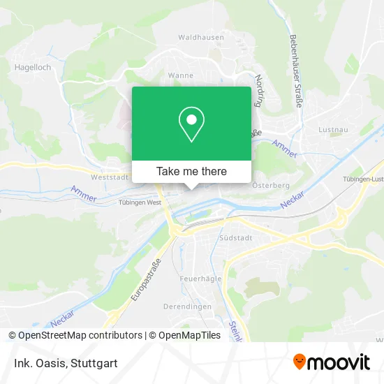
See Ink. Oasis, Tübingen, on the map
Public Transit to Ink. Oasis in Tübingen
Wondering how to get to Ink. Oasis in Tübingen? Moovit helps you find the best way to get to Ink. Oasis with step-by-step directions from the nearest public transit station.
Moovit provides free maps and live directions to help you navigate through your city. View schedules, routes, timetables, and find out how long does it take to get to Ink. Oasis in real time.
Looking for the nearest stop or station to Ink. Oasis? Check out this list of stops closest to your destination: Tübingen Haagtor; Tübingen Hauptbahnhof; Tübingen Stadtgraben; Tübingen Neckarhalde; Tübingen Parkhaus König; Tübingen Rümelinstraße.
Bus: 11, 7611, 826, 828, 9, 12, N90, 827, RT828, X82, 1, 13, 16, 17, 18, N99.Train: RB63, RE6, RE6, MEX12, MEX18, RE6, MEX12, MEX18.
Want to see if there’s another route that gets you there at an earlier time? Moovit helps you find alternative routes or times. Get directions from and directions to Ink. Oasis easily from the Moovit App or Website.
We make riding to Ink. Oasis easy, which is why over 1.5 million users, including users in Tübingen, trust Moovit as the best app for public transit. You don’t need to download an individual bus app or train app, Moovit is your all-in-one transit app that helps you find the best bus time or train time available.
For information on prices of bus and train, costs and ride fares to Ink. Oasis, please check the Moovit app.
Use the app to navigate to popular places including to the airport, hospital, stadium, grocery store, mall, coffee shop, school, college, and university.
Ink. Oasis Address: Haaggasse 27 72070 Tübingen street in Tübingen
- Little Fat Dog Tattoo Tübingen,
- Naturheilpraxis Britt von Borstel-Wertz,
- Albertinenkrankenhaus,
- Aktionszentrum Arme Welt,
- Brunos Kleinkunstbühne im Club Voltaire,
- Jugendzentrum,
- Feierabendkollektiv,
- Dragon-Tattoo Tätowierungen,
- Institut für Logotherapie und Existenzanalyse,
- Schneider Sorin,
- Glückspilz,
- Harri&Günni,
- Goldersbach Design-Studio für Strategie und Nachhaltige Gestaltung,
- Georg Jörg Joe Küster,
- Perückenstudio Haarmonie,
- Reisebüro Yaldiz,
- Rieger Schnaas,
- Ammerkeramik,
- Tabak-Schrade,
- Stocherkahn-Erlebnis Tübingen
Places Near Ink. Oasis (Tübingen)
- Hanns-Martin-Schleyer-Halle (Stuttgart Hans-Martin-Schleyerhalle), Bad Cannstatt,
- Im Wizemann (Halle), Bad Cannstatt,
- Geilhaus Haus 33a, Reutlingen-Betzingen,
- Porsche Museum, Zuffenhausen,
- SI-Centrum, Möhringen,
- Waldfriedhof, Degerloch,
- Porsche-Arena, Bad Cannstatt,
- Mercedes-Benz Museum, Bad Cannstatt,
- Marmorsaal Im Weissenburgpark, Stuttgart-Süd,
- Mettingen Eros-Center Puff Laufhaus, Esslingen Am Neckar,
- Gasometer Pforzheim, Pforzheim,
- Hauptbahnhof Stuttgart, Stuttgart-Mitte,
- Schleyerhalle, Bad Cannstatt,
- Klinikum Stuttgart - Katharinenhospital, Stuttgart-Mitte,
- FlixBus Haltestelle, Stuttgart,
- Pariser Platz Stuttgart, Stuttgart-Mitte,
- Mercedes-Benz Museum (Mercedes Museum Stuttgart), Bad Cannstatt,
- Hanns-Martin-Schleyer-Halle, Bad Cannstatt,
- Gleis 101/102 (tief), Stuttgart-Mitte,
- Wilhelma (U-Bahn Wilhelma), Bad Cannstatt
How to get to popular places in Stuttgart with public transit
Get around Tübingen by public transit!
Traveling around Tübingen has never been so easy. See step by step directions as you travel to any attraction, street or major public transit station. View bus and train schedules, arrival times, service alerts and detailed routes on a map, so you know exactly how to get to anywhere in Tübingen.
When traveling to any destination around Tübingen use Moovit's Live Directions with Get Off Notifications to know exactly where and how far to walk, how long to wait for your line, and how many stops are left. Moovit will alert you when it's time to get off — no need to constantly re-check whether yours is the next stop.
Wondering how to use public transit in Tübingen or how to pay for public transit in Tübingen? Moovit public transit app can help you navigate your way with public transit easily, and at minimum cost. It includes public transit fees, ticket prices, and costs. Looking for a map of Tübingen public transit lines? Moovit public transit app shows all public transit maps in Tübingen with all Bus, Train, Subway, Light Rail, Ferry, S-Bahn and Funicular routes and stops on an interactive map.
Stuttgart has 7 transit type(s), including: Bus, Train, Subway, Light Rail, Ferry, S-Bahn and Funicular, operated by several transit agencies, including SSB - Stadtbahn, SSB, SSB - Seilbahn / Zacke, S-Bahn Stuttgart, Rhein-Neckar-Verkehr GmbH (rnv), Karlsruher Verkehrsverbund, DB AG, DB Regiobus BW, Arverio Baden-Württemberg GmbH, DB RegioNetz Verkehrs GmbH Westfrankenbahn, DB Regio AG Baden-Württemberg, Südwestdeutsche Verkehrs-AG, DB Regio AG Mitte Region Hessen, DB and Bodensee-Oberschwaben-Bahn