How to get to Inkfluential Printing by bus?
Click on the bus route to see step by step directions with maps, line arrival times and updated time schedules.
From Color Factory, Manhattan
91 minFrom Mcsorley's Old Ale House, Manhattan
86 minFrom Jury Duty 111 Centre Street, Manhattan
86 minFrom Broadway–Lafayette Street, Manhattan
82 minFrom Battery Park City, Manhattan
103 minFrom St. Marks Place, Manhattan
87 minFrom E 9th St, Manhattan
86 minFrom Bayonne Golf Club Ferry, Manhattan
98 minFrom Village Halloween Parade, Manhattan
94 minFrom Fulton St, Manhattan
103 min
How to get to Inkfluential Printing by subway?
Click on the subway route to see step by step directions with maps, line arrival times and updated time schedules.
From Color Factory, Manhattan
42 minFrom Mcsorley's Old Ale House, Manhattan
44 minFrom Jury Duty 111 Centre Street, Manhattan
33 minFrom Broadway–Lafayette Street, Manhattan
38 minFrom Battery Park City, Manhattan
41 minFrom St. Marks Place, Manhattan
44 minFrom E 9th St, Manhattan
45 minFrom Bayonne Golf Club Ferry, Manhattan
43 minFrom Village Halloween Parade, Manhattan
44 minFrom Fulton St, Manhattan
40 min
Bus stops near Inkfluential Printing in New York - New Jersey
Subway stations near Inkfluential Printing in New York - New Jersey
Bus lines to Inkfluential Printing in New York - New Jersey
What are the closest stations to Inkfluential Printing?
The closest stations to Inkfluential Printing are:
- Cortelyou Rd/Stratford Rd is 15 yards away, 1 min walk.
- Coney Island Av/Cortelyou Rd is 78 yards away, 2 min walk.
- Cortelyou Rd is 474 yards away, 6 min walk.
- 18 Av/Coney Island Av is 611 yards away, 8 min walk.
- Ditmas Av is 1109 yards away, 14 min walk.
- Newkirk Plaza is 1224 yards away, 15 min walk.
- Church Av is 1479 yards away, 18 min walk.
Which bus lines stop near Inkfluential Printing?
These bus lines stop near Inkfluential Printing: B103, B68, B8.
Which subway line stops near Inkfluential Printing?
Q (Downtown & Brooklyn)
What’s the nearest subway station to Inkfluential Printing in New York - New Jersey?
The nearest subway station to Inkfluential Printing in New York - New Jersey is Cortelyou Rd. It’s a 6 min walk away.
What’s the nearest bus station to Inkfluential Printing in New York - New Jersey?
The nearest bus station to Inkfluential Printing in New York - New Jersey is Cortelyou Rd/Stratford Rd. It’s a 1 min walk away.
What time is the first subway to Inkfluential Printing in New York - New Jersey?
The F is the first subway that goes to Inkfluential Printing in New York - New Jersey. It stops nearby at 3:00 AM.
What time is the last subway to Inkfluential Printing in New York - New Jersey?
The F is the last subway that goes to Inkfluential Printing in New York - New Jersey. It stops nearby at 4:25 AM.
What time is the first bus to Inkfluential Printing in New York - New Jersey?
The B68 is the first bus that goes to Inkfluential Printing in New York - New Jersey. It stops nearby at 3:14 AM.
What time is the last bus to Inkfluential Printing in New York - New Jersey?
The B8 is the last bus that goes to Inkfluential Printing in New York - New Jersey. It stops nearby at 3:25 AM.
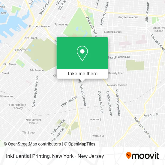
See Inkfluential Printing, New York - New Jersey, on the map
Public Transit to Inkfluential Printing in New York - New Jersey
Wondering how to get to Inkfluential Printing in New York - New Jersey? Moovit helps you find the best way to get to Inkfluential Printing with step-by-step directions from the nearest public transit station.
Moovit provides free maps and live directions to help you navigate through your city. View schedules, routes, timetables, and find out how long does it take to get to Inkfluential Printing in real time.
Looking for the nearest stop or station to Inkfluential Printing? Check out this list of stops closest to your destination: Cortelyou Rd/Stratford Rd; Coney Island Av/Cortelyou Rd; Cortelyou Rd; 18 Av/Coney Island Av; Ditmas Av; Newkirk Plaza; Church Av.
Bus: B103, B68, B8, BM1, BM2, BM3, BM4.Subway: Q, F, FX, B, G.
Want to see if there’s another route that gets you there at an earlier time? Moovit helps you find alternative routes or times. Get directions from and directions to Inkfluential Printing easily from the Moovit App or Website.
We make riding to Inkfluential Printing easy, which is why over 1.5 million users, including users in New York - New Jersey, trust Moovit as the best app for public transit. You don’t need to download an individual bus app or train app, Moovit is your all-in-one transit app that helps you find the best bus time or train time available.
For information on prices of subway and bus, costs and ride fares to Inkfluential Printing, please check the Moovit app.
Use the app to navigate to popular places including to the airport, hospital, stadium, grocery store, mall, coffee shop, school, college, and university.
Inkfluential Printing Address: 1029 Cortelyou Rd street in New York - New Jersey
- Victorian Cafe,
- Blitz Dojo Martial Arts and Fitness,
- Sagoya Yoga,
- Mimi's Brooklyn,
- Taylor and Co. Books,
- Lea Brooklyn,
- Burger Bhai,
- Cfsc - Checks Cashed #40,
- Stratford Rd (cortelyou and stratford),
- Design Z&L Nail Salon,
- Brooklyn Style,
- Andrew’S Luncheonette by Hard Times Sundaes,
- Cfsc,
- Datatech Wireless,
- Western Union,
- Ecoatm,
- Hartwell Vegetarian,
- Bad Therapy,
- Brooklyn Direct Cremation Services,
- Underdog Guitars
Places Near Inkfluential Printing (New York - New Jersey)
- Rockefeller Center, Manhattan,
- Hudson Yards, Manhattan,
- Pier 83, Manhattan,
- 1 Police Plaza, Manhattan,
- SoHo, Manhattan,
- Chinatown, Manhattan,
- Times Square, Manhattan,
- 26 Federal Plaza, Manhattan,
- Katz's Deli, Manhattan,
- 111 Centre New York City Supreme Court, Manhattan,
- 376 Hudson Street, Manhattan,
- Wall Street, Manhattan,
- 66 John Street, Manhattan,
- 911 Memorial, Manhattan,
- Queens Center Mall, Queens,
- 3 Stone St, Manhattan,
- Bellevue Hospital, Manhattan,
- San Gennaro Feast, Manhattan,
- qqqq, Manhattan,
- Mountainside Hospital, Glen Ridge
How to get to popular places in New York - New Jersey with public transit
Get around New York - New Jersey by public transit!
Traveling around New York - New Jersey has never been so easy. See step by step directions as you travel to any attraction, street or major public transit station. View bus and train schedules, arrival times, service alerts and detailed routes on a map, so you know exactly how to get to anywhere in New York - New Jersey.
When traveling to any destination around New York - New Jersey use Moovit's Live Directions with Get Off Notifications to know exactly where and how far to walk, how long to wait for your line, and how many stops are left. Moovit will alert you when it's time to get off — no need to constantly re-check whether yours is the next stop.
Wondering how to use public transit in New York - New Jersey or how to pay for public transit in New York - New Jersey? Moovit public transit app can help you navigate your way with public transit easily, and at minimum cost. It includes public transit fees, ticket prices, and costs. Looking for a map of New York - New Jersey public transit lines? Moovit public transit app shows all public transit maps in New York - New Jersey with all Bus, Train, Subway, Light Rail, Ferry and Cable Car routes and stops on an interactive map.
New York - New Jersey has 6 transit type(s), including: Bus, Train, Subway, Light Rail, Ferry and Cable Car, operated by several transit agencies, including MTA Subway, Metro-North Railroad, LIRR, PATH, MTA New York City Transit - Express routes, MTA Bus, NJ Transit, NYC Ferry, NICE bus, Bee-Line Bus, NJ Transit Rail, Norwalk Transit District, Hartford Line, River Valley Transit and HART