How to get to Inkmaster by bus?
Click on the bus route to see step by step directions with maps, line arrival times and updated time schedules.
From Parque Coimbra, Área Metropolitana De Madrid Y Corredor Del Henares
232 minFrom FABRIK, Humanes De Madrid
160 minFrom Hospital Infanta Cristina., Área Metropolitana De Madrid Y Corredor Del Henares
101 minFrom Hospital Universitario Infanta Elena, Valdemoro
229 minFrom Desguaces La Torre, Comarca Sur
100 minFrom Tanatorio De Móstoles, Área Metropolitana De Madrid Y Corredor Del Henares
266 minFrom Centro Comercial Xanadú, Arroyomolinos
213 minFrom Balneario Thermas De Griñón, Comarca Sur
148 minFrom Parla, Madrid, Parla
103 minFrom Universidad Rey Juan Carlos (Campus Fuenlabrada), Fuenlabrada
172 min
What are the closest stations to Inkmaster?
The closest stations to Inkmaster are:
- Recas - Pza. De España is 309 meters away, 5 min walk.
- Recas is 312 meters away, 5 min walk.
Which bus line stops near Inkmaster?
464 (Yunclillos - General Varela)
What’s the nearest bus station to Inkmaster in Recas?
The nearest bus stations to Inkmaster in Recas are Recas - Pza. De España and Recas. The closest one is a 5 min walk away.
What time is the first bus to Inkmaster in Recas?
The 464 is the first bus that goes to Inkmaster in Recas. It stops nearby at 6:02 AM.
What time is the last bus to Inkmaster in Recas?
The 464 is the last bus that goes to Inkmaster in Recas. It stops nearby at 12:34 AM.
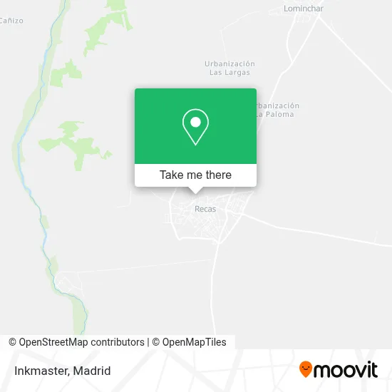
See Inkmaster, Recas, on the map
Public Transit to Inkmaster in Recas
Wondering how to get to Inkmaster in Recas? Moovit helps you find the best way to get to Inkmaster with step-by-step directions from the nearest public transit station.
Moovit provides free maps and live directions to help you navigate through your city. View schedules, routes, timetables, and find out how long does it take to get to Inkmaster in real time.
Looking for the nearest stop or station to Inkmaster? Check out this list of stops closest to your destination: Recas - Pza. De España; Recas.
Bus: 464, VCM-044.
Want to see if there’s another route that gets you there at an earlier time? Moovit helps you find alternative routes or times. Get directions from and directions to Inkmaster easily from the Moovit App or Website.
We make riding to Inkmaster easy, which is why over 1.5 million users, including users in Recas, trust Moovit as the best app for public transit. You don’t need to download an individual bus app or train app, Moovit is your all-in-one transit app that helps you find the best bus time or train time available.
For information on prices of bus, costs and ride fares to Inkmaster, please check the Moovit app.
Use the app to navigate to popular places including to the airport, hospital, stadium, grocery store, mall, coffee shop, school, college, and university.
Inkmaster Address: Calle Oliva, 1 45211 Recas street in Recas
- Mgs Seguros Recas,
- Peluquería Ohhlala,
- Regalos Ivanaithor,
- Cementerio Ntra. Sra. de la Oliva - Recas,
- Inprocosa Servicio Agu,
- Ana Isabel Calvo Rojo,
- Camino de Chozas de Canales a Recas 5,
- Juan Ramón Jiménez 35,
- JJGCH71,
- Pro Estilistas Itziar,
- Hermanos Bravo Hernández,
- Construcciones Hermanos Rosell,
- Sanchez Diaz Angeles,
- Papel y Lapiz,
- La Higuera,
- Angel Bravo Lorente,
- Mario Bravo Nutrición,
- Muñoz Bravo,
- Pedro Bravo Ortiz,
- La Bellota
Places Near Inkmaster (Recas)
- Centro Comercial Oasiz Madrid, Área Metropolitana De Madrid Y Corredor Del Henares,
- Plenilunio, Área Metropolitana De Madrid Y Corredor Del Henares,
- Sala La Riviera, Madrid,
- Palacio De Vistalegre, Área Metropolitana De Madrid Y Corredor Del Henares,
- Rastro De Madrid, Área Metropolitana De Madrid Y Corredor Del Henares,
- Hospital Clínico Universitario San Carlos, Madrid,
- Hospital Universitario La Paz, Madrid,
- Centro Comercial La Gavia, Área Metropolitana De Madrid Y Corredor Del Henares,
- Tres Aguas, Alcorcón,
- Calle de López de Hoyos 169, Madrid,
- Wizink Center, Madrid,
- Nassica, Área Metropolitana De Madrid Y Corredor Del Henares,
- Mendez Alvaro, Madrid,
- Estadio Wanda Metropolitano, Área Metropolitana De Madrid Y Corredor Del Henares,
- Centro Comercial Islazul, Área Metropolitana De Madrid Y Corredor Del Henares,
- Plaza Mayor, Madrid,
- Mercadillo de Majadahonda, Majadahonda,
- Centro Comercial La Vaguada, Área Metropolitana De Madrid Y Corredor Del Henares,
- Hospital Universitario Ramón y Cajal, Madrid,
- Estacion de Chamartin, Madrid
How to get to popular places in Madrid with public transit
Get around Recas by public transit!
Traveling around Recas has never been so easy. See step by step directions as you travel to any attraction, street or major public transit station. View bus and train schedules, arrival times, service alerts and detailed routes on a map, so you know exactly how to get to anywhere in Recas.
When traveling to any destination around Recas use Moovit's Live Directions with Get Off Notifications to know exactly where and how far to walk, how long to wait for your line, and how many stops are left. Moovit will alert you when it's time to get off — no need to constantly re-check whether yours is the next stop.
Wondering how to use public transit in Recas or how to pay for public transit in Recas? Moovit public transit app can help you navigate your way with public transit easily, and at minimum cost. It includes public transit fees, ticket prices, and costs. Looking for a map of Recas public transit lines? Moovit public transit app shows all public transit maps in Recas with all Bus, Train, Metro and Light Rail routes and stops on an interactive map.
Madrid has 4 transit type(s), including: Bus, Train, Metro and Light Rail, operated by several transit agencies, including Metro de Madrid, Metro Ligero, Tranvía de Parla, Renfe Cercanías - Servicios de Autobús especiales, Renfe Cercanias, Renfe Cercanías, EMT, Interurbanos, Urbanos de Alcalá de Henares, Urbanos de Alcobendas, Urbanos de Alcorcón, Urbanos de Algete, Urbanos de Aranjuez, Urbanos de Arganda del Rey and Urbanos de Arroyomolinos