How to get to Inlingua by bus?
Click on the bus route to see step by step directions with maps, line arrival times and updated time schedules.
From Klinik Tettnang, Tettnang
177 minFrom D 78333 Stockach, Verwaltungsgemeinschaft Stockach
163 minFrom Asia World, Verwaltungsgemeinschaft Friedrichshafen
105 minFrom Compleo, Verwaltungsverband Mittleres Schussental
110 minFrom Oh VV, Leutkirch
200 minFrom Camping Iriswiese, Verwaltungsverband Eriskirch-Kressbronn am Bodensee-Langenargen
152 min
How to get to Inlingua by train?
Click on the train route to see step by step directions with maps, line arrival times and updated time schedules.
Bus stops near Inlingua in Konstanz
Ferry station near Inlingua in Konstanz
- Konstanz Staad/Autofähre, 21 min walk,VIEW
Train stations near Inlingua in Konstanz
- Konstanz-Petershausen Bahnhof, 25 min walk,VIEW
Bus lines to Inlingua in Konstanz
- 12, Konstanz Stephansschule - Wollmatingen Urisberg,VIEW
- 12/3, Konstanz Buhlenweg Süd - Konstanz Bürgerbüro,VIEW
- 15, Konstanz Staad Autofähre/Hotel Schiff - Wollmatingen Bahnhof,VIEW
- 2, Wollmatingen Radolfzeller Str. - Konstanz Bürgerbüro,VIEW
- 3, Konstanz Stephansschule - Konstanz Brandenburger Straße,VIEW
- 4/13, Konstanz Stephansschule - Konstanz Bürgerbüro,VIEW
- N, Konstanz Stephansschule - Konstanz Bürgerbüro,VIEW
- 13/4, Konstanz Bürgerbüro,VIEW
- 14, Konstanz Pfeiferhölzle Wendeplatte - Konstanz Bürgerbüro,VIEW
- 9, Konstanz Universität - Konstanz Universität,VIEW
- 203, Langenrain Bürgerhaus,VIEW
- 203, Langenrain Dorfplatz,VIEW
- 203S, Konstanz Sternenpl./Spanierstr.,VIEW
- 700, Markdorf Bahnhof,VIEW
- 7394, Konstanz Bürgerbüro,VIEW
- 908, Konstanz, Zähringerplatz,VIEW
What are the closest stations to Inlingua?
The closest stations to Inlingua are:
- Konstanz Bismarcksteig is 37 meters away, 1 min walk.
- Konstanz Friedrichstraße is 409 meters away, 6 min walk.
- Konstanz Zähringerplatz is 476 meters away, 7 min walk.
- Konstanz Staad/Autofähre is 1617 meters away, 21 min walk.
- Konstanz-Petershausen Bahnhof is 1907 meters away, 25 min walk.
Which train lines stop near Inlingua?
These train lines stop near Inlingua: RE 2, S6, S62.
Which bus lines stop near Inlingua?
These bus lines stop near Inlingua: 700, 7394.
What’s the nearest train station to Inlingua in Konstanz?
The nearest train station to Inlingua in Konstanz is Konstanz-Petershausen Bahnhof. It’s a 25 min walk away.
What’s the nearest bus station to Inlingua in Konstanz?
The nearest bus station to Inlingua in Konstanz is Konstanz Bismarcksteig. It’s a 1 min walk away.
What’s the nearest ferry station to Inlingua in Konstanz?
The nearest ferry station to Inlingua in Konstanz is Konstanz Staad/Autofähre. It’s a 21 min walk away.
What time is the first light rail to Inlingua in Konstanz?
The S6 is the first light rail that goes to Inlingua in Konstanz. It stops nearby at 4:39 AM.
What time is the last light rail to Inlingua in Konstanz?
The S6 is the last light rail that goes to Inlingua in Konstanz. It stops nearby at 1:22 AM.
What time is the first train to Inlingua in Konstanz?
The S6 is the first train that goes to Inlingua in Konstanz. It stops nearby at 4:39 AM.
What time is the last train to Inlingua in Konstanz?
The S6 is the last train that goes to Inlingua in Konstanz. It stops nearby at 1:01 AM.
What time is the first bus to Inlingua in Konstanz?
The 13/4 is the first bus that goes to Inlingua in Konstanz. It stops nearby at 5:01 AM.
What time is the last bus to Inlingua in Konstanz?
The N is the last bus that goes to Inlingua in Konstanz. It stops nearby at 2:34 AM.
What time is the first ferry to Inlingua in Konstanz?
The FÄHRE is the first ferry that goes to Inlingua in Konstanz. It stops nearby at 3:05 AM.
What time is the last ferry to Inlingua in Konstanz?
The FÄHRE is the last ferry that goes to Inlingua in Konstanz. It stops nearby at 2:50 AM.
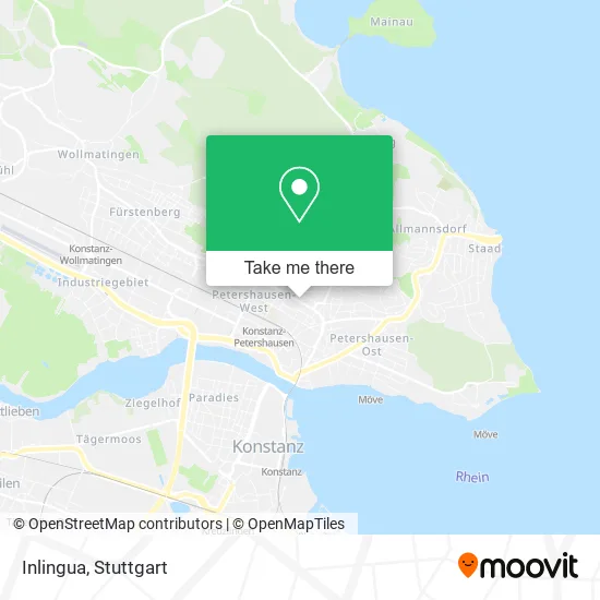
See Inlingua, Konstanz, on the map
Public Transit to Inlingua in Konstanz
Wondering how to get to Inlingua in Konstanz? Moovit helps you find the best way to get to Inlingua with step-by-step directions from the nearest public transit station.
Moovit provides free maps and live directions to help you navigate through your city. View schedules, routes, timetables, and find out how long does it take to get to Inlingua in real time.
Looking for the nearest stop or station to Inlingua? Check out this list of stops closest to your destination: Konstanz Bismarcksteig; Konstanz Friedrichstraße; Konstanz Zähringerplatz; Konstanz Staad/Autofähre; Konstanz-Petershausen Bahnhof.
Train: RE 2, S6, S62, RE2, RE4, RE 4.Bus: 700, 7394, 12, 12/3, 15, 2, 3, 13/4, 14, 9.Ferry: FÄHRE.
Want to see if there’s another route that gets you there at an earlier time? Moovit helps you find alternative routes or times. Get directions from and directions to Inlingua easily from the Moovit App or Website.
We make riding to Inlingua easy, which is why over 1.5 million users, including users in Konstanz, trust Moovit as the best app for public transit. You don’t need to download an individual bus app or train app, Moovit is your all-in-one transit app that helps you find the best bus time or train time available.
For information on prices of bus and train, costs and ride fares to Inlingua, please check the Moovit app.
Use the app to navigate to popular places including to the airport, hospital, stadium, grocery store, mall, coffee shop, school, college, and university.
Inlingua Address: Wollmatinger Straße 22 78467 Konstanz street in Konstanz
- Podologie Henke - Fachpraxis für Medizinische Fußbehandlungen,
- Seitentrend,
- Limco International,
- Diakonisches Werk d. Evang.,
- Podologie Henke,
- Digitaldruckhaus,
- Druckerei Messmer,
- Das Rückenzentrum,
- Diakonischen Werk,
- Bäckerei Stickel,
- Werners Fahrschule W. Zwiene,
- Pirmos Kebap Haus Konstanz,
- Michael Noll Min-Funktionsmodellbau,
- Yim Siam,
- City Waschsalon,
- Nails Beauties Konstanz,
- Backstube Stickel,
- Penny,
- Miradlo It,
- Cat Thai Maßage Konstanz
Places Near Inlingua (Konstanz)
- Geilhaus Haus 33a, Reutlingen-Betzingen,
- Hanns-Martin-Schleyer-Halle (Stuttgart Hans-Martin-Schleyerhalle), Bad Cannstatt,
- Hanns-Martin-Schleyer-Halle, Bad Cannstatt,
- FlixBus Haltestelle, Stuttgart,
- Wilhelma (U-Bahn Wilhelma), Bad Cannstatt,
- Pariser Platz Stuttgart, Stuttgart-Mitte,
- Schleyerhalle, Bad Cannstatt,
- Im Wizemann (Halle), Bad Cannstatt,
- Hauptbahnhof Stuttgart, Stuttgart-Mitte,
- Mercedes-Benz Museum, Bad Cannstatt,
- Klinikum Stuttgart - Katharinenhospital, Stuttgart-Mitte,
- Gasometer Pforzheim, Pforzheim,
- Porsche Museum, Zuffenhausen,
- Waldfriedhof, Degerloch,
- SI-Centrum, Möhringen,
- Mettingen Eros-Center Puff Laufhaus, Esslingen Am Neckar,
- Mercedes-Benz Museum (Mercedes Museum Stuttgart), Bad Cannstatt,
- Marmorsaal Im Weissenburgpark, Stuttgart-Süd,
- Porsche-Arena, Bad Cannstatt,
- Gleis 101/102 (tief), Stuttgart-Mitte
How to get to popular places in Stuttgart with public transit
Get around Konstanz by public transit!
Traveling around Konstanz has never been so easy. See step by step directions as you travel to any attraction, street or major public transit station. View bus and train schedules, arrival times, service alerts and detailed routes on a map, so you know exactly how to get to anywhere in Konstanz.
When traveling to any destination around Konstanz use Moovit's Live Directions with Get Off Notifications to know exactly where and how far to walk, how long to wait for your line, and how many stops are left. Moovit will alert you when it's time to get off — no need to constantly re-check whether yours is the next stop.
Wondering how to use public transit in Konstanz or how to pay for public transit in Konstanz? Moovit public transit app can help you navigate your way with public transit easily, and at minimum cost. It includes public transit fees, ticket prices, and costs. Looking for a map of Konstanz public transit lines? Moovit public transit app shows all public transit maps in Konstanz with all Bus, Train, Subway, Light Rail, Ferry, S-Bahn and Funicular routes and stops on an interactive map.
Stuttgart has 7 transit type(s), including: Bus, Train, Subway, Light Rail, Ferry, S-Bahn and Funicular, operated by several transit agencies, including SSB - Stadtbahn, SSB, SSB - Seilbahn / Zacke, S-Bahn Stuttgart, Rhein-Neckar-Verkehr GmbH (rnv), Karlsruher Verkehrsverbund, DB AG, DB Regiobus BW, Arverio Baden-Württemberg GmbH, DB RegioNetz Verkehrs GmbH Westfrankenbahn, DB Regio AG Baden-Württemberg, Südwestdeutsche Verkehrs-AG, DB Regio AG Mitte Region Hessen, DB and Bodensee-Oberschwaben-Bahn