Directions to Inn-the Colonnade Baltimore with public transportation
The following transit lines have routes that pass near Inn-the Colonnade Baltimore
 Bus: 22, 51, CITYLINK SILVER, 95.
- Metro: METRO.
How to get to Inn-the Colonnade Baltimore by bus?
Click on the bus route to see step by step directions with maps, line arrival times and updated time schedules.
From I-695 @ Exit 26 (York Rd/MD 45)
36 minFrom University Of Maryland Medical Center
33 minFrom Mva
35 minFrom Towson, MD
31 minFrom I-695 @ Exit 18 (Liberty Rd/MD 26)
49 minFrom Johns Hopkins Medicine at Green Spring Station
44 minFrom Reisterstown Road Plaza
42 minFrom Walmart
53 minFrom I-695 @ Exit 17 (Security Blvd/MD 122)
68 minFrom Walmart Supercenter
54 min
How to get to Inn-the Colonnade Baltimore by metro?
Click on the metro route to see step by step directions with maps, line arrival times and updated time schedules.
Bus stops near Inn-the Colonnade Baltimore
Light Rail stations near Inn-the Colonnade Baltimore
- Penn Station, 35 min walk,VIEW
Bus lines to Inn-the Colonnade Baltimore
What are the closest stations to Inn-the Colonnade Baltimore?
The closest stations to Inn-the Colonnade Baltimore are:
- University Pwky & Charles St Wb is 26 yards away, 1 min walk.
- Charles St & University Pkwy Nb is 83 yards away, 2 min walk.
- University Pkwy & Charles St Sb is 141 yards away, 2 min walk.
- Penn Station is 2942 yards away, 35 min walk.
Which bus lines stop near Inn-the Colonnade Baltimore?
These bus lines stop near Inn-the Colonnade Baltimore: 22, 51, CITYLINK SILVER.
Which metro line stops near Inn-the Colonnade Baltimore?
METRO (Towards John Hopkins)
What’s the nearest bus station to Inn-the Colonnade Baltimore?
The nearest bus station to Inn-the Colonnade Baltimore is University Pwky & Charles St Wb. It’s a 1 min walk away.
What time is the first light rail to Inn-the Colonnade Baltimore?
The LIGHT RAILLINK is the first light rail that goes to Inn-the Colonnade Baltimore. It stops nearby at 3:42 AM.
What time is the last light rail to Inn-the Colonnade Baltimore?
The LIGHT RAILLINK is the last light rail that goes to Inn-the Colonnade Baltimore. It stops nearby at 1:30 AM.
What time is the first bus to Inn-the Colonnade Baltimore?
The CITYLINK SILVER is the first bus that goes to Inn-the Colonnade Baltimore. It stops nearby at 3:48 AM.
What time is the last bus to Inn-the Colonnade Baltimore?
The 22 is the last bus that goes to Inn-the Colonnade Baltimore. It stops nearby at 2:13 AM.
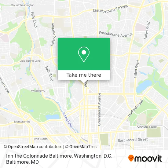
See Inn-the Colonnade Baltimore on the map
Public Transportation to Inn-the Colonnade Baltimore
Wondering how to get to Inn-the Colonnade Baltimore? Moovit helps you find the best way to get to Inn-the Colonnade Baltimore with step-by-step directions from the nearest public transit station.
Moovit provides free maps and live directions to help you navigate through your city. View schedules, routes, timetables, and find out how long does it take to get to Inn-the Colonnade Baltimore in real time.
Looking for the nearest stop or station to Inn-the Colonnade Baltimore? Check out this list of stops closest to your destination: University Pwky & Charles St Wb; Charles St & University Pkwy Nb; University Pkwy & Charles St Sb; Penn Station.
Bus: 22, 51, CITYLINK SILVER, 95.Metro: METRO.
Want to see if there’s another route that gets you there at an earlier time? Moovit helps you find alternative routes or times. Get directions from and directions to Inn-the Colonnade Baltimore easily from the Moovit App or Website.
We make riding to Inn-the Colonnade Baltimore easy, which is why over 1.5 million users, including users in Baltimore, trust Moovit as the best app for public transit. You don’t need to download an individual bus app or train app, Moovit is your all-in-one transit app that helps you find the best bus time or train time available.
For information on prices of bus and metro, costs and ride fares to Inn-the Colonnade Baltimore, please check the Moovit app.
Use the app to navigate to popular places including to the airport, hospital, stadium, grocery store, mall, coffee shop, school, college, and university.
Inn-the Colonnade Baltimore Address: 4 W University Pkwy Baltimore, MD 21218 street in Baltimore
- GHCC,
- Inn at The Colonnade Baltimore - A DoubleTree by Hilton Hotel,
- Homewood Field,
- University Pkwy & Canterbury,
- Covid-19 Testing Site: Medstar Union Memorial Hospital (Coronavirus Testing Site),
- Dr. Lew C. Schon Innovation Fund,
- Homewood Field,
- Johns Hopkins University,
- Halstead at Guilford,
- Johns Hopkins University Bloomberg Center for Physics & Astronomy,
- Dr Ricardo Quarrie, MD (Dr Jacob M Wisbeck, MD),
- Arnold Palmer Sports Health Center,
- Frank Ross Ebert,
- Dr Anand Murthi, MD,
- William H. Baugher,
- Union Memorial Hospital,
- Charles Street & 33rd Street Southbound,
- 33rd St and Saint Paul St,
- Kajiken,
- Richard J Hackerman
Places Near Inn-the Colonnade Baltimore
- National Museum of African American History and Culture, Washington,
- Warner Theatre, Washington,
- Marriott Marquis Washington, DC, Washington,
- Pennsylvania Ave NW (3rd st and pennsylvania), Washington,
- PG Mall, Prince George's County,
- Camden Yards, Baltimore,
- M&T Bank Stadium, Baltimore,
- The Anthem, Washington,
- Amazon Hq2, Arlington County,
- Museum Of The Bible, Washington,
- Washington DC VA Medical Center, Washington,
- Capital One Arena, Washington,
- Westfield Montgomery Mall, Montgomery County,
- Washington National Cathedral, Washington,
- Sibley Memorial Hospital, Washington,
- Rock Creek Tennis Center, Washington,
- Basilica of the National Shrine, Washington,
- National Theatre, Washington,
- Georgetown, Washington,
- National Zoo, Washington
How to get to popular places in Washington, D.C. - Baltimore, MD with public transit
Get around Baltimore by public transit!
Traveling around Baltimore has never been so easy. See step by step directions as you travel to any attraction, street or major public transit station. View bus and train schedules, arrival times, service alerts and detailed routes on a map, so you know exactly how to get to anywhere in Baltimore.
When traveling to any destination around Baltimore use Moovit's Live Directions with Get Off Notifications to know exactly where and how far to walk, how long to wait for your line, and how many stops are left. Moovit will alert you when it's time to get off — no need to constantly re-check whether yours is the next stop.
Wondering how to use public transit in Baltimore or how to pay for public transit in Baltimore? Moovit public transit app can help you navigate your way with public transit easily, and at minimum cost. It includes public transit fees, ticket prices, and costs. Looking for a map of Baltimore public transit lines? Moovit public transit app shows all public transit maps in Baltimore with all Bus, Train, Metro, Light Rail and Ferry routes and stops on an interactive map.
Washington, D.C. - Baltimore, MD has 5 transit type(s), including: Bus, Train, Metro, Light Rail and Ferry, operated by several transit agencies, including WMATA, Montgomery County Ride On, Fairfax Connector, TheBus, PRTC, DASH - Alexandria, Arlington Transit (ART), RTA of Central Maryland, MDOT MTA, MDOT MTA Light RailLink, MDOT MTA Commuter Bus, MDOT MTA Local Bus, FXBGO!, Virginia Railway Express (VRE) and MARC