Directions to Innisdale Seccondary School (Barrie) with public transportation
The following transit lines have routes that pass near Innisdale Seccondary School
How to get to Innisdale Seccondary School by bus?
Click on the bus route to see step by step directions with maps, line arrival times and updated time schedules.
How to get to Innisdale Seccondary School by train?
Click on the train route to see step by step directions with maps, line arrival times and updated time schedules.
Train stations near Innisdale Seccondary School in Barrie
- Allandale Waterfront Go,31 min walk,
What are the closest stations to Innisdale Seccondary School?
The closest stations to Innisdale Seccondary School are:
- Allandale Waterfront Go is 2177 meters away, 31 min walk.
Which bus lines stop near Innisdale Seccondary School?
These bus lines stop near Innisdale Seccondary School: 1B, 3A, 3B.
Which train line stops near Innisdale Seccondary School?
BR
See Innisdale Seccondary School, Barrie, on the map
Public Transit to Innisdale Seccondary School in Barrie
Wondering how to get to Innisdale Seccondary School in Barrie, Canada? Moovit helps you find the best way to get to Innisdale Seccondary School with step-by-step directions from the nearest public transit station.
Moovit provides free maps and live directions to help you navigate through your city. View schedules, routes, timetables, and find out how long does it take to get to Innisdale Seccondary School in real time.
Looking for the nearest stop or station to Innisdale Seccondary School? Check out this list of stops closest to your destination: Allandale Waterfront Go.
Bus:1B3A3BTrain:BR
Want to see if there’s another route that gets you there at an earlier time? Moovit helps you find alternative routes or times. Get directions from and directions to Innisdale Seccondary School easily from the Moovit App or Website.
We make riding to Innisdale Seccondary School easy, which is why over 1.5 million users, including users in Barrie, trust Moovit as the best app for public transit. You don’t need to download an individual bus app or train app, Moovit is your all-in-one transit app that helps you find the best bus time or train time available.
For information on prices of bus, train and subway, costs and ride fares to Innisdale Seccondary School, please check the Moovit app.
Use the app to navigate to popular places including to the airport, hospital, stadium, grocery store, mall, coffee shop, school, college, and university.
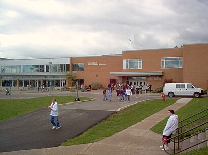
Innisdale Seccondary School Address: Chieftain Crescent street in Barrie
Attractions near Innisdale Seccondary School
Innisdale Secondary School Sports Field,Allandale Recreation Centre,Innisdale Secondary School,Napoleon Fireplaces,Fazal Shawarma,Sgj Northland Steel Mfg Inc,L4N 4Y5,Lowe's,Royal Tank Lines,Classical Martial Arts Research Academy (CMARA),Barrie (City),370 Bayview Drive,Lindsay Tsang & Associates,The Louvre,The Met,The Maclauren,The Rom,Maxi Storage,Bokkie's Biltong,6YHow to get to popular attractions in Barrie with public transit
Kiss & Ride Passenger Pick-up, Toronto,Opera House, Toronto,St Patrick Station, Toronto,Casino Rama, King,Carlton Street, Toronto,Kipling Subway Station, Toronto,Pearson Airport Terminal 3 (Arrivals Level Columns C8-C12), Mississauga,Cf Fairview Mall, Toronto,Costco Wholesale, Toronto,Humber River Hospital-Wilson, Toronto,Bridgepoint Health, Toronto,Pickering, Ontario, Pickering,Etobicoke West Mall, Toronto,4900 Yonge St., Toronto,Scarborough, Toronto,Billy Bishop Airport Tunnel, Toronto,Toronto Union Station, Toronto,6880 Financial Drive, Mississauga,The Royal Cinema, Toronto,Spadina Avenue & Front Street West, TorontoGet around Barrie by public transit!
Traveling around Barrie has never been so easy. See step by step directions as you travel to any attraction, street or major public transit station. View bus and train schedules, arrival times, service alerts and detailed routes on a map, so you know exactly how to get to anywhere in Barrie.
When traveling to any destination around Barrie use Moovit's Live Directions with Get Off Notifications to know exactly where and how far to walk, how long to wait for your line, and how many stops are left. Moovit will alert you when it's time to get off — no need to constantly re-check whether yours is the next stop.
Wondering how to use public transit in Barrie or how to pay for public transit in Barrie? Moovit public transit app can help you navigate your way with public transit easily, and at minimum cost. It includes public transit fees, ticket prices, and costs. Looking for a map of Barrie public transit lines? Moovit public transit app shows all public transit maps in Barrie with all bus, train or subway routes and stops on an interactive map.
Barrie has 3 transit type(s), including: bus, train or subway, operated by several transit agencies, including TTC, TTC Streetcar, Toronto Subway, GO Transit Bus, GO Transit, Amtrak, York Region Transit, Grand River Transit, Guelph Transit, grt, Hamilton Street Railway, MiWay, Brampton Transit, Burlington Transit and Oakville Transit