Directions to Innocent's Ink (Farmingville) with public transportation
The following transit lines have routes that pass near Innocent's Ink
 Bus: 52B, 53.
- Train: GREENPORT SERVICE.
How to get to Innocent's Ink by bus?
Click on the bus route to see step by step directions with maps, line arrival times and updated time schedules.
From Splish Splash Waterpark, Calverton
73 minFrom Jake's 58 Casino, Islandia
47 minFrom Baxter Pavillion @ Good Sam, West Islip
107 minFrom Good Samaritan Hospital Medical Center, West Islip
127 minFrom Paramount, Huntington
151 minFrom Brentwood, NY, Brentwood
71 minFrom Tanger Outlets, Deer Park
94 minFrom Tanger Outlets, Riverhead, Calverton
77 minFrom Tanger Outlets, Deer Park, Deer Park
97 minFrom Hauppauge ny, Hauppauge
90 min
Bus stops near Innocent's Ink in Farmingville
Train station near Innocent's Ink in Farmingville
- Medford, 32 min walk,VIEW
Bus lines to Innocent's Ink in Farmingville
What are the closest stations to Innocent's Ink?
The closest stations to Innocent's Ink are:
- Horseblock Rd/Lidge Dr is 388 yards away, 5 min walk.
- Horseblock Rd/Waverly Ave is 1299 yards away, 16 min walk.
- Medford is 2706 yards away, 32 min walk.
Which bus line stops near Innocent's Ink?
52B (Brookhaven Town Hall)
What’s the nearest bus station to Innocent's Ink in Farmingville?
The nearest bus station to Innocent's Ink in Farmingville is Horseblock Rd/Lidge Dr. It’s a 5 min walk away.
What time is the first train to Innocent's Ink in Farmingville?
The GREENPORT SERVICE is the first train that goes to Innocent's Ink in Farmingville. It stops nearby at 6:33 AM.
What time is the last train to Innocent's Ink in Farmingville?
The GREENPORT SERVICE is the last train that goes to Innocent's Ink in Farmingville. It stops nearby at 10:06 PM.
What time is the first bus to Innocent's Ink in Farmingville?
The 52B is the first bus that goes to Innocent's Ink in Farmingville. It stops nearby at 5:18 AM.
What time is the last bus to Innocent's Ink in Farmingville?
The 53 is the last bus that goes to Innocent's Ink in Farmingville. It stops nearby at 10:07 PM.
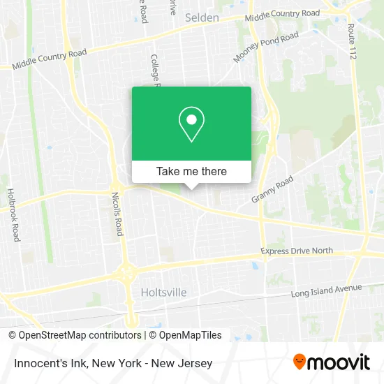
See Innocent's Ink, Farmingville, on the map
Public Transit to Innocent's Ink in Farmingville
Wondering how to get to Innocent's Ink in Farmingville? Moovit helps you find the best way to get to Innocent's Ink with step-by-step directions from the nearest public transit station.
Moovit provides free maps and live directions to help you navigate through your city. View schedules, routes, timetables, and find out how long does it take to get to Innocent's Ink in real time.
Looking for the nearest stop or station to Innocent's Ink? Check out this list of stops closest to your destination: Horseblock Rd/Lidge Dr; Horseblock Rd/Waverly Ave; Medford.
Bus: 52B, 53.Train: GREENPORT SERVICE.
Want to see if there’s another route that gets you there at an earlier time? Moovit helps you find alternative routes or times. Get directions from and directions to Innocent's Ink easily from the Moovit App or Website.
We make riding to Innocent's Ink easy, which is why over 1.5 million users, including users in Farmingville, trust Moovit as the best app for public transit. You don’t need to download an individual bus app or train app, Moovit is your all-in-one transit app that helps you find the best bus time or train time available.
For information on prices of bus and train, costs and ride fares to Innocent's Ink, please check the Moovit app.
Get to Innocent's Ink with public transit and pay for the ride in the Moovit app. In addition to all info you may need for your trip to Innocent's Ink, including live directions, real-time arrivals and fare prices, you can also buy public transit passes for your rides. No need for cash or paper tickets to get to Innocent's Ink - everything you need is accessible in the app with a click of the button.
Use the app to navigate to popular places including to the airport, hospital, stadium, grocery store, mall, coffee shop, school, college, and university.
Innocent's Ink Address: 32 Raymond Ave street in Farmingville
- Kareem Alexander Baldwin,
- New Fang Fang Spa,
- Scott’S Guitar Repair,
- Luniqcassie,
- Michael's Pride Above Ground Pool Liner Replacement Specialist,
- Reglazing Boss,
- Rubes Sandro,
- Fences by Barone,
- Magic Car Wash & Lube Center,
- Dunkin',
- Nicholas Marchese: Allstate Insurance,
- By His Grace Dominican Salon Farmingville,
- Walk-In Clinic,
- Pro Star Construction,
- Precious Kids,
- Marchese Agency Inc.: Allstate Insurance,
- Brookhaven Roofing,
- One Earth Deposits,
- Kelly Real Estate Inc.,
- Symphony Nails & Spa
Places Near Innocent's Ink (Farmingville)
- Rockefeller Center, Manhattan,
- 376 Hudson Street, Manhattan,
- 111 Centre New York City Supreme Court, Manhattan,
- Pier 83, Manhattan,
- Mountainside Hospital, Glen Ridge,
- 911 Memorial, Manhattan,
- Wall Street, Manhattan,
- Katz's Deli, Manhattan,
- Hudson Yards, Manhattan,
- qqqq, Manhattan,
- Bellevue Hospital, Manhattan,
- San Gennaro Feast, Manhattan,
- 3 Stone St, Manhattan,
- 66 John Street, Manhattan,
- 1 Police Plaza, Manhattan,
- Queens Center Mall, Queens,
- 26 Federal Plaza, Manhattan,
- Times Square, Manhattan,
- Chinatown, Manhattan,
- SoHo, Manhattan
How to get to popular places in New York - New Jersey with public transit
Get around Farmingville by public transit!
Traveling around Farmingville has never been so easy. See step by step directions as you travel to any attraction, street or major public transit station. View bus and train schedules, arrival times, service alerts and detailed routes on a map, so you know exactly how to get to anywhere in Farmingville.
When traveling to any destination around Farmingville use Moovit's Live Directions with Get Off Notifications to know exactly where and how far to walk, how long to wait for your line, and how many stops are left. Moovit will alert you when it's time to get off — no need to constantly re-check whether yours is the next stop.
Wondering how to use public transit in Farmingville or how to pay for public transit in Farmingville? Moovit public transit app can help you navigate your way with public transit easily, and at minimum cost. It includes public transit fees, ticket prices, and costs. Looking for a map of Farmingville public transit lines? Moovit public transit app shows all public transit maps in Farmingville with all Bus, Train, Subway, Light Rail, Ferry and Cable Car routes and stops on an interactive map.
New York - New Jersey has 6 transit type(s), including: Bus, Train, Subway, Light Rail, Ferry and Cable Car, operated by several transit agencies, including MTA Subway, Metro-North Railroad, LIRR, PATH, MTA New York City Transit - Express routes, MTA Bus, NJ Transit, NYC Ferry, NICE bus, Bee-Line Bus, NJ Transit Rail, Norwalk Transit District, Hartford Line, River Valley Transit and HART