How to get to Innovation Cardiology by bus?
Click on the bus route to see step by step directions with maps, line arrival times and updated time schedules.
How to get to Innovation Cardiology by train?
Click on the train route to see step by step directions with maps, line arrival times and updated time schedules.
Light Rail stations near Innovation Cardiology in Norfolk
- Monticello, 5 min walk,VIEW
Bus stops near Innovation Cardiology in Norfolk
Ferry station near Innovation Cardiology in Norfolk
- Ferry Stop - Waterside, 13 min walk,VIEW
Bus lines to Innovation Cardiology in Norfolk
What are the closest stations to Innovation Cardiology?
The closest stations to Innovation Cardiology are:
- Monticello is 324 yards away, 5 min walk.
- Fort Norfolk Station is 657 yards away, 8 min walk.
- Olney & Norfolk General is 969 yards away, 12 min walk.
- Ferry Stop - Waterside is 1026 yards away, 13 min walk.
- Colonial & Boissevain is 1395 yards away, 17 min walk.
Which bus lines stop near Innovation Cardiology?
These bus lines stop near Innovation Cardiology: 023, 961.
Which train line stops near Innovation Cardiology?
NORTHEAST REGIONAL (Norfolk)
Which light rail line stops near Innovation Cardiology?
800 (Evmc Fort Norfolk Station)
What’s the nearest light rail station to Innovation Cardiology in Norfolk?
The nearest light rail station to Innovation Cardiology in Norfolk is Monticello. It’s a 5 min walk away.
What’s the nearest bus station to Innovation Cardiology in Norfolk?
The nearest bus station to Innovation Cardiology in Norfolk is Fort Norfolk Station. It’s a 8 min walk away.
What’s the nearest ferry station to Innovation Cardiology in Norfolk?
The nearest ferry station to Innovation Cardiology in Norfolk is Ferry Stop - Waterside. It’s a 13 min walk away.
What time is the first light rail to Innovation Cardiology in Norfolk?
The 800 is the first light rail that goes to Innovation Cardiology in Norfolk. It stops nearby at 5:27 AM.
What time is the last light rail to Innovation Cardiology in Norfolk?
The 800 is the last light rail that goes to Innovation Cardiology in Norfolk. It stops nearby at 11:37 PM.
What time is the first bus to Innovation Cardiology in Norfolk?
The 023 is the first bus that goes to Innovation Cardiology in Norfolk. It stops nearby at 5:05 AM.
What time is the last bus to Innovation Cardiology in Norfolk?
The 002 is the last bus that goes to Innovation Cardiology in Norfolk. It stops nearby at 12:39 AM.
What time is the first ferry to Innovation Cardiology in Norfolk?
The 090 is the first ferry that goes to Innovation Cardiology in Norfolk. It stops nearby at 5:45 AM.
What time is the last ferry to Innovation Cardiology in Norfolk?
The 090 is the last ferry that goes to Innovation Cardiology in Norfolk. It stops nearby at 9:45 PM.
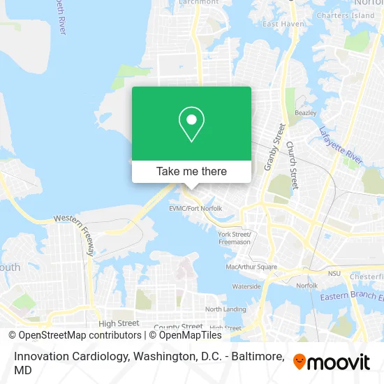
See Innovation Cardiology, Norfolk, on the map
Public Transit to Innovation Cardiology in Norfolk
Wondering how to get to Innovation Cardiology in Norfolk? Moovit helps you find the best way to get to Innovation Cardiology with step-by-step directions from the nearest public transit station.
Moovit provides free maps and live directions to help you navigate through your city. View schedules, routes, timetables, and find out how long does it take to get to Innovation Cardiology in real time.
Looking for the nearest stop or station to Innovation Cardiology? Check out this list of stops closest to your destination: Monticello; Fort Norfolk Station; Olney & Norfolk General; Ferry Stop - Waterside; Colonial & Boissevain.
Bus: 023, 961, 002, 044, 011.Train: NORTHEAST REGIONAL.Light Rail: 800.Ferry: 090.
Want to see if there’s another route that gets you there at an earlier time? Moovit helps you find alternative routes or times. Get directions from and directions to Innovation Cardiology easily from the Moovit App or Website.
We make riding to Innovation Cardiology easy, which is why over 1.5 million users, including users in Norfolk, trust Moovit as the best app for public transit. You don’t need to download an individual bus app or train app, Moovit is your all-in-one transit app that helps you find the best bus time or train time available.
For information on prices of bus, train and light rail, costs and ride fares to Innovation Cardiology, please check the Moovit app.
Use the app to navigate to popular places including to the airport, hospital, stadium, grocery store, mall, coffee shop, school, college, and university.
Innovation Cardiology Address: 400 Gresham Dr Norfolk, VA 23507 street in Norfolk
- Same Day STD Testing,
- Morrison S Neil DDS,
- CHKD Wheelchair Clinic,
- Cardiology Associates of Lakeview,
- Hussein M Aboulatta MD,
- Womancare Center PLC PCS,
- King's Daughters Milk Bank at CHKD,
- Newby Keith H Dr,
- USPS Collection Box - Blue Box,
- Cardiology & Arrhythmia Consultants,
- Jeness Uniform Centers,
- ATM,
- Truist Bank,
- Women Caring,
- Dr Gary H Payman MD,
- Dr Michael H Sperling MD,
- Douglas H Howerton MD,
- Alex O Williams MD,
- Mitchell Paul B MD,
- Clinical Research Associates of Tidewater
Places Near Innovation Cardiology (Norfolk)
- Camden Yards, Baltimore,
- The Anthem, Washington,
- Capital One Arena, Washington,
- National Museum of African American History and Culture, Washington,
- National Zoo, Washington,
- Washington DC VA Medical Center, Washington,
- National Mall, Washington,
- Basilica of the National Shrine, Washington,
- Museum Of The Bible, Washington,
- Pennsylvania Ave NW (3rd st and pennsylvania), Washington,
- Warner Theatre, Washington,
- Westfield Montgomery Mall, Montgomery County,
- Rock Creek Tennis Center, Washington,
- Marriott Marquis Washington, DC, Washington,
- Washington National Cathedral, Washington,
- Georgetown, Washington,
- PG Mall, Prince George's County,
- Sibley Memorial Hospital, Washington,
- Amazon Hq2, Arlington County,
- M&T Bank Stadium, Baltimore
How to get to popular places in Washington, D.C. - Baltimore, MD with public transit
Get around Norfolk by public transit!
Traveling around Norfolk has never been so easy. See step by step directions as you travel to any attraction, street or major public transit station. View bus and train schedules, arrival times, service alerts and detailed routes on a map, so you know exactly how to get to anywhere in Norfolk.
When traveling to any destination around Norfolk use Moovit's Live Directions with Get Off Notifications to know exactly where and how far to walk, how long to wait for your line, and how many stops are left. Moovit will alert you when it's time to get off — no need to constantly re-check whether yours is the next stop.
Wondering how to use public transit in Norfolk or how to pay for public transit in Norfolk? Moovit public transit app can help you navigate your way with public transit easily, and at minimum cost. It includes public transit fees, ticket prices, and costs. Looking for a map of Norfolk public transit lines? Moovit public transit app shows all public transit maps in Norfolk with all Bus, Train, Metro, Light Rail and Ferry routes and stops on an interactive map.
Washington, D.C. - Baltimore, MD has 5 transit type(s), including: Bus, Train, Metro, Light Rail and Ferry, operated by several transit agencies, including WMATA, Montgomery County Ride On, Fairfax Connector, TheBus, PRTC, DASH - Alexandria, Arlington Transit (ART), RTA of Central Maryland, MDOT MTA, MDOT MTA Light RailLink, MDOT MTA Commuter Bus, MDOT MTA Local Bus, FXBGO!, Virginia Railway Express (VRE) and MARC