How to get to Innovationsagentur Rottweil by bus?
Click on the bus route to see step by step directions with maps, line arrival times and updated time schedules.
From Beatparade
126 minFrom Klinik Hohenfreudenstadt
159 minFrom Stadtwerke Villingen-Schwenningen GmbH
115 minFrom Hotel Palmenwald
116 minFrom Campingplatz Schüttehof Horb
158 minFrom Waldeck Spa
128 minFrom Berghütte Lauterbad
122 minFrom Bauhaus Villingen-Schwenningen
115 minFrom Fachklinik Sonnenhof Waldachtal
163 minFrom Lützenhardt
157 min
How to get to Innovationsagentur Rottweil by train?
Click on the train route to see step by step directions with maps, line arrival times and updated time schedules.
Bus stops near Innovationsagentur Rottweil
Train stations near Innovationsagentur Rottweil
Bus lines to Innovationsagentur Rottweil
- 3, Rottweil Hausen o.R. Horgenerstraße - Rottweil Göllsdorf Kreissparkasse,VIEW
- 49S, Dunningen Post - Rottweil Bahnhof,VIEW
- 9004, Rottweil Bahnhof - Rottweil Hausen o.R. Horgenerstraße,VIEW
- 9009, Zimmern ob Rottweil Zimmern o.R. Am Dorfplatz - Dunningen Post,VIEW
- 9478, Rottweil Bahnhof,VIEW
- 7444, Oberndorf am Neckar Oberndorf Bahnhof/Zob,VIEW
- 40, Rottweil Bahnhof,VIEW
- 2120, Rottweil Bahnhof,VIEW
- 2021, Dunningen Eschachschule,VIEW
- 1, Deißlingen Mitte - Zimmern ob Rottweil Zimmern Römerallee,VIEW
- 2, Rottweil Saline (Autohaus) - Rottweil RW Saline (Einkaufszentrum),VIEW
- 7444, Oberndorf am Neckar Oberndorf Bahnhof/ZOB Bstg C - Rottweil Bahnhof,VIEW
- 9001, Deißlingen Mitte - Rottweil Zimmerner Straße,VIEW
- 9002, Rottweil Durschstraße - Rottweil Bahnhof,VIEW
- 9006, Rottweil Bahnhof - Rottweil Tannstraße,VIEW
- 9020, Bösingen Dorfplatz - Rottweil Bahnhof,VIEW
- 9444, Oberndorf Webertal - Rottweil Landratsamt,VIEW
- 1S, Deißlingen Gupfen,VIEW
- 2S, Rottweil Durschstraße - Rottweil Hausen M.-Kolbe-Schule,VIEW
- 34/35, Oberndorf am Neckar Oberndorf Bahnhof/ZOB Bstg G - Rottweil Saline (Autohaus),VIEW
What are the closest stations to Innovationsagentur Rottweil?
The closest stations to Innovationsagentur Rottweil are:
- Rottweil Waldhorn is 173 meters away, 3 min walk.
- Rottweil Schramberger Straße is 347 meters away, 5 min walk.
- Rottweil Schwarzes Tor is 379 meters away, 6 min walk.
- Rottweil Schramb. Str. Hst.Iii is 449 meters away, 6 min walk.
- Rottweil Marxstraße is 539 meters away, 7 min walk.
- Rottweil Nägelesgraben is 699 meters away, 10 min walk.
- Rottweil Schulzentrum is 844 meters away, 12 min walk.
- Rottweil is 3804 meters away, 49 min walk.
- Rottweil Bahnhof is 3804 meters away, 49 min walk.
- Rottweil Göllsdorf Bahnhof is 4933 meters away, 64 min walk.
Which train lines stop near Innovationsagentur Rottweil?
These train lines stop near Innovationsagentur Rottweil: IC87, RB42.
Which bus lines stop near Innovationsagentur Rottweil?
These bus lines stop near Innovationsagentur Rottweil: 40, 49S, 5, 7440, 7444.
What’s the nearest bus station to Innovationsagentur Rottweil?
The nearest bus station to Innovationsagentur Rottweil is Rottweil Waldhorn. It’s a 3 min walk away.
What time is the first train to Innovationsagentur Rottweil?
The RE14 is the first train that goes to Innovationsagentur Rottweil. It stops nearby at 5:11 AM.
What time is the last train to Innovationsagentur Rottweil?
The RE14 is the last train that goes to Innovationsagentur Rottweil. It stops nearby at 12:06 AM.
What time is the first bus to Innovationsagentur Rottweil?
The 40 is the first bus that goes to Innovationsagentur Rottweil. It stops nearby at 4:55 AM.
What time is the last bus to Innovationsagentur Rottweil?
The 9478 is the last bus that goes to Innovationsagentur Rottweil. It stops nearby at 12:48 AM.
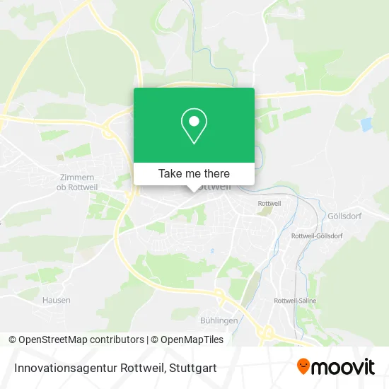
See Innovationsagentur Rottweil on the map
Public Transportation to Innovationsagentur Rottweil
Wondering how to get to Innovationsagentur Rottweil? Moovit helps you find the best way to get to Innovationsagentur Rottweil with step-by-step directions from the nearest public transit station.
Moovit provides free maps and live directions to help you navigate through your city. View schedules, routes, timetables, and find out how long does it take to get to Innovationsagentur Rottweil in real time.
Looking for the nearest stop or station to Innovationsagentur Rottweil? Check out this list of stops closest to your destination: Rottweil Waldhorn; Rottweil Schramberger Straße; Rottweil Schwarzes Tor; Rottweil Schramb. Str. Hst.Iii; Rottweil Marxstraße; Rottweil Nägelesgraben; Rottweil Schulzentrum; Rottweil; Rottweil Bahnhof; Rottweil Göllsdorf Bahnhof.
Train: IC87, RB42, SVG, RE4, RE14, RE4, RE4, RE4, RE14A, RB 43.Bus: 40, 49S, 5, 7440, 7444, 3, 9004, 9009, 9478.
Want to see if there’s another route that gets you there at an earlier time? Moovit helps you find alternative routes or times. Get directions from and directions to Innovationsagentur Rottweil easily from the Moovit App or Website.
We make riding to Innovationsagentur Rottweil easy, which is why over 1.5 million users, including users in Rottweil, trust Moovit as the best app for public transit. You don’t need to download an individual bus app or train app, Moovit is your all-in-one transit app that helps you find the best bus time or train time available.
For information on prices of bus and train, costs and ride fares to Innovationsagentur Rottweil, please check the Moovit app.
Use the app to navigate to popular places including to the airport, hospital, stadium, grocery store, mall, coffee shop, school, college, and university.
Innovationsagentur Rottweil Address: Schramberger Straße 14 78628 Rottweil street in Rottweil
- Dr. Mechthild Wolber,
- Schuldekanatamt,
- Religionspädagogisches Institut,
- Musa Holding,
- Ulrich Kirn,
- Pva Pau,
- Immo Neuer Wall Rottweil,
- Seniorenzentrum Bad Kissingen,
- Bhkw Colnrade,
- Wea Auerbach Verwaltungs,
- Seniorenzentrum Wn-Beinstein,
- Pv-Anlagen Schönbrunn,
- Gvs Consulting,
- Familie Elisabeth Tengelmann,
- Solaranlagen Rw 2018,
- Immo Gewerbepark Neu-Ulm,
- Gvs Verwaltungs,
- Skeehil Germany,
- Wka Sedg Rothenfurth,
- Taktani
Places Near Innovationsagentur Rottweil
- Porsche-Arena, Bad Cannstatt,
- Marmorsaal Im Weissenburgpark, Stuttgart-Süd,
- Waldfriedhof, Degerloch,
- Mercedes-Benz Museum (Mercedes Museum Stuttgart), Bad Cannstatt,
- Im Wizemann (Halle), Bad Cannstatt,
- Geilhaus Haus 33a, Reutlingen-Betzingen,
- Hanns-Martin-Schleyer-Halle (Stuttgart Hans-Martin-Schleyerhalle), Bad Cannstatt,
- Wilhelma (U-Bahn Wilhelma), Bad Cannstatt,
- Porsche Museum, Zuffenhausen,
- Mercedes-Benz Museum, Bad Cannstatt,
- Gleis 101/102 (tief), Stuttgart-Mitte,
- Mettingen Eros-Center Puff Laufhaus, Esslingen Am Neckar,
- Gasometer Pforzheim, Pforzheim,
- Hauptbahnhof Stuttgart, Stuttgart-Mitte,
- Hanns-Martin-Schleyer-Halle, Bad Cannstatt,
- Pariser Platz Stuttgart, Stuttgart-Mitte,
- FlixBus Haltestelle, Stuttgart,
- Schleyerhalle, Bad Cannstatt,
- Klinikum Stuttgart - Katharinenhospital, Stuttgart-Mitte,
- SI-Centrum, Möhringen
How to get to popular places in Stuttgart with public transit
Get around Rottweil by public transit!
Traveling around Rottweil has never been so easy. See step by step directions as you travel to any attraction, street or major public transit station. View bus and train schedules, arrival times, service alerts and detailed routes on a map, so you know exactly how to get to anywhere in Rottweil.
When traveling to any destination around Rottweil use Moovit's Live Directions with Get Off Notifications to know exactly where and how far to walk, how long to wait for your line, and how many stops are left. Moovit will alert you when it's time to get off — no need to constantly re-check whether yours is the next stop.
Wondering how to use public transit in Rottweil or how to pay for public transit in Rottweil? Moovit public transit app can help you navigate your way with public transit easily, and at minimum cost. It includes public transit fees, ticket prices, and costs. Looking for a map of Rottweil public transit lines? Moovit public transit app shows all public transit maps in Rottweil with all Bus, Train, Subway, Light Rail, Ferry, S-Bahn and Funicular routes and stops on an interactive map.
Stuttgart has 7 transit type(s), including: Bus, Train, Subway, Light Rail, Ferry, S-Bahn and Funicular, operated by several transit agencies, including SSB - Stadtbahn, SSB, SSB - Seilbahn / Zacke, S-Bahn Stuttgart, Rhein-Neckar-Verkehr GmbH (rnv), Karlsruher Verkehrsverbund, DB AG, DB Regiobus BW, Arverio Baden-Württemberg GmbH, DB RegioNetz Verkehrs GmbH Westfrankenbahn, DB Regio AG Baden-Württemberg, Südwestdeutsche Verkehrs-AG, DB Regio AG Mitte Region Hessen, DB and Bodensee-Oberschwaben-Bahn