How to get to Innovative Medical Wellness by bus?
Click on the bus route to see step by step directions with maps, line arrival times and updated time schedules.
From NW 79th St / NW 7th Ave, Miami
59 minFrom Hilton Cabana Miami Beach, Miami Beach
49 minFrom Joe Dimaggio Children's Hospital, Hollywood
88 minFrom Antique Trade Center, Hollywood
76 minFrom Hard Rock Stadium, Miami Gardens
81 minFrom Tri-Rail - Hollywood Station, Hollywood
88 minFrom Opa-Locka, FL, Miami
64 minFrom Hollywood Blvd & 441, Hollywood
71 minFrom Flea Market, Miami
43 minFrom Collins Ave, Miami Beach
41 min
Bus stops near Innovative Medical Wellness in Miami
Train station near Innovative Medical Wellness in Miami
- Aventura, 24 min walk,VIEW
Bus lines to Innovative Medical Wellness in Miami
What are the closest stations to Innovative Medical Wellness?
The closest stations to Innovative Medical Wellness are:
- Ne 164 St & Ne 19 Av is 15 yards away, 1 min walk.
- Ne 19 Av & Ne 164 St is 93 yards away, 2 min walk.
- Ne 163 St @ Ne 19 Av is 203 yards away, 3 min walk.
- Ne 164 St & Ne 18 Av is 213 yards away, 3 min walk.
- Aventura is 2044 yards away, 24 min walk.
Which bus lines stop near Innovative Medical Wellness?
These bus lines stop near Innovative Medical Wellness: 510, 75, NMBEACB.
What’s the nearest train station to Innovative Medical Wellness in Miami?
The nearest train station to Innovative Medical Wellness in Miami is Aventura. It’s a 24 min walk away.
What’s the nearest bus station to Innovative Medical Wellness in Miami?
The nearest bus station to Innovative Medical Wellness in Miami is Ne 164 St & Ne 19 Av. It’s a 1 min walk away.
What time is the first train to Innovative Medical Wellness in Miami?
The BLFM is the first train that goes to Innovative Medical Wellness in Miami. It stops nearby at 6:09 AM.
What time is the last train to Innovative Medical Wellness in Miami?
The BLFM is the last train that goes to Innovative Medical Wellness in Miami. It stops nearby at 12:07 AM.
What time is the first bus to Innovative Medical Wellness in Miami?
The 510 is the first bus that goes to Innovative Medical Wellness in Miami. It stops nearby at 5:06 AM.
What time is the last bus to Innovative Medical Wellness in Miami?
The 510 is the last bus that goes to Innovative Medical Wellness in Miami. It stops nearby at 12:28 AM.
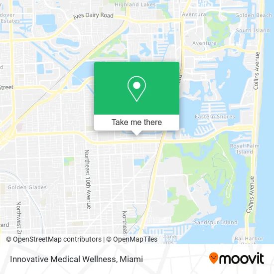
See Innovative Medical Wellness, Miami, on the map
Public Transit to Innovative Medical Wellness in Miami
Wondering how to get to Innovative Medical Wellness in Miami? Moovit helps you find the best way to get to Innovative Medical Wellness with step-by-step directions from the nearest public transit station.
Moovit provides free maps and live directions to help you navigate through your city. View schedules, routes, timetables, and find out how long does it take to get to Innovative Medical Wellness in real time.
Looking for the nearest stop or station to Innovative Medical Wellness? Check out this list of stops closest to your destination: Ne 164 St & Ne 19 Av; Ne 19 Av & Ne 164 St; Ne 163 St @ Ne 19 Av; Ne 164 St & Ne 18 Av; Aventura.
Bus: 510, 75, NMBEACB, NMBEACC.Train: BLFM.
Want to see if there’s another route that gets you there at an earlier time? Moovit helps you find alternative routes or times. Get directions from and directions to Innovative Medical Wellness easily from the Moovit App or Website.
We make riding to Innovative Medical Wellness easy, which is why over 1.5 million users, including users in Miami, trust Moovit as the best app for public transit. You don’t need to download an individual bus app or train app, Moovit is your all-in-one transit app that helps you find the best bus time or train time available.
For information on prices of bus and train, costs and ride fares to Innovative Medical Wellness, please check the Moovit app.
Use the app to navigate to popular places including to the airport, hospital, stadium, grocery store, mall, coffee shop, school, college, and university.
Innovative Medical Wellness Address: 1899 NE 164th St North Miami Beach, FL 33162 street in Miami
- Consolidated Funding,
- Creators Playland,
- Sarah Allison Dr,
- Cleaning Wizards,
- Wedderburn & Jacobs PA,
- Consumer Law Office PA,
- All County Staffing Dade,
- Edificium Construction LLC,
- Place Quiet,
- Alpha Healthcare Clinic,
- Tãpico Latino,
- Hair Goddess Boutique,
- Ipul NMB,
- Abnox,
- N Miami Beach Ruby Locksmith LTD,
- Heroes Hangout,
- Opalocka Pain Management,
- US Self Storage,
- Law Office of Bryant Filomeno,
- Safefoodhandler
Places Near Innovative Medical Wellness (Miami)
- Dolphin Mall, Miami,
- Port of Miami Cruise Terminal, Miami,
- Sawgrass Mall, Miami,
- Wynwood, Miami,
- Miami Design District, Miami,
- Keiser University Flagship Campus, West Palm Beach,
- Miami Freedom Park, Miami,
- Bayside Marketplace, Miami,
- Sawgrass mall ( FL ), Miami Beach,
- Dolphin Mall Bus, Miami,
- Little Havana, Miami,
- Miami VA Hospital, Miami,
- Zoo Miami, Miami,
- Miami-Dade County Courthouse, Miami,
- Aventura Mall, Miami,
- Marlins Park, Miami,
- Hard Rock Stadium, Miami Gardens,
- Richard E. Gerstein Justice Building, Miami,
- Brickell City Centre, Miami,
- Aventura Mall, Miami Beach
How to get to popular places in Miami with public transit
Get around Miami by public transit!
Traveling around Miami has never been so easy. See step by step directions as you travel to any attraction, street or major public transit station. View bus and train schedules, arrival times, service alerts and detailed routes on a map, so you know exactly how to get to anywhere in Miami.
When traveling to any destination around Miami use Moovit's Live Directions with Get Off Notifications to know exactly where and how far to walk, how long to wait for your line, and how many stops are left. Moovit will alert you when it's time to get off — no need to constantly re-check whether yours is the next stop.
Wondering how to use public transit in Miami or how to pay for public transit in Miami? Moovit public transit app can help you navigate your way with public transit easily, and at minimum cost. It includes public transit fees, ticket prices, and costs. Looking for a map of Miami public transit lines? Moovit public transit app shows all public transit maps in Miami with all Bus, Train, Light Rail and Ferry routes and stops on an interactive map.
Miami has 4 transit type(s), including: Bus, Train, Light Rail and Ferry, operated by several transit agencies, including Broward County Transit, Miami-Dade Transit, Metrorail, Palm Tran, Tri-Rail, Brightline, MARTY, City of Homestead Trolley, Key West Transit, Treasure Coast Connector, GoLine IRT, Amtrak, Greyhound-us, FlixBus-us and Aventura Express Shuttle Bus