Directions to Inova Distribuidora (Xaxim) with public transportation
The following transit lines have routes that pass near Inova Distribuidora
How to get to Inova Distribuidora by bus?
Click on the bus route to see step by step directions with maps, line arrival times and updated time schedules.
From Pátio Batel, Batel
50 minFrom Rua José de Alencar, Juvevê
55 minFrom Rua Emílio de Menezes, São Francisco
52 minFrom Av. João Gualberto, 623, Alto Da Glória
48 minFrom Avenida Cândido de Abreu, Centro Cívico
40 minFrom Boate Garotas Anonimas de Plantão, São José Dos Pinhais
35 minFrom Faculdade Estácio Curitiba, Cristo Rei
46 minFrom Avenida Presidente Kennedy 4121, Portão
40 minFrom Clube Atlético Paranaense, Água Verde
50 minFrom Estação Tubo Maria Clara, Alto Da Glória
56 min
Bus stops near Inova Distribuidora in Xaxim
Bus lines to Inova Distribuidora in Xaxim
What are the closest stations to Inova Distribuidora?
The closest stations to Inova Distribuidora are:
- R. Cristiano Strobel, 1820 is 70 meters away, 2 min walk.
- R. Waldemar Loureiro Campos, 3169 (Cemitério do Boqueirão) is 107 meters away, 2 min walk.
- R. Cascavel, 960 is 492 meters away, 7 min walk.
Which bus lines stop near Inova Distribuidora?
These bus lines stop near Inova Distribuidora: 030 INTERBAIRROS III, 513 HAUER / BOQUEIRÃO, 522 MARINGÁ.
What’s the nearest bus station to Inova Distribuidora in Xaxim?
The nearest bus stations to Inova Distribuidora in Xaxim are R. Cristiano Strobel, 1820 and R. Waldemar Loureiro Campos, 3169 (Cemitério do Boqueirão). The closest one is a 2 min walk away.
What time is the first bus to Inova Distribuidora in Xaxim?
The 030 INTERBAIRROS III is the first bus that goes to Inova Distribuidora in Xaxim. It stops nearby at 5:13 AM.
What time is the last bus to Inova Distribuidora in Xaxim?
The 030 INTERBAIRROS III is the last bus that goes to Inova Distribuidora in Xaxim. It stops nearby at 12:40 AM.
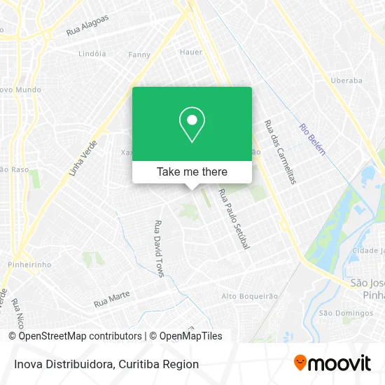
See Inova Distribuidora, Xaxim, on the map
Public Transit to Inova Distribuidora in Xaxim
Wondering how to get to Inova Distribuidora in Xaxim? Moovit helps you find the best way to get to Inova Distribuidora with step-by-step directions from the nearest public transit station.
Moovit provides free maps and live directions to help you navigate through your city. View schedules, routes, timetables, and find out how long does it take to get to Inova Distribuidora in real time.
Looking for the nearest stop or station to Inova Distribuidora? Check out this list of stops closest to your destination: R. Cristiano Strobel; R. Waldemar Loureiro Campos; R. Cascavel.
Bus: 030 INTERBAIRROS III, 513 HAUER / BOQUEIRÃO, 522 MARINGÁ, 521 NIVALDO BRAGA.
Want to see if there’s another route that gets you there at an earlier time? Moovit helps you find alternative routes or times. Get directions from and directions to Inova Distribuidora easily from the Moovit App or Website.
We make riding to Inova Distribuidora easy, which is why over 1.5 million users, including users in Xaxim, trust Moovit as the best app for public transit. You don’t need to download an individual bus app or train app, Moovit is your all-in-one transit app that helps you find the best bus time or train time available.
For information on prices of bus, costs and ride fares to Inova Distribuidora, please check the Moovit app.
Use the app to navigate to popular places including to the airport, hospital, stadium, grocery store, mall, coffee shop, school, college, and university.
Inova Distribuidora Address: Rua Waldemar Loureiro Campos, 3225 Boqueirão Curitiba-PR 81670-360 street in Xaxim
- Rafaela Bueno Estética Facial / Corporal,
- Multi - Barras Fixadores, Tubos e Conexoes,
- Rua Cristiano Strobel,
- Igreja Evangélica Menonita De Curitiba,
- Igreja Evangélica Irmãos Menonitas,
- Rua Waldemar Loureiro Campos 3319,
- Serralheria Assis,
- Kaiane Muriel - Biomedicina Estética,
- R. Waldemar Loureiro Campos, 3043 - Boqueirão,
- Studio Wiens Salao de Beleza,
- Edilson José Zanini,
- Rua Pastor David Koop 189,
- Tim Tim Produções de Eventos,
- Colégio Erasto Gaertner / Faculdade Fidelis,
- Faculdade Fidelis,
- Kani Dog Supermercado do Cachorro,
- Colégio Erasto Gaertner,
- Mais Caçambas,
- AVN Sports,
- Salão Irene Renczeczen
Places Near Inova Distribuidora (Xaxim)
- Pontifícia Universidade Católica do Paraná (PUCPR), Prado Velho,
- Rua Martim Afonso 558, Mercês,
- Hospital Da Cruz Vermelha, Batel,
- Arena Da Baixada - Curitiba,
- Shopping Palladium, Portão,
- Hospital Erasto Gaertner, Jardim Das Américas,
- Hospital de Clínicas (HC - UFPR), Centro,
- Jockey Plaza Shopping Center, Tarumã,
- Park Shopping Barigüi, Mossunguê,
- Parque Barigui, Mercês,
- Hospital Nossa Senhora Das Graças, Mercês,
- Hospital do Rocio, Campo,
- Jardim Botânico de Curitiba PR, Centro,
- Hospital Madalena Sofia, Bairro Alto,
- Hospital Universitário Evangélico de Curitiba, Bigorrilho,
- Hospital Angelina Caron, Campina Grande Do Sul,
- Rua General Mário Tourinho, Campina Do Siqueira,
- Shopping Estação, Rebouças,
- Campo Largo, Campo,
- Hhhhh, Fazendinha
How to get to popular places in Curitiba Region with public transit
Get around Xaxim by public transit!
Traveling around Xaxim has never been so easy. See step by step directions as you travel to any attraction, street or major public transit station. View bus and train schedules, arrival times, service alerts and detailed routes on a map, so you know exactly how to get to anywhere in Xaxim.
When traveling to any destination around Xaxim use Moovit's Live Directions with Get Off Notifications to know exactly where and how far to walk, how long to wait for your line, and how many stops are left. Moovit will alert you when it's time to get off — no need to constantly re-check whether yours is the next stop.
Wondering how to use public transit in Xaxim or how to pay for public transit in Xaxim? Moovit public transit app can help you navigate your way with public transit easily, and at minimum cost. It includes public transit fees, ticket prices, and costs. Looking for a map of Xaxim public transit lines? Moovit public transit app shows all public transit maps in Xaxim with all Bus and Cable Car routes and stops on an interactive map.
Curitiba Region has 2 transit type(s), including: Bus and Cable Car, operated by several transit agencies, including Sistema Integrado de Mobilidade (URBS), Sistema Integrado de Mobilidade (AMEP), URBS (Cartões bancários e Dinheiro), URBS (Cartões bancários / Cartão URBS), AMEP (Cartões bancários / Cartão MetroCard), AMEP (Cartões bancários / Cartão MetroCard / Dinheiro), Viação Colombo (Dinheiro), TRIAR (Cartão TRIAR / Dinheiro), Empresa Curitiba Cerro Azul (Dinheiro), Expresso Nossa Senhora da Penha (Dinheiro), Empresa Campo Alto Tijucas (Dinheiro), Auto Viação São José (Cartão VEM / Dinheiro), BRT S/A (Cartão VEM / Dinheiro), TransPiedade (Cartão Cidadão / Dinheiro) and Oceânica Sul (Cartão Transporte / Dinheiro)