How to get to Inova Secu by bus?
Click on the bus route to see step by step directions with maps, line arrival times and updated time schedules.
From Boulevard Macdonald, Paris
101 minFrom Primark, Villeneuve-La-Garenne
57 minFrom Rock en Seine, Saint-Cloud
55 minFrom Bon Marché, Paris
58 minFrom Rue Pierre Guérin, Paris
70 minFrom L'Aquarium, Paris
50 minFrom Rue De Sevres, Paris
50 minFrom Bibliothèque Nationale de France – Richelieu, Paris
57 minFrom Hotel Lutetia, Paris
56 minFrom Banque de France, Paris
61 min
How to get to Inova Secu by train?
Click on the train route to see step by step directions with maps, line arrival times and updated time schedules.
Bus stops near Inova Secu in Colombes
Light Rail stations near Inova Secu in Colombes
- Victor Basch, 8 min walk,VIEW
Bus lines to Inova Secu in Colombes
What are the closest stations to Inova Secu?
The closest stations to Inova Secu are:
- Les Renouillers is 87 meters away, 2 min walk.
- Cimetière de Colombes is 271 meters away, 4 min walk.
- Audra is 385 meters away, 6 min walk.
- Jacques Eleonor Ferme is 414 meters away, 6 min walk.
- Victor Basch is 558 meters away, 8 min walk.
- Le Stade is 736 meters away, 10 min walk.
- Les Vallées is 1362 meters away, 18 min walk.
Which train line stops near Inova Secu?
J (Paris-Saint-Lazare)
Which bus lines stop near Inova Secu?
These bus lines stop near Inova Secu: 164, 235, 378.
What’s the nearest light rail station to Inova Secu in Colombes?
The nearest light rail station to Inova Secu in Colombes is Victor Basch. It’s a 8 min walk away.
What’s the nearest train station to Inova Secu in Colombes?
The nearest train station to Inova Secu in Colombes is Le Stade. It’s a 10 min walk away.
What’s the nearest bus station to Inova Secu in Colombes?
The nearest bus station to Inova Secu in Colombes is Les Renouillers. It’s a 2 min walk away.
What time is the first light rail to Inova Secu in Colombes?
The T2 is the first light rail that goes to Inova Secu in Colombes. It stops nearby at 6:20 AM.
What time is the last light rail to Inova Secu in Colombes?
The T2 is the last light rail that goes to Inova Secu in Colombes. It stops nearby at 1:11 AM.
What time is the first train to Inova Secu in Colombes?
The J is the first train that goes to Inova Secu in Colombes. It stops nearby at 4:54 AM.
What time is the last train to Inova Secu in Colombes?
The J is the last train that goes to Inova Secu in Colombes. It stops nearby at 1:14 AM.
What time is the first bus to Inova Secu in Colombes?
The 164 is the first bus that goes to Inova Secu in Colombes. It stops nearby at 6:08 AM.
What time is the last bus to Inova Secu in Colombes?
The 304 is the last bus that goes to Inova Secu in Colombes. It stops nearby at 1:35 AM.
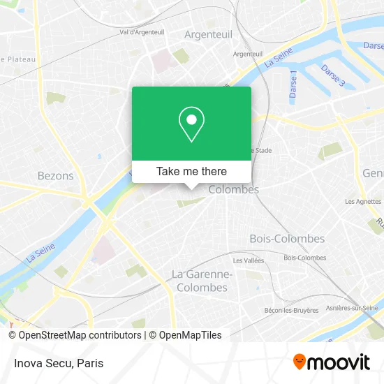
See Inova Secu, Colombes, on the map
Public Transit to Inova Secu in Colombes
Wondering how to get to Inova Secu in Colombes? Moovit helps you find the best way to get to Inova Secu with step-by-step directions from the nearest public transit station.
Moovit provides free maps and live directions to help you navigate through your city. View schedules, routes, timetables, and find out how long does it take to get to Inova Secu in real time.
Looking for the nearest stop or station to Inova Secu? Check out this list of stops closest to your destination: Les Renouillers; Cimetière de Colombes; Audra; Jacques Eleonor Ferme; Victor Basch; Le Stade; Les Vallées.
Train: J, L.Bus: 164, 235, 378, 167, 304, 276, 176.
Want to see if there’s another route that gets you there at an earlier time? Moovit helps you find alternative routes or times. Get directions from and directions to Inova Secu easily from the Moovit App or Website.
We make riding to Inova Secu easy, which is why over 1.5 million users, including users in Colombes, trust Moovit as the best app for public transit. You don’t need to download an individual bus app or train app, Moovit is your all-in-one transit app that helps you find the best bus time or train time available.
For information on prices of bus, train, metro and light rail, costs and ride fares to Inova Secu, please check the Moovit app.
Use the app to navigate to popular places including to the airport, hospital, stadium, grocery store, mall, coffee shop, school, college, and university.
Inova Secu Address: 227 Rue Saint-Denis 92700 Colombes street in Colombes
- Services Rapides,
- M la Beauté,
- Garage Saint-Denis,
- Ait Ahmed,
- 92700,
- Albert Ménès,
- Santé Vaut le Bonheur,
- 205 Rue Saint-Denis,
- Caroma,
- Pains & Gourmandises,
- Artisan Boulanger Pâtissier,
- Manao Paris,
- Bayadair,
- Cimetière Gabriel Péri,
- Tina Cosmetic Beauty Salon,
- Egooroocrea,
- Dojo Ambroise Paré - Gymnase,
- Entente Seine Nord 92,
- École Élémentaire Publique Ambroise Paré a,
- Tamaglit House
Places Near Inova Secu (Colombes)
- Gare Routière Flixbus, Paris,
- Beaugrenelle, Paris,
- Créteil Soleil, Creteil,
- Marché Saint-Pierre, Paris,
- Hôpital Pitié Salpêtrière, Paris,
- Galeries Lafayette, Paris,
- Hôpital Saint-Joseph, Paris,
- Centre Hospitalier des 15/20, Paris,
- Théâtre Mogador, Paris,
- 29 Rue Manin, Paris,
- Hôpital de la Pitié-Salpêtrière, Paris,
- Hôpital Necker, Paris,
- Hôpital Beaujon, Clichy,
- Atelier Des Lumieres, Paris,
- Hopital Foch, Suresnes,
- Hôpital Cochin, Paris,
- Hôpital Henri Mondor, Creteil,
- Fondation Louis Vuitton, Paris,
- Galeries Lafayette Haussmann, Paris,
- Hopital Lariboisière, Paris
How to get to popular places in Paris with public transit
Get around Colombes by public transit!
Traveling around Colombes has never been so easy. See step by step directions as you travel to any attraction, street or major public transit station. View bus and train schedules, arrival times, service alerts and detailed routes on a map, so you know exactly how to get to anywhere in Colombes.
When traveling to any destination around Colombes use Moovit's Live Directions with Get Off Notifications to know exactly where and how far to walk, how long to wait for your line, and how many stops are left. Moovit will alert you when it's time to get off — no need to constantly re-check whether yours is the next stop.
Wondering how to use public transit in Colombes or how to pay for public transit in Colombes? Moovit public transit app can help you navigate your way with public transit easily, and at minimum cost. It includes public transit fees, ticket prices, and costs. Looking for a map of Colombes public transit lines? Moovit public transit app shows all public transit maps in Colombes with all Bus, Train, Metro, Light Rail, RER, Funicular and Gondola routes and stops on an interactive map.
Paris has 7 transit type(s), including: Bus, Train, Metro, Light Rail, RER, Funicular and Gondola, operated by several transit agencies, including RATP, RER, RER Bus de remplacement, Train, Train Bus de remplacement, Tramway Bus de remplacement, TER, ADP, Magical Shuttle, Argenteuil - Boucles de Seine, Autocars Dominique, Bièvre, Brie et 2 Morin, Le Bus - C.C. du Clermontois and Cœur d’Essonne