How to get to Inpe Inc. by bus?
Click on the bus route to see step by step directions with maps, line arrival times and updated time schedules.
From The Fillmore Silver Spring, Montgomery County
54 minFrom Embassy Suites-Bethesda Washington DC, Montgomery County
78 minFrom Silver Spring Civic Building (Silver Spring Civic Center), Montgomery County
56 minFrom National Institutes of Health (NIH), Montgomery County
63 minFrom Silver Spring, Maryland, Montgomery County
58 minFrom Westfield Montgomery Mall, Montgomery County
70 minFrom Park Potomac Place, Montgomery County
55 minFrom Riderwood Village, Montgomery County
48 minFrom Wheaton Mall, Montgomery County
59 minFrom Consulado General de El Salvador en El Dmv, Montgomery County
71 min
How to get to Inpe Inc. by metro?
Click on the metro route to see step by step directions with maps, line arrival times and updated time schedules.
From The Fillmore Silver Spring, Montgomery County
58 minFrom Silver Spring Civic Building (Silver Spring Civic Center), Montgomery County
62 minFrom National Institutes of Health (NIH), Montgomery County
96 minFrom Silver Spring, Maryland, Montgomery County
58 minFrom Wheaton Mall, Montgomery County
69 minFrom Consulado General de El Salvador en El Dmv, Montgomery County
64 min
Bus stops near Inpe Inc. in Montgomery County
Metro station near Inpe Inc. in Montgomery County
- Glenmont, 41 min walk,VIEW
Bus lines to Inpe Inc. in Montgomery County
What are the closest stations to Inpe Inc.?
The closest stations to Inpe Inc. are:
- Layhill Rd & Post Ln is 741 yards away, 10 min walk.
- Rippling Brook Dr & Hewitt Ave is 840 yards away, 11 min walk.
- Glenmont is 3477 yards away, 41 min walk.
Which bus lines stop near Inpe Inc.?
These bus lines stop near Inpe Inc.: 26, 39, 49.
Which metro line stops near Inpe Inc.?
RED (Glenmont)
What’s the nearest bus station to Inpe Inc. in Montgomery County?
The nearest bus station to Inpe Inc. in Montgomery County is Layhill Rd & Post Ln. It’s a 10 min walk away.
What time is the first metro to Inpe Inc. in Montgomery County?
The RED is the first metro that goes to Inpe Inc. in Montgomery County. It stops nearby at 5:00 AM.
What time is the last metro to Inpe Inc. in Montgomery County?
The RED is the last metro that goes to Inpe Inc. in Montgomery County. It stops nearby at 12:37 AM.
What time is the first bus to Inpe Inc. in Montgomery County?
The 26 is the first bus that goes to Inpe Inc. in Montgomery County. It stops nearby at 4:58 AM.
What time is the last bus to Inpe Inc. in Montgomery County?
The 26 is the last bus that goes to Inpe Inc. in Montgomery County. It stops nearby at 1:24 AM.
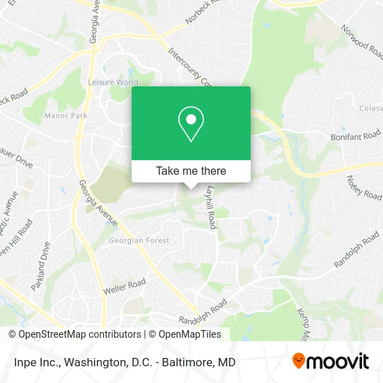
See Inpe Inc., Montgomery County, on the map
Public Transit to Inpe Inc. in Montgomery County
Wondering how to get to Inpe Inc. in Montgomery County? Moovit helps you find the best way to get to Inpe Inc. with step-by-step directions from the nearest public transit station.
Moovit provides free maps and live directions to help you navigate through your city. View schedules, routes, timetables, and find out how long does it take to get to Inpe Inc. in real time.
Looking for the nearest stop or station to Inpe Inc.? Check out this list of stops closest to your destination: Layhill Rd & Post Ln; Rippling Brook Dr & Hewitt Ave; Glenmont.
Bus: 26, 39, 49, 51.Metro: RED.
Want to see if there’s another route that gets you there at an earlier time? Moovit helps you find alternative routes or times. Get directions from and directions to Inpe Inc. easily from the Moovit App or Website.
We make riding to Inpe Inc. easy, which is why over 1.5 million users, including users in Montgomery County, trust Moovit as the best app for public transit. You don’t need to download an individual bus app or train app, Moovit is your all-in-one transit app that helps you find the best bus time or train time available.
For information on prices of bus and metro, costs and ride fares to Inpe Inc., please check the Moovit app.
Use the app to navigate to popular places including to the airport, hospital, stadium, grocery store, mall, coffee shop, school, college, and university.
Inpe Inc. Address: 13809 N Gate Dr Silver Spring, MD 20906 street in Montgomery County
- Matthew Henson Trail,
- 26 ride on bus Twinbrook,
- Montgomery County Tennis Assoc,
- Residential and Commercial Locksmith,
- Armor Home Ins,
- Petros Marafatsos & Sons,
- Rene Painting,
- DMV Got Junk,
- Reliable Home Improvements,
- Remodeling Brother,
- Apá Painting,
- Bright Side Assisted Living,
- Argyle Middle School,
- Wat Thai DC Buddhist Temple,
- Souza Pavers,
- Jake Premium Renovation,
- Mid County Community Rec Ctr,
- Fabi Salgados,
- Catered Vacation,
- Wolfensohn Atrium - The World Bank
Places Near Inpe Inc. (Montgomery County)
- Basilica of the National Shrine, Washington,
- Amazon Hq2, Arlington County,
- Washington National Cathedral, Washington,
- National Zoo, Washington,
- Museum Of The Bible, Washington,
- Sibley Memorial Hospital, Washington,
- Rock Creek Tennis Center, Washington,
- National Mall, Washington,
- The Anthem, Washington,
- Westfield Montgomery Mall, Montgomery County,
- Washington DC VA Medical Center, Washington,
- PG Mall, Prince George's County,
- Capital One Arena, Washington,
- M&T Bank Stadium, Baltimore,
- Marriott Marquis Washington, DC, Washington,
- Georgetown, Washington,
- National Museum of African American History and Culture, Washington,
- Warner Theatre, Washington,
- Camden Yards, Baltimore,
- Pennsylvania Ave NW (3rd st and pennsylvania), Washington
How to get to popular places in Washington, D.C. - Baltimore, MD with public transit
Get around Montgomery County by public transit!
Traveling around Montgomery County has never been so easy. See step by step directions as you travel to any attraction, street or major public transit station. View bus and train schedules, arrival times, service alerts and detailed routes on a map, so you know exactly how to get to anywhere in Montgomery County.
When traveling to any destination around Montgomery County use Moovit's Live Directions with Get Off Notifications to know exactly where and how far to walk, how long to wait for your line, and how many stops are left. Moovit will alert you when it's time to get off — no need to constantly re-check whether yours is the next stop.
Wondering how to use public transit in Montgomery County or how to pay for public transit in Montgomery County? Moovit public transit app can help you navigate your way with public transit easily, and at minimum cost. It includes public transit fees, ticket prices, and costs. Looking for a map of Montgomery County public transit lines? Moovit public transit app shows all public transit maps in Montgomery County with all Bus, Train, Metro, Light Rail and Ferry routes and stops on an interactive map.
Washington, D.C. - Baltimore, MD has 5 transit type(s), including: Bus, Train, Metro, Light Rail and Ferry, operated by several transit agencies, including WMATA, Montgomery County Ride On, Fairfax Connector, TheBus, PRTC, DASH - Alexandria, Arlington Transit (ART), RTA of Central Maryland, MDOT MTA, MDOT MTA Light RailLink, MDOT MTA Commuter Bus, MDOT MTA Local Bus, FXBGO!, Virginia Railway Express (VRE) and MARC