How to get to Input Output by bus?
Click on the bus route to see step by step directions with maps, line arrival times and updated time schedules.
From Town Center at Boca Raton-East, Boca Raton
58 minFrom Palm Beach State College, Boca Raton
45 minFrom Brazzers, Boca Raton
59 minFrom John Knox Village Health Center, Pompano Beach
48 minFrom Harrah's Pompano Beach, Pompano Beach
73 minFrom Broward College North Campus Bldg. 48, Pompano Beach
68 minFrom Don Estridge High Tech Middle Sch, Boca Raton
81 minFrom Florida Atlantic University, Boca Raton
47 minFrom Intersection : N Andrews Ave & Sample Rd., Pompano Beach
42 minFrom Walmart Supercenter, Pompano Beach
64 min
How to get to Input Output by train?
Click on the train route to see step by step directions with maps, line arrival times and updated time schedules.
Bus stops near Input Output in Deerfield Beach
Train stations near Input Output in Deerfield Beach
What are the closest stations to Input Output?
The closest stations to Input Output are:
- Hillsboro Boulevard/Northeast 9th Avenue is 117 yards away, 2 min walk.
- US 1 & Hillsboro Boulevard is 339 yards away, 5 min walk.
- Deerfield Beach Station is 553 yards away, 7 min walk.
- Boca Raton is 1587 yards away, 19 min walk.
Which bus lines stop near Input Output?
These bus lines stop near Input Output: 10, 48, 50.
Which train line stops near Input Output?
TRIRAIL (Southbound To Miami Airport)
What’s the nearest train station to Input Output in Deerfield Beach?
The nearest train station to Input Output in Deerfield Beach is Deerfield Beach Station. It’s a 7 min walk away.
What’s the nearest bus station to Input Output in Deerfield Beach?
The nearest bus station to Input Output in Deerfield Beach is Hillsboro Boulevard/Northeast 9th Avenue. It’s a 2 min walk away.
What time is the first train to Input Output in Deerfield Beach?
The TRIRAIL is the first train that goes to Input Output in Deerfield Beach. It stops nearby at 4:35 AM.
What time is the last train to Input Output in Deerfield Beach?
The FLORIDIAN is the last train that goes to Input Output in Deerfield Beach. It stops nearby at 4:57 PM.
What time is the first bus to Input Output in Deerfield Beach?
The 10 is the first bus that goes to Input Output in Deerfield Beach. It stops nearby at 5:17 AM.
What time is the last bus to Input Output in Deerfield Beach?
The 10 is the last bus that goes to Input Output in Deerfield Beach. It stops nearby at 12:05 AM.
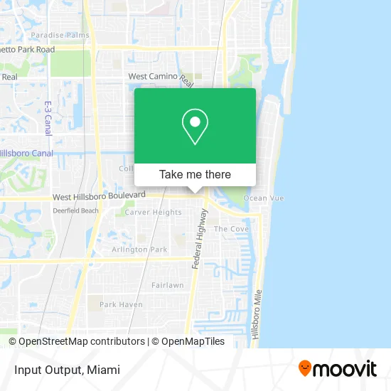
See Input Output, Deerfield Beach, on the map
Public Transit to Input Output in Deerfield Beach
Wondering how to get to Input Output in Deerfield Beach? Moovit helps you find the best way to get to Input Output with step-by-step directions from the nearest public transit station.
Moovit provides free maps and live directions to help you navigate through your city. View schedules, routes, timetables, and find out how long does it take to get to Input Output in real time.
Looking for the nearest stop or station to Input Output? Check out this list of stops closest to your destination: Hillsboro Boulevard/Northeast 9th Avenue; US 1 & Hillsboro Boulevard; Deerfield Beach Station; Boca Raton.
Bus: 10, 48, 50.Train: TRIRAIL, FLORIDIAN, SILVER METEOR, BLFM.
Want to see if there’s another route that gets you there at an earlier time? Moovit helps you find alternative routes or times. Get directions from and directions to Input Output easily from the Moovit App or Website.
We make riding to Input Output easy, which is why over 1.5 million users, including users in Deerfield Beach, trust Moovit as the best app for public transit. You don’t need to download an individual bus app or train app, Moovit is your all-in-one transit app that helps you find the best bus time or train time available.
For information on prices of bus and train, costs and ride fares to Input Output, please check the Moovit app.
Use the app to navigate to popular places including to the airport, hospital, stadium, grocery store, mall, coffee shop, school, college, and university.
Input Output Address: 811 E Hillsboro Blvd Deerfield Beach, FL 33441 street in Deerfield Beach
- Affordable Counseling Services,
- Florida Health Clinic,
- City of Deerfield Beach,
- Title Link,
- Broward County Libraries - Deerfield Beach Percy White Branch,
- Ticket Shield,
- American Express,
- Fulton Agency Inc.,
- Deerfield Beach Pier, Florida,
- Salvation Army,
- Locksmith Broward Paramount LP,
- Capable Plumbing Service,
- Your Local Chiropractor Center,
- Asap Roadside Services,
- Extensive Experience,
- DUNKIN',
- Itz the Pawn Shop,
- Cellular Sales (US Cellular),
- Union Bank,
- Gizmo's Auto Repair
Places Near Input Output (Deerfield Beach)
- Miami Design District, Miami,
- Bayside Marketplace, Miami,
- Aventura Mall, Miami Beach,
- Port of Miami Cruise Terminal, Miami,
- Miami VA Hospital, Miami,
- Richard E. Gerstein Justice Building, Miami,
- Sawgrass Mall, Miami,
- Zoo Miami, Miami,
- Miami-Dade County Courthouse, Miami,
- Dolphin Mall, Miami,
- Little Havana, Miami,
- Wynwood, Miami,
- Dolphin Mall Bus, Miami,
- Miami Freedom Park, Miami,
- Sawgrass mall ( FL ), Miami Beach,
- Keiser University Flagship Campus, West Palm Beach,
- Aventura Mall, Miami,
- Brickell City Centre, Miami,
- Hard Rock Stadium, Miami Gardens,
- Marlins Park, Miami
How to get to popular places in Miami with public transit
Get around Deerfield Beach by public transit!
Traveling around Deerfield Beach has never been so easy. See step by step directions as you travel to any attraction, street or major public transit station. View bus and train schedules, arrival times, service alerts and detailed routes on a map, so you know exactly how to get to anywhere in Deerfield Beach.
When traveling to any destination around Deerfield Beach use Moovit's Live Directions with Get Off Notifications to know exactly where and how far to walk, how long to wait for your line, and how many stops are left. Moovit will alert you when it's time to get off — no need to constantly re-check whether yours is the next stop.
Wondering how to use public transit in Deerfield Beach or how to pay for public transit in Deerfield Beach? Moovit public transit app can help you navigate your way with public transit easily, and at minimum cost. It includes public transit fees, ticket prices, and costs. Looking for a map of Deerfield Beach public transit lines? Moovit public transit app shows all public transit maps in Deerfield Beach with all Bus, Train, Light Rail and Ferry routes and stops on an interactive map.
Miami has 4 transit type(s), including: Bus, Train, Light Rail and Ferry, operated by several transit agencies, including Broward County Transit, Miami-Dade Transit, Metrorail, Palm Tran, Tri-Rail, Brightline, MARTY, City of Homestead Trolley, Key West Transit, Treasure Coast Connector, GoLine IRT, Amtrak, Greyhound-us, FlixBus-us and Aventura Express Shuttle Bus