How to get to Insight Global by bus?
Click on the bus route to see step by step directions with maps, line arrival times and updated time schedules.
From Potomac Mills Mall, Prince William County
218 minFrom Lorton, VA - Amtrak Auto Train Station (LOR), Fairfax County
233 minFrom Lorton, VA, Fairfax County
228 minFrom Rose Gaming Resort, Prince William County
243 minFrom Busch Gardens Williamsburg (Employee Parking Lot), James City County
159 minFrom Amazon Fulfillment Center-Ric3, Richmond
93 minFrom Woodbridge, VA, Prince William County
163 minFrom UVA Hospital Medical Center, Charlottesville
308 min
Bus stops near Insight Global in Richmond
Bus lines to Insight Global in Richmond
What are the closest stations to Insight Global?
The closest stations to Insight Global are:
- Boulevard + Clay is 248 yards away, 4 min walk.
- Scotts Addition Westbound Station is 279 yards away, 4 min walk.
- Broad + Belmont is 319 yards away, 4 min walk.
- Boulevard + Robinhood is 1323 yards away, 16 min walk.
Which bus lines stop near Insight Global?
These bus lines stop near Insight Global: 18, 20, BRT.
What’s the nearest bus station to Insight Global in Richmond?
The nearest bus stations to Insight Global in Richmond are Boulevard + Clay, Scotts Addition Westbound Station and Broad + Belmont. The closest one is a 4 min walk away.
What time is the first bus to Insight Global in Richmond?
The BRT is the first bus that goes to Insight Global in Richmond. It stops nearby at 5:08 AM.
What time is the last bus to Insight Global in Richmond?
The BRT is the last bus that goes to Insight Global in Richmond. It stops nearby at 1:27 AM.
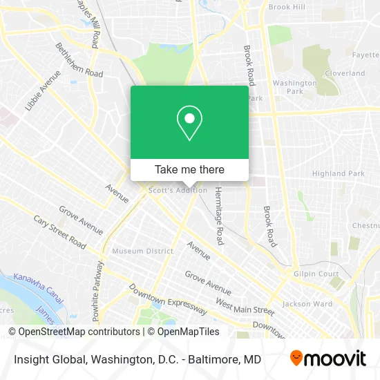
See Insight Global, Richmond, on the map
Public Transit to Insight Global in Richmond
Wondering how to get to Insight Global in Richmond? Moovit helps you find the best way to get to Insight Global with step-by-step directions from the nearest public transit station.
Moovit provides free maps and live directions to help you navigate through your city. View schedules, routes, timetables, and find out how long does it take to get to Insight Global in real time.
Looking for the nearest stop or station to Insight Global? Check out this list of stops closest to your destination: Boulevard + Clay; Scotts Addition Westbound Station; Broad + Belmont; Boulevard + Robinhood.
Bus: 18, 20, BRT, 50, 14.
Want to see if there’s another route that gets you there at an earlier time? Moovit helps you find alternative routes or times. Get directions from and directions to Insight Global easily from the Moovit App or Website.
We make riding to Insight Global easy, which is why over 1.5 million users, including users in Richmond, trust Moovit as the best app for public transit. You don’t need to download an individual bus app or train app, Moovit is your all-in-one transit app that helps you find the best bus time or train time available.
For information on prices of bus and train, costs and ride fares to Insight Global, please check the Moovit app.
Use the app to navigate to popular places including to the airport, hospital, stadium, grocery store, mall, coffee shop, school, college, and university.
Insight Global Address: 1800 Summit Ave Richmond, VA 23230 street in Richmond
- Monument Consulting,
- Hobbs & Associates,
- Reservoir Distillery,
- Automatic Leasing Service,
- Drive To Work,
- O Randolph Rollins Attorney,
- A Taste of California,
- Baker Atrium Lofts,
- Securitas,
- Freehold Communities,
- The Lofts,
- Afterglow Coffee Cooperative,
- Richmond Cycling Corps,
- Isley Brewing Company,
- Zora Pax,
- Armenhyl Group,
- Titan Office Solutions,
- Richgal Properties,
- Joe Homebuyer Greater Richmond,
- Shark Bilt
Places Near Insight Global (Richmond)
- Sibley Memorial Hospital, Washington,
- Westfield Montgomery Mall, Montgomery County,
- Museum Of The Bible, Washington,
- National Zoo, Washington,
- Washington National Cathedral, Washington,
- Washington DC VA Medical Center, Washington,
- Camden Yards, Baltimore,
- Amazon Hq2, Arlington County,
- Marriott Marquis Washington, DC, Washington,
- Georgetown, Washington,
- M&T Bank Stadium, Baltimore,
- Warner Theatre, Washington,
- Basilica of the National Shrine, Washington,
- The Anthem, Washington,
- Capital One Arena, Washington,
- National Mall, Washington,
- National Museum of African American History and Culture, Washington,
- PG Mall, Prince George's County,
- Rock Creek Tennis Center, Washington,
- Pennsylvania Ave NW (3rd st and pennsylvania), Washington
How to get to popular places in Washington, D.C. - Baltimore, MD with public transit
Get around Richmond by public transit!
Traveling around Richmond has never been so easy. See step by step directions as you travel to any attraction, street or major public transit station. View bus and train schedules, arrival times, service alerts and detailed routes on a map, so you know exactly how to get to anywhere in Richmond.
When traveling to any destination around Richmond use Moovit's Live Directions with Get Off Notifications to know exactly where and how far to walk, how long to wait for your line, and how many stops are left. Moovit will alert you when it's time to get off — no need to constantly re-check whether yours is the next stop.
Wondering how to use public transit in Richmond or how to pay for public transit in Richmond? Moovit public transit app can help you navigate your way with public transit easily, and at minimum cost. It includes public transit fees, ticket prices, and costs. Looking for a map of Richmond public transit lines? Moovit public transit app shows all public transit maps in Richmond with all Bus, Train, Metro, Light Rail and Ferry routes and stops on an interactive map.
Washington, D.C. - Baltimore, MD has 5 transit type(s), including: Bus, Train, Metro, Light Rail and Ferry, operated by several transit agencies, including WMATA, Montgomery County Ride On, Fairfax Connector, TheBus, PRTC, DASH - Alexandria, Arlington Transit (ART), RTA of Central Maryland, MDOT MTA, MDOT MTA Light RailLink, MDOT MTA Commuter Bus, MDOT MTA Local Bus, FXBGO!, Virginia Railway Express (VRE) and MARC