How to get to Insigneo by bus?
Click on the bus route to see step by step directions with maps, line arrival times and updated time schedules.
From United Palace Theatre, Manhattan
65 minFrom Park Side Restaurant, Queens
59 minFrom Consulado Ecuatoriano en Queens, Queens
52 minFrom 185 West Broadway, Manhattan
57 minFrom Riverside Church, Manhattan
43 minFrom Rego Park, Queens
41 minFrom Fulton Ave, Bronx
67 minFrom Mitsuwa Marketplace, Edgewater
52 minFrom Fort Lee, NJ, Fort Lee
61 min
How to get to Insigneo by train?
Click on the train route to see step by step directions with maps, line arrival times and updated time schedules.
How to get to Insigneo by subway?
Click on the subway route to see step by step directions with maps, line arrival times and updated time schedules.
Subway stations near Insigneo in Manhattan
Bus stops near Insigneo in Manhattan
- Madison Av/ E 55 St, 2 min walk,VIEW
- Madison Av/E 55 St, 2 min walk,VIEW
- Madison Av/E 54 St, 2 min walk,VIEW
- Madison Av / E 54 St, 2 min walk,VIEW
- Madison Av/E 52 St, 2 min walk,VIEW
- Madison Av/E 56 St, 3 min walk,VIEW
- Madison Av/E 55 St, 3 min walk,VIEW
- Madison Av/E 53 St, 3 min walk,VIEW
- E 57th St & Park Ave, 4 min walk,VIEW
- E 57 St/Madison Av, 4 min walk,VIEW
Bus lines to Insigneo in Manhattan
- QM21, Midtown 57 St Via Madison Av,VIEW
- SIM23, Annadale - Midtown Manhattan Express,VIEW
- SIM24, Prince's Bay - Midtown Manhattan Express,VIEW
- BM1, Mill Basin - Downtown/Midtown,VIEW
- BM2, Canarsie/Spring Creek - Downtown/Midtown,VIEW
- BM3, Sheepshead Bay - Downtown/Midtown,VIEW
- BM4, Gerritsen Beach - Downtown/Midtown,VIEW
- BM5, Spring Creek - Midtown,VIEW
- BXM11, Wakefield - Midtown,VIEW
- X27, Bay Ridge - Manhattan Express,VIEW
- X28, Sea Gate / Bensonhurst - Manhattan Express,VIEW
- X37, Bay Ridge - Midtown Manhattan Express,VIEW
- X38, Sea Gate / Bensonhurst - Midtown Manhattan Express,VIEW
- 28, - Bxm4c,VIEW
- Q32, Jackson Heights,VIEW
- SIM4C, Huguenot - Manhattan Express,VIEW
- SIM6, Eltingville - Midtown Manhattan Express,VIEW
- SIM8, Huguenot - Midtown Manhattan Express,VIEW
- SIM11, New Dorp - Midtown Manhattan Express,VIEW
- SIM22, Eltingville - Midtown Manhattan Express,VIEW
What are the closest stations to Insigneo?
The closest stations to Insigneo are:
- Lexington Av/53 St is 35 yards away, 1 min walk.
- Madison Av/ E 55 St is 75 yards away, 2 min walk.
- Madison Av/E 55 St is 77 yards away, 2 min walk.
- Madison Av/E 54 St is 86 yards away, 2 min walk.
- Madison Av / E 54 St is 105 yards away, 2 min walk.
- Madison Av/E 52 St is 109 yards away, 2 min walk.
- Madison Av/E 56 St is 138 yards away, 3 min walk.
- Madison Av/E 55 St is 139 yards away, 3 min walk.
- Madison Av/E 53 St is 195 yards away, 3 min walk.
- E 57th St & Park Ave is 247 yards away, 4 min walk.
- E 57 St/Madison Av is 287 yards away, 4 min walk.
- 5 Av/59 St is 295 yards away, 4 min walk.
- Lexington Av/59 St is 639 yards away, 8 min walk.
Which bus lines stop near Insigneo?
These bus lines stop near Insigneo: 57TH ST, BM2, BM5, BXM4, M4, M5, M7, Q32, QM12.
Which train lines stop near Insigneo?
These train lines stop near Insigneo: 2, BABYLON BRANCH, PORT WASHINGTON BRANCH, YEL.
Which subway lines stop near Insigneo?
These subway lines stop near Insigneo: 5, E, F.
What’s the nearest subway station to Insigneo in Manhattan?
The nearest subway station to Insigneo in Manhattan is Lexington Av/53 St. It’s a 1 min walk away.
What’s the nearest bus station to Insigneo in Manhattan?
The nearest bus stations to Insigneo in Manhattan are Madison Av/ E 55 St, Madison Av/E 55 St, Madison Av/E 54 St, Madison Av / E 54 St and Madison Av/E 52 St. The closest one is a 2 min walk away.
What time is the first subway to Insigneo in Manhattan?
The 6 is the first subway that goes to Insigneo in Manhattan. It stops nearby at 3:00 AM.
What time is the last subway to Insigneo in Manhattan?
The N is the last subway that goes to Insigneo in Manhattan. It stops nearby at 4:07 AM.
What time is the first bus to Insigneo in Manhattan?
The M2 is the first bus that goes to Insigneo in Manhattan. It stops nearby at 3:31 AM.
What time is the last bus to Insigneo in Manhattan?
The M2 is the last bus that goes to Insigneo in Manhattan. It stops nearby at 2:21 AM.
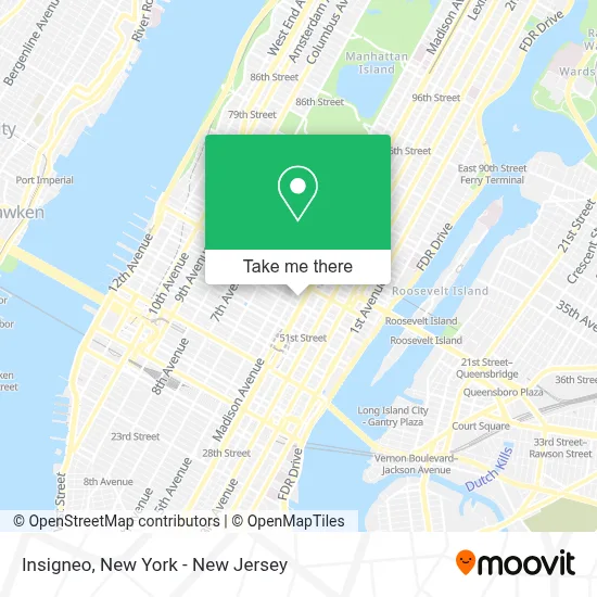
See Insigneo, Manhattan, on the map
Public Transit to Insigneo in Manhattan
Wondering how to get to Insigneo in Manhattan? Moovit helps you find the best way to get to Insigneo with step-by-step directions from the nearest public transit station.
Moovit provides free maps and live directions to help you navigate through your city. View schedules, routes, timetables, and find out how long does it take to get to Insigneo in real time.
Looking for the nearest stop or station to Insigneo? Check out this list of stops closest to your destination: Lexington Av/53 St; Madison Av/ E 55 St; Madison Av/E 55 St; Madison Av/E 54 St; Madison Av / E 54 St; Madison Av/E 52 St; Madison Av/E 56 St; Madison Av/E 55 St; Madison Av/E 53 St; E 57th St & Park Ave; E 57 St/Madison Av; 5 Av/59 St; Lexington Av/59 St.
Bus: 57TH ST, BM2, BM5, BXM4, M4, M5, M7, Q32, QM12, QM21, SIM23, SIM24.Train: 2, BABYLON BRANCH, PORT WASHINGTON BRANCH, YEL.Subway: 5, E, F, FX, N, R, W, 4, 6, 6X.
Want to see if there’s another route that gets you there at an earlier time? Moovit helps you find alternative routes or times. Get directions from and directions to Insigneo easily from the Moovit App or Website.
We make riding to Insigneo easy, which is why over 1.7 million users, including users in Manhattan, trust Moovit as the best app for public transit. You don’t need to download an individual bus app or train app, Moovit is your all-in-one transit app that helps you find the best bus time or train time available.
For information on prices of subway, bus and train, costs and ride fares to Insigneo, please check the Moovit app.
Use the app to navigate to popular places including to the airport, hospital, stadium, grocery store, mall, coffee shop, school, college, and university.
Insigneo Address: 410 Park Avenue, Suite 420 street in Manhattan
- Classic Car Club Manhattan,
- Fresh Bites Deli,
- Sack & Sack, Attorneys at Law,
- Marto Capital,
- Icd Group International,
- Elias,
- Dr.Tiffanymrice,
- Lion's New York Realty,
- Visodent NY,
- Dvl,
- Mercer Advisors Wealth Management,
- Cohesive Therapy Nyc,
- Empleos Canada,
- Paul Lebrecque,
- Oon Arvelo Salon,
- Albert Narcisse Hair Colorist,
- Richard B Arkway Books,
- Oceana Restaurant,
- David Seidman Dds,
- Practiceinbalance Dental Spa NY
Places Near Insigneo (Manhattan)
- 911 Memorial, Manhattan,
- Times Square, Manhattan,
- 111 Centre New York City Supreme Court, Manhattan,
- Chinatown, Manhattan,
- qqqq, Manhattan,
- SoHo, Manhattan,
- 376 Hudson Street, Manhattan,
- Katz's Deli, Manhattan,
- Mountainside Hospital, Glen Ridge,
- Rockefeller Center, Manhattan,
- 66 John Street, Manhattan,
- 3 Stone St, Manhattan,
- Bellevue Hospital, Manhattan,
- Queens Center Mall, Queens,
- Hudson Yards, Manhattan,
- Pier 83, Manhattan,
- San Gennaro Feast, Manhattan,
- Wall Street, Manhattan,
- 1 Police Plaza, Manhattan,
- 26 Federal Plaza, Manhattan
How to get to popular places in New York - New Jersey with public transit
Get around Manhattan by public transit!
Traveling around Manhattan has never been so easy. See step by step directions as you travel to any attraction, street or major public transit station. View bus and train schedules, arrival times, service alerts and detailed routes on a map, so you know exactly how to get to anywhere in Manhattan.
When traveling to any destination around Manhattan use Moovit's Live Directions with Get Off Notifications to know exactly where and how far to walk, how long to wait for your line, and how many stops are left. Moovit will alert you when it's time to get off — no need to constantly re-check whether yours is the next stop.
Wondering how to use public transit in Manhattan or how to pay for public transit in Manhattan? Moovit public transit app can help you navigate your way with public transit easily, and at minimum cost. It includes public transit fees, ticket prices, and costs. Looking for a map of Manhattan public transit lines? Moovit public transit app shows all public transit maps in Manhattan with all Bus, Train, Subway, Light Rail, Ferry and Cable Car routes and stops on an interactive map.
New York - New Jersey has 6 transit type(s), including: Bus, Train, Subway, Light Rail, Ferry and Cable Car, operated by several transit agencies, including MTA Subway, Metro-North Railroad, LIRR, PATH, MTA New York City Transit - Express routes, MTA Bus, NJ Transit, NYC Ferry, NICE bus, Bee-Line Bus, NJ Transit Rail, Norwalk Transit District, Hartford Line, River Valley Transit and HART