Directions to Inspextro (Queens) with public transportation
The following transit lines have routes that pass near Inspextro
 Bus: Q46, Q60, Q80, Q37, QM18.
- Train: BABYLON BRANCH, FAR ROCKAWAY BRANCH, CITY TERMINAL ZONE, HEMPSTEAD BRANCH, LONG BEACH BRANCH.
- Subway: E, F, FX.
How to get to Inspextro by bus?
Click on the bus route to see step by step directions with maps, line arrival times and updated time schedules.
From Long Island City, Queens
66 minFrom jetBlue Terminal 5 JFK Int'l Airport NY, Queens
72 minFrom Long island Jewish Hospital, Queens
34 minFrom Long Island City Courthouse, Queens
68 minFrom 22-11 43rd Avenue, Queens
66 minFrom Consulado Ecuatoriano en Queens, Queens
49 minFrom Queens Center Mall, Queens
36 minFrom MTA-21st St-Queensbridge, Queens
66 minFrom 32-20 northern blvd, Queens
70 minFrom Jackson Ave, Queens
61 min
How to get to Inspextro by train?
Click on the train route to see step by step directions with maps, line arrival times and updated time schedules.
How to get to Inspextro by subway?
Click on the subway route to see step by step directions with maps, line arrival times and updated time schedules.
From Long Island City, Queens
30 minFrom Long Island City Courthouse, Queens
23 minFrom 22-11 43rd Avenue, Queens
27 minFrom Consulado Ecuatoriano en Queens, Queens
21 minFrom Queens Center Mall, Queens
27 minFrom MTA-21st St-Queensbridge, Queens
30 minFrom 32-20 northern blvd, Queens
24 minFrom Jackson Ave, Queens
18 min
Bus stops near Inspextro in Queens
Train station near Inspextro in Queens
- Kew Gardens, 8 min walk,VIEW
Subway station near Inspextro in Queens
- 75 Av, 9 min walk,VIEW
Bus lines to Inspextro in Queens
- Q37, Kew Gardens Via Aqueduct,VIEW
- Q80, Kew Gardens Via Lefferts Bl,VIEW
- Q45, Kew Gardens Via Union Tpke,VIEW
- Q46, Rush Lij Hospital Via Union Tpke,VIEW
- Q48, Rush Glen Oaks Via Union Tpke,VIEW
- QM18, S. Ozone Pk 130 St Via Lefferts Bl,VIEW
- Q60, Jamaica LIRR Via Queens Bl,VIEW
- QM65, Laurelton,VIEW
- QM63, Rosedale,VIEW
- QM64, Elmont,VIEW
- QM68, Floral Park,VIEW
- Q10, Rush Kew Gardens Via Lefferts Bl Via 130 St,VIEW
What are the closest stations to Inspextro?
The closest stations to Inspextro are:
- 80 Rd /Austin St is 247 yards away, 4 min walk.
- Queens Blvd/78 Av is 300 yards away, 4 min walk.
- Queens Blvd/Union Tpke is 303 yards away, 4 min walk.
- Kew Gardens Rd/80 Rd is 477 yards away, 6 min walk.
- Kew Gardens is 664 yards away, 8 min walk.
- 75 Av is 713 yards away, 9 min walk.
Which bus lines stop near Inspextro?
These bus lines stop near Inspextro: Q46, Q60, Q80.
Which train lines stop near Inspextro?
These train lines stop near Inspextro: BABYLON BRANCH, FAR ROCKAWAY BRANCH.
Which subway line stops near Inspextro?
E (Uptown & Queens)
What’s the nearest subway station to Inspextro in Queens?
The nearest subway station to Inspextro in Queens is 75 Av. It’s a 9 min walk away.
What’s the nearest train station to Inspextro in Queens?
The nearest train station to Inspextro in Queens is Kew Gardens. It’s a 8 min walk away.
What’s the nearest bus station to Inspextro in Queens?
The nearest bus stations to Inspextro in Queens are 80 Rd /Austin St, Queens Blvd/78 Av and Queens Blvd/Union Tpke. The closest one is a 4 min walk away.
What time is the first subway to Inspextro in Queens?
The E is the first subway that goes to Inspextro in Queens. It stops nearby at 3:00 AM.
What time is the last subway to Inspextro in Queens?
The F is the last subway that goes to Inspextro in Queens. It stops nearby at 4:08 AM.
What time is the first train to Inspextro in Queens?
The BABYLON BRANCH is the first train that goes to Inspextro in Queens. It stops nearby at 3:00 AM.
What time is the last train to Inspextro in Queens?
The BABYLON BRANCH is the last train that goes to Inspextro in Queens. It stops nearby at 3:02 AM.
What time is the first bus to Inspextro in Queens?
The Q45 is the first bus that goes to Inspextro in Queens. It stops nearby at 3:00 AM.
What time is the last bus to Inspextro in Queens?
The Q46 is the last bus that goes to Inspextro in Queens. It stops nearby at 3:11 AM.
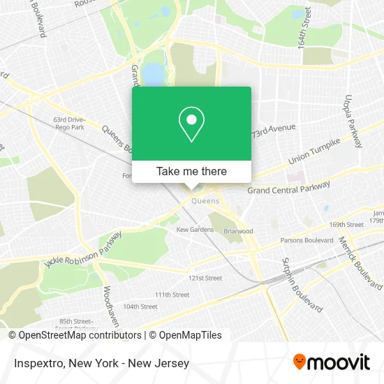
See Inspextro, Queens, on the map
Public Transit to Inspextro in Queens
Wondering how to get to Inspextro in Queens? Moovit helps you find the best way to get to Inspextro with step-by-step directions from the nearest public transit station.
Moovit provides free maps and live directions to help you navigate through your city. View schedules, routes, timetables, and find out how long does it take to get to Inspextro in real time.
Looking for the nearest stop or station to Inspextro? Check out this list of stops closest to your destination: 80 Rd /Austin St; Queens Blvd/78 Av; Queens Blvd/Union Tpke; Kew Gardens Rd/80 Rd; Kew Gardens; 75 Av.
Bus: Q46, Q60, Q80, Q37, QM18, QM65, Q45, Q48, QM63, QM64, QM68.Train: BABYLON BRANCH, FAR ROCKAWAY BRANCH, CITY TERMINAL ZONE, HEMPSTEAD BRANCH, LONG BEACH BRANCH.Subway: E, F, FX.
Want to see if there’s another route that gets you there at an earlier time? Moovit helps you find alternative routes or times. Get directions from and directions to Inspextro easily from the Moovit App or Website.
We make riding to Inspextro easy, which is why over 1.5 million users, including users in Queens, trust Moovit as the best app for public transit. You don’t need to download an individual bus app or train app, Moovit is your all-in-one transit app that helps you find the best bus time or train time available.
For information on prices of subway, bus, train and light rail, costs and ride fares to Inspextro, please check the Moovit app.
Use the app to navigate to popular places including to the airport, hospital, stadium, grocery store, mall, coffee shop, school, college, and university.
Inspextro Address: 118-21 Queens Blvd street in Queens
- Master Monster Consulting,
- Hk Law,
- Foreclosure Bankruptcy Lawyers,
- Mr. Fixsmith,
- Law Office Of Stephen A Gargiulo,
- Tallergallet, Llc.,
- Hanger Clinic: Prosthetics & Orthotics,
- Rq Partners, Inc.,
- Forest Hills,
- Law Offices Of Alexander C. Pabst,
- Carter Thomas Home Care,
- Abraham Law Group Pc,
- Akeem All In One Home Improvement,
- Law Office Of Randy S. Alpert,
- Law Office Of Peter Scott Dufault,
- Poltielov & Habib,
- Poltielov Law Firm Injury Lawyers,
- Tolle Robert M,
- Richard Cary Spivack,
- Envision Business Solutions
Places Near Inspextro (Queens)
- Queens Center Mall, Queens,
- Times Square, Manhattan,
- 66 John Street, Manhattan,
- Bellevue Hospital, Manhattan,
- Mountainside Hospital, Glen Ridge,
- Katz's Deli, Manhattan,
- Chinatown, Manhattan,
- Wall Street, Manhattan,
- 1 Police Plaza, Manhattan,
- 111 Centre New York City Supreme Court, Manhattan,
- 3 Stone St, Manhattan,
- SoHo, Manhattan,
- Pier 83, Manhattan,
- 26 Federal Plaza, Manhattan,
- qqqq, Manhattan,
- Rockefeller Center, Manhattan,
- 911 Memorial, Manhattan,
- Hudson Yards, Manhattan,
- 376 Hudson Street, Manhattan,
- San Gennaro Feast, Manhattan
How to get to popular places in New York - New Jersey with public transit
Get around Queens by public transit!
Traveling around Queens has never been so easy. See step by step directions as you travel to any attraction, street or major public transit station. View bus and train schedules, arrival times, service alerts and detailed routes on a map, so you know exactly how to get to anywhere in Queens.
When traveling to any destination around Queens use Moovit's Live Directions with Get Off Notifications to know exactly where and how far to walk, how long to wait for your line, and how many stops are left. Moovit will alert you when it's time to get off — no need to constantly re-check whether yours is the next stop.
Wondering how to use public transit in Queens or how to pay for public transit in Queens? Moovit public transit app can help you navigate your way with public transit easily, and at minimum cost. It includes public transit fees, ticket prices, and costs. Looking for a map of Queens public transit lines? Moovit public transit app shows all public transit maps in Queens with all Bus, Train, Subway, Light Rail, Ferry and Cable Car routes and stops on an interactive map.
New York - New Jersey has 6 transit type(s), including: Bus, Train, Subway, Light Rail, Ferry and Cable Car, operated by several transit agencies, including MTA Subway, Metro-North Railroad, LIRR, PATH, MTA New York City Transit - Express routes, MTA Bus, NJ Transit, NYC Ferry, NICE bus, Bee-Line Bus, NJ Transit Rail, Norwalk Transit District, Hartford Line, River Valley Transit and HART