How to get to Insurance by bus?
Click on the bus route to see step by step directions with maps, line arrival times and updated time schedules.
From Bryson Insurance & Bail Bonding, Fort Myers
50 minFrom New England Journal of Medicine, Fort Myers
64 minFrom Team St Pete, Fort Myers
49 minFrom Cape Coral Pkwy E / Vincennes Blvd, Cape Coral
36 minFrom Ad Pro Master, Fort Myers
33 minFrom Fort Myers Pest Control Co., Fort Myers
69 minFrom downtown cape coral, Cape Coral
37 minFrom Cobra Kai Dojo (PAL), Cape Coral
38 minFrom Andres R Auto Repair, Suncoast Estates
90 minFrom Del Prado Blvd & Cape Coral Pkwy, Cape Coral
35 min
Bus stops near Insurance in Cape Coral
Bus lines to Insurance in Cape Coral
What are the closest stations to Insurance?
The closest stations to Insurance are:
- Hancock Bridge Pkwy @ SE 16th Pl is 231 yards away, 3 min walk.
- Del Prado Blvd @ Hanck Brdg Pkwy-Sb 1 is 290 yards away, 4 min walk.
Which bus lines stop near Insurance?
These bus lines stop near Insurance: 595, 70.
What’s the nearest bus station to Insurance in Cape Coral?
The nearest bus station to Insurance in Cape Coral is Hancock Bridge Pkwy @ SE 16th Pl. It’s a 3 min walk away.
What time is the first bus to Insurance in Cape Coral?
The 70 is the first bus that goes to Insurance in Cape Coral. It stops nearby at 5:32 AM.
What time is the last bus to Insurance in Cape Coral?
The 70 is the last bus that goes to Insurance in Cape Coral. It stops nearby at 9:57 PM.
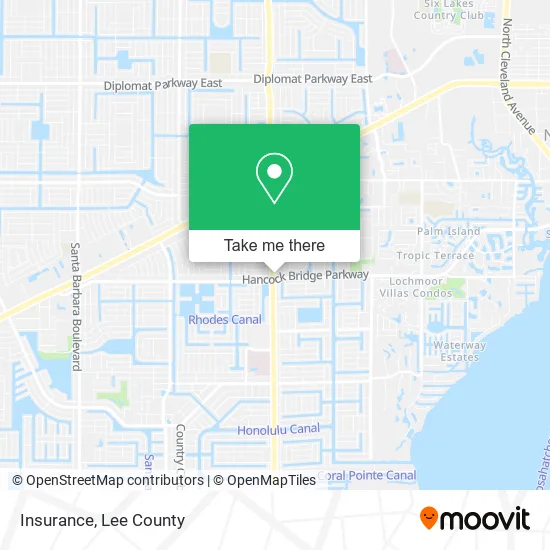
See Insurance, Cape Coral, on the map
Public Transit to Insurance in Cape Coral
Wondering how to get to Insurance in Cape Coral? Moovit helps you find the best way to get to Insurance with step-by-step directions from the nearest public transit station.
Moovit provides free maps and live directions to help you navigate through your city. View schedules, routes, timetables, and find out how long does it take to get to Insurance in real time.
Looking for the nearest stop or station to Insurance? Check out this list of stops closest to your destination: Hancock Bridge Pkwy @ SE 16th Pl; Del Prado Blvd @ Hanck Brdg Pkwy-Sb 1.
Bus: 595, 70, 40.
Want to see if there’s another route that gets you there at an earlier time? Moovit helps you find alternative routes or times. Get directions from and directions to Insurance easily from the Moovit App or Website.
We make riding to Insurance easy, which is why over 1.5 million users, including users in Cape Coral, trust Moovit as the best app for public transit. You don’t need to download an individual bus app or train app, Moovit is your all-in-one transit app that helps you find the best bus time or train time available.
For information on prices of bus, costs and ride fares to Insurance, please check the Moovit app.
Use the app to navigate to popular places including to the airport, hospital, stadium, grocery store, mall, coffee shop, school, college, and university.
Insurance Address: 9 Del Prado Blvd N Cape Coral, FL 33909 street in Cape Coral
- Affiliated Employee Services,
- Lakeman Richard D PA,
- Fed USA Insurance Financial Services,
- Dream Team Mortgage,
- Stryker Counseling and Consulting,
- Executive Suites,
- Circle K,
- Fl380 - Cape Coral,
- Anthony F Fransway MD,
- Ameripath,
- Dr T J Tejera DMD MD,
- Richards & Associates Orthodontics,
- Golosow Lorraine M MD,
- Del Prado & Hancock Bridge,
- Hancock Bridge Pkwy E / Del Prado Blvd N,
- Coinstar,
- Tommy's Express Car Wash,
- Okinawas Karate do Learning Center,
- Cape Coral Pawnshop & Jewelry,
- Del Prado Store
Places Near Insurance (Cape Coral)
- Amazon Warehouse Rsw5,
- Pelican Landing Beach Shuttle, Bonita Springs,
- Miromar Outlets, Estero,
- Walmart Supercenter, Fort Myers,
- Lehigh Acres, FL, Lehigh Acres,
- Lee County Tax Collector, Cape Coral,
- Edison Mall, Fort Myers,
- Bonita Beach, Bonita Springs,
- Seminole Casino Hotel Immokalee,
- I-75 & Colonial (Exit 136), Fort Myers,
- I-75 & MLK (Exit 138), Fort Myers,
- US-41, Fort Myers,
- Bonita Bay Private Beach Club, Bonita Springs,
- Rosa Parks Transportation Center, Fort Myers,
- Bonita Springs, FL, Bonita Springs,
- Flixbus, Fort Myers,
- Ft Myers Airport RSW,
- Matlacha Nude Beach, Matlacha Isles-Matlacha Shores,
- U.S.-41 / Colonial Blvd. Intersection, Fort Myers,
- All About U Naples Escorts, Pine Ridge
How to get to popular places in Lee County with public transit
Get around Cape Coral by public transit!
Traveling around Cape Coral has never been so easy. See step by step directions as you travel to any attraction, street or major public transit station. View bus and train schedules, arrival times, service alerts and detailed routes on a map, so you know exactly how to get to anywhere in Cape Coral.
When traveling to any destination around Cape Coral use Moovit's Live Directions with Get Off Notifications to know exactly where and how far to walk, how long to wait for your line, and how many stops are left. Moovit will alert you when it's time to get off — no need to constantly re-check whether yours is the next stop.
Wondering how to use public transit in Cape Coral or how to pay for public transit in Cape Coral? Moovit public transit app can help you navigate your way with public transit easily, and at minimum cost. It includes public transit fees, ticket prices, and costs. Looking for a map of Cape Coral public transit lines? Moovit public transit app shows all public transit maps in Cape Coral with all bus routes and stops on an interactive map.
Lee County has 1 transit type(s), including: bus, operated by several transit agencies, including LeeTran, CAT and FlixBus-us