How to get to Insync Design by bus?
Click on the bus route to see step by step directions with maps, line arrival times and updated time schedules.
From Community Coach 77 Bus Stop, Livingston
95 minFrom West Orange, NJ, West Orange
108 minFrom Randolph, NJ, Randolph
66 minFrom Dover, NJ, Dover
68 minFrom Saint Barnabas Medical Center, Livingston
113 minFrom Community Coach Bus 77, West Orange
107 minFrom Wayne, NJ, Wayne
100 minFrom Lakeland Bus Stop, Parsippany-Troy Hills
21 min
How to get to Insync Design by train?
Click on the train route to see step by step directions with maps, line arrival times and updated time schedules.
Bus stop near Insync Design in Hanover
- Ridgedale Ave at Malapardis Rd, 4 min walk,VIEW
Train station near Insync Design in Hanover
- Morristown, 3 min walk,VIEW
Bus lines to Insync Design in Hanover
- 871, Boonton,VIEW
What are the closest stations to Insync Design?
The closest stations to Insync Design are:
- Ridgedale Ave at Malapardis Rd is 234 yards away, 4 min walk.
- Morristown is 244 yards away, 3 min walk.
Which bus lines stop near Insync Design?
These bus lines stop near Insync Design: 871, 874, 880.
Which train line stops near Insync Design?
MEL (Hoboken / New York Penn Station)
What’s the nearest train station to Insync Design in Hanover?
The nearest train station to Insync Design in Hanover is Morristown. It’s a 3 min walk away.
What’s the nearest bus station to Insync Design in Hanover?
The nearest bus station to Insync Design in Hanover is Ridgedale Ave at Malapardis Rd. It’s a 4 min walk away.
What time is the first train to Insync Design in Hanover?
The MEL is the first train that goes to Insync Design in Hanover. It stops nearby at 4:23 AM.
What time is the last train to Insync Design in Hanover?
The MEL is the last train that goes to Insync Design in Hanover. It stops nearby at 2:13 AM.
What time is the first bus to Insync Design in Hanover?
The 871 is the first bus that goes to Insync Design in Hanover. It stops nearby at 6:40 AM.
What time is the last bus to Insync Design in Hanover?
The 871 is the last bus that goes to Insync Design in Hanover. It stops nearby at 6:58 PM.
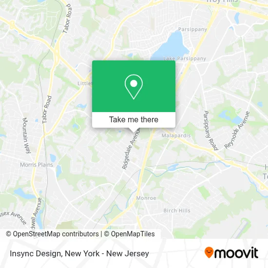
See Insync Design, Hanover, on the map
Public Transit to Insync Design in Hanover
Wondering how to get to Insync Design in Hanover? Moovit helps you find the best way to get to Insync Design with step-by-step directions from the nearest public transit station.
Moovit provides free maps and live directions to help you navigate through your city. View schedules, routes, timetables, and find out how long does it take to get to Insync Design in real time.
Looking for the nearest stop or station to Insync Design? Check out this list of stops closest to your destination: Ridgedale Ave at Malapardis Rd; Morristown.
Bus: 871, 874, 880.Train: MEL.
Want to see if there’s another route that gets you there at an earlier time? Moovit helps you find alternative routes or times. Get directions from and directions to Insync Design easily from the Moovit App or Website.
We make riding to Insync Design easy, which is why over 1.5 million users, including users in Hanover, trust Moovit as the best app for public transit. You don’t need to download an individual bus app or train app, Moovit is your all-in-one transit app that helps you find the best bus time or train time available.
For information on prices of bus and train, costs and ride fares to Insync Design, please check the Moovit app.
Use the app to navigate to popular places including to the airport, hospital, stadium, grocery store, mall, coffee shop, school, college, and university.
Insync Design Address: 14 Ridgedale Ave street in Hanover
- Cody Financial Advisors,
- City Wide Facility Solutions,
- Academy Physical Therapy & Wellness,
- Yukon Training, Inc.,
- Pelorus Elder & Behavioral Health,
- Accessible Home Health Care Of Northern New Jersey,
- Cloud Strategies, Inc.,
- Dallas J Herold,
- Edward Jones - Financial Advisor: Dallas J Herold, Cfp®|Cepa®,
- Employment Horizons, Inc.,
- Automotive Locksmith Locksmith,
- Panurgy It Solutions,
- Marketsmith, Inc. Headquarters,
- Cologix New Jersey Data Center,
- Safari Solutions,
- The Law Offices Of Joseph D Sullivan,
- Baseone Fitness,
- Quicktrack Chimney Repair,
- Jersey 74 Wrestling School,
- Next Step College Consulting Services
Places Near Insync Design (Hanover)
- Katz's Deli, Manhattan,
- 66 John Street, Manhattan,
- Bellevue Hospital, Manhattan,
- San Gennaro Feast, Manhattan,
- qqqq, Manhattan,
- 1 Police Plaza, Manhattan,
- Queens Center Mall, Queens,
- 376 Hudson Street, Manhattan,
- 911 Memorial, Manhattan,
- SoHo, Manhattan,
- Times Square, Manhattan,
- Hudson Yards, Manhattan,
- Pier 83, Manhattan,
- Mountainside Hospital, Glen Ridge,
- 111 Centre New York City Supreme Court, Manhattan,
- Chinatown, Manhattan,
- 3 Stone St, Manhattan,
- Rockefeller Center, Manhattan,
- Wall Street, Manhattan,
- 26 Federal Plaza, Manhattan
How to get to popular places in New York - New Jersey with public transit
Get around Hanover by public transit!
Traveling around Hanover has never been so easy. See step by step directions as you travel to any attraction, street or major public transit station. View bus and train schedules, arrival times, service alerts and detailed routes on a map, so you know exactly how to get to anywhere in Hanover.
When traveling to any destination around Hanover use Moovit's Live Directions with Get Off Notifications to know exactly where and how far to walk, how long to wait for your line, and how many stops are left. Moovit will alert you when it's time to get off — no need to constantly re-check whether yours is the next stop.
Wondering how to use public transit in Hanover or how to pay for public transit in Hanover? Moovit public transit app can help you navigate your way with public transit easily, and at minimum cost. It includes public transit fees, ticket prices, and costs. Looking for a map of Hanover public transit lines? Moovit public transit app shows all public transit maps in Hanover with all Bus, Train, Subway, Light Rail, Ferry and Cable Car routes and stops on an interactive map.
New York - New Jersey has 6 transit type(s), including: Bus, Train, Subway, Light Rail, Ferry and Cable Car, operated by several transit agencies, including MTA Subway, Metro-North Railroad, LIRR, PATH, MTA New York City Transit - Express routes, MTA Bus, NJ Transit, NYC Ferry, NICE bus, Bee-Line Bus, NJ Transit Rail, Norwalk Transit District, Hartford Line, River Valley Transit and HART