Directions to Inszone Insurance Services (Tulsa) with public transportation
The following transit lines have routes that pass near Inszone Insurance Services
 Bus: 700.
How to get to Inszone Insurance Services by bus?
Click on the bus route to see step by step directions with maps, line arrival times and updated time schedules.
From Lyon's Indian Store, Tulsa
58 minFrom 81st & Sheridan, Tulsa
88 minFrom Mike's Fresh Roasted Nuts, Tulsa
58 minFrom Spencer Edward Voth, D.O., Tulsa
39 minFrom Daviel's Paint/Body & Collison, Tulsa
59 minFrom Sloane, Tulsa
58 minFrom Woops, Tulsa
58 minFrom A Caring Alternative, Tulsa
56 minFrom Legends Complete Car Care - Auto Detail, Tulsa
49 minFrom Animal Medical and Surgical Hospital, Tulsa
62 min
Bus stop near Inszone Insurance Services in Tulsa
- (8413) Peoria Ave & 36th St Sb, 5 min walk,VIEW
Bus lines to Inszone Insurance Services in Tulsa
- 700, To 81st/Lewis,VIEW
What are the closest stations to Inszone Insurance Services?
The closest stations to Inszone Insurance Services are:
- (8413) Peoria Ave & 36th St Sb is 365 yards away, 5 min walk.
Which bus line stops near Inszone Insurance Services?
700 (To Peoria/54th N)
What’s the nearest bus station to Inszone Insurance Services in Tulsa?
The nearest bus station to Inszone Insurance Services in Tulsa is (8413) Peoria Ave & 36th St Sb. It’s a 5 min walk away.
What time is the first bus to Inszone Insurance Services in Tulsa?
The 700 is the first bus that goes to Inszone Insurance Services in Tulsa. It stops nearby at 5:36 AM.
What time is the last bus to Inszone Insurance Services in Tulsa?
The 700 is the last bus that goes to Inszone Insurance Services in Tulsa. It stops nearby at 10:14 PM.
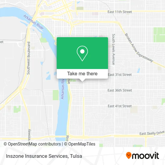
See Inszone Insurance Services, Tulsa, on the map
Public Transit to Inszone Insurance Services in Tulsa
Wondering how to get to Inszone Insurance Services in Tulsa? Moovit helps you find the best way to get to Inszone Insurance Services with step-by-step directions from the nearest public transit station.
Moovit provides free maps and live directions to help you navigate through your city. View schedules, routes, timetables, and find out how long does it take to get to Inszone Insurance Services in real time.
Looking for the nearest stop or station to Inszone Insurance Services? Check out this list of stops closest to your destination: (8413) Peoria Ave & 36th St Sb.
Bus: 700.
Want to see if there’s another route that gets you there at an earlier time? Moovit helps you find alternative routes or times. Get directions from and directions to Inszone Insurance Services easily from the Moovit App or Website.
We make riding to Inszone Insurance Services easy, which is why over 1.5 million users, including users in Tulsa, trust Moovit as the best app for public transit. You don’t need to download an individual bus app or train app, Moovit is your all-in-one transit app that helps you find the best bus time or train time available.
For information on prices of bus, costs and ride fares to Inszone Insurance Services, please check the Moovit app.
Use the app to navigate to popular places including to the airport, hospital, stadium, grocery store, mall, coffee shop, school, college, and university.
Inszone Insurance Services Address: 1133 E 33rd Pl S Tulsa, OK 74105 street in Tulsa
- Flexplan Administrators,
- Blank Med Spa,
- Tiny Blessings Midtown,
- Thrive IV Hydration, Inc.,
- Permanent Makeup of Tulsa,
- Hawthorne Elementary School,
- Elmer's BBQ,
- Oath Law,
- Jeff Burritt,
- Rty Law,
- 3 Tequilas Mexican Grill & Cantina,
- Freeman Team Mortgage,
- Cherokee Contracting,
- 222 Injury Lawyers,
- Wandres Law,
- Muirfield Resources Company,
- Daniels Greer Properties,
- Smith Barkett Law Group,
- Daniels Greer Commercial Real Estate,
- Melissa Dawn van Ranken: Allstate Insurance
Places Near Inszone Insurance Services (Tulsa)
- St Francis South Cardinal Building, Tulsa,
- Tulsa Ok, Tulsa,
- Woodland Hills Mall, Tulsa,
- Broken Arrow, OK, Broken Arrow,
- Amazon Fulfillment Center-TUL2, Tulsa,
- S Garnett Rd / E 21st St, Tulsa,
- Osage Casino, Tulsa,
- Alagon Spa (Olympus Spa), Tulsa,
- Tulsa Zoo, Tulsa,
- Plaza Santa Cecilia, Tulsa,
- Tulsa State Fair, Tulsa,
- 71st & Memorial, Tulsa,
- Zavala Plus, Tulsa,
- Saint Francis Hospital, Tulsa,
- Hard Rock Casino, Tulsa,
- Bixby, OK, Bixby,
- Walmart, Tulsa,
- Fallout Shelter, Tulsa,
- St. Francis Hospital Outpatient Infusion, Tulsa,
- River Spirit Casino, Tulsa
How to get to popular places in Tulsa with public transit
Get around Tulsa by public transit!
Traveling around Tulsa has never been so easy. See step by step directions as you travel to any attraction, street or major public transit station. View bus and train schedules, arrival times, service alerts and detailed routes on a map, so you know exactly how to get to anywhere in Tulsa.
When traveling to any destination around Tulsa use Moovit's Live Directions with Get Off Notifications to know exactly where and how far to walk, how long to wait for your line, and how many stops are left. Moovit will alert you when it's time to get off — no need to constantly re-check whether yours is the next stop.
Wondering how to use public transit in Tulsa or how to pay for public transit in Tulsa? Moovit public transit app can help you navigate your way with public transit easily, and at minimum cost. It includes public transit fees, ticket prices, and costs. Looking for a map of Tulsa public transit lines? Moovit public transit app shows all public transit maps in Tulsa with all bus routes and stops on an interactive map.
Tulsa has 1 transit type(s), including: bus, operated by several transit agencies, including MetroLink Tulsa and Greyhound-us