Directions to Intech Retail (Indianapolis City (Balance)) with public transportation
The following transit lines have routes that pass near Intech Retail
 Bus: 37.
How to get to Intech Retail by bus?
Click on the bus route to see step by step directions with maps, line arrival times and updated time schedules.
From Emergency Dentist Indianapolis 24/7, Indianapolis City (Balance)
94 minFrom Butler University Jordan Hall, Indianapolis City (Balance)
92 minFrom The Meridian South, Indianapolis City (Balance)
112 minFrom Ross Hall Front Desk, Indianapolis City (Balance)
95 minFrom Rainbowshops, Indianapolis City (Balance)
50 minFrom STARBUCKS, Indianapolis City (Balance)
95 minFrom Check Into Cash, Indianapolis City (Balance)
99 minFrom E 86th St / N Meridian St, Indianapolis City (Balance)
162 minFrom I-65 and Michigan, Indianapolis City (Balance)
83 minFrom Lot 7 (North 40), Indianapolis City (Balance)
59 min
Bus stop near Intech Retail in Indianapolis City (Balance)
- Woodland Dr - 7223 N, 5 min walk,VIEW
Bus lines to Intech Retail in Indianapolis City (Balance)
- 37, Transit Center,VIEW
What are the closest stations to Intech Retail?
The closest stations to Intech Retail are:
- Woodland Dr - 7223 N is 346 yards away, 5 min walk.
Which bus line stops near Intech Retail?
37 (Intech Park)
What’s the nearest bus station to Intech Retail in Indianapolis City (Balance)?
The nearest bus station to Intech Retail in Indianapolis City (Balance) is Woodland Dr - 7223 N. It’s a 5 min walk away.
What time is the first bus to Intech Retail in Indianapolis City (Balance)?
The 37 is the first bus that goes to Intech Retail in Indianapolis City (Balance). It stops nearby at 4:25 AM.
What time is the last bus to Intech Retail in Indianapolis City (Balance)?
The 37 is the last bus that goes to Intech Retail in Indianapolis City (Balance). It stops nearby at 10:54 PM.
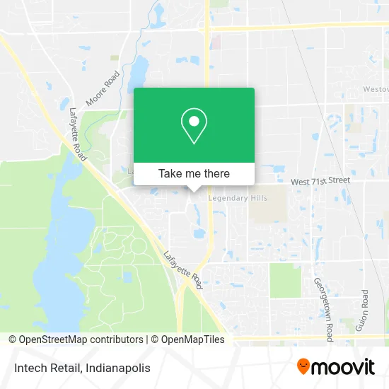
See Intech Retail, Indianapolis City (Balance), on the map
Public Transit to Intech Retail in Indianapolis City (Balance)
Wondering how to get to Intech Retail in Indianapolis City (Balance)? Moovit helps you find the best way to get to Intech Retail with step-by-step directions from the nearest public transit station.
Moovit provides free maps and live directions to help you navigate through your city. View schedules, routes, timetables, and find out how long does it take to get to Intech Retail in real time.
Looking for the nearest stop or station to Intech Retail? Check out this list of stops closest to your destination: Woodland Dr - 7223 N.
Bus: 37.
Want to see if there’s another route that gets you there at an earlier time? Moovit helps you find alternative routes or times. Get directions from and directions to Intech Retail easily from the Moovit App or Website.
We make riding to Intech Retail easy, which is why over 1.5 million users, including users in Indianapolis City (Balance), trust Moovit as the best app for public transit. You don’t need to download an individual bus app or train app, Moovit is your all-in-one transit app that helps you find the best bus time or train time available.
For information on prices of bus, costs and ride fares to Intech Retail, please check the Moovit app.
Use the app to navigate to popular places including to the airport, hospital, stadium, grocery store, mall, coffee shop, school, college, and university.
Intech Retail Address: 6335 Intech Commons Dr street in Indianapolis City (Balance)
- Macizo Restaurant,
- Staffmark,
- INTECH Park,
- Holiday Inn Express & Suites-Holiday Inn Express & Indianapolis Northwest,
- Grand Residences by Marriott-Indianapolis Northwest,
- Aramark Corporation,
- Butler-MacDonald Inc.,
- Pathfinder Insurance School,
- Indiana Wesleyan University,
- Katlin Purlee, Pa,
- Brandi N Tolman, do,
- I-465 W 71st St,
- Evance Solutions,
- United States Dept of Homeland Scrty,
- WXIN-TV Fox 59,
- Indianapolis Gsa,
- JDS Uniphase,
- Social Security Office,
- A Bride's Choice Florist,
- West Indy Barbell
Places Near Intech Retail (Indianapolis City (Balance))
- Eskenazi Hospital, Indianapolis City (Balance),
- Train Ride At Castleton Mall, Indianapolis City (Balance),
- Lilly Corporate Center (Eli Lilly & Co), Indianapolis City (Balance),
- Indiana, Indianapolis City (Balance),
- Plainfield, IN, Plainfield,
- Indianapolis Airport Zone 2, Indianapolis City (Balance),
- 119 W 19th St Parking, Indianapolis City (Balance),
- Jersey Barn, Indianapolis City (Balance),
- Gainbridge Fieldhouse, Indianapolis City (Balance),
- Lucas Oil Stadium, Indianapolis City (Balance),
- St. Vincent Hospital - Indianapolis, Indianapolis City (Balance),
- Indianapolis Motor Speedway, Speedway,
- THE BALT, Indianapolis City (Balance),
- St. Vincent entrance #1, Indianapolis City (Balance),
- I-465 / I-65 Interchange, Indianapolis City (Balance),
- Indiana Convention Center, Indianapolis City (Balance),
- Cotter's Massage Parlor With Happy Endings, Indianapolis City (Balance),
- I U Health Methodist Hospital, Indianapolis City (Balance),
- Castleton Square Mall, Indianapolis,
- Methodist Hospital of Indianapolis, Indianapolis City (Balance)
How to get to popular places in Indianapolis with public transit
Get around Indianapolis City (Balance) by public transit!
Traveling around Indianapolis City (Balance) has never been so easy. See step by step directions as you travel to any attraction, street or major public transit station. View bus and train schedules, arrival times, service alerts and detailed routes on a map, so you know exactly how to get to anywhere in Indianapolis City (Balance).
When traveling to any destination around Indianapolis City (Balance) use Moovit's Live Directions with Get Off Notifications to know exactly where and how far to walk, how long to wait for your line, and how many stops are left. Moovit will alert you when it's time to get off — no need to constantly re-check whether yours is the next stop.
Wondering how to use public transit in Indianapolis City (Balance) or how to pay for public transit in Indianapolis City (Balance)? Moovit public transit app can help you navigate your way with public transit easily, and at minimum cost. It includes public transit fees, ticket prices, and costs. Looking for a map of Indianapolis City (Balance) public transit lines? Moovit public transit app shows all public transit maps in Indianapolis City (Balance) with all bus routes and stops on an interactive map.
Indianapolis has 1 transit type(s), including: bus, operated by several transit agencies, including IndyGo, FlixBus-us and Greyhound-us