How to get to Integrated Electronics & Computer Service by bus?
Click on the bus route to see step by step directions with maps, line arrival times and updated time schedules.
From Patterson Park, Baltimore
64 minFrom Hyatt Regency Baltimore Inner Harbor, Baltimore
51 minFrom Towson Town Center, Baltimore County
46 minFrom University Of Maryland Medical Center, Baltimore
47 minFrom Lexington Market, Baltimore
44 minFrom Fells Point, Baltimore
57 minFrom Walmart, Baltimore County
74 minFrom Johns Hopkins Mountcastle Auditorium, Baltimore
72 minFrom I-695 @ Exit 26 (York Rd/MD 45), Baltimore County
49 minFrom Medstar Union Memorial Hospital, Baltimore
40 min
How to get to Integrated Electronics & Computer Service by metro?
Click on the metro route to see step by step directions with maps, line arrival times and updated time schedules.
Bus stops near Integrated Electronics & Computer Service in Baltimore
- Reisterstown Rd & Rogers Ave Sb, 3 min walk,VIEW
- Rogers Ave Metro Station Bay 1, 6 min walk,VIEW
- Rogers Ave Metro Station Bay 2, 6 min walk,VIEW
- Rogers Ave Station, 6 min walk,VIEW
- Belvedere Ave & Reisterstown Rd FS Wb, 8 min walk,VIEW
- Rogers Ave Metro Station Bay 5, 9 min walk,VIEW
- Rogers Ave Metro Station Bay 6, 9 min walk,VIEW
Metro station near Integrated Electronics & Computer Service in Baltimore
- Reisterstown Plaza Metro, 33 min walk,VIEW
Light Rail stations near Integrated Electronics & Computer Service in Baltimore
- Cold Spring Lane, 36 min walk,VIEW
Bus lines to Integrated Electronics & Computer Service in Baltimore
What are the closest stations to Integrated Electronics & Computer Service?
The closest stations to Integrated Electronics & Computer Service are:
- Reisterstown Rd & Rogers Ave Sb is 184 yards away, 3 min walk.
- Rogers Ave Metro Station Bay 1 is 445 yards away, 6 min walk.
- Rogers Ave Metro Station Bay 2 is 474 yards away, 6 min walk.
- Rogers Ave Station is 474 yards away, 6 min walk.
- Belvedere Ave & Reisterstown Rd FS Wb is 606 yards away, 8 min walk.
- Rogers Ave Metro Station Bay 5 is 711 yards away, 9 min walk.
- Rogers Ave Metro Station Bay 6 is 739 yards away, 9 min walk.
- Reisterstown Plaza Metro is 2750 yards away, 33 min walk.
- Cold Spring Lane is 3041 yards away, 36 min walk.
Which bus lines stop near Integrated Electronics & Computer Service?
These bus lines stop near Integrated Electronics & Computer Service: 30, 80, 83.
Which metro line stops near Integrated Electronics & Computer Service?
METRO (Towards Owing Mills)
What’s the nearest bus station to Integrated Electronics & Computer Service in Baltimore?
The nearest bus station to Integrated Electronics & Computer Service in Baltimore is Reisterstown Rd & Rogers Ave Sb. It’s a 3 min walk away.
What time is the first light rail to Integrated Electronics & Computer Service in Baltimore?
The LIGHT RAILLINK is the first light rail that goes to Integrated Electronics & Computer Service in Baltimore. It stops nearby at 4:28 AM.
What time is the last light rail to Integrated Electronics & Computer Service in Baltimore?
The LIGHT RAILLINK is the last light rail that goes to Integrated Electronics & Computer Service in Baltimore. It stops nearby at 12:45 AM.
What time is the first metro to Integrated Electronics & Computer Service in Baltimore?
The METRO is the first metro that goes to Integrated Electronics & Computer Service in Baltimore. It stops nearby at 3:45 AM.
What time is the last metro to Integrated Electronics & Computer Service in Baltimore?
The METRO is the last metro that goes to Integrated Electronics & Computer Service in Baltimore. It stops nearby at 12:23 AM.
What time is the first bus to Integrated Electronics & Computer Service in Baltimore?
The 80 is the first bus that goes to Integrated Electronics & Computer Service in Baltimore. It stops nearby at 3:00 AM.
What time is the last bus to Integrated Electronics & Computer Service in Baltimore?
The 80 is the last bus that goes to Integrated Electronics & Computer Service in Baltimore. It stops nearby at 3:22 AM.
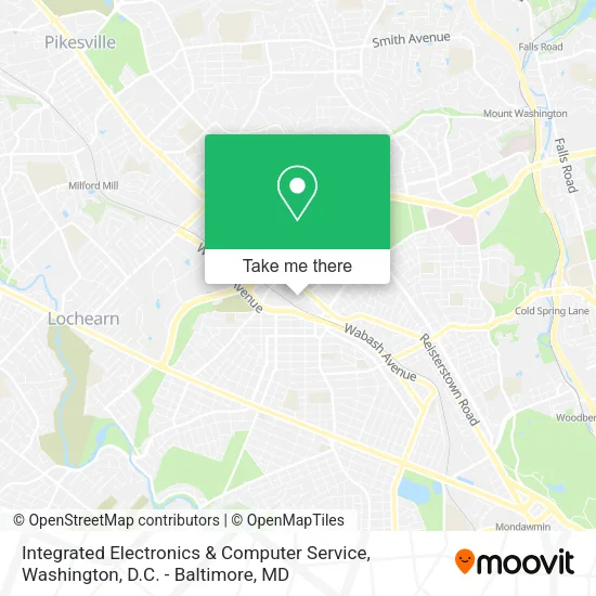
See Integrated Electronics & Computer Service, Baltimore, on the map
Public Transit to Integrated Electronics & Computer Service in Baltimore
Wondering how to get to Integrated Electronics & Computer Service in Baltimore? Moovit helps you find the best way to get to Integrated Electronics & Computer Service with step-by-step directions from the nearest public transit station.
Moovit provides free maps and live directions to help you navigate through your city. View schedules, routes, timetables, and find out how long does it take to get to Integrated Electronics & Computer Service in real time.
Looking for the nearest stop or station to Integrated Electronics & Computer Service? Check out this list of stops closest to your destination: Reisterstown Rd & Rogers Ave Sb; Rogers Ave Metro Station Bay 1; Rogers Ave Metro Station Bay 2; Rogers Ave Station; Belvedere Ave & Reisterstown Rd FS Wb; Rogers Ave Metro Station Bay 5; Rogers Ave Metro Station Bay 6; Reisterstown Plaza Metro; Cold Spring Lane.
Bus: 30, 80, 83, 34, 28, 94, 31.Metro: METRO.
Want to see if there’s another route that gets you there at an earlier time? Moovit helps you find alternative routes or times. Get directions from and directions to Integrated Electronics & Computer Service easily from the Moovit App or Website.
We make riding to Integrated Electronics & Computer Service easy, which is why over 1.5 million users, including users in Baltimore, trust Moovit as the best app for public transit. You don’t need to download an individual bus app or train app, Moovit is your all-in-one transit app that helps you find the best bus time or train time available.
For information on prices of bus and metro, costs and ride fares to Integrated Electronics & Computer Service, please check the Moovit app.
Use the app to navigate to popular places including to the airport, hospital, stadium, grocery store, mall, coffee shop, school, college, and university.
Integrated Electronics & Computer Service Address: 4128 Hayward Ave Baltimore, MD 21215 street in Baltimore
- 8061.Biz,
- Excelleration Office Interiors,
- Glen-Gery L & L Masonry Supply Center,
- Docman Investment,
- Armor Prep Coatings,
- BC's Unlimited Promotions & Fundraising,
- smart Steps Inc.,
- Mobile Threads,
- Cmsvend*Terry's Vendin,
- First Choice Auto Whol,
- Ips,
- arlington lewin methodist church,
- Vision Wrecker Service Inc,
- Albarka Groceries,
- CJ's Convenience,
- Classic Express,
- smart Start Ignition Interlock,
- Empire Tag & Title,
- New Mt Zion Holy,
- Mike & Mike's Mobile Auto Detailing
Places Near Integrated Electronics & Computer Service (Baltimore)
- Washington DC VA Medical Center, Washington,
- The Anthem, Washington,
- Sibley Memorial Hospital, Washington,
- Westfield Montgomery Mall, Montgomery County,
- Warner Theatre, Washington,
- M&T Bank Stadium, Baltimore,
- Rock Creek Tennis Center, Washington,
- Washington National Cathedral, Washington,
- Amazon Hq2, Arlington County,
- National Museum of African American History and Culture, Washington,
- National Zoo, Washington,
- Museum Of The Bible, Washington,
- National Theatre, Washington,
- PG Mall, Prince George's County,
- Pennsylvania Ave NW (3rd st and pennsylvania), Washington,
- Capital One Arena, Washington,
- Georgetown, Washington,
- Basilica of the National Shrine, Washington,
- Marriott Marquis Washington, DC, Washington,
- Camden Yards, Baltimore
How to get to popular places in Washington, D.C. - Baltimore, MD with public transit
Get around Baltimore by public transit!
Traveling around Baltimore has never been so easy. See step by step directions as you travel to any attraction, street or major public transit station. View bus and train schedules, arrival times, service alerts and detailed routes on a map, so you know exactly how to get to anywhere in Baltimore.
When traveling to any destination around Baltimore use Moovit's Live Directions with Get Off Notifications to know exactly where and how far to walk, how long to wait for your line, and how many stops are left. Moovit will alert you when it's time to get off — no need to constantly re-check whether yours is the next stop.
Wondering how to use public transit in Baltimore or how to pay for public transit in Baltimore? Moovit public transit app can help you navigate your way with public transit easily, and at minimum cost. It includes public transit fees, ticket prices, and costs. Looking for a map of Baltimore public transit lines? Moovit public transit app shows all public transit maps in Baltimore with all Bus, Train, Metro, Light Rail and Ferry routes and stops on an interactive map.
Washington, D.C. - Baltimore, MD has 5 transit type(s), including: Bus, Train, Metro, Light Rail and Ferry, operated by several transit agencies, including WMATA, Montgomery County Ride On, Fairfax Connector, TheBus, PRTC, DASH - Alexandria, Arlington Transit (ART), RTA of Central Maryland, MDOT MTA, MDOT MTA Light RailLink, MDOT MTA Commuter Bus, MDOT MTA Local Bus, FXBGO!, Virginia Railway Express (VRE) and MARC