How to get to Intellibridge by bus?
Click on the bus route to see step by step directions with maps, line arrival times and updated time schedules.
From Kaiser Permanente - Falls Church Medical Center, Falls Church
40 minFrom King's Dominion, Fairfax County
83 minFrom Inova Fairfax Hospital, Fairfax County
40 minFrom Defense Health Agency Headquarters, Fairfax County
69 minFrom Inova Fairfax Hospital North Tower Building, Fairfax County
47 minFrom Carderock Division of the Naval Surface Warfare Center, Montgomery County
96 minFrom Northern Virginia Community College - Annandale Campus, Fairfax County
78 minFrom Bullis School, Montgomery County
93 minFrom Sibley Memorial Hospital, Washington
115 minFrom Reston Town Center, Fairfax County
55 min
How to get to Intellibridge by metro?
Click on the metro route to see step by step directions with maps, line arrival times and updated time schedules.
Bus stops near Intellibridge in Fairfax County
Metro station near Intellibridge in Fairfax County
- Spring Hill, 10 min walk,VIEW
Bus lines to Intellibridge in Fairfax County
What are the closest stations to Intellibridge?
The closest stations to Intellibridge are:
- Spring Hill Rd @ Tyco Rd is 190 yards away, 3 min walk.
- Tysons Westpark is 396 yards away, 6 min walk.
- Jones Branch Dr @ Lincoln Way is 482 yards away, 7 min walk.
- Spring Hill is 775 yards away, 10 min walk.
Which bus lines stop near Intellibridge?
These bus lines stop near Intellibridge: 401, 432, 574, 798.
Which metro line stops near Intellibridge?
SILVER (Ashburn)
What’s the nearest metro station to Intellibridge in Fairfax County?
The nearest metro station to Intellibridge in Fairfax County is Spring Hill. It’s a 10 min walk away.
What’s the nearest bus station to Intellibridge in Fairfax County?
The nearest bus station to Intellibridge in Fairfax County is Spring Hill Rd @ Tyco Rd. It’s a 3 min walk away.
What time is the first metro to Intellibridge in Fairfax County?
The SILVER is the first metro that goes to Intellibridge in Fairfax County. It stops nearby at 5:07 AM.
What time is the last metro to Intellibridge in Fairfax County?
The SILVER is the last metro that goes to Intellibridge in Fairfax County. It stops nearby at 12:43 AM.
What time is the first bus to Intellibridge in Fairfax County?
The 401 is the first bus that goes to Intellibridge in Fairfax County. It stops nearby at 4:35 AM.
What time is the last bus to Intellibridge in Fairfax County?
The 402 is the last bus that goes to Intellibridge in Fairfax County. It stops nearby at 11:22 PM.
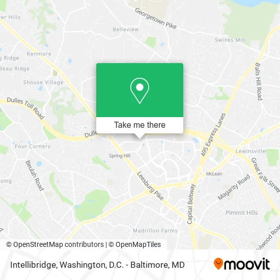
See Intellibridge, Fairfax County, on the map
Public Transit to Intellibridge in Fairfax County
Wondering how to get to Intellibridge in Fairfax County? Moovit helps you find the best way to get to Intellibridge with step-by-step directions from the nearest public transit station.
Moovit provides free maps and live directions to help you navigate through your city. View schedules, routes, timetables, and find out how long does it take to get to Intellibridge in real time.
Looking for the nearest stop or station to Intellibridge? Check out this list of stops closest to your destination: Spring Hill Rd @ Tyco Rd; Tysons Westpark; Jones Branch Dr @ Lincoln Way; Spring Hill.
Bus: 401, 432, 574, 798, 402, 427, 423.Metro: SILVER.
Want to see if there’s another route that gets you there at an earlier time? Moovit helps you find alternative routes or times. Get directions from and directions to Intellibridge easily from the Moovit App or Website.
We make riding to Intellibridge easy, which is why over 1.5 million users, including users in Fairfax County, trust Moovit as the best app for public transit. You don’t need to download an individual bus app or train app, Moovit is your all-in-one transit app that helps you find the best bus time or train time available.
For information on prices of bus and metro, costs and ride fares to Intellibridge, please check the Moovit app.
Use the app to navigate to popular places including to the airport, hospital, stadium, grocery store, mall, coffee shop, school, college, and university.
Intellibridge Address: 1430 Spring Hill Rd McLean, VA 22102 street in Fairfax County
- Hewlett Packard,
- The Commlaw Group,
- The Majors Law Firm,
- Blink Charging,
- NTB - National Tire & Battery,
- Forvis Mazars,
- Experienced Locksmith,
- Ecitie,
- Piper Enterprise Solutions,
- VA-267 E Exit 17 Centreville,
- Tysons TSR,
- VIVI Massage,
- Chanel Wellness Center Spa,
- Advance Concepts Inc.,
- Hunan Cafe,
- Salsa Room,
- TSR Tysons,
- B&M Therapy,
- Cash for Gold Diamond and Luxury Watches,
- Mama Mina'z Pizza
Places Near Intellibridge (Fairfax County)
- Amazon Hq2, Arlington County,
- Westfield Montgomery Mall, Montgomery County,
- Sibley Memorial Hospital, Washington,
- Pennsylvania Ave NW (3rd st and pennsylvania), Washington,
- National Zoo, Washington,
- M&T Bank Stadium, Baltimore,
- National Museum of African American History and Culture, Washington,
- PG Mall, Prince George's County,
- Capital One Arena, Washington,
- Washington DC VA Medical Center, Washington,
- Museum Of The Bible, Washington,
- Georgetown, Washington,
- National Mall, Washington,
- The Anthem, Washington,
- Camden Yards, Baltimore,
- Rock Creek Tennis Center, Washington,
- Warner Theatre, Washington,
- Basilica of the National Shrine, Washington,
- Marriott Marquis Washington, DC, Washington,
- Washington National Cathedral, Washington
How to get to popular places in Washington, D.C. - Baltimore, MD with public transit
Get around Fairfax County by public transit!
Traveling around Fairfax County has never been so easy. See step by step directions as you travel to any attraction, street or major public transit station. View bus and train schedules, arrival times, service alerts and detailed routes on a map, so you know exactly how to get to anywhere in Fairfax County.
When traveling to any destination around Fairfax County use Moovit's Live Directions with Get Off Notifications to know exactly where and how far to walk, how long to wait for your line, and how many stops are left. Moovit will alert you when it's time to get off — no need to constantly re-check whether yours is the next stop.
Wondering how to use public transit in Fairfax County or how to pay for public transit in Fairfax County? Moovit public transit app can help you navigate your way with public transit easily, and at minimum cost. It includes public transit fees, ticket prices, and costs. Looking for a map of Fairfax County public transit lines? Moovit public transit app shows all public transit maps in Fairfax County with all Bus, Train, Metro, Light Rail and Ferry routes and stops on an interactive map.
Washington, D.C. - Baltimore, MD has 5 transit type(s), including: Bus, Train, Metro, Light Rail and Ferry, operated by several transit agencies, including WMATA, Montgomery County Ride On, Fairfax Connector, TheBus, PRTC, DASH - Alexandria, Arlington Transit (ART), RTA of Central Maryland, MDOT MTA, MDOT MTA Light RailLink, MDOT MTA Commuter Bus, MDOT MTA Local Bus, FXBGO!, Virginia Railway Express (VRE) and MARC