Directions to Interact Digitally (Queens) with public transportation
The following transit lines have routes that pass near Interact Digitally
 Bus: B62, M60-SBS, Q100, Q18, Q19.
- Train: LONG BEACH BRANCH, PORT WASHINGTON BRANCH.
- Subway: N, W.
- Ferry: AS.
How to get to Interact Digitally by bus?
Click on the bus route to see step by step directions with maps, line arrival times and updated time schedules.
How to get to Interact Digitally by train?
Click on the train route to see step by step directions with maps, line arrival times and updated time schedules.
How to get to Interact Digitally by subway?
Click on the subway route to see step by step directions with maps, line arrival times and updated time schedules.
Bus stops near Interact Digitally in Queens
Subway station near Interact Digitally in Queens
- 30 Av, 10 min walk,VIEW
Ferry station near Interact Digitally in Queens
- Astoria, 15 min walk,VIEW
Bus lines to Interact Digitally in Queens
What are the closest stations to Interact Digitally?
The closest stations to Interact Digitally are:
- Astoria Blvd/Crescent St is 135 yards away, 2 min walk.
- 21 St/Astoria Blvd is 402 yards away, 5 min walk.
- Hoyt Av South/31 St is 447 yards away, 6 min walk.
- 30 Av/Crescent St is 528 yards away, 7 min walk.
- 30 Av is 748 yards away, 10 min walk.
- Astoria is 1231 yards away, 15 min walk.
Which bus lines stop near Interact Digitally?
These bus lines stop near Interact Digitally: B62, M60-SBS, Q100, Q18.
Which train lines stop near Interact Digitally?
These train lines stop near Interact Digitally: LONG BEACH BRANCH, PORT WASHINGTON BRANCH.
Which subway lines stop near Interact Digitally?
These subway lines stop near Interact Digitally: N, W.
What’s the nearest subway station to Interact Digitally in Queens?
The nearest subway station to Interact Digitally in Queens is 30 Av. It’s a 10 min walk away.
What’s the nearest bus station to Interact Digitally in Queens?
The nearest bus station to Interact Digitally in Queens is Astoria Blvd/Crescent St. It’s a 2 min walk away.
What’s the nearest ferry station to Interact Digitally in Queens?
The nearest ferry station to Interact Digitally in Queens is Astoria. It’s a 15 min walk away.
What time is the first subway to Interact Digitally in Queens?
The N is the first subway that goes to Interact Digitally in Queens. It stops nearby at 3:00 AM.
What time is the last subway to Interact Digitally in Queens?
The N is the last subway that goes to Interact Digitally in Queens. It stops nearby at 3:02 AM.
What time is the first bus to Interact Digitally in Queens?
The Q100 is the first bus that goes to Interact Digitally in Queens. It stops nearby at 3:09 AM.
What time is the last bus to Interact Digitally in Queens?
The M60-SBS is the last bus that goes to Interact Digitally in Queens. It stops nearby at 3:14 AM.
What time is the first ferry to Interact Digitally in Queens?
The AS is the first ferry that goes to Interact Digitally in Queens. It stops nearby at 6:09 AM.
What time is the last ferry to Interact Digitally in Queens?
The AS is the last ferry that goes to Interact Digitally in Queens. It stops nearby at 8:55 PM.
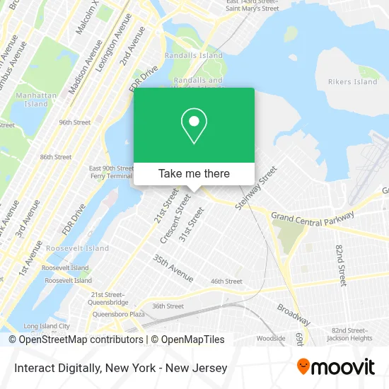
See Interact Digitally, Queens, on the map
Public Transit to Interact Digitally in Queens
Wondering how to get to Interact Digitally in Queens? Moovit helps you find the best way to get to Interact Digitally with step-by-step directions from the nearest public transit station.
Moovit provides free maps and live directions to help you navigate through your city. View schedules, routes, timetables, and find out how long does it take to get to Interact Digitally in real time.
Looking for the nearest stop or station to Interact Digitally? Check out this list of stops closest to your destination: Astoria Blvd/Crescent St; 21 St/Astoria Blvd; Hoyt Av South/31 St; 30 Av/Crescent St; 30 Av; Astoria.
Bus: B62, M60-SBS, Q100, Q18, Q19, Q69.Train: LONG BEACH BRANCH, PORT WASHINGTON BRANCH.Subway: N, W.Ferry: AS.
Want to see if there’s another route that gets you there at an earlier time? Moovit helps you find alternative routes or times. Get directions from and directions to Interact Digitally easily from the Moovit App or Website.
We make riding to Interact Digitally easy, which is why over 1.5 million users, including users in Queens, trust Moovit as the best app for public transit. You don’t need to download an individual bus app or train app, Moovit is your all-in-one transit app that helps you find the best bus time or train time available.
For information on prices of subway, bus and train, costs and ride fares to Interact Digitally, please check the Moovit app.
Use the app to navigate to popular places including to the airport, hospital, stadium, grocery store, mall, coffee shop, school, college, and university.
Interact Digitally Address: 25-31 Astoria Blvd street in Queens
- Vacation Angel,
- Arvanitis Cpa,
- Lima Brow Studio,
- Fms Group,
- Advanced Accounting Practice Aap,
- Astoria Psychic Readings by Nina,
- Top5ive Barbershop,
- Messinian Benevolent Association,
- Serenity Asian Massage Astoria,
- Astoria 27th,
- Forte Lab,
- Ups Authorized Shipping Outlet,
- The Taco Spot Nyc,
- Studio Cibelly Abreu,
- Astorias Hub International & Domestic Shipping ♤,
- Vinted Go Parcel Shop,
- Astoria World Manor,
- Cornicello,
- Christa Panagios Beatique,
- A C E - N Y C Zoning and Code Consultants
Places Near Interact Digitally (Queens)
- 66 John Street, Manhattan,
- Wall Street, Manhattan,
- 911 Memorial, Manhattan,
- 111 Centre New York City Supreme Court, Manhattan,
- SoHo, Manhattan,
- Katz's Deli, Manhattan,
- 376 Hudson Street, Manhattan,
- Hudson Yards, Manhattan,
- Queens Center Mall, Queens,
- 26 Federal Plaza, Manhattan,
- San Gennaro Feast, Manhattan,
- qqqq, Manhattan,
- Bellevue Hospital, Manhattan,
- 1 Police Plaza, Manhattan,
- Pier 83, Manhattan,
- 3 Stone St, Manhattan,
- Chinatown, Manhattan,
- Rockefeller Center, Manhattan,
- Times Square, Manhattan,
- Mountainside Hospital, Glen Ridge
How to get to popular places in New York - New Jersey with public transit
Get around Queens by public transit!
Traveling around Queens has never been so easy. See step by step directions as you travel to any attraction, street or major public transit station. View bus and train schedules, arrival times, service alerts and detailed routes on a map, so you know exactly how to get to anywhere in Queens.
When traveling to any destination around Queens use Moovit's Live Directions with Get Off Notifications to know exactly where and how far to walk, how long to wait for your line, and how many stops are left. Moovit will alert you when it's time to get off — no need to constantly re-check whether yours is the next stop.
Wondering how to use public transit in Queens or how to pay for public transit in Queens? Moovit public transit app can help you navigate your way with public transit easily, and at minimum cost. It includes public transit fees, ticket prices, and costs. Looking for a map of Queens public transit lines? Moovit public transit app shows all public transit maps in Queens with all Bus, Train, Subway, Light Rail, Ferry and Cable Car routes and stops on an interactive map.
New York - New Jersey has 6 transit type(s), including: Bus, Train, Subway, Light Rail, Ferry and Cable Car, operated by several transit agencies, including MTA Subway, Metro-North Railroad, LIRR, PATH, MTA New York City Transit - Express routes, MTA Bus, NJ Transit, NYC Ferry, NICE bus, Bee-Line Bus, NJ Transit Rail, Norwalk Transit District, Hartford Line, River Valley Transit and HART