How to get to Interactive Technologies Corp by bus?
Click on the bus route to see step by step directions with maps, line arrival times and updated time schedules.
From The Trans Icon, Menanggal
45 minFrom Suko Manunggal, Surabaya
34 minFrom Purimas Regency, Gunung Anyar
53 minFrom Universitas Pembangunan Nasional Veteran Jawa Timur, Gunung Anyar
51 minFrom Tuban, Surabaya, Greges
28 minFrom Samsat Corner Giant Pondok Chandra, Sidoarjo
60 minFrom BRI Corporate Campus University Surabaya, Siwalankerto
54 minFrom Gunung kelud, Ngagelrejo
24 minFrom Pakuwon City Mall, Keputih
33 min
How to get to Interactive Technologies Corp by train?
Click on the train route to see step by step directions with maps, line arrival times and updated time schedules.
Bus stops near Interactive Technologies Corp in Ketabang
Train stations near Interactive Technologies Corp in Ketabang
Bus lines to Interactive Technologies Corp in Ketabang
What are the closest stations to Interactive Technologies Corp?
The closest stations to Interactive Technologies Corp are:
- Jalan Kusuma Bangsa 23 is 103 meters away, 2 min walk.
- Jalan Ambengan 59 is 235 meters away, 4 min walk.
- Jalan Ambengan 54 is 354 meters away, 5 min walk.
- Jalan Kusuma Bangsa 63 B is 448 meters away, 6 min walk.
- Rs Adi Husada Undaan A is 708 meters away, 10 min walk.
- Jalan Kapasari 24 is 714 meters away, 10 min walk.
- Jalan Ngaglik 3-5 is 759 meters away, 10 min walk.
- Undaan Kulon 3, 4 is 834 meters away, 11 min walk.
- Stasiun Surabaya Kota is 2394 meters away, 31 min walk.
- Stasiun Surabaya Pasar Turi is 3200 meters away, 41 min walk.
Which bus lines stop near Interactive Technologies Corp?
These bus lines stop near Interactive Technologies Corp: F, GS, O1, WB, WK.
Which train line stops near Interactive Technologies Corp?
A (Sidoarjo)
What’s the nearest bus station to Interactive Technologies Corp in Ketabang?
The nearest bus station to Interactive Technologies Corp in Ketabang is Jalan Kusuma Bangsa 23. It’s a 2 min walk away.
What time is the first train to Interactive Technologies Corp in Ketabang?
The S is the first train that goes to Interactive Technologies Corp in Ketabang. It stops nearby at 3:00 AM.
What time is the last train to Interactive Technologies Corp in Ketabang?
The SP is the last train that goes to Interactive Technologies Corp in Ketabang. It stops nearby at 1:51 AM.
What time is the first bus to Interactive Technologies Corp in Ketabang?
The F is the first bus that goes to Interactive Technologies Corp in Ketabang. It stops nearby at 4:09 AM.
What time is the last bus to Interactive Technologies Corp in Ketabang?
The M is the last bus that goes to Interactive Technologies Corp in Ketabang. It stops nearby at 9:19 PM.
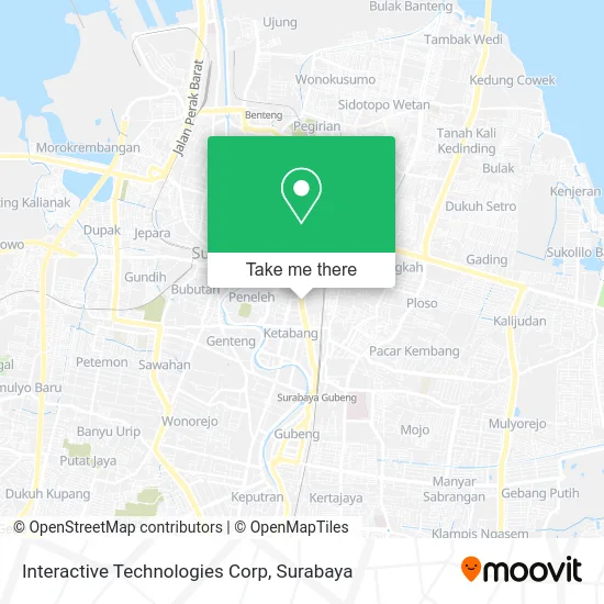
See Interactive Technologies Corp, Ketabang, on the map
Public Transit to Interactive Technologies Corp in Ketabang
Wondering how to get to Interactive Technologies Corp in Ketabang? Moovit helps you find the best way to get to Interactive Technologies Corp with step-by-step directions from the nearest public transit station.
Moovit provides free maps and live directions to help you navigate through your city. View schedules, routes, timetables, and find out how long does it take to get to Interactive Technologies Corp in real time.
Looking for the nearest stop or station to Interactive Technologies Corp? Check out this list of stops closest to your destination: Jalan Kusuma Bangsa 23; Jalan Ambengan 59; Jalan Ambengan 54; Jalan Kusuma Bangsa 63 B; Rs Adi Husada Undaan A; Jalan Kapasari 24; Jalan Ngaglik 3-5; Undaan Kulon 3; Stasiun Surabaya Kota; Stasiun Surabaya Pasar Turi.
Bus: F, GS, O1, WB, WK, C, O, LK.Train: A, D, J, P, S, SP.
Want to see if there’s another route that gets you there at an earlier time? Moovit helps you find alternative routes or times. Get directions from and directions to Interactive Technologies Corp easily from the Moovit App or Website.
We make riding to Interactive Technologies Corp easy, which is why over 1.5 million users, including users in Ketabang, trust Moovit as the best app for public transit. You don’t need to download an individual bus app or train app, Moovit is your all-in-one transit app that helps you find the best bus time or train time available.
For information on prices of bus and train, costs and ride fares to Interactive Technologies Corp, please check the Moovit app.
Use the app to navigate to popular places including to the airport, hospital, stadium, grocery store, mall, coffee shop, school, college, and university.
Interactive Technologies Corp Address: Jalan Kusuma Bangsa Surabaya 60136 street in Ketabang
- AOC Showroom & Service Centre,
- Acer Customer Service Center Surabaya,
- Advan Store II,
- Spektra Finance,
- Msi Store Megastar Surabaya,
- Smc,
- Sosis & Pentol Ibu Anik,
- Gallery Advan,
- Active X,
- Marga Catering Dan Wedding Service,
- Gota Computer,
- Spere Part Notebook,
- Toko Komputer Online Surabaya,
- Duta Sarana Computer,
- Jalan Kusuma Bangsa Surabaya,
- Depo Lala,
- Customer Support Visipro,
- Stiger Electronic,
- Warung Kopi Mat Tinggal,
- Discount Notebook
Places Near Interactive Technologies Corp (Ketabang)
- Galaxy Mall Surabaya, Mulyorejo,
- BG Junction Mall, Bubutan,
- UPN Veteran Jawa Timur, Gunung Anyar,
- Masjid Al-Akbar, Surabaya,
- GBT (Gelora Bung Tomo) Surabaya, Benowo,
- Grand City Mall, Surabaya, Gubeng,
- Kebun Binatang Surabaya, Darmo,
- Bis Damri P1 (Perak-Bungurasih PP), Krembangan Selatan,
- PTC, Surabaya,
- Smoking Room Terminal Domestik Juanda International Airport, Sidoarjo,
- Stadion gelora bung tomo(surabaya,jawa timur), Surabaya,
- Graha Pena, Ketintang,
- Taman Harmoni, Keputih,
- Pelabuhan Tanjung Perak,
- Pakuwon City Mall, Keputih,
- Kantor Regional II BKN Surabaya, Sidoarjo,
- Halte Bis Royal Plaza, Wonokromo,
- Universitas Negeri Surabaya (UNESA), Lidah Wetan,
- Bg Junction, Bubutan,
- Pakuwon Mall, Lontar
How to get to popular places in Surabaya with public transit
Get around Ketabang by public transit!
Traveling around Ketabang has never been so easy. See step by step directions as you travel to any attraction, street or major public transit station. View bus and train schedules, arrival times, service alerts and detailed routes on a map, so you know exactly how to get to anywhere in Ketabang.
When traveling to any destination around Ketabang use Moovit's Live Directions with Get Off Notifications to know exactly where and how far to walk, how long to wait for your line, and how many stops are left. Moovit will alert you when it's time to get off — no need to constantly re-check whether yours is the next stop.
Wondering how to use public transit in Ketabang or how to pay for public transit in Ketabang? Moovit public transit app can help you navigate your way with public transit easily, and at minimum cost. It includes public transit fees, ticket prices, and costs. Looking for a map of Ketabang public transit lines? Moovit public transit app shows all public transit maps in Ketabang with all Bus and Train routes and stops on an interactive map.
Surabaya has 2 transit type(s), including: Bus and Train, operated by several transit agencies, including KAI Commuter, Angkutan Surabaya, Trans Semanggi Suroboyo, Suroboyo Bus, Feeder Wira Wiri Suroboyo, Trans Jatim and DAMRI