How to get to Intercontinental Hotel Group by bus?
Click on the bus route to see step by step directions with maps, line arrival times and updated time schedules.
From Seven Corners Center (Seven Corners Shopping Center Falls Church VA), Fairfax County
77 minFrom The Ritz-Carlton Pentagon City, Arlington County
64 minFrom Consulado General de El Salvador en El Dmv, Montgomery County
55 minFrom The Home Depot, Washington
40 minFrom PG Mall, Prince George's County
75 minFrom I-295 Exit 1 - Naval Research Lab, Washington
101 minFrom Hyatt Regency Crystal City at Reagan National Airport, Arlington County
60 minFrom Hyattsville District Court, Prince George's County
58 minFrom Prince George's Plaza Metro Station, Prince George's County
79 minFrom Tomb of the Unknown Soldier, Arlington County
70 min
How to get to Intercontinental Hotel Group by train?
Click on the train route to see step by step directions with maps, line arrival times and updated time schedules.
How to get to Intercontinental Hotel Group by metro?
Click on the metro route to see step by step directions with maps, line arrival times and updated time schedules.
From Seven Corners Center (Seven Corners Shopping Center Falls Church VA), Fairfax County
58 minFrom The Ritz-Carlton Pentagon City, Arlington County
27 minFrom Consulado General de El Salvador en El Dmv, Montgomery County
42 minFrom The Home Depot, Washington
29 minFrom PG Mall, Prince George's County
41 minFrom Hyatt Regency Crystal City at Reagan National Airport, Arlington County
43 minFrom Prince George's Plaza Metro Station, Prince George's County
35 minFrom Tomb of the Unknown Soldier, Arlington County
29 min
Bus stops near Intercontinental Hotel Group in Washington
Metro stations near Intercontinental Hotel Group in Washington
Bus lines to Intercontinental Hotel Group in Washington
What are the closest stations to Intercontinental Hotel Group?
The closest stations to Intercontinental Hotel Group are:
- P St Nw+21 St NW is 91 yards away, 2 min walk.
- P St Nw+22 St NW is 125 yards away, 2 min walk.
- Massachusetts Av Nw+20 St NW is 288 yards away, 4 min walk.
- Farragut North is 314 yards away, 4 min walk.
- Farragut West is 431 yards away, 6 min walk.
- Washington Dc (Dupont Circle) is 465 yards away, 6 min walk.
Which bus lines stop near Intercontinental Hotel Group?
These bus lines stop near Intercontinental Hotel Group: 325, A58, C91, D94, D96.
Which train line stops near Intercontinental Hotel Group?
MARC (Outbound - Washington)
Which metro line stops near Intercontinental Hotel Group?
RED (Shady Grove)
What’s the nearest metro station to Intercontinental Hotel Group in Washington?
The nearest metro station to Intercontinental Hotel Group in Washington is Farragut North. It’s a 4 min walk away.
What’s the nearest bus station to Intercontinental Hotel Group in Washington?
The nearest bus stations to Intercontinental Hotel Group in Washington are P St Nw+21 St NW and P St Nw+22 St NW. The closest one is a 2 min walk away.
What time is the first metro to Intercontinental Hotel Group in Washington?
The BLUE is the first metro that goes to Intercontinental Hotel Group in Washington. It stops nearby at 5:23 AM.
What time is the last metro to Intercontinental Hotel Group in Washington?
The RED is the last metro that goes to Intercontinental Hotel Group in Washington. It stops nearby at 12:10 AM.
What time is the first bus to Intercontinental Hotel Group in Washington?
The D94 is the first bus that goes to Intercontinental Hotel Group in Washington. It stops nearby at 5:12 AM.
What time is the last bus to Intercontinental Hotel Group in Washington?
The FLIXBUS 2601 is the last bus that goes to Intercontinental Hotel Group in Washington. It stops nearby at 1:40 AM.
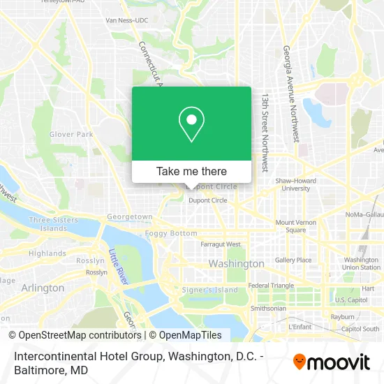
See Intercontinental Hotel Group, Washington, on the map
Public Transit to Intercontinental Hotel Group in Washington
Wondering how to get to Intercontinental Hotel Group in Washington? Moovit helps you find the best way to get to Intercontinental Hotel Group with step-by-step directions from the nearest public transit station.
Moovit provides free maps and live directions to help you navigate through your city. View schedules, routes, timetables, and find out how long does it take to get to Intercontinental Hotel Group in real time.
Looking for the nearest stop or station to Intercontinental Hotel Group? Check out this list of stops closest to your destination: P St Nw+21 St NW; P St Nw+22 St NW; Massachusetts Av Nw+20 St NW; Farragut North; Farragut West; Washington Dc (Dupont Circle).
Bus: 325, A58, C91, D94, D96, D74, D90, FLIXBUS 2601.Train: MARC.Metro: RED, BLUE, ORANGE, SILVER.
Want to see if there’s another route that gets you there at an earlier time? Moovit helps you find alternative routes or times. Get directions from and directions to Intercontinental Hotel Group easily from the Moovit App or Website.
We make riding to Intercontinental Hotel Group easy, which is why over 1.5 million users, including users in Washington, trust Moovit as the best app for public transit. You don’t need to download an individual bus app or train app, Moovit is your all-in-one transit app that helps you find the best bus time or train time available.
For information on prices of metro, bus and train, costs and ride fares to Intercontinental Hotel Group, please check the Moovit app.
Use the app to navigate to popular places including to the airport, hospital, stadium, grocery store, mall, coffee shop, school, college, and university.
Intercontinental Hotel Group Address: 2121 P St NW Washington, DC 20037 street in Washington
- Omni Hotels,
- The Royal Sonesta Washington DC Dupont Circle (Sonesta Hotel),
- Royal Sonesta Washington DC,
- Urbana,
- Residence Inn Washington DC Dupont Circle,
- Residence Inn-Dupont Circle (Residence Inn Washington Dc),
- Pride Smoke Shop,
- Duck Duck Goose,
- Beduci,
- Main Justice,
- Pooja Hemnani (DC Auto and Home Insurance Agent PJ Hemnani),
- Giordano Bruno University,
- Polish Consulate,
- Das Ethiopian,
- Duffy's Irish Pub,
- Pizzeria Paradiso,
- Obelisk,
- Taras Shevchenko Memorial,
- Baron Hotel (Bier Baron Tavern),
- DC Comedy Loft
Places Near Intercontinental Hotel Group (Washington)
- Basilica of the National Shrine, Washington,
- The Anthem, Washington,
- National Museum of African American History and Culture, Washington,
- Marriott Marquis Washington, DC, Washington,
- Westfield Montgomery Mall, Montgomery County,
- Pennsylvania Ave NW (3rd st and pennsylvania), Washington,
- Amazon Hq2, Arlington County,
- Washington National Cathedral, Washington,
- National Mall, Washington,
- Georgetown, Washington,
- Museum Of The Bible, Washington,
- Washington DC VA Medical Center, Washington,
- Camden Yards, Baltimore,
- Capital One Arena, Washington,
- Warner Theatre, Washington,
- Sibley Memorial Hospital, Washington,
- PG Mall, Prince George's County,
- National Zoo, Washington,
- Rock Creek Tennis Center, Washington,
- M&T Bank Stadium, Baltimore
How to get to popular places in Washington, D.C. - Baltimore, MD with public transit
Get around Washington by public transit!
Traveling around Washington has never been so easy. See step by step directions as you travel to any attraction, street or major public transit station. View bus and train schedules, arrival times, service alerts and detailed routes on a map, so you know exactly how to get to anywhere in Washington.
When traveling to any destination around Washington use Moovit's Live Directions with Get Off Notifications to know exactly where and how far to walk, how long to wait for your line, and how many stops are left. Moovit will alert you when it's time to get off — no need to constantly re-check whether yours is the next stop.
Wondering how to use public transit in Washington or how to pay for public transit in Washington? Moovit public transit app can help you navigate your way with public transit easily, and at minimum cost. It includes public transit fees, ticket prices, and costs. Looking for a map of Washington public transit lines? Moovit public transit app shows all public transit maps in Washington with all Bus, Train, Metro, Light Rail and Ferry routes and stops on an interactive map.
Washington, D.C. - Baltimore, MD has 5 transit type(s), including: Bus, Train, Metro, Light Rail and Ferry, operated by several transit agencies, including WMATA, Montgomery County Ride On, Fairfax Connector, TheBus, PRTC, DASH - Alexandria, Arlington Transit (ART), RTA of Central Maryland, MDOT MTA, MDOT MTA Light RailLink, MDOT MTA Commuter Bus, MDOT MTA Local Bus, FXBGO!, Virginia Railway Express (VRE) and MARC