Directions to Interior de la Pirámide de Cholula (Ocoyucan) with public transportation
The following transit lines have routes that pass near Interior de la Pirámide de Cholula
How to get to Interior de la Pirámide de Cholula by bus?
Click on the bus route to see step by step directions with maps, line arrival times and updated time schedules.
From Centro de Maternidad Joaquin Colombres, Puebla
56 minFrom Iglesia de la Medalla Milagrosa, Puebla
54 minFrom Ciudad Universitaria, Puebla
32 minFrom Parque Industrial Bralemex, San Pedro Cholula
54 minFrom Pepsi, Puebla
53 minFrom Fray Pedro de Melgarejo 2454, Puebla
40 minFrom Infonavit San Jorge, Ocoyucan
48 minFrom Laboratorios UMA, Puebla
47 minFrom Centro Médico Nacional IMSS San José, San Andrés Cholula
38 minFrom Joaquín Colombres, Puebla
56 min
Bus stops near Interior de la Pirámide de Cholula in Ocoyucan
Bus lines to Interior de la Pirámide de Cholula in Ocoyucan
- RUTA SUBURBANA PIRÁMIDES, Ramal 1, Barrio De San Miguel - Concepción Guadalupe,VIEW
- RUTA 33, Ramal 3, Los Héroes Puebla - Reserva Territorial Atlixcáyotl,VIEW
- RUTA 45A, Ramal 1, Agrícola Resurgimiento - El Molinito,VIEW
- RUTA NGA, Ramal 1, San Isidro Castillotla - Las Cuartillas,VIEW
- RUTA 41, Ramal 1, Bosques De San Sebastián - Concepción La Cruz,VIEW
- A6, Lomas De Angelópolis,VIEW
- CORREDOR ATLIXCAYOTL, Lomas de Angelopolis - Via Atlixcayotl - Av. Juarez (Circular),VIEW
- RUTA AZTECA B, Ramal 1, Lomas Flor Del Bosque - Villa De Los Ángeles (Ida),VIEW
- RUTA AZTECA C, Ramal 1, San Esteban - Villa De Los Ángeles,VIEW
- RUTA MALACATEPEC A, Ramal 1, Sta. Ma. Malacatepec - Centro,VIEW
- TRANSPORTE NOCTURNO, Paseo Bravo - Caseta Atlixco (Circuito),VIEW
- RUTA 14A, Ramal 1, 20 De Nov. - Paseo De San Andrés,VIEW
- A36, Angelópolis - Paradero Torrecillas,VIEW
What are the closest stations to Interior de la Pirámide de Cholula?
The closest stations to Interior de la Pirámide de Cholula are:
- A. Serdán 906 is 324 meters away, 5 min walk.
- V. De Los Robles, 10d is 582 meters away, 8 min walk.
- Municipio Libre-Carranza is 704 meters away, 10 min walk.
- V. De Las Magnolias, 5d is 717 meters away, 10 min walk.
- Avenida Villa Doroda, 1 is 851 meters away, 11 min walk.
- Violetas, 102b is 897 meters away, 12 min walk.
Which bus lines stop near Interior de la Pirámide de Cholula?
These bus lines stop near Interior de la Pirámide de Cholula: RUTA 29, RUTA 33, RUTA AZTECA B, RUTA AZTECA C, RUTA SUBURBANA PIRÁMIDES.
What’s the nearest bus station to Interior de la Pirámide de Cholula in Ocoyucan?
The nearest bus station to Interior de la Pirámide de Cholula in Ocoyucan is A. Serdán 906. It’s a 5 min walk away.
What time is the first bus to Interior de la Pirámide de Cholula in Ocoyucan?
The TRANSPORTE NOCTURNO is the first bus that goes to Interior de la Pirámide de Cholula in Ocoyucan. It stops nearby at 3:02 AM.
What time is the last bus to Interior de la Pirámide de Cholula in Ocoyucan?
The TRANSPORTE NOCTURNO is the last bus that goes to Interior de la Pirámide de Cholula in Ocoyucan. It stops nearby at 2:02 AM.
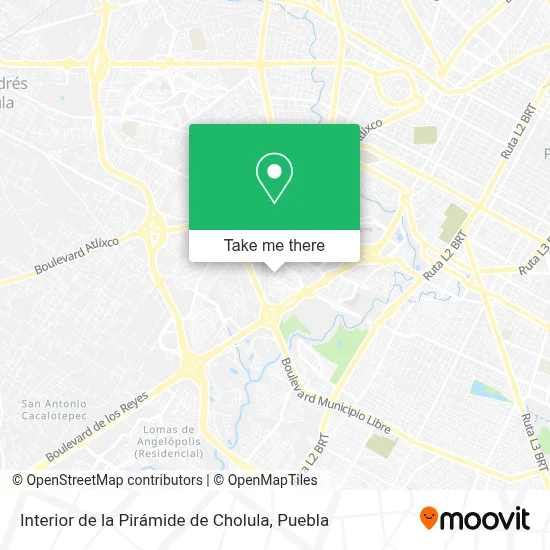
See Interior de la Pirámide de Cholula, Ocoyucan, on the map
Public Transit to Interior de la Pirámide de Cholula in Ocoyucan
Wondering how to get to Interior de la Pirámide de Cholula in Ocoyucan? Moovit helps you find the best way to get to Interior de la Pirámide de Cholula with step-by-step directions from the nearest public transit station.
Moovit provides free maps and live directions to help you navigate through your city. View schedules, routes, timetables, and find out how long does it take to get to Interior de la Pirámide de Cholula in real time.
Looking for the nearest stop or station to Interior de la Pirámide de Cholula? Check out this list of stops closest to your destination: A. Serdán 906; V. De Los Robles; Municipio Libre-Carranza; V. De Las Magnolias; Avenida Villa Doroda; Violetas.
Bus: RUTA 29, RUTA 33, RUTA AZTECA B, RUTA AZTECA C, RUTA SUBURBANA PIRÁMIDES, RUTA 45A, RUTA NGA, RUTA 41, A6, CORREDOR ATLIXCAYOTL, RUTA MALACATEPEC A, TRANSPORTE NOCTURNO.
Want to see if there’s another route that gets you there at an earlier time? Moovit helps you find alternative routes or times. Get directions from and directions to Interior de la Pirámide de Cholula easily from the Moovit App or Website.
We make riding to Interior de la Pirámide de Cholula easy, which is why over 1.5 million users, including users in Ocoyucan, trust Moovit as the best app for public transit. You don’t need to download an individual bus app or train app, Moovit is your all-in-one transit app that helps you find the best bus time or train time available.
For information on prices of bus, costs and ride fares to Interior de la Pirámide de Cholula, please check the Moovit app.
Use the app to navigate to popular places including to the airport, hospital, stadium, grocery store, mall, coffee shop, school, college, and university.
Interior de la Pirámide de Cholula Address: Interior de la Pirámide de Cholula, Calle Villas de Metepec, Fraccionamiento Villas de Atlixco, 728 street in Ocoyucan
- Cecina La Atlixquense,
- Pastelería La Féte,
- Moto Shop Beauty & Service,
- Centro de Idiomas,
- Nadira Boutique & Nails,
- Conjunto Habitacional Momosa,
- Jardin La Antigua Concepción,
- Fraccionamiento Momosa,
- Plántula México,
- Fraccionamiento Villas de Atlixco,
- RSA,
- Grupo Voluntario Mexicano Aleman,
- Papelería El Rincon de Monet,
- Dental Torres,
- Una Nueva Esperanza Abp,
- Nenuk Burger El Arte Dedel Buen Comer,
- Farmacia Magdalena,
- Desayunos y Comida Gourmet,
- Comercializadora Lh de Mexico, S.A. de C.V.,
- Geovillas La Hacienda "Hda. La Gavia"
Places Near Interior de la Pirámide de Cholula (Ocoyucan)
- Complejo Cultural Universitario, Ocoyucan,
- Centro Comercial Angelópolis, San Andrés Cholula,
- Hospital Imss La Margarita, Puebla,
- Galerías Serdán, San Pedro Cholula,
- Parque Puebla, Puebla,
- Tres Cruces, Puebla,
- Zona de los Fuertes, Puebla,
- SAT, San Andrés Cholula,
- Secretaria de Finanzas, Puebla,
- Centro de Desarrollo Comunitario Tres Cruces, Puebla,
- Estadio Cuauhtémoc, Puebla,
- Ciudad Judicial del Estado de Puebla, San Andrés Cholula,
- Ciudad Universitaria, Puebla,
- Plaza Las Animas, Puebla,
- Hospital Traumatología y Ortopedia de Puebla, San Pedro Cholula,
- Centro Integral de Servicios CIS, San Andrés Cholula,
- 25 Zona Militar, Puebla,
- Plaza Dorada Centro Comercial, Puebla,
- Hospital General Regional 36 IMSS San Alejandro, San Andrés Cholula,
- Parque Ecologico, Pue., San Andrés Cholula
How to get to popular places in Puebla with public transit
Get around Ocoyucan by public transit!
Traveling around Ocoyucan has never been so easy. See step by step directions as you travel to any attraction, street or major public transit station. View bus and train schedules, arrival times, service alerts and detailed routes on a map, so you know exactly how to get to anywhere in Ocoyucan.
When traveling to any destination around Ocoyucan use Moovit's Live Directions with Get Off Notifications to know exactly where and how far to walk, how long to wait for your line, and how many stops are left. Moovit will alert you when it's time to get off — no need to constantly re-check whether yours is the next stop.
Wondering how to use public transit in Ocoyucan or how to pay for public transit in Ocoyucan? Moovit public transit app can help you navigate your way with public transit easily, and at minimum cost. It includes public transit fees, ticket prices, and costs. Looking for a map of Ocoyucan public transit lines? Moovit public transit app shows all public transit maps in Ocoyucan with all bus routes and stops on an interactive map.
Puebla has 1 transit type(s), including: bus, operated by several transit agencies, including RUTA, RUTA Alimentadoras, Rutas Convencionales and Líneas temporales