How to get to Intermex by bus?
Click on the bus route to see step by step directions with maps, line arrival times and updated time schedules.
From Little Havana To Go, Miami
38 minFrom Bruce W. Carter VA Medical Center, Miami
69 minFrom NW 37th Ave / NW 7th St, Miami
41 minFrom Calle Ocho / SW 12th Ave, Miami
39 minFrom State Attorney's Office - Graham Bldg, Miami
63 minFrom mercy hospital trolley stop, Miami
64 minFrom Greyhound Bus Station, Miami, FL, Miami
46 minFrom Hca Florida Mercy Hospital-ER, Miami
66 minFrom METRORail-Vizcaya (Vizcaya Metrorail Station), Miami
51 minFrom Richard E. Gerstein Justice Building, Miami
67 min
Bus stops near Intermex in Miami
What are the closest stations to Intermex?
The closest stations to Intermex are:
- Sw 8 St @ Sw 73 Av is 72 yards away, 1 min walk.
- Sw 8 St @ Sw 70 Av is 474 yards away, 6 min walk.
Which bus lines stop near Intermex?
These bus lines stop near Intermex: 8, MIAFLAG.
What’s the nearest bus station to Intermex in Miami?
The nearest bus station to Intermex in Miami is Sw 8 St @ Sw 73 Av. It’s a 1 min walk away.
What time is the first bus to Intermex in Miami?
The 8 is the first bus that goes to Intermex in Miami. It stops nearby at 4:28 AM.
What time is the last bus to Intermex in Miami?
The 8 is the last bus that goes to Intermex in Miami. It stops nearby at 1:08 AM.
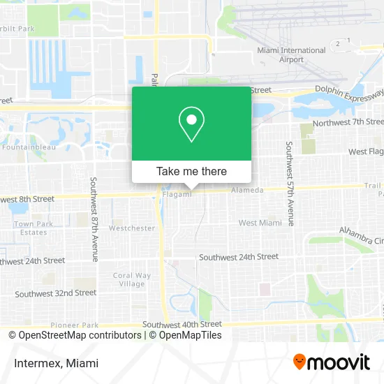
See Intermex, Miami, on the map
Public Transit to Intermex in Miami
Wondering how to get to Intermex in Miami? Moovit helps you find the best way to get to Intermex with step-by-step directions from the nearest public transit station.
Moovit provides free maps and live directions to help you navigate through your city. View schedules, routes, timetables, and find out how long does it take to get to Intermex in real time.
Looking for the nearest stop or station to Intermex? Check out this list of stops closest to your destination: Sw 8 St @ Sw 73 Av; Sw 8 St @ Sw 70 Av.
Bus: 8, MIAFLAG.
Want to see if there’s another route that gets you there at an earlier time? Moovit helps you find alternative routes or times. Get directions from and directions to Intermex easily from the Moovit App or Website.
We make riding to Intermex easy, which is why over 1.5 million users, including users in Miami, trust Moovit as the best app for public transit. You don’t need to download an individual bus app or train app, Moovit is your all-in-one transit app that helps you find the best bus time or train time available.
For information on prices of bus and train, costs and ride fares to Intermex, please check the Moovit app.
Use the app to navigate to popular places including to the airport, hospital, stadium, grocery store, mall, coffee shop, school, college, and university.
Location: Miami
- Moyra Victoria Tu Guia Espiritual,
- Gallo Travel Agency,
- Miccosukee Indian Village,
- Commercial Tax Service,
- Didiray Shop,
- Brugal Makeup,
- Marco A Rodriguez, DDS,
- Arias Remodeling,
- Varadero Logistics,
- Amo Hair Studio,
- KM Technologies and Computers Solutions,
- Wesley Fadez,
- Coccolala Spa Bar - Mobile Luxury Skin Care Spa,
- Epic Driveway & Landscaping,
- Lilis Art Decors,
- Impetus 25,
- Ebg Screen Enclosures & Techos de Aluminio,
- Elys Laundry Services,
- Vega al,
- Arboria Landscape & Tree Care
Places Near Intermex (Miami)
- Sawgrass Mall, Miami,
- Aventura Mall, Miami,
- Miami Freedom Park, Miami,
- Hard Rock Stadium, Miami Gardens,
- Wynwood, Miami,
- Dolphin Mall Bus, Miami,
- Zoo Miami, Miami,
- Marlins Park, Miami,
- Bayside Marketplace, Miami,
- Miami Design District, Miami,
- Aventura Mall, Miami Beach,
- Sawgrass mall ( FL ), Miami Beach,
- Dolphin Mall, Miami,
- Keiser University Flagship Campus, West Palm Beach,
- Miami VA Hospital, Miami,
- Miami-Dade County Courthouse, Miami,
- Port of Miami Cruise Terminal, Miami,
- Little Havana, Miami,
- Brickell City Centre, Miami,
- Richard E. Gerstein Justice Building, Miami
How to get to popular places in Miami with public transit
Get around Miami by public transit!
Traveling around Miami has never been so easy. See step by step directions as you travel to any attraction, street or major public transit station. View bus and train schedules, arrival times, service alerts and detailed routes on a map, so you know exactly how to get to anywhere in Miami.
When traveling to any destination around Miami use Moovit's Live Directions with Get Off Notifications to know exactly where and how far to walk, how long to wait for your line, and how many stops are left. Moovit will alert you when it's time to get off — no need to constantly re-check whether yours is the next stop.
Wondering how to use public transit in Miami or how to pay for public transit in Miami? Moovit public transit app can help you navigate your way with public transit easily, and at minimum cost. It includes public transit fees, ticket prices, and costs. Looking for a map of Miami public transit lines? Moovit public transit app shows all public transit maps in Miami with all Bus, Train, Light Rail and Ferry routes and stops on an interactive map.
Miami has 4 transit type(s), including: Bus, Train, Light Rail and Ferry, operated by several transit agencies, including Broward County Transit, Miami-Dade Transit, Metrorail, Palm Tran, Tri-Rail, Brightline, MARTY, City of Homestead Trolley, Key West Transit, Treasure Coast Connector, GoLine IRT, Amtrak, Greyhound-us, FlixBus-us and Aventura Express Shuttle Bus